Tag Archives: geothink students

Geothoughts 15: Reflections from Geothink’s Researchers at the Conclusion of the Grant

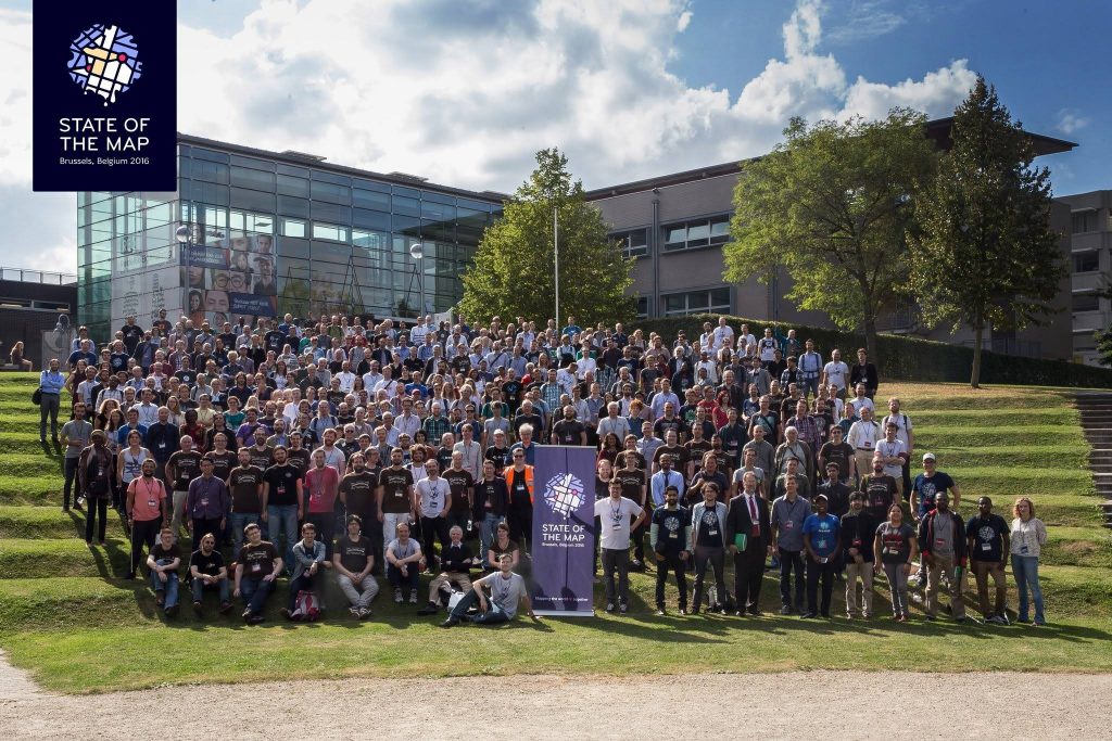
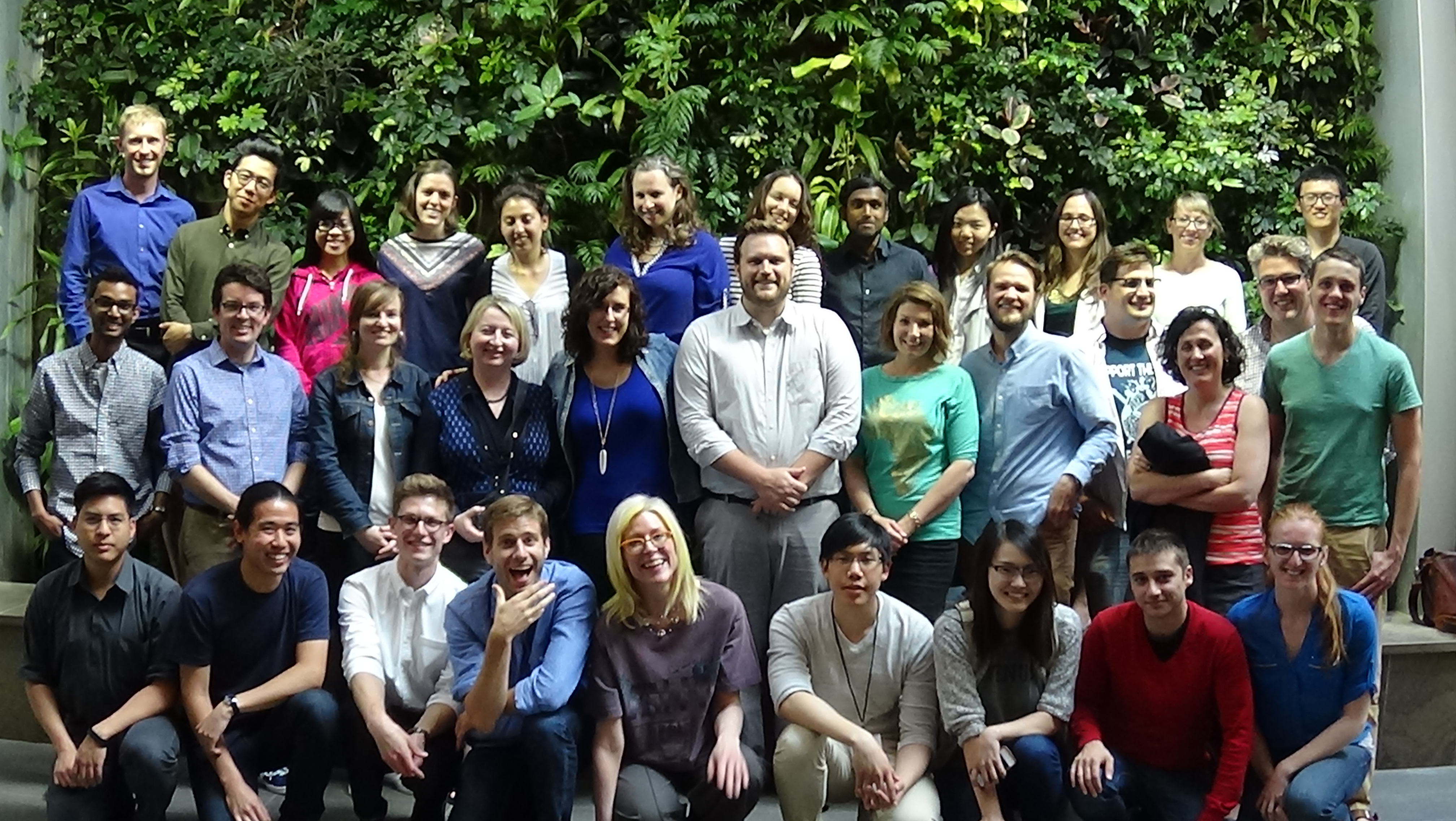
2015 Geothink Summer Institute students, faculty and staff

By Sam Lumley

We’re excited to present our 15th episode of Geothoughts. You can also subscribe to this Podcast by finding it on iTunes.

In this episode, we take a look back over five years of fruitful Geothink research. We spoke to Geothink Head Renee Sieber, Co-Applicants Rob Fieck, Daniel Paré and Stéphane Roche, and Geothink students Rachel Bloom and Edgar Baculi about their most memorable experiences with the grant.

Thanks for tuning in. And we hope you subscribe with us at Geothoughts on iTunes. A transcript of this original audio podcast follows.

TRANSCRIPT OF AUDIO PODCAST

Welcome to Geothoughts. I’m Sam Lumley.

[Geothink.ca theme music]

“The Geothink grant that was funded by the social science and humanities research council of Canada is coming to an end. We have done great work in terms of creating new theories, new frameworks, new applications, new data sets new collaborations.”

That was Geothink Head Renee Sieber, an associate professor at McGill University’s Department of Geography and School of Environment. Funded by Canada’s Social Sciences and Humanities Research Council, the Geothink partnership grant has involved 26 researchers and 30 partners, while also training more than 100 students. As the grant wraps up, we’ve been hearing from our researchers and students as they reflect on their involvement in the grant over the past five years.

We started off by speaking to former Geothink student Rachel Bloom about her most memorable experiences with the grant.

“I was the lead of Geothink’s Open Data Standards project when I was a student at McGill University. The most memorable Geothink experience would have to be designing a survey that I delivered to open data publishers at cities in north america about open-data standards. It’s memorable because it was a really challenging process due to my research topic being so new. And it also helped me develop my skills as a researcher for the future.”

The Geothink grant has brought together researchers from many different backgrounds and from different parts of the world. It was this point that Geothink co-applicant Rob Feick, an associate professor in Waterloo University’s School of Planning, emphasised while talking about the influence of Geothink on his own work.

“My research has really benefited from my work with Geothink in a few ways, one of which is Geothink is really a multi disciplinary network. It’s a network of people that span disciplines from geography, law, planning and a host of others. And having these different types of expertise around the table has really helped ground my research.”

“It’s also very applied work we’re working with local regional governments on problems that matter to people, both problems that matter to people right now and those that people are seeing both in the research community and in applied context, coming down the pipe in future years. So one of the ways, just using special data quality as of those areas that a number of us have been looking at and that that I have really benefited from in my exposure in Geothink, is understanding that it is far less of a technical matter and it’s a combination of technical and a social and governance matter, and we’re starting to understand that something that we thought was relatively simple, of spatial data quality, is much more complex.”

This interdisciplinary approach was also highlighted by Sieber, as being essential to  exploring how interactions between citizens and government are mediated by technology.

“It’s been marvelous in terms of the interdisciplinary of bringing together geographers lawyers, people in the private sector, people in government to work on issues of what’s happening to the conversations between citizens and cities. And on how can we make sure the technology is not an impediment, but actually enhances that conversation”

Working alongside people from different academic fields can help to offer a broader perspective on the big issues facing citizens and governments.  It also led some Geothink researchers to shift their own own research interests. This was the case for Geothink Co-Applicant Stéphane Roche, an associate professor in University Laval’s Department of Geomatics, who talked about his focus moving from the technical to the ethical over the course of the grant.

“My main interest within Geothink was more about social inclusion within a smart city context, spatial justice and ethics, which was quite far from what I was supposed to do at the beginning. So in my case, the move was quite big. Geothink is as a network different sectors, different disciplines, different expertise, and working on these issues around the relationship between spatial and social justice, cities and technology. And that that was really remarkable. I really enjoyed and appreciated the the dynamism and the motivation of our group of students, some of them coming from law, some others from engineering some from social science. And it was really rich in term of interaction.”

Throughout the grant new partnerships and opportunities have emerged, and co-applicant Daniel Paré, an associate professor in the University of Ottawa’s Department of Communication and School of Information Studies, highlighted his new collaborations with the Open Government Partnership.

“My involvement with Geothink has influenced my research in so much as it has opened the door towards getting to work with OGP partnership. So based on my Geothink work in open data and open government, that’s transformed, if you will, into the role with the OGP. Where I’m responsible for overseeing assessments of the implementation of Ontario’s Open Data Action Plan.”

We went on to ask Paré about his most memorable experiences as part of the grant.

“I think the most memorable experience has been working with the great team that was put together, and that includes our great team of students that are brought together every year in terms of the student based meetings and such. So for me that’s always been a highlight of the team actually getting together physically and meeting over a period of three to four days. That’s been key; those sessions always been so rich on multiple levels.”

Opportunities for collaboration and exchange were facilitated by the four Geothink summer institutes. Many collaborators and partners emphasised how helpful it was to bring researchers, partners and students together under one roof. Feick pointed to 2015 Summer Institute held at McGill University as being his most memorable moment.

“I’ve had a lot of memorable moments in this in this project over the years, but I think the one that sticks with me the most was at a summer institute that we had for the Geothink students here at waterloo. The summer institutes are opportunities where students from a variety of different universities could come together and work on an applied problem and learn about a particular aspect of geospatial information and its interfacing with society.”

“Students in this particular summer institute had the task of developing an application. We had teams of students that hadn’t met before that came together over the course of a week and put together some really fantastic applications. And these applications, I think, spurred a lot of their own research that they were going to continue on with, but also was really interesting to see how again the different perspectives that the students brought, along with those people that were assisting them through the SI, actually came to fruition.”

The summer institutes also stood out to former Geothink student Edgar Baculi, now a graduate researcher in Ryerson’s Department of Geography.

“We have all these disciplines and I remember benefing greatly from talking to the economics student, sociologist, communication and journalism students on the topic open data and it opened my mind to the idea of, if we’re talking about open data it’s not just going to be the GIS people who are going to benefit or the academics, it’s going to be the sociology students, it’s going to be a journalist from the Toronto Star, it’s going to be all these people who need to understand what open-data is from their perspective and from other perspectives.”

“So, I would say, Geothink was very important in letting me know the inside from other perspectives. And as for networking, that’s a lot of disciplines to go through, and we were all from across canada, and I think actually a few of us were from the States, if I remember correctly, so it was a great networking experience. Many of them are still friends of mine on twitter and LinkedIn, so, great experience.”

The five-year Geothink Partnership Grant may be coming to its conclusion, but the research and its applications will continue. We asked Sieber what lay in store for Geothink’s research themes, the community the partnership helped to foster and the grant’s continuing work.

“We have transformed, I’m happy to say, the lives of over 100 students. I’d like to think that we transformed the lives of many people in the public sector and the private sector across canada. I know it has certainly transformed my life. It has transformed the life of the researchers involved in this project.”

“So while this grant ends, that doesn’t mean that Geothink as a concept, and a research trajectory has ended. Many of our apps will live on beyond us. Certainly our research and our own research trajectories have been changed as a result, so that work’s going to go on even after the grant ends. And, of course, we’re also looking for new grants to pursue this research!”

[Geothink.ca theme music]

[Voice over: Geothoughts are brought to you by Geothink.ca supported by generous funding from Canada’s Social Sciences and Research Council and generous donations from our grant partners.]

###

If you have thoughts or questions about this podcast, get in touch with Sam Lumley, Geothink’s digital journalist, at sam.lumley@mail.mcgill.ca.


New International Open Data Standards Directory Launched by GovEx and Geothink Partnership

Geothink and the Center for Government Excellence (GovEx) at Johns Hopkins University launched a first-of-its-kind Open Data Standards Directory today that identifies and assembles standards for open data shared by governments.

By Sam Lumley

Geothink and the Center for Government Excellence (GovEx) at Johns Hopkins University launched a first-of-its-kind Open Data Standards Directory today that identifies and assembles standards for open data shared by governments. The new directory provides guidance on the best format for sharing specific types of data to ensure its interoperability across local, regional and national jurisdictions.

The site began as a Geothink project led by McGill University student Rachel Bloom and was supervised by Geothink Head Renee Sieber, an associate professor in McGill University’s Department of Geography and School of Environment. For her undergraduate honors research in the Department of Geography, Bloom developed a tool for searching and querying relevant open data standard for a diverse range of municipal open data. In partnership with GovEx, Julia Conzon and Nicolas Levy as McGill undergraduate students contributed to the project via visualizing and researching the directory.

Former McGill University student Rachel Bloom initiated the Open Data Standards Directory as her undergraduate honors project.

“I think one of the biggest challenges was providing this information in a way that was easily accessible in a dashboard format,” Bloom said. “It was difficult because the standards are complex and it’s hard to capture all of the desired information about them in an easy visual style based around our users.”

“The standards directory helps people not only know what’s out there,” she added. “But based on a systematic approach, it allows people to also evaluate the standard and help them on their decision of which one to adopt. So I think that’s really valuable.”

This initiative has been further developed by The Center for Government Excellence (GovEx) at Johns Hopkins University in partnership with Geothink and members of the open data community. It now represents the first ever international data standards directory. It helps governments provide data in formats that will most effectively support informed decision-making and the provision of services.

“There’s a serious need for coordination on how governments at all levels classify different types of open data,” Sieber said. “A collaboration with McGill University, this directory provides a comprehensive inventory of how data on transit, road construction, public facilities and more has been classified. It also allows evaluation of different standards to help guide governments in choosing the most useful ones.”

The project emphasizes a collaborative approach that opens a two-way dialogue with municipalities. This allows its creators to better understand what is valued within the decision-making process and to encourage the adoption of specific standards for how open data is released. Users around the world are able and encouraged to contribute additional information and update existing standards.

“Open data improves the lives of hundreds of millions of people, many incrementally and some dramatically,” Andrew Nicklin, GovEx Director of Data Practices, said. “Our new directory will encourage global standards for how data is organized for more effective production and consumption at scale. This will insure an even greater impact on the local government services level.”

Historically, city governments and others have faced several challenges in dealing with open data sets. Among these challenges is a lack of agreement and coordination on how data sets should be structured to best serve the public that are intended to be able to access them. The establishment and organisation of common standards can address this problem by encouraging practices that ensure data is accessible and usable by citizens. It can also ensure that datasets released by differing municipalities will be interoperable.

“The directory’s inventory helps simplify and demystify choices for governments and citizens by answering the question ‘what’s out there?’ but also takes it a step further by assessing the value of these standards to a city’s data provision,” said Jean-Noé Landry, Executive Director of OpenNorth, a Geothink partner in this work. “The directory allows us to align data practices, join up data, and enable emergent data uses. Data interoperability is one key to unlocking open data’s innovation potential and we believe this inventory is a very important step towards it.”

Currently there are over 60 standards on the directory from around the world and in multiple languages. GovEx hope to expand these efforts to continually broaden its range of standards, languages and user-bases.

To find out more about the open data standards directory project, you can listen to Geothink’s podcast on the initial project, catch an update on GovEx’s latest Datapoints podcast or visit the GovEx Beta Data Standards Directory website.

###

If you have thoughts or questions about the article, get in touch with Sam Lumley, Geothink’s newsletter editor, at sam.lumley@mail.mcgill.ca.

Bringing Smart Cities to an Interdisciplinary Group of Scholars – Geothink Summer Institute Day 1

A panel introduces the idea of a smart city to students at Geothink’s 2017 Summer Institute at McGill University in Montreal, QC.

By Drew Bush

The term smart cities can mean one thing to a scholar of geomatics and something entirely different to an urban planner. The morning panelists on the first day of Geothink’s 2017 Summer Institute at McGill University in Montreal, QC enlightened more than 30 students and visitors on their perspectives.

The panel kicked off the main theme of this year’s gathering: “Smart City: Toward a Just City.” Each of the three days of the Summer Institute combined workshops, panel discussions and hands-on learning modules that culminated in a competition judged by Montreal city officials and tech entrepreneurs. The goal of the competition was for student groups to develop and assess the major principles guiding Montreal’s 2015-2017 Montréal Smart and Digital City Action Plan.

Discussion began with introductions by Geothink Head Renee Sieber, associate professor in McGill’s School of Environment and Department of Geography. Presentations were given by Stephane Guidoin, open data chief advisor in Montreal’s Smart and Digital City Office and Geothink Co-Applicants Stéphane Roche, associate professor in University Laval’s Department of Geomatics; Pamela Robinson, associate professor in Ryerson University’s School of Urban and Regional Planning; Rob Feick, associate professor in Waterloo University’s School of Planning; Teresa Scassa, Canada research chair in University of Ottawa’s Faculty of Law; and Victoria Fast, an assistant professor at University of Calgary’s Department of Geography.

“I work on the smart city and especially on the way digital technology, geospatial technology could improve the capability of citizens to be more engaged in cities,” Roche told students to begin the panel discussion. “And this is why for me, smart is really linked to citizen engagement.”

“Smart cities, for me, is based on four components,” he added. “The first one is digital, so that means the integration of engineering the urban systems, so it’s really about urban engineering and improving the efficiency of engineering structure for urban management. The second component is open, so a smart city means opening cooperation and participation. The third one is this idea of being able to give an answer for different issues based on the use of sensing, learning and sharing. This is the component where citizen engagement is really, really important. And the fourth one is this idea of urban innovation. A smart city is also really linked to this idea of innovation. Not only economical innovation but the way we build cities. And the way we build living space for people.”

Not all the panelists focused on citizen-engagement or new sensors being installed in cities. Robinson spoke on how urban planners talk about smart cities. She noted that the role of planners is to consider the public good and how this should be defined and protected in the development of smart cities in relation to issues of sustainability, equity and inclusion. Scassa noted that she teaches law and, therefore, she thinks of smart cities as sensor-laden cities that make much new data available. For her, this opens many new questions for governance processes and personal privacy.

Later in the day, Montreal City Council Chairman Harout Chitilian introduced students to the ways in which Montreal aims to blend open data, new tech and entrepreneurship to make Montreal a leader in smart cities. He spoke at the Institute even as outside McGill the city celebrated its 375th anniversary. In an interview afterwards, he offered a practical perspective on what being a smart city meant for Montreal residents.

“So first and foremost, you get accountability,” Chitilian said. “So you know where your tax dollars are going in terms of as far as the services are concerned. You know how your contracts are being managed as far as who it’s being given out to and what are the concentration of contracts in certain areas. And you also have accountability from your public safety/police forces that have now a transparent way of reporting a crime map from the city of Montreal.”

“And then now, bit-by-bit, on a service-by-service basis, you also have real-time data of the progress of the services that are delivered to you,” he added. “And we started with snow removal but there will be much more in years to come.”

After more in-depth presentations on civic engagement by Feick and Robinson, accessibility by Fast and free public Wi-Fi by Guidoin, the day transitioned into its first student activity. Groups were asked to answer three questions about McGill’s campus and enrolling as a student. The catch was that half the groups could use free campus Wi-Fi (which Chitilian had just announced as part of the city’s plan) and the other half could not use any online sources.

“I think it was a good chance to re-think about the internet that’s available in different places,” said Wonjun Cho, an undergraduate student at McGill. “I think it was personally easier to find many places using Internet and Wi-Fi. And, yeah, it would have been interesting if I had an experience in analogue as well to compare. But overall it was a lot of fun.”

As a resident of Montreal, Cho also felt strongly about the city’s move to install free public Wi-Fi.

“There are many tourists who visit Montreal every year,” Cho added. “And, especially international tourists, they often find a hard time to get place to place. And these days so many people use apps and Google maps and trip sites to find hotels. And it would definitely be an enhanced experience for visitors to Montreal. And also for people who live here because not many people have unlimited amounts of data on their cell phones.”

As the day drew to a close, students were led in a discussion by Sieber on what they knew about smart cities prior to their arrival and how the day’s events had changed their perspectives. In attendance were students of mixed disciplines ranging from geography and urban planning to law and geomatics.

“If you see what’s going on right now with the group work, getting students from different universities, from different parts of Canada—let’s face it from different disciplines—bringing together their own set of experiences and skills into a group learning situation, I think that’s a meaningful outcome as well,” Geothink Co-Applicant Jon Corbett, associate professor at University of British Columbia at Okanagan’s Department of Geography, said. “So I’m really happy to see how well the students seem to be getting on, how well they work together in small groups, and I think that, hopefully, will be laying the foundation for, you know, for future graduate students. So that when they go to conferences or, who knows, when they become academics, they will already have that relationship or those relationships in place.”

###

If you have thoughts or questions about the article, get in touch with Drew Bush, Geothink’s digital journalist, at drew.bush@mail.mcgill.ca.


Augmented Reality in Real Life: Evaluating the Potential of New Digital Tools for Use in Municipal Planning Practice

By: Laura Brown, Natalia Dmuchowska, Brodie Johnson, Teresa Liu, Corinna Prior, Matthew Zentner

Pokémon Go was a phenomenon that swept the world this past summer. Cities around the globe experienced an influx of citizens into their public spaces as everyone tried to ‘catch-em-all.’ Crazed Pokémon trainers wandered the city swiping their phones and battling to win gyms, ultimately searching for the coveted Pikachu. The significance of these movements within the urban environment has been covered here.

The game is based on augmented reality (AR) technology that overlays a game world on top of a live map of the city, creating new ways for players to interact with the spaces around them. While other applications like Google Maps and Foursquare use similar technology, it was Pokémon GO that became the first game to achieve widespread success.

Over the last three months, a group of graduate researchers from the School of Urban and Regional Planning at Ryerson University also caught the PokéFever and sought to explore more serious aspects of the game. Working with clients from the City of Toronto Manager’s Office and Public Consultation Unit, their research investigates the challenges that municipalities face in working with new and emerging technologies and how urban planners might be able to use similar technology to consult and engage with the public. The potential of AR technology such as Pokémon GO to alter the behaviour of people in real space presents both opportunities to attract people to certain locations and animate space, as well as concerns regarding public safety and security, and inequities arising from disparities in access.

Pokémon GO Findings
Conducting an exploratory analysis into the relationship between game data and demographic data, the team first investigated the distribution of PokéStops and PokéGyms throughout Toronto. In the game, PokéStops are locations where players receive items necessary for gameplay, and players may join one of three teams and “battle” for possession of PokéGyms. For their research, however, the team was interested in these landmarks as fixed locations that draw players to visit them in the real world. In addition, the locations of these markers were selected based on the Google database as well as player suggestions from a previous AR game by the same developer called Ingress. According to the developer, the markers that were frequented most by Ingress players became Gyms in Pokémon GO, and the others became PokéStops.

While 90% of people within the city lived within a five-minute walk of game elements, access varies significantly in terms of density, disproportionately making the game play experience much richer in the downtown core. Whereas overcrowding in open spaces and parks became the focus of media attention, there was actually a much higher concentration of game elements along major corridors like Queen Street. Narrowing our boundaries to just the downtown core, however, did reveal higher concentrations of gyms and stops in open spaces. These results were surprising and suggest the different forms that the public realm takes across the city.

Figure 1. Indicators of concentrated play spaces in the City of Toronto, as represented by the fixed landmarks in Pokémon GO (PokéStops and Gyms)

Public Realm
As we moved through our analysis, something meaningful emerged. We started to think about Stops and Gyms as indicators of concentrated play spaces. The map below depicts what happens when you remove the road lines – clusters of dots begin to reflect desire paths into areas of the public realm that were appropriated for game play. Rather than simply revealing the distribution of the game throughout the urban fabric, the placement of the Stops and Gyms hint at the fine-grained spaces that interconnect more formal “Open Spaces” across the city. This may contribute to a more nuanced view of the public realm, in addition to the more obvious areas defined by parks and open spaces.

Figure 2. PokéStops and Gyms in the City of Toronto, without road lines

Because many of the Stop and Gym locations were user generated and determined on the basis of usage (based on Niantic’s previous AR game Ingress), they may serve as indicators of where players might want to linger and occupy the public realm, as well as landmarks that hold cultural significance. While we recognize that this data only reflects a segment of the public, we think it might be possible for city planners to use this data in their analyses of streetscapes and cultural heritage, to better visualize existing public assets. Further it provides insight into how citizens use spaces in the city.

Augmented Reality and Planning
Current public consultation and engagement practices with citizens and stakeholders are predicated on in-person interaction, although they are increasingly occurring through online and other platforms. AR technology can draw people to new spaces and change the way they move around the city. Harnessing AR could bring new opportunities for reaching different demographics in the places where they live, work, and play.

We looked at the potential of using augmented reality technology to enhance development proposal signs through geo-location and visualization. Imagine walking down a street and receiving a notification on your smartphone for a nearby development proposal. By clicking it on it, the user is guided to the location where they are shown a visualization of the project conveniently through their phone. This would provide more meaningful information about the size and scale of the project, allowing people to see the full extent of the proposal in human scale and in context, while reviewing specific details right then and there.

Figure 3. Application of AR technology for visualization of a development project. Source: Augment

Finally, augmented reality can be used as a platform for public education and collaboration between community groups to enhance heritage planning and the public realm. This could potentially transform the whole city into a new type of living museum without borders, inspiring people to feel greater ownership over the city and its heritage.

Evaluating Technology for Planning
It is also necessary to understand how emerging technologies are created, implemented, and used. We have created an evaluative framework that explores the different areas planners must be aware of when evaluating new technology, an overview of which is shown in the figure below. These include the technical aspects and requirements (such as the platform of the technology), opportunities for greater engagement (ways to break down barriers like language and visual or auditory impairment), and potential inequalities and liabilities (such as data security concerns and differing abilities to access technology). Most importantly, this assessment allows planners to determine the usefulness of a technology in their daily planning practice.

Figure 4. Evaluative framework for planners for examining new technologies

The continually changing world of technology creates new opportunities that have the potential to enhance the way people interact with their city and the processes that govern it. We feel that planners are well placed to harness these emerging technologies to augment their cities in real life.

Although the Pokémon craze has since died down, it provided us with a unique opportunity to discover the potential of emerging technologies. We look forward to seeing what the future has in store for cities and for urban planners.

The full evaluative framework and results from the Pokémon GO analysis will be posted to the Geothink website shortly.

For more information please feel free to contact us at teampokeplan@gmail.com. Team PokéPlan is comprised of Laura Brown, Natalia Dmuchowska, Brodie Johnson, Teresa Liu, Corinna Prior and Matthew Zentner.

Thank you to our supervisor and Geothink co-applicant Dr. Pamela Robinson (Ryerson University, School of Urban and Regional Planning) and our clients at the City of Toronto!

New Geothink graduate: Dr. Harrison Smith

Dr. Harrison Smith recently completed his PhD at the University of Toronto’s Faculty of Information under the supervision of David J. Phillips and co-supervised by Geothink co-applicant Dr. Leslie Shade (University of Toronto). In this article, he tells us how his research examined the impact of location data in marketing. Dr. Smith’s next endeavour is a post doctoral research position at Newcastle University’s Global Urban Research Unit in the UK under the direction of Roger Burrows and Steve Graham.

By Harrison Smith

My dissertation, “The Mobile Distinction: Economies of Intimacy in the Field of Location Based Marketing”, examines the cultural and economic significance of location data in new kinds of marketing applications. When you survey existing research on location-based media, you tend to see a focus on user-centric studies that examines how these new interfaces can produce new kinds of intimacies and affective relationships between people and places. While certainly important, I argue there is a gap in our understanding of the political economy of locative media, and in turn the geo-spatial web, particularly with respect to how audiences are commodified and classified into specific segments through location data. I hypothesized that marketers are using location data to measure consumer lifestyles and tastes in ways that are similar to geodemographic classification. Traditionally, audiences are segmented by postal codes; in my dissertation, I sought to understand how location data can be used in a similar way to measure and classify lifestyles along particular hierarchies of cultural and economic worth. This allows us to theorize a broader political and cultural economy of the geo-spatial web, and questions certain dominant beliefs concerning the relationship between interactive cartography, big data, and power, particularly as urban environments are increasingly mediated by mobile for a variety of civic and commercial applications.

I focused specifically on the emergence of location based marketing using Pierre Bourdieu’s conceptual framework of habitus, capital, and field. I gathered my data through qualitative interviews with mobile and location-based marketers, participant observations of marketing conferences, as well as document analysis of mobile and location based marketing literature.

I asked two basic questions:

  1. What is the political economy of location data in mobile and location-based marketing?
  2. What are the underlying values, beliefs, philosophies of location data in the field of location based marketing?

These two questions are complimentary because the economic value of location data is contingent upon how marketers can successfully imbricate audiences into new fields of cultural production by appealing to specific logics of consumer lifestyles and practices through mobile media. Put differently, I discovered that the potential success of location based marketing depends on audience consent to participate and interact with marketers. This is important because it reveals a deeper level of understanding about geo-locative media and data that is structured by social, cultural, and economic relationships between consumers and institutional forces such as marketers.

I was particularly interested in understanding the specific values and philosophies that marketers are trying to enact in order to reveal how location data can inform geodemographic classifications using new kinds of metrics. I discovered that marketers employ numerous strategies for collecting location data from audiences that extend beyond GPS sensing. Sometimes, audiences may not even realize this is happening on an everyday basis because of the numerous methods it is possible to collect or infer location data from smartphones without our knowledge. For example, in some cases, location data is not actually collected by marketers themselves, but instead harvested from third party advertising exchanges during routine advertisement requests. When that happens, location data can be used to measure the efficacy of advertising. Third parties analyze the extent to which mobile advertising can drive audiences into particular stores, effectively offering a mobile measurement for audience conversion rates, namely by driving audiences into particular locations.

Furthermore, this can also be done through the passive collection of MAC (media access control) addresses, which are unique identifiers for hardware that are broadcast by smartphones on regular intervals. This is interesting because it represents a non-intrusive method for collecting location data. It is also worth considering how this kind of location data could also be used by non-commercial institutions, such as urban planners. In fact, there are many examples in which public spaces such as parks are now layered with sensors that collect location data from visitors, and can measure who they are, where they came from, and what other places they visited.

However, this is not an inevitable trend in the future of smart cities, as I argue that the capacity for collecting location data depends on the production of consent or the negotiation of resistance. A lot of work and investment must be done to convince large brands and individual stores of the value of targeting consumers in this way. The smartphone is a very personal, intimate device, and there may be resistance from consumers to letting marketers track them all the time, with ubiquitous access to their location history, or the ability to send targeted push notifications to mobile audiences in specific locations. This necessarily brings up important ethical questions around surveillance and privacy, as well as the kinds of lifestyles and consumer practices that are encouraged through mobile media. In my own interviews, many marketers side-stepped the issue of privacy by focusing instead on the inherent value exchange of data for various kinds of rewards or distinctions.

We will definitely see many different conversations emerge around how location data intersects with our values and attitudes towards surveillance in increasingly automated urban environments. In an interdisciplinary context such as Geothink, this will allow us to ask better questions concerning the value of location data, and be more critical on these issues.

I would like to thank my supervisory committee, which includes David Phillips, Leslie Shade, and Ronda McEwan. I also want to thank Geothink, particularly for the friendships I have developed on the team, and which has helped me appreciate the broader significance of my research.

Leveraging Open Data: International perspectives presented at URISA’s GIS-Pro 2016 conference

This is a cross-post from Geothink co-applicant Dr. Claus Rinner‘s website, written by Geothink student Sarah Greene, Ryerson University. Sarah is Candidate for the Master’s of Spatial Analysis at Ryerson University. Her research focusses on open data.

By Sarah Greene

This past week, URISA held its 54th annual GIS-Pro conference in Toronto, bringing together GIS professionals and businesses from around the world. The conference provided many interesting sessions including one focused entirely on open data. This session, titled “Leveraging Open Data”, included government as well as private sector perspectives.

The session began with a presentation from the Government of North Carolina, discussing the importance of metadata. They are currently collaborating with a number of agencies to create and share a metadata profile to help others open up their data and understand how to implement the standards suggested. They have produced a living document which can be accessed through their webpage.

The next speaker at the session represented Pitkin County in Colorado. They represent an open data success story with a number of great resources available for download on their website including high quality aerial imagery. An important aspect to their open data project was their engagement with their local community to understand what data should be opened, and then marketing those datasets which were released.

The Government of Ontario was also present as this session, presenting on the current status of open data for the province. The Ontario Government promotes an Open by Default approach and currently has over 500 datasets from 49 agencies available to download through their portal. They are working towards continuing to increase their open datasets available.

A presentation by MapYourProperty provided an interesting perspective from the private sector using open data to successfully run their business. They heavily depend on visualizing open data to provide a web-based mapping application for the planning and real estate community to search properties, map zoning information and create a due diligence report based on the information found. This is one example of many that exist in the private sector of open data helping build new companies, or help existing companies thrive.

Lastly, a representative from Esri Canada’s BC office wrapped up the session reminding us all of the importance of opening data. This included highlighting the seemingly endless benefits to open data, including providing information to help make decisions, supporting innovation, creating smart cities and building connections. Of course, open data is big business for Esri too, with the addition of ArcGIS Open Data as a hosted open data catalog to the ArcGIS Online platform.

This session showcased some great initiatives taking place in Canada and the United States that are proving the importance of opening up data and how this can be done successfully. It is exciting to see what has been taking place locally and internationally and it will be even more exciting to see what happens in the future, as both geospatial and a-spatial data products continue to become more openly available.

A talk at the GIS Pro 2016 conference. Photo credit: Claus Rinner

A talk at the GIS Pro 2016 conference. Photo credit: Claus Rinner

See the original post here

The State of the Map 2016

Recently graduated Geothink student Julia Conzon (McGill University) has recently returned from the State of the Map conference in Brussels, on a travel grant. Julia was able to meet individuals interested in different social, political, and technical components of OpenStreetMap, which solidified her beliefs that the success of volunteered geographic information relies on both social and technical fields. Julia’s interests in mapping include: increasing diversity to reduce the digital divide and harnessing government support.

SOTM group photo (photo by Tatiana Van Campenhout)

SOTM group photo (photo by Tatiana Van Campenhout)

By Julia Conzon

I recently attended the State of the Map (SOTM) in Brussels, Belgium. SOTM is a conference that discusses various social, political, and technical components of OpenStreetMap (OSM), a mapping website that aims to map all of Earth’s landscapes, such as social and physical infrastructures. You may wonder, doesn’t Google already do this? In short, yes, Google has done an efficient job producing Google Maps and its associated routing/navigation software; but it still has its limitations. First, Google Maps has several unmapped locations. As addressed by SOTM’s keynote speaker Allan Mustard, US Ambassador to Turkmenistan, if you compare the map of Ashgabat, Turkmenistan, between Google Maps and OSM, you will certainly see a difference (Figure 1). Secondly, Google’s spatial data is not open, which hampers equality and empowerment. Thanks to Ambassador Mustard’s initiative to use OSM, he and several Ashgabat locals have mapped out the remote city and now the citizens can use this open spatial data for various socio-economic purposes. For example, prior to the OSM maps, Ashgabat taxi drivers did not know where all the gas stations were located. Now, with a local map openly accessible to all citizens, Ambassador Mustard says taxi drivers are more efficient at navigation. In short, OSM provides an open-source platform that allows worldwide internet users to contribute geographic features of anywhere from anywhere, which then can be freely downloaded by anyone to use.

Figure 1. Differences in Ashgabat, Turkmenistan between OSM (left) and Google Maps (right) (screenshots from OSM and Google Maps)

Figure 1. Differences in Ashgabat between OSM (left) and Google Maps (right) (screenshots from OSM and Google Maps)

Government Support
As seen with Ambassador Mustard, there are some within government who do support crowdsourced mapping initiatives. With Federal funding, Statistics Canada has announced a pilot crowdsourcing project starting in October 2016 to use OSM’s platform to crowdsource building data. It was also exciting to see the government presence at the conference (such as a member of Statistics Canada) and government partnerships such as between Etalab (a French government organisation) and OSM France.

Through one of the Birds of a Feather (BoF) discussions I participated in, it is apparent that OSM’s platform is positively reshaping certain government’s perceptions on how to produce open data. However, a presentation from Usman Latif, a journalist from Pakistan and the founder of Open Humanitarians (formerly DigitalHumanitarians.pk), reminded the SOTM audience that not all governments are democratizing their data. In Pakistan, broad laws have made unauthorised mapping activities by locals illegal. Usman risks penalties if he encourages local mapping, but he explained that to follow the law, he encourages students and youth to map parts of the world outside Pakistan and “to be a part of a global humanitarian society.” Usman’s goal is to proliferate a vibrant community of humanitarian mappers in Pakistan who can eventually use their mapping skills to participate in the global humanitarian society, particularly in disaster response. With Pakistan prone to earthquakes and floods, Usman hopes these educated Pakistanis will contribute to domestic disaster responses once Pakistan opens up local mapping. With this mindset, Usman now educates university students in Pakistan on using OSM. Although not all governments are supportive of open spatial data, Usman’s goals illustrate how educating locals about OSM and encouraging them to contribute to global (digital) humanitarian society can promote local empowerment, something I believe is a worthwhile alternative.

Smart Cities
Apart from social and political components of OSM, many presentations also addressed technical components; more specifically, new automated tools for OSM users. Some of these tools can be used to promote smart cities. Christian Quest and Michel Blancard from Etalab presented OpenSolarMap (view Figure 2). This presentation discussed using machine learning to identify which rooftops throughout France are most suitable for solar panel instalment based on rooftop aspect direction (north, south, west, east, or flat). Although there are still some variables that are excluded (e.g., solar intensity or rooftop angle), the software does highlight a more efficient methodology.

etalab-visualisation

Figure 2. Etalab’s map visualization of rooftop directions (photo by Julia Conzon).

There were also three presentations proposing different methods to map indoor areas. Indoor data can be used for a series of smart city applications, such as geomarketing. For instance, a mobile app could link indoor routing with a store’s product information to direct a customer to the product they want in the store while also encouraging them to pass by other similar products. Although each presentation proposed slightly different methodologies to map out indoor areas, all three shared similar concerns on mapping certain features, such as whether a stairway takes you up or down a floor. There were also different stances on opening up the indoor data to the public. For example, French National Railway Company (SNCF) have mapped the interiors of all popular stations in Paris; but, instead of this data being openly accessible to the public, they combined their data with OSM data to create an app that provides maps of these stations’ interiors. Unfortunately, this app is not available for free, which disappointed myself and my neighbouring audience members. On the other hand, Roland Olbricht’s and Roland Wagner’s workshop taught the audience how to map building interiors with OpenStationMap, which is an OSM project that aims to incorporate indoor mapping onto OSM’s station polygons. As Google Maps has also introduced indoor mapping, Carto Cité’s presentation on indoor mapping reminded the audience, ‘We can’t leave it all to Google’ (Figure 3). If we leave indoor mapping to a few corporations, data accessibility may be restricted for commercial interests.

Figure 3. Indoor mapping efforts should not be undertaken by only a few actors

Figure 3. Indoor mapping efforts should not be undertaken by only a few actors (screenshot from YouTube)

Conclusion
Overall, the State of the Map presented two trends: collaborative learning and machine learning. The latter trend reflects discussions on automation of mapping processes, while the former trend reflects discussions on on-the-ground mapping with locals. Although these trends seem diverging, OSM’s platform is capable of incorporating both. As OSM Foundation’s Mikel Maron mentioned, it is about being “a part of the database.” Whether it be building technical tools to ease mapping complex areas or educating locals to contribute geospatial data, both trends aim to provide open geospatial data for all to use.

This collaborative environment has ultimately encouraged me to sustain the initiative for open spatial data. With the knowledge I have gained from the conference, I will introduce several new activities to Maptime MTL. Feel free to contact me at juliaconzon@gmail.com or maptimemtl@gmail.com if you are interested in participating or collaborating. You can also connect with me on Twitter @julconz and LinkedIn.

Paulina Marczak – looking back on her co-op at Open North

paulina-marczak

As she is now embarking on a Master’s degree, I interviewed Paulina Marczak (former Geothink student) to reflect on her four month co-op with Geothink partner, Open North.

What have you been up to since your internship at Open North?
After Open North, I did another co-op in the fall term with Dr. Derek Robinson under an NSERC USRA [Natural Sciences and Engineering Resource Council Undergraduate Student Research Award] grant, where I looked at variations in aboveground vegetative carbon storage across different spatial resolutions within Southwestern Ontario.
I just finished my undergraduate degree at the University of Waterloo. My undergraduate thesis looked at landscape configurations with wetlands in the boreal plains and asked: Is there a relationship between geology and wetland landscape configuration?

Right now I have just begun pursuing a Master’s degree in Geography at Queen’s University in Kingston. So I went into another sub-field still related to geography, but diverging from open data.

Your work in open data and open government are quite removed from your current course
Yes. I wanted to go into climate change after my undergrad, particularly through GIS and remote sensing. However, this summer I had the opportunity to work for the Canadian Open Data Exchange (ODX) and got to help develop their plans for commercialization of open data. They wanted someone who understood the value of open data.

What do you think you got out of your time at Open North?
I learned a lot. I started out from zero experience with open data. You know, it’s easy to fall down the rabbit hole of open data and explore one particular aspect of it, like metadata, without even touching another aspect Being able to co-author white papers that contribute to a global-scale initiative, and interview people from around the world, that was a really valuable and unique experience.

What was it like working for a non-profit?
James, Stéphane, and everyone at Open North were really great. It was different because all my previous co-ops were in government, federal and municipal. They were very structured. Open North was smaller, and it required you to be more. They want you to be a part of that team. They make you feel like you are a critical component of the team, not to mention the valuable mentorship they provide. Infomediaries, they prod governments, they speak on behalf of and give a voice to the people. That’s why I think their work is impactful. Working at Open North also gave me the opportunity to attend the Canadian Open Data Summit 2015 in Ottawa, where I got to meet various members of the open data community and speak to panelists.

What skills did you bring from Open North to your current position?
Being able to critically research, and experience with technologies such as APIs and R (statistical software). Most important is writing. At Open North I learned to write on a deadline, such as our OGP [Open Government Partnership] white papers, and I also learned about academic writing from Professor Renee Sieber.

It’s been interesting as a new Master’s student. I was talking to a librarian here in Kingston and they were interested in the idea of open data, but were surprisingly satisfied with the very restrictive data agreements that are currently in place…there is more work to be done on the advocacy side. On the other hand, I was able to talk to the City of Kingston and they are about to roll out a new open data initiative, per Council approval. From my interactions with the librarian, I realized that I could talk about this topic now and I had some idea of how things should be done. In fact, they were looking to me for advice, which was a new milestone for me.

It sounds like you may be interested in advocating for open data in your new environment?
Sure. I can talk about it, but I don’t feel I have the capacity and knowledge to spearhead it. But I do feel it is my responsibility to inform people if they don’t know what open data is or want to learn about some of current issues surrounding open data these days.

Do you feel more confident in talking about open data now?
Yes, but I don’t feel like I’m the expert. I feel like I’m an apprentice. Constantly learning.