SmartHalo, a circular device that can be easily installed to provide both an anti-theft alarm and directions while biking, consists of a circular light that attaches to the handlebars of any bike (Image courtesy of SmartHalo).
By Drew Bush

Co-founder of the start-up SmartHalo, Xavier Peich wants to use technology to reinvent the bicycle and help it become the main means of transport in the cities of the future. He spoke at Geothink’s 2017 Summer Institute at McGill University in Montreal, QC.
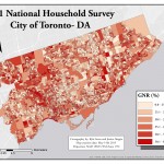
Smart cities may one day enable urban planners to predict where bike lanes and traffic amelioration are needed most. This will partially be due to a new bike-ready navigation system that’s revolutionizing how cyclists find their way around urban areas worldwide.
SmartHalo, a circular device that can be easily installed to provide both an anti-theft alarm and directions while biking, consists of a circular light that attaches to the handlebars of any bike. The device’s inventors dream of how to make bikes as convenient as automobiles, and, in the process, reshape urban society.
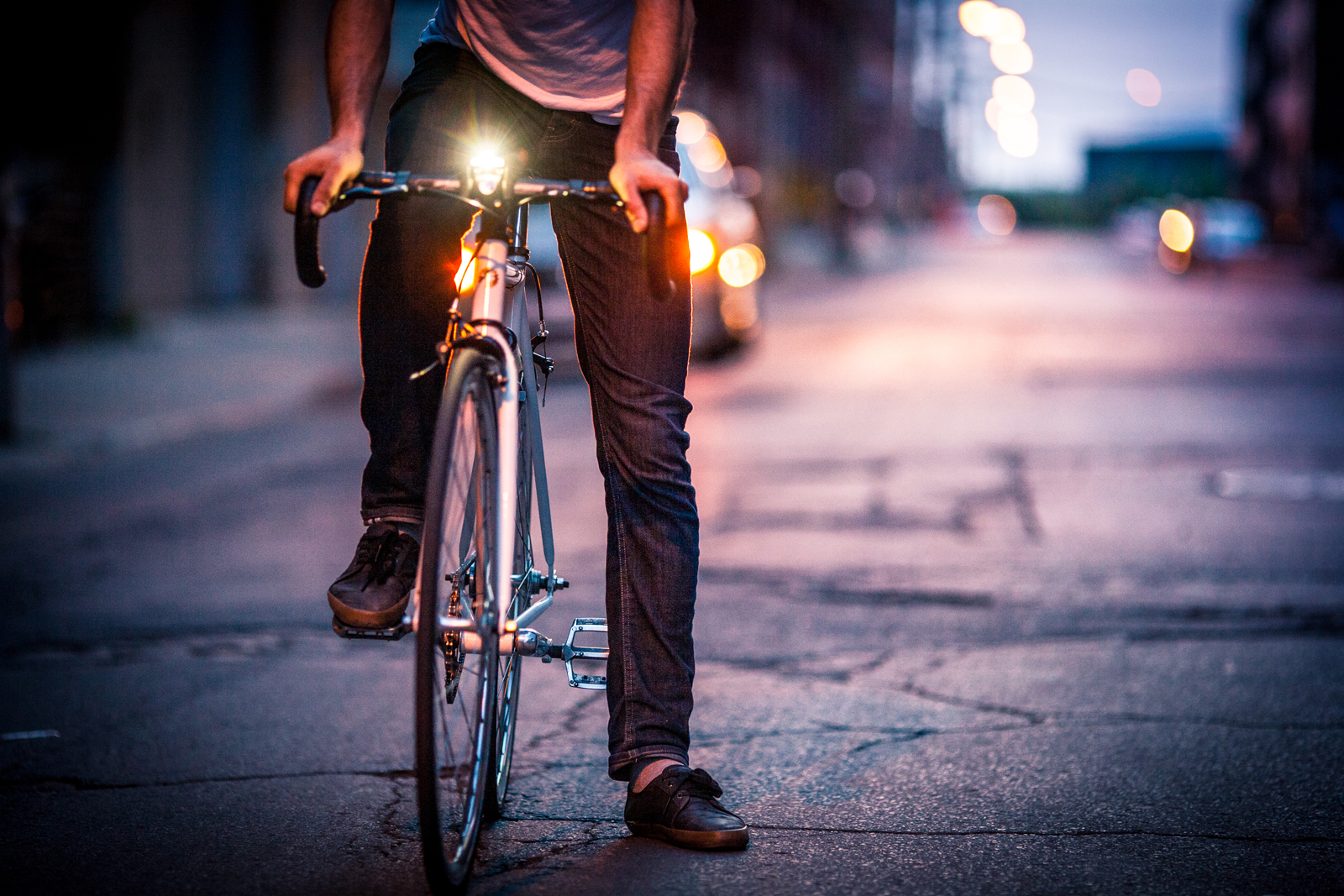
“I’ve been biking for transport for a while now, probably about 15 years,” SmartHalo Co-Founder, Xavier Peich, told Geothink.ca at the 2017 Summer Institute at McGill University in Montreal, QC. “When I was younger, when I was doing my bachelors, I spent a year abroad in Paris as a student. And I traveled the whole year by bike. And I feel that I discovered the city so well just because I was biking all the time—perhaps better than some Parisians there. And I noticed that there were some places that I have been going often. And other places that I was just discovering.”
Check out a video of SmartHalo Co-Founder Xavier Peich talking about SmartHalo at the 2017 Geothink Summer Institute in the first half of this video also featuring Local Logic Co-Founder Vincent-Charles Hodder.
“And towards the end of the year, I sort of wanted to know, like hey, it would be neat to see a sort of heat map of like where I’ve been and are there places I go all the time,” he added. “So that was one thing. And the other thing is—and that was back then before smartphones—so it was a built difficult to find your way around town or especially a new city. And I found myself wanting to have a very simple interface that would connect to my phone to show me directions.”
The circular light on SmartHalo intuitively directs bikers as to what direction they should turn at an intersection by lighting up on that part of the circle, Peich said. He added that this device essentially puts biking around cities on par with cars in terms of safety (from theft) and convenience (in terms of navigation). Peich and many cycling advocates note biking has the additional benefits of saving you time on parking and improving your health. SmartHalo can also help direct bikers on accessible cyclist paths and safer routes.
“What brought us into choosing this interface, instead of like putting a map or just two arrows, actually comes from living in Europe and realizing that most cities around the world are not just like Montreal where it’s just left and right—most of the time it will be in diagonals,” Peich said. “So you have to design by thinking about that. Is there a way that we can show all types of directions? Well the circle is incredible simple. It’s perhaps the simplest form. But, then, you can show very complex information too.”
The potential uses for data from a device like SmartHalo are seemingly endless. Bikers using SmartHalo can help map parts of urban areas where smartphone carrying pedestrians and automobiles do not frequently go—yet cyclists may have occasion to do so. For example, more suburban and rural places may make ideal routes for cyclists on vacation or trying to get out of town but can often be dominated by traffic on a few main streets or nearby highways.
“Obviously, if you just commute to work from your house and you’re just doing that everyday, and you don’t go anywhere else, of course you know your way around,” Peich said. “But when you use the bike as your main mode of transportation, then you end up going to new places all the time. And this is when it sort of makes sense to try to see how a GPS or a navigation system would be applied to bikes.”
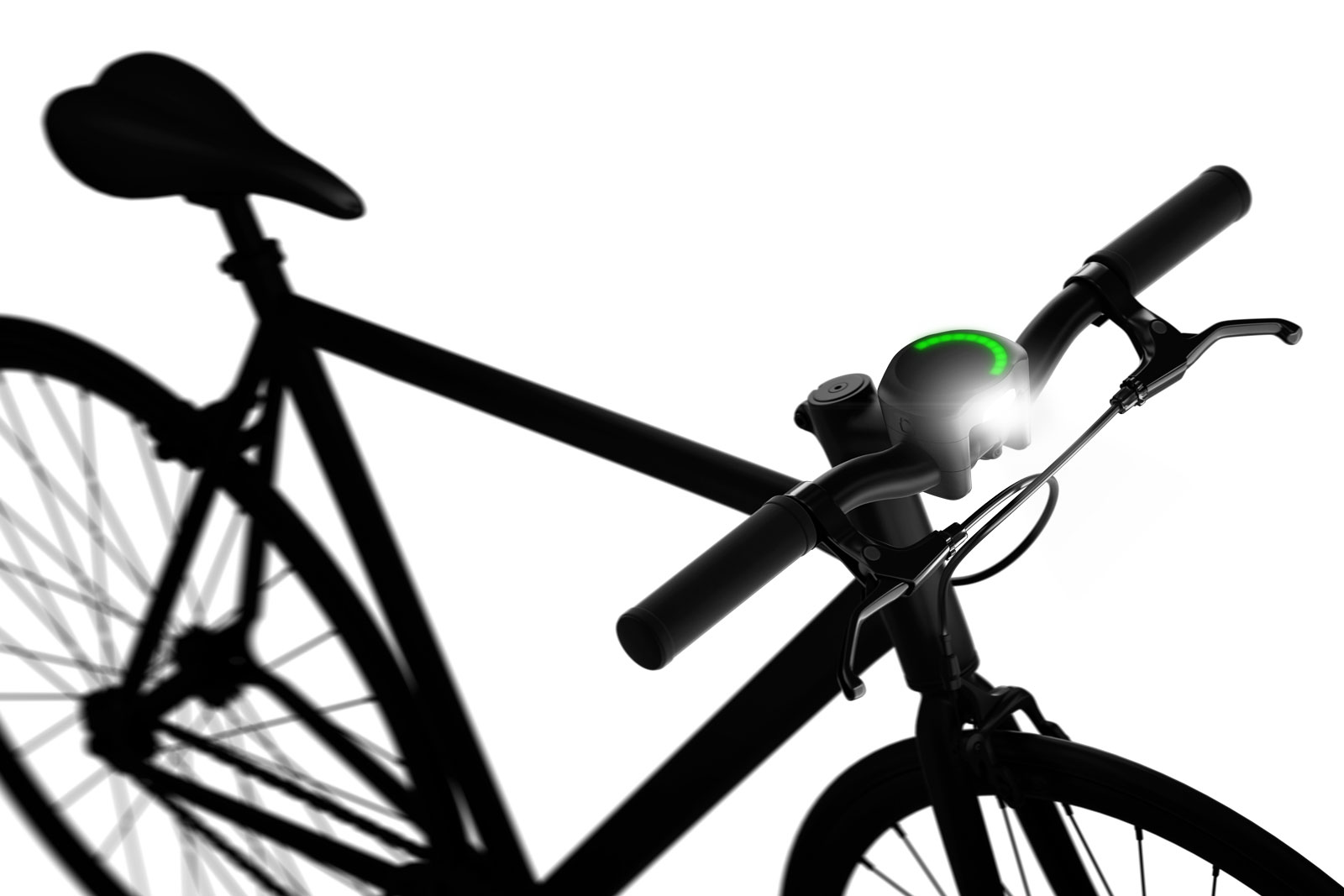
The circular light on SmartHalo intuitively directs bikers as to what direction they should turn at an intersection by lighting up on that part of the circle (Image courtesy of SmartHalo).
###
If you have thoughts or questions about the article, get in touch with Drew Bush, Geothink’s digital journalist at drew.bush@mail.mcgill.ca