Leveraging Open Data: International perspectives presented at URISA’s GIS-Pro 2016 conference

This is a cross-post from Geothink co-applicant Dr. Claus Rinner‘s website, written by Geothink student Sarah Greene, Ryerson University. Sarah is Candidate for the Master’s of Spatial Analysis at Ryerson University. Her research focusses on open data.

By Sarah Greene

This past week, URISA held its 54th annual GIS-Pro conference in Toronto, bringing together GIS professionals and businesses from around the world. The conference provided many interesting sessions including one focused entirely on open data. This session, titled “Leveraging Open Data”, included government as well as private sector perspectives.

The session began with a presentation from the Government of North Carolina, discussing the importance of metadata. They are currently collaborating with a number of agencies to create and share a metadata profile to help others open up their data and understand how to implement the standards suggested. They have produced a living document which can be accessed through their webpage.

The next speaker at the session represented Pitkin County in Colorado. They represent an open data success story with a number of great resources available for download on their website including high quality aerial imagery. An important aspect to their open data project was their engagement with their local community to understand what data should be opened, and then marketing those datasets which were released.

The Government of Ontario was also present as this session, presenting on the current status of open data for the province. The Ontario Government promotes an Open by Default approach and currently has over 500 datasets from 49 agencies available to download through their portal. They are working towards continuing to increase their open datasets available.

A presentation by MapYourProperty provided an interesting perspective from the private sector using open data to successfully run their business. They heavily depend on visualizing open data to provide a web-based mapping application for the planning and real estate community to search properties, map zoning information and create a due diligence report based on the information found. This is one example of many that exist in the private sector of open data helping build new companies, or help existing companies thrive.

Lastly, a representative from Esri Canada’s BC office wrapped up the session reminding us all of the importance of opening data. This included highlighting the seemingly endless benefits to open data, including providing information to help make decisions, supporting innovation, creating smart cities and building connections. Of course, open data is big business for Esri too, with the addition of ArcGIS Open Data as a hosted open data catalog to the ArcGIS Online platform.

This session showcased some great initiatives taking place in Canada and the United States that are proving the importance of opening up data and how this can be done successfully. It is exciting to see what has been taking place locally and internationally and it will be even more exciting to see what happens in the future, as both geospatial and a-spatial data products continue to become more openly available.

A talk at the GIS Pro 2016 conference. Photo credit: Claus Rinner

A talk at the GIS Pro 2016 conference. Photo credit: Claus Rinner

See the original post here

On the Hunt for Social Justice and Empowerment

By Logan Cochrane, Mark Gill, Jon Corbett

The participatory geoweb has the potential to transform relations of power – who contributes and names places, what is excluded and labeled. This transformation can occur through newfound opportunities for engagement and giving voice to spatially relevant issues. In the 1990s, GIScience recognized this potential and made explicit the importance that social issues would, and should take within the discipline and practice. Geothink did likewise, making social justice one of its key themes. While Web 2.0 and the geoweb has promised greater forms of equality, particularly through supporting user generated content, we know that maps remain value-laden, and are embedded with particular power relations that are not necessarily equally distributed. Social justice is a term that describes the equitable distribution of resources, opportunities, and privileges within society. Amidst the Web 2.0 enthusiasm, we were interested in how issues of social justice are being addressed within the context of the geoweb in academic literature. You might be surprised what we found.

We first set out to take stock of the current state of GIScience literature (Cochrane et al, 2016). Using the ten most highly ranked academic journals by GIScientists. We assessed ten years of literature. We narrowed the more than 14,000 articles published from 2005 to 2014 to those having some relationship to the geoweb and/or crowdsourcing, using broad and inclusive terms. Of the resulting sub-set, we searched for social justice, and terms related to it, for example empowerment. We found that only three articles engaged explicitly with social justice . Even more surprising, terms related to social justice (empowerment, marginalization, social change, environmental justice, spatial justice, etc), were limited to the marginal periphery of these top tier journals. In other words, these ideas tended not to be the main content of the research. We argue that GIScience runs the risk of missing important insights , as mapmakers around the world are engaged in practice, but ignored in top tier GIScience journals.

Finding that social justice was more likely to be a footnote than a substantial focus of the research endeavour or engagement, we then wondered about empowerment. We had searched for it in the original article, but wanted to expand the search (adding ten more years of journals, 1996-2014, and using an open search rather than specific journals) and go into more detail (Corbett, Cochrane and Gill, 2016). Empowerment is of particular interest for GIScience because so many assume the use of the participatory geoweb results in empowerment. While the usage of the term has increased with time, the concept was consistently ill-defined and insufficiently measured. Amazingly, almost one quarter (24%) of the articles that mentioned “empowerment” were not included in the main text, but in places such as the works cited list or an endnote. Even of those that did engage with the concept in a substantial way, only a minority defined the term, fewer still explained how they measured it, and only five listed the specific metrics. We argue that researchers should make a greater effort to adequately define what they mean by “empowerment” and provide a way to actually assess how projects are providing that particular empowerment.

These two papers act as key reference points for those interested in the participatory geoweb. While our papers do not negate the potential for positive impacts, they highlight the fact that research commonly does not engage with social justice, and when terms like empowerment are used, they are often not defined or cannot justify claims of positive impact. As Web 2.0 technologies encourage people to take part in creating knowledge, through maps or otherwise, we need researchers to study how participatory and crowdsourcing approaches to map making intersect with issues of social justice. Based on these findings, we hope to draw attention to this important aspect of GIScience which has long been identified as a crucial area of research.

Dr. Corbett's research team are tackling issues of empowerment via the geoweb and have developed tools such as GeoLive

Dr. Corbett’s research team are tackling issues of empowerment via the geoweb and have developed tools such as GeoLive

For more information, see the two papers this post was based on:
Cochrane, L., Corbett, J., Evans, M. and Gill, M. 2016. Searching for Social Justice in GIScience Publications. Cartography and Geographic Information Science http://dx.doi.org/10.1080/15230406.2016.1212673

Corbett, J., Cochrane, L. and Gill, M. 2016. Powering Up: Revisiting Participatory GIS and Empowerment. The Cartographic Journal http://dx.doi.org/10.1080/00087041.2016.1209624

Potentials and Pitfalls of Civic Engagement through Pokémon GO, Augmented Reality, and Gamification

By Peck Sangiambut

Media coverage in recent months may be focusing on Niantic’s continuous battle with Pokémon GO exploits and the game’s apparent demise, but here at Geothink we still see great potential in augmented reality (AR) games to promote community engagement. Our research examines communities and citizen-government engagement, particularly through geospatial technologies such as the geoweb. At the height of the craze, Pokémon GO resulted in conspicuous movements of people through engagement with a location-based service. This provides us with a convenient case study of the potential effects of a location-based service that causes movement of people through gamification. Geothink has also investigated gamification in urban planning and citizen engagement through platforms such as Minecraft and the precursor to Pokémon GO, Ingress. A recent publication from Geothink student, Lisa Mather Ward, and her supervisor, Dr. Pamela Robinson, has looked at Minecraft’s potential for public consultation.

Pokémon GO and Geography

Geothink co-applicant Dr. Claus Rinner (Ryerson University, Department of Geography and Environmental Studies) has written a post introducing geographic analysis concepts with Pokémon GO. In it, he writes about geographic distribution, catchment areas, and links them to geospatial analysis methods such as buffering, distance decay, and suitability mapping. Some of the built-in distributions of Pokémon (such as having certain types of Pokémon available for certain types of terrain, weather, continents, and time of day) are similar to what we look for in ecological species distribution. The same concepts and techniques are widely used by corporations conducting market research, retail analysis, and location intelligence. As such, Pokémon Go is a great way to introduce basic geographic concepts to students and the interested public.

A Medium for Contestation of Urban Places?

Movements of people that are a direct result of their interaction with a mobile app could result in new contestations of space and place. Pokémon GO is potentially one tool that influences and reassigns cultural identity and platial meaning. In downtown Montreal, we have seen a regular congregation of Pokémon trainers develop around Cabot Square to catch Pokémon, level up, and wrestle for control over its gym. Will this new influx of people change the identity of Cabot Square? Or has this already happened?

Pokémon Go (right) versus swing dancing (left) - is location-based gaming a new tool to contest space and place? Photo credit: Suthee Sangiambut

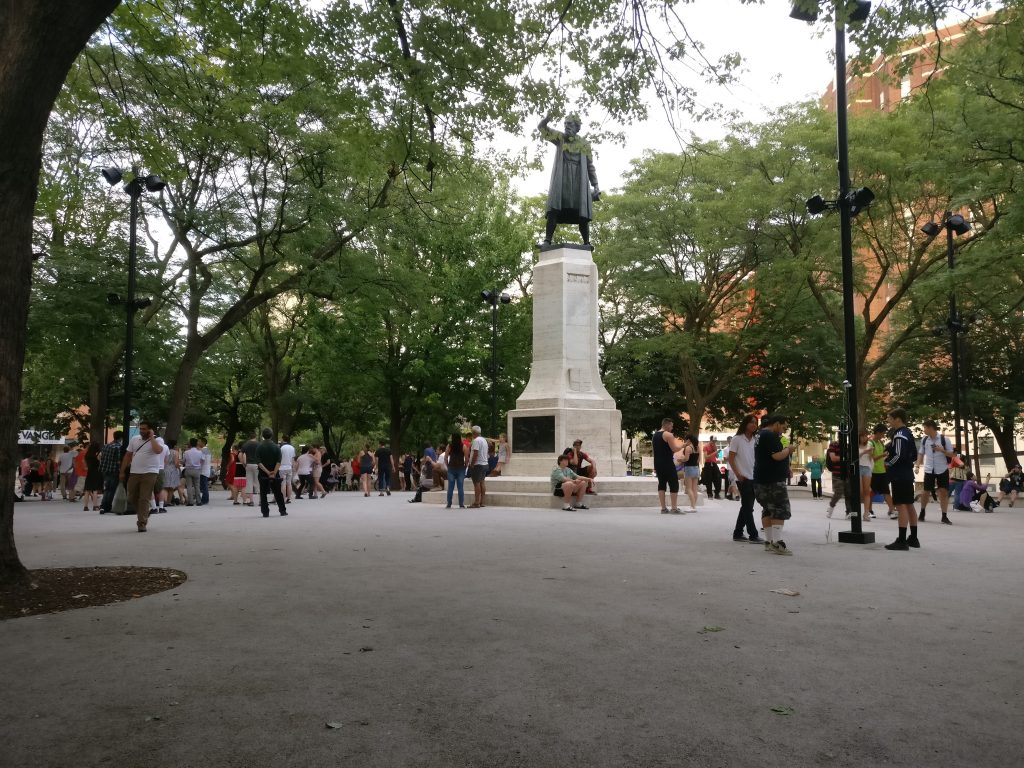
Pokémon Go (right) versus swing dancing (left) – is location-based gaming a new tool for contesting space and place? Photo credit: Suthee Sangiambut

Geothink Head, Dr. Renee Sieber (McGill University, Department of Geography and School of Environment), has spoken of the potential abuses or biases that may result from the placement of Pokémon and pokéstops on the map. Algorithms are the determinant for a pokéstop and Pokémon spawn locations. However, as Sieber emphasises, technology itself should never be assumed to be neutral. Implicit biases may be injected by programmers, managers of the technology, and the underlying data. For example, it has been noted that certain neighbourhoods are poorer in pokéstops, potentially due to the distribution biases in crowdsourced contributions that formed a part of the underlying pokéstop dataset.

On the other hand, does location-based gaming have the potential for real-world community building? Are players actually exploring their own communities?

Geothink co-applicant Dr. Stéphane Roche (Université Laval, Département des sciences géomatiques) and his PhD student, Territutea Quesnot have studied landmarks and wayfinding, particularly through social networks with gamified interactions such as FourSquare. As Roche notes, the concept of ‘checking in’ to a location is not new. Pokémon GO’s uniqueness is in its content and in overlaying the Pokémon universe over the real world (such as through the camera feature) with more integration than Ingress. For Roche, such movements of people could also be a form of contestation or appropriation of places. He defines an urban place as “an equation between a physical location, an event, and the name associated with the phenomenon”. Landmarks in the city can therefore have multiple ‘places’ depending on their usage. For example, a pond has one use during the summer, but turns into an ice skating rink during the winter. Pokémon GO, Roche says, “has created new urban places, in a location where existing places were already there”. Roche cautions us to not immediately condemn the phenomenon of Pokémon GO players congregating in large groups, as contestation and appropriation of urban places is not a new process. Pokémon GO itself has not had an entirely negative effect on urban environments and has been attributed as a factor in revitalising the Brussels community after this year’s terrorist attacks.

Roche is optimistic that “gamification and technology has the potential to improve our understanding of the world, improve our skills, including spatial skills, and could help people to discover new components of the world”, but also echoes Sieber’s concerns over algorithmic regulation where, “because of the choices that are embedded in the code and algorithms, there is a kind of orientation and social classification…and it becomes more and more difficult to discover new things”.

For Rinner, government should not have to resort to gamification to promote community engagement or citizen-government interaction, but he admits,

“I am afraid that it will soon be necessary to get anyone to do anything good. So, yes, I expect that government will soon use gamification to motivate people to engage in planning questions or politics. And more concerningly, I expect that businesses will use geolocation games to steer people to the right, or maybe wrong, places.”

AR and Gamification: Potential for Civic Engagement in Urban Planning

Regardless of Pokémon GO’s success, Geothink is looking to investigate the potential of AR in promoting civic engagement at the municipal level. Geothink co-applicant Dr. Pamela Robinson (Ryerson University, School of Urban and Regional Planning) has brought together a group of six masters’ of urban planning graduate students to investigate AR’s potential for the City of Toronto. Their mission is:

To explore the potential of AR technology in relation to public consultation & civic engagement by local governments and to provide a framework for analyzing future engagement opportunities

According to the students, AR has a high potential due to its fusing of the digital and physical. Unlike Virtual Reality (VR), AR does not completely remove the physical world and users can still interact with each other face-to-face, rather than being restricted to a virtual environment.

Currently at a preliminary stage of their project, the students have investigated the distribution of pokéstops and urban accessibility to pokéstops to examine the geographic reach of the game in the city. The density and location of check-in locations for any gamified service are crucial when attempting to attract people to a particular location, such as the location of a public consultation or town hall meeting and also important for evaluating how inclusive the tool can be in terms of reaching residents. The students discovered that a player’s experiences of Pokémon GO can really differ depending on where they live in Toronto.

Team PokéPlan (as they have named themselves) is also looking at other issues that a municipality will be concerned with, such as legal considerations (privacy, liability), language barriers, issues of service coverage and accessibility (the digital divide), and how to reach broad and target audiences, and finally gamification. According to Geothink student Corinna Prior, the City of Toronto has already begun to experiment with more flexible types of consultation such as the Planners in Public Spaces programme where planners go to the people. For Prior, “gamification is a really powerful tool. The potential to get people out and about is really powerful”. If AR and gamification could be used to support public consultation processes, we may experience radical changes in how citizens interact with their municipal governments.

More updates on TeamPokéPlan once their project ramps up. In November, Team PokéPlan will host a World Town Planning Day breakfast (November 8th), be the guest speakers at Civic Tech Toronto’s Hack Night (November 15th) and present their final report on November 22nd. For more information about their work please contact Pamela Robinson.

Catching up with former Geothink Project Manager, Alex Taciuk

Geothink’s former Project Manager, Alexander Taciuk, has just begun the next step of his career in Vancouver. Geothink caught up with him to find out where he has been and where he is headed.

alex-taciuk
By Peck Sangiambut

What have you been up to since you left Geothink?
I went on a three month trip around the world. Southeast Asia for a couple of months and then Europe for a month. Saw everything I could see, explored cities, ate everything that came across my plate, to varying results. Now I have just started my studies here in Vancouver, at the School of Community and Regional Planning at the University of British Columbia. I learned so much at Geothink, there were times that it was intense, and it was all a wonderful experience.

What made you decide on a degree in planning?
I’ve toyed with the idea for a long time. It’s part of why I did a degree in urban geography at McGill University. The time that I had in Geothink gave me the chance to actually speak to a lot of city officials and Geothink partners, and see what they do. That reinforced my desire to work in a municipal field, work with citizens, and find ways to make government and citizens coexist in a productive and harmonious way. The decision to go into planning really came about during my time in Geothink, and so far I think it has been the right decision.

Did Geothink help shape your views on the urban planning issues most important to you?
Yes. One of my personal interests is in transportation. Although transportation issues didn’t represent themselves heavily in Geothink, it was always exciting to hear about work on transportation. It was really cool to hear about Prof. Scott Bell’s work on voluntary cellphone tracking in Saskatoon and what he found when buses went on strike in the middle of their experiment, which produced a sort of natural break [in transportation flows].

Would be able to bring what you’ve learned from Geothink, such as open data and open government, to your new field?
Absolutely. I think that being able to learn about open government, open data, crowdsourcing, and smart cities, the various urban issues discussed in Geothink will add a lot of richness to my new degree. Hopefully I’ve gained enough to create more nuanced views of urban planning issues, which I can convey to planners.

Geothink has also looked at city-to-citizen interaction. Do you see yourself working towards improving these efforts in urban planning from what you’ve learned here?
I hope so. I think that the work that Geothink has done on public consultations and citizen participation could add a lot to what we are doing in the planning world. One of the classes I’m in, called Planning Practices and Methods, is about learning a toolkit on how to solve multi-criteria, multi-stakeholder, very complex problems. You learn how to come up with objectives for them, develop alternatives, and when you need to ask the public a ‘value’ question or when you need to bring in technical experts. I already see some parallels with Geothinkers’ research such as in Spatial Decision Support Decisions. To have public consultations on issues to develop what the public thinks their values are, and not just do that from face-to-face meetings, but to be able to do that digitally in a constructive way, that is the value that Geothink could bring to planning.

Are there any skills you learned while at Geothink that you are bringing forward?
There were a lot of soft skills I learned in terms of organisation, connecting with people, and trying to bring people onboard with new ideas that they may not yet see a connection to. The events that I really enjoyed doing were the Summer Institutes, I absolutely loved them, there were points during them where I couldn’t believe that this was my job. I learned a lot about organising events, and seeing things run smoothly, students coming in and actually getting something out of it, such as the one we did last year where the students were consulting for the City of Ottawa – learning how to create that was such a great process.

What was the best experience you had at Geothink? What will you miss the most?
I’ll miss the people in Geothink. No government mandated that we need to study open cities or open government. It was a bunch of professors, and partners, that came together and said ‘hey this is a really good topic and something we should investigate’. So they just did it. And so being able to get on the phone and speak with academics and research partners from around Canada and hear about the work they are doing – that was really great. I had a lot of conversations with Prof. Jon Corbett where we discussed his projects and various ways of doing them, and just having the opportunity to be that sounding board was a fantastic experience. That’s what I’ll miss.

I like to say a huge ‘thank you’ to Dr. Renee Sieber. I learned a lot under her mentorship, and it was great working under her. I also want to give a big thank you to all our researchers and partners for allowing me to work with them. I am confident that we will continue to get brilliant output from you all, and am incredibly excited to see how Geothink progresses in its final stages.

The State of the Map 2016

Recently graduated Geothink student Julia Conzon (McGill University) has recently returned from the State of the Map conference in Brussels, on a travel grant. Julia was able to meet individuals interested in different social, political, and technical components of OpenStreetMap, which solidified her beliefs that the success of volunteered geographic information relies on both social and technical fields. Julia’s interests in mapping include: increasing diversity to reduce the digital divide and harnessing government support.

SOTM group photo (photo by Tatiana Van Campenhout)

SOTM group photo (photo by Tatiana Van Campenhout)

By Julia Conzon

I recently attended the State of the Map (SOTM) in Brussels, Belgium. SOTM is a conference that discusses various social, political, and technical components of OpenStreetMap (OSM), a mapping website that aims to map all of Earth’s landscapes, such as social and physical infrastructures. You may wonder, doesn’t Google already do this? In short, yes, Google has done an efficient job producing Google Maps and its associated routing/navigation software; but it still has its limitations. First, Google Maps has several unmapped locations. As addressed by SOTM’s keynote speaker Allan Mustard, US Ambassador to Turkmenistan, if you compare the map of Ashgabat, Turkmenistan, between Google Maps and OSM, you will certainly see a difference (Figure 1). Secondly, Google’s spatial data is not open, which hampers equality and empowerment. Thanks to Ambassador Mustard’s initiative to use OSM, he and several Ashgabat locals have mapped out the remote city and now the citizens can use this open spatial data for various socio-economic purposes. For example, prior to the OSM maps, Ashgabat taxi drivers did not know where all the gas stations were located. Now, with a local map openly accessible to all citizens, Ambassador Mustard says taxi drivers are more efficient at navigation. In short, OSM provides an open-source platform that allows worldwide internet users to contribute geographic features of anywhere from anywhere, which then can be freely downloaded by anyone to use.

Figure 1. Differences in Ashgabat, Turkmenistan between OSM (left) and Google Maps (right) (screenshots from OSM and Google Maps)

Figure 1. Differences in Ashgabat between OSM (left) and Google Maps (right) (screenshots from OSM and Google Maps)

Government Support
As seen with Ambassador Mustard, there are some within government who do support crowdsourced mapping initiatives. With Federal funding, Statistics Canada has announced a pilot crowdsourcing project starting in October 2016 to use OSM’s platform to crowdsource building data. It was also exciting to see the government presence at the conference (such as a member of Statistics Canada) and government partnerships such as between Etalab (a French government organisation) and OSM France.

Through one of the Birds of a Feather (BoF) discussions I participated in, it is apparent that OSM’s platform is positively reshaping certain government’s perceptions on how to produce open data. However, a presentation from Usman Latif, a journalist from Pakistan and the founder of Open Humanitarians (formerly DigitalHumanitarians.pk), reminded the SOTM audience that not all governments are democratizing their data. In Pakistan, broad laws have made unauthorised mapping activities by locals illegal. Usman risks penalties if he encourages local mapping, but he explained that to follow the law, he encourages students and youth to map parts of the world outside Pakistan and “to be a part of a global humanitarian society.” Usman’s goal is to proliferate a vibrant community of humanitarian mappers in Pakistan who can eventually use their mapping skills to participate in the global humanitarian society, particularly in disaster response. With Pakistan prone to earthquakes and floods, Usman hopes these educated Pakistanis will contribute to domestic disaster responses once Pakistan opens up local mapping. With this mindset, Usman now educates university students in Pakistan on using OSM. Although not all governments are supportive of open spatial data, Usman’s goals illustrate how educating locals about OSM and encouraging them to contribute to global (digital) humanitarian society can promote local empowerment, something I believe is a worthwhile alternative.

Smart Cities
Apart from social and political components of OSM, many presentations also addressed technical components; more specifically, new automated tools for OSM users. Some of these tools can be used to promote smart cities. Christian Quest and Michel Blancard from Etalab presented OpenSolarMap (view Figure 2). This presentation discussed using machine learning to identify which rooftops throughout France are most suitable for solar panel instalment based on rooftop aspect direction (north, south, west, east, or flat). Although there are still some variables that are excluded (e.g., solar intensity or rooftop angle), the software does highlight a more efficient methodology.

etalab-visualisation

Figure 2. Etalab’s map visualization of rooftop directions (photo by Julia Conzon).

There were also three presentations proposing different methods to map indoor areas. Indoor data can be used for a series of smart city applications, such as geomarketing. For instance, a mobile app could link indoor routing with a store’s product information to direct a customer to the product they want in the store while also encouraging them to pass by other similar products. Although each presentation proposed slightly different methodologies to map out indoor areas, all three shared similar concerns on mapping certain features, such as whether a stairway takes you up or down a floor. There were also different stances on opening up the indoor data to the public. For example, French National Railway Company (SNCF) have mapped the interiors of all popular stations in Paris; but, instead of this data being openly accessible to the public, they combined their data with OSM data to create an app that provides maps of these stations’ interiors. Unfortunately, this app is not available for free, which disappointed myself and my neighbouring audience members. On the other hand, Roland Olbricht’s and Roland Wagner’s workshop taught the audience how to map building interiors with OpenStationMap, which is an OSM project that aims to incorporate indoor mapping onto OSM’s station polygons. As Google Maps has also introduced indoor mapping, Carto Cité’s presentation on indoor mapping reminded the audience, ‘We can’t leave it all to Google’ (Figure 3). If we leave indoor mapping to a few corporations, data accessibility may be restricted for commercial interests.

Figure 3. Indoor mapping efforts should not be undertaken by only a few actors

Figure 3. Indoor mapping efforts should not be undertaken by only a few actors (screenshot from YouTube)

Conclusion
Overall, the State of the Map presented two trends: collaborative learning and machine learning. The latter trend reflects discussions on automation of mapping processes, while the former trend reflects discussions on on-the-ground mapping with locals. Although these trends seem diverging, OSM’s platform is capable of incorporating both. As OSM Foundation’s Mikel Maron mentioned, it is about being “a part of the database.” Whether it be building technical tools to ease mapping complex areas or educating locals to contribute geospatial data, both trends aim to provide open geospatial data for all to use.

This collaborative environment has ultimately encouraged me to sustain the initiative for open spatial data. With the knowledge I have gained from the conference, I will introduce several new activities to Maptime MTL. Feel free to contact me at juliaconzon@gmail.com or maptimemtl@gmail.com if you are interested in participating or collaborating. You can also connect with me on Twitter @julconz and LinkedIn.

Notes from the GIScience Conference 2016

Last month, Geothink took part in the GIScience 2016 conference in Montreal, a biennial conference for academics in the field of GIS and geography. Geothink was present as a sponsor. Additionally, multiple Geothink academics were present to engage in academic discussion, and members of Geothink were also involved in the organisation of the conference.
One of our volunteers, Lesley Johnson, reports her experience of the conference.

By Lesley Johnson

The 9th installment of the International GIScience conference was held in Montreal (27-30 September) – the first time the conference has been held in Canada. The conference was ambitious as it covered a lot of ground in 4 days: from a workshop on Machine Learning on Tuesday, to the impact of human intention on geospatial data quality on Thursday, and then finally to the definition and meaning of GIScience itself on Friday.

Perhaps the overarching goal of the conference was to put the sheer breadth of this challenging, shapeshifting, but most of all, exciting, field of study into perspective. How do we categorize GIScience? Where does it fall in the tree of science? Is it indeed a discipline in its own right?

To answer these questions, over 250 attendees from across the globe came together to debate these questions and find out about the latest advances in the field. The conference kicked off on Tuesday with hands-on workshops (“Understanding Spatial Data (big and Small) with Visual Analytics”, “Machine learning methods for spatial and temporal analysis”). Attendees in the Machine Learning tutorial were taught by University College of London’s James Haworth on how to use Support Vector Machine regressions to analyze datasets; an important skill for any budding or experienced GIScientist to have in their back pocket.

Wednesday’s schedule was packed full of exciting and diverse sessions. Following the keynote on the “Internet of Mobile Things”, the Cognition and Place session was held, where attendees were asked to think about “place” beyond the positivist notion of “space”. The importance of spatial scale and cell resolution was also emphasized and re-examined in the Raster Models and Modelling session, moderated by Memorial University’s Rodolphe Devillers. Barbara Buttenfield’s research “measuring distance as the horse runs” was especially interesting, as I had personally never heard of the term before. Differences in spatial resolution can affect distance calculations. Even at local scales, it is important to account for factors such as the curvature of terrain.

img_20160929_111925

Thursday’s keynote on “Artistry in GIScience” by Deniis Hlynsky (Rhode Island School of Design) sparked many an interesting conversation. It pushed scientists to think outside of the academic box, and think about what great beauty there is in the phenomena that we study everyday: from starlings flying across the sky each wing beat captured and superimposed, to cartographic design. Does GIScience always need to be about …science? Can GIArt be a discipline in its own right?

As the conference came to a close on Friday, a final panel of GIScientists was brought together and were asked by Dr. Renee Sieber, one of the main conference organizers, “what is GIScience?” The question led to other questions, such as “Does the title of a researcher determine their funding opportunities, or does the research speak for itself regardless?” and “What name would bring the most attention to a higher education program: spatial data sciences or geographic information sciences?” As a graduate student, most of the conversation seemed pointless: Can’t we just do research and not worry about the semantics of it? I then realized that gaining funding and disseminating your research are crucial to doing research after graduate school. Maybe I do indeed need to think about the implications of the title on my business card a bit more.

Collaboration is also needed between the Geographic Information Systems and the Geographic Information Science; between those who are engaged in GIScience questions (such as those relating to spatial data accuracy), and those who use Geographic Information Systems software for specific domain questions.

Finally, congratulations go to Dr. Renee Sieber, for receiving the Canadian Association of Geographers Lifetime Achievement and GIScience Excellence Award!

The conference was, in short, wide in scope and ambitious in its depth. It achieved its goal of bringing GIScientists (or spatial data analysts, if you will) from across the globe, and pushing the definition of GIScience itself. Needless to say, I look forward to the tenth installment of the GIScience conference – hopefully I’ll have figured out what to call myself by then.

Paulina Marczak – looking back on her co-op at Open North

paulina-marczak

As she is now embarking on a Master’s degree, I interviewed Paulina Marczak (former Geothink student) to reflect on her four month co-op with Geothink partner, Open North.

What have you been up to since your internship at Open North?
After Open North, I did another co-op in the fall term with Dr. Derek Robinson under an NSERC USRA [Natural Sciences and Engineering Resource Council Undergraduate Student Research Award] grant, where I looked at variations in aboveground vegetative carbon storage across different spatial resolutions within Southwestern Ontario.
I just finished my undergraduate degree at the University of Waterloo. My undergraduate thesis looked at landscape configurations with wetlands in the boreal plains and asked: Is there a relationship between geology and wetland landscape configuration?

Right now I have just begun pursuing a Master’s degree in Geography at Queen’s University in Kingston. So I went into another sub-field still related to geography, but diverging from open data.

Your work in open data and open government are quite removed from your current course
Yes. I wanted to go into climate change after my undergrad, particularly through GIS and remote sensing. However, this summer I had the opportunity to work for the Canadian Open Data Exchange (ODX) and got to help develop their plans for commercialization of open data. They wanted someone who understood the value of open data.

What do you think you got out of your time at Open North?
I learned a lot. I started out from zero experience with open data. You know, it’s easy to fall down the rabbit hole of open data and explore one particular aspect of it, like metadata, without even touching another aspect Being able to co-author white papers that contribute to a global-scale initiative, and interview people from around the world, that was a really valuable and unique experience.

What was it like working for a non-profit?
James, Stéphane, and everyone at Open North were really great. It was different because all my previous co-ops were in government, federal and municipal. They were very structured. Open North was smaller, and it required you to be more. They want you to be a part of that team. They make you feel like you are a critical component of the team, not to mention the valuable mentorship they provide. Infomediaries, they prod governments, they speak on behalf of and give a voice to the people. That’s why I think their work is impactful. Working at Open North also gave me the opportunity to attend the Canadian Open Data Summit 2015 in Ottawa, where I got to meet various members of the open data community and speak to panelists.

What skills did you bring from Open North to your current position?
Being able to critically research, and experience with technologies such as APIs and R (statistical software). Most important is writing. At Open North I learned to write on a deadline, such as our OGP [Open Government Partnership] white papers, and I also learned about academic writing from Professor Renee Sieber.

It’s been interesting as a new Master’s student. I was talking to a librarian here in Kingston and they were interested in the idea of open data, but were surprisingly satisfied with the very restrictive data agreements that are currently in place…there is more work to be done on the advocacy side. On the other hand, I was able to talk to the City of Kingston and they are about to roll out a new open data initiative, per Council approval. From my interactions with the librarian, I realized that I could talk about this topic now and I had some idea of how things should be done. In fact, they were looking to me for advice, which was a new milestone for me.

It sounds like you may be interested in advocating for open data in your new environment?
Sure. I can talk about it, but I don’t feel I have the capacity and knowledge to spearhead it. But I do feel it is my responsibility to inform people if they don’t know what open data is or want to learn about some of current issues surrounding open data these days.

Do you feel more confident in talking about open data now?
Yes, but I don’t feel like I’m the expert. I feel like I’m an apprentice. Constantly learning.

The New Geothink Brochure

I am pleased to announce that we have just published a new Geothink brochure highlighting some of our research. You may be seeing some physical copies at Geothink events. In the meantime, please feel free to click the image below and download a copy for yourself. It is also available on this website under the Resources section.

brochure-screenshot