Category Archives: In The News

Crowdsourcing for better science and governance?

Screen Shot 2016-01-25 at 12.39.53 PM

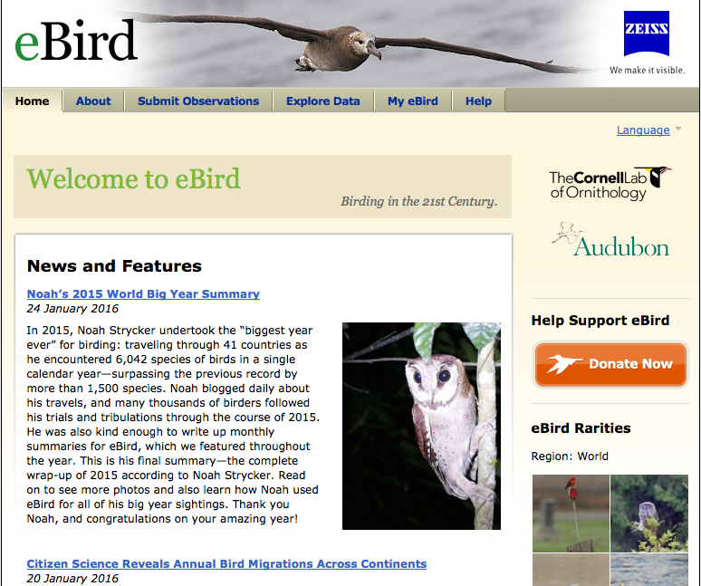
Cornell University Lab of Ornithology’s E-Bird Web site allows citizen scientists to contribute data on birds for real scientific research as one novel application of crowdsourcing.

By Drew Bush

At Cornell University’s Lab of Ornithology, scientists have long benefited from the legions of enthusiasts who find joy in observing and reporting the birds they see during their daily routines. In 2002, the lab worked with the United States National Audubon Society to launch eBird, an online database where scientists and amateur naturalists can submit real-time observations of the birds they see and their behavior. Since 2013, scientists have benefited from more than 100,000,000 observations and data for over 10,240 species in the program generated by more than 100,000 users.

Often hailed as an application of crowdsourcing that democratizes science by giving citizens the power to contribute, E-Bird is emblematic of a recent trend in applying crowdsourcing to problems outside the for-profit, business sectors where it began. In Canada, a new Community Fishers application allows citizen scientists to collect oceanographic data for Ocean Networks Canada and a number of Canadian cities use PlaceSpeak to collect public opinions on topics related to given locations. In the United States, this trend has led to the introduction of the Crowdsourcing and Citizen Science Act. The bill’s author, Senator Chris Coons of Delaware, wrote in a Wired article this past September that his bill makes explicit “that executive branch agencies, commissions, and all military branches have the explicit authority to make use of crowdsourcing and citizen science projects, utilizing the resourcefulness and innovation of the public to solve problems.”

brabham-daren-500

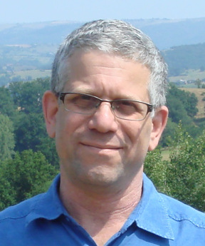
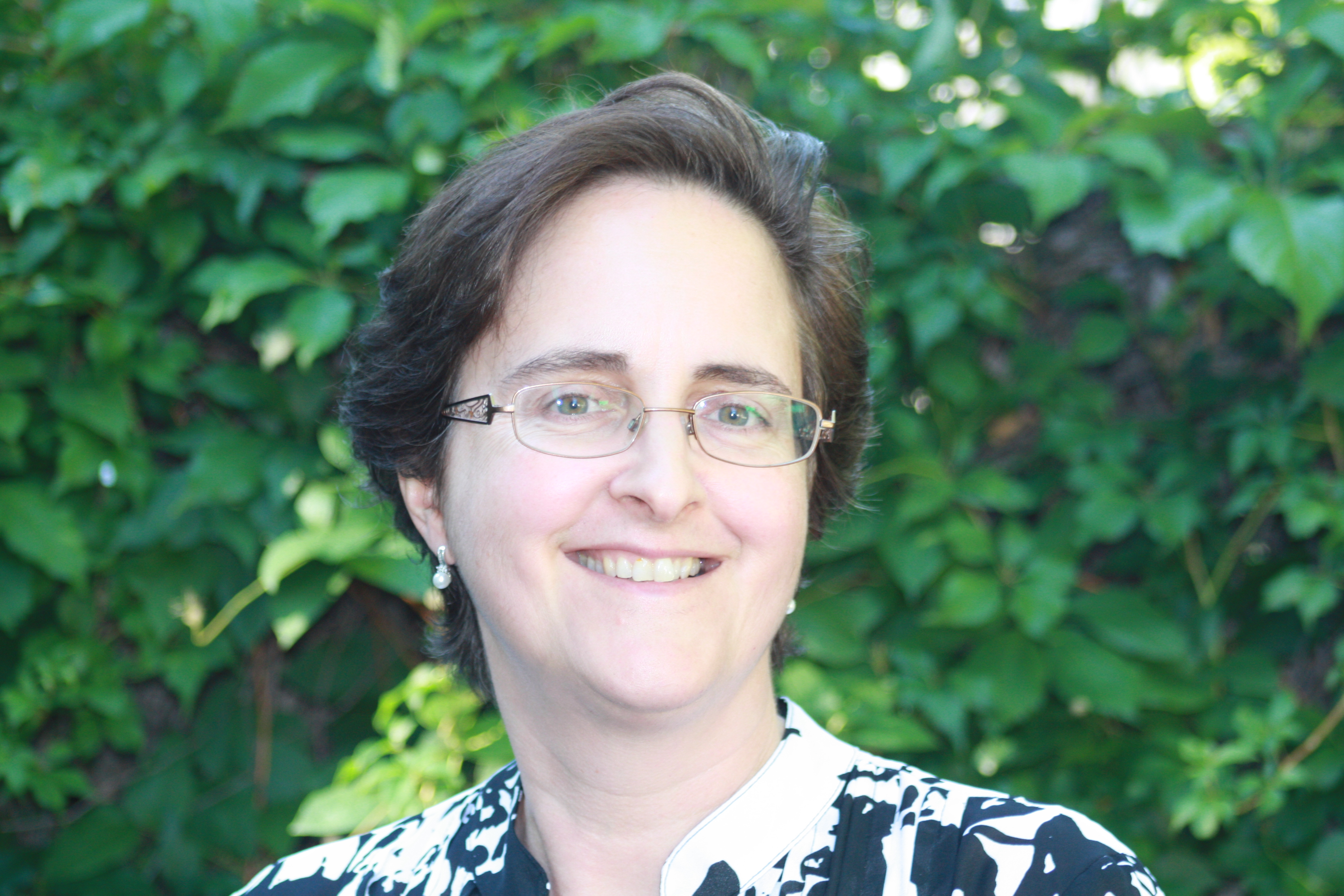
Geothink researcher Daren Brabham is an assistant professor at the University of Southern California School for Communication and Journalism.

Geothink researcher Daren Brabham, an assistant professor at the University of Southern California School for Communication and Journalism, has long worked on research that supports this development. He is also widely credited as being the first to publish scholarly research that utilizes the word crowdsourcing. (Although he himself notes that one-time Wired editor Jeff Howe actually coined the term in a June 2006 issue where he wrote about Threadless.)

“I’ve got this kind of crazy idea for a citizen science kind of hub, you know call it for lack of a better term a [United States] citizen science corps for instance, or a North American citizen science corps,” Brabham said. “It would be a big program where all these scientific organizations could host—and also museums and researchers at state universities—could host their challenges that they want online communities to go do and solve these problems and gather scientific data in the community or whatever it might be. To post those in one single hub and find a way to gamify that where people can earn badges or level ups or even prizes for donors, or whatever it might be, to get people engaged in helping these organizations.”

Brabham believes crowdsourcing represents not only a tool to help scientists or the government do their work, but an opportunity to redefine what it means to provide service to one’s country—which in the past has been synonymous with military service. He envisions a future where if the United States National Aeronautics Administration (NASA) needs help analyzing water levels or categorizing stars by galaxy, they could involve thousands of citizen scientists in the project much like E-Bird does today.

Today’s trends in crowdsourcing mirror the evolution of his work. In particular, Brabham’s early work focused on applying crowdsourcing to uses in government, non-profits, and in public health. Many of these uses have since become common with, for example, the United States Office of Citizen Services and Innovative Technologies using DigitalGov to provide “information and services to the public anywhere and anytime.” In particular, one of its recent products, The Federal Community of Practice on Crowdsourcing and Citizen Science (CCS), works across the government to share lessons learned and develop best practices for designing, implementing, and evaluating crowdsourcing and citizen science initiatives.

Design Matters

Some of the key concerns for any crowdsourcing initiative, whether it be for urban planning, policy-making, or a for profit venture, is how to build a committed online community, sustain interest in it, and handle dissent amongst its users. Researchers on this subject seek to answer the question of what drives these communities to form and if design issues inhibit or accelerate this process.

For example, it’s difficult to know whether crowdsourced citizen science might succeed best if it involves primary school students in projects that count butterflies or instead utilizes iPhones to measure soil samples. It also helps to figure out why certain types of web-based platforms succeed at engaging communities while others have struggled. Brabham calls this type of assessment work “user-experience design,” which was a particular focus during Geothink’s 2015 Summer Institute.

In work he’s completed with other researchers, Brabham has found platforms that are easy to use, enjoyable, and have an intuitive interface have higher success rates. This may sound obvious but it’s more than just establishing a set of best practices for how all platforms should be designed. Instead, online sites must be organized according to the different tasks users are asked to complete or the different roles they might play.

For example, Brabham often talks about Threadless, a crowdsourced clothing and apparel site, and not just because his early involvement with it set him on his current research path after his now wife suggested he write a paper during his doctoral work applying this approach to sociocultural issues. In particular, he cites how Web sites like it give users a very clear idea of what audience it’s intended for, the activities the site allows users to undertake (shop, submit designs, or rate designs), and also includes a clear, user-friendly interface.

“I think when people are asked to contribute content or ideas or whatever it might be to a web site or organization in a crowdsourced arrangement, they really do care about how easy it is to convey their idea to you and figure out how it’s going to be used,” he said.

He points out that all too often researchers and critics focus on examining bad crowdsourcing initiatives rather than on what makes a given effort work. As crowdsourcing continues to be used in the public realm to help with citizen science efforts, paying attention to the details will become increasingly important. In particular, designers must provide users with multiple entry points, web sites with component parts organized based on tasks, and clear front pages that don’t overwhelm the average person.

A plethora of other issues surround both the implementation of crowdsourcing in public policy or for citizen science, and with its possible future uses. Brabham writes more about recent trends in the use of crowdsourcing in his recently published book: Crowdsourcing in the Public Sector. His earlier book, Crowdsourcing, is often cited for its importance in tracing crowdsourcing’s origins, future applications, and potential research paths.

If you have thoughts or questions about this article, get in touch with Drew Bush, Geothink’s digital journalist, at drew.bush@mail.mcgill.ca.

Four Geothink Partner Cities Named to Top 10 on First Ever Canada Open Cities Index

Rankings of Canada's Top 10 cities out of possible max scores of 193 (Image courtesy of Public Sector Digest).

Rankings of Canada’s Top 10 cities out of possible max scores of 193 in Public Sector Digest’s 2015 Open Cities Index (Image courtesy of Public Sector Digest).

By Drew Bush

Numerous city, state, and provincial governments across North America are finding new ways to share government data online. With more than 60 nations now part of the Open Government Partnership, it’s often difficult to determine which initiatives are simply part of a growing fad instead of being true attempts at more responsive and accountable government.

In the United States, President Barak Obama announced plans in 2009 to make many federal agencies open by default with government information, yet just last month the office charged with carrying out this directive failed to openly publish a schedule for its guidelines on this work. In Canada, a variety of city initiatives aim to allow citizens to more easily view crime statistics, find out information about neighborhood quality of life, or time the arrival of the next bus. With so many initiatives, it can be difficult to determine which best improves municipal responsiveness or offers new services to citizens particularly amidst promises by the newly elected Liberal government on open data (see Tweet below).

The authors of Public Sector Digest’s first ever 2015 Open Cities Index aim to solve this problem by providing “a reference point for the performance” of open data programs in 34 Canadian cities. The authors of the index undertook a survey to measure 107 variables related to open data programs. In particular, the index measures three types of data sets cities may have made available: those related to accountability (e.g. elections or budget data), innovation (e.g. traffic volume or service requests), and social policy (e.g. crime rates or health performance).

Across each data set in these three categories, municipalities were scored on five variables according to questions such as whether their data sets are available online, machine readable, free, and up-to-date. The aim was to help these municipalities, which often have limited resources to spend on open data programs, to assess their strengths and weaknesses and improve open data programs.

Four Geothink partner cities made the top 10 of the index, with Edmonton in first place, Toronto second, Ottawa fourth, and Vancouver sixth. At last year’s Canadian Open Data Summit, Edmonton also won the Canadian Open Data Award. You can find the full list of city rankings on the report’s home page. Yet the value of these types of ratings and awards will only be shown over time, according to many practitioners in the field.

“It’s hard to tell what it means to be ranked fourth because it’s a brand new thing,” said Robert Giggey, the coordinator and lead for the City of Ottawa’s Open Data program. “It’s not something that’s done every year, every month, that everybody knows about and is waiting for. So it’s kind of yet to be determined.”

The Value of the Index

Other indexes have measured open data at the national level, such as the Open Data Barometer. And measurements of municipal open data undertaken by two university students focused only on what types of data sets were available. The Open Cities Index works to take this a step further by engaging with key areas of interest. In particular, the index aims to standardize measurements around three themes:

1. Readiness—To what extent is the municipality ready/capable of fostering positive outcomes through its open data initiative?
2. Implementation—To what extent has the city fulfilled its open data goals and ultimately, what data has it posted online?
3. Impact—To what extent has the posted information been used, what benefits has the city accrued as a result of its open data program, and to what extent is the city capable of measuring the impact?

One Geothink researcher cautions, however, that it’s difficult to ascertain the worth of the index until its authors make the full report available along with more information on the 107 variables surveyed. In particular, he said, implementation can be a difficult metric to measure because different cities have different data collection responsibilities and different goals.

“I’m working on some research right now that shows that governments don’t actually have very good tracking metrics for use,” Peter Johnson, assistant professor in the Department of Geography and Environmental Management at the University of Waterloo, wrote in an e-mail to Geothink.ca. “Much of their sense of who uses open data and what it is used for is anecdotal and certainly incomplete. Since open data is provided with few restrictions, it is difficult to track who is using it and what it is being used for in any comprehensive way.”

Beyond the data online now, cities interested in being included in future years of the index and accessing a detailed analysis of municipal open data programs across Canada must contact Public Sector Digest. Some municipalities, like Ottawa, may wait and see how it goes in those places that have already paid for the service, according to Giggey.

“I want to see what the reaction is from the open data community, from other jurisdictions, from other areas—Geothink—about what they think of the index,” he said. “Is this any good? Is it worth anything? Then we’ll look to see if it’s something we want to invest in.”

A screen shot of Toronto's Open Data portal for city hall.

A screen shot of Toronto’s Open Data portal for city hall.

The Reaction Among Geothink Partner Cities

The value of the index will be determined as more details on its methodology and conclusions are released, and, perhaps, it becomes a regular measure of open data work in Canada’s municipalities. For now city staff in charge of open data work in the cities interviewed by Geothink.ca agree that the index does achieve the goal of bringing recognition to the work they are doing. In Ottawa, this has included work to make the city accountable by providing datasets on elected officials, budget data, lobbyist and employee information, and 311 calls. Toronto got a relatively early start with city budgets in 2009 and now also has a portal with social data on neighborhoods (including datasets like demographics, public health, and crime rates).

“I am glad the index recognizes the time and effort each city puts in to make its data open and accessible for reuse and repurpose,” Linda Low, open data coordinator for the City of Vancouver, wrote in an e-mail. Datasets in her city include information on crime, business licenses, property tax, Orthophoto imagery, and census local areal profiles. “This doesn’t happen overnight and it certainly is a team effort to get to where we are today.”

Edmonton’s recognition for its work derives from a 2010 decision by city leaders to launch an open data catalogue and the 2011 awarding of a $400,000 IBM Smart Cities Challenge award grant. Work in the city has included using advanced analysis of open data streams to enhance crime enforcement and prevention, an “open lab” to provide new products that improve citizen interactions with government, and interactive neighbourhood maps that will help Edmontonians locate and examine waste disposal services, recreational centres, transit information, and capital projects. More can be found on Edmonton’s work in a previous Geothink article.

“We are thrilled and honoured that our innovation and hard work have been recognized,” Yvonne Chen, a strategic planner for the City of Edmonton, wrote in an e-mail. She noted that Edmonton’s success, which results directly from a city council policy on open data, includes having an online budget tool that increases transparency about the allocation of public funds. “Our goal has always been to be a leader in the Canadian open government movement.”

While the recognition helps bring attention to the work being done by cities, much remains to be seen about how well the index actually compares cities against each other when objectives and the types of data recorded can vary greatly.

“It’s great to be in the top 10 any time, but we know from when we got the survey sent to us, we weren’t sure of all their measures that they were taking,” Keith McDonald, open data lead for the City of Toronto, said.

“We’d like to see other studies and maybe a little more apples to apples comparison for sure,” he added. “I think actually that was the intent—I can’t speak for the Public Sector Digest—but I think that was the intent of having an ongoing group that would buy into their measuring, so that people could continue to tweak and make it a stronger real apples to apples comparison. And we would support that.”

In fact, the value of an index like this one may lie in allowing cities to track their own progress over time.

“For all those cities included (and even those that aren’t) it can help to narrow the field as to where effort may be best placed to improve open data provision,” Johnson wrote of what he called a “high-profile external evaluation” of each city’s work.

If you have thoughts or questions about this article, get in touch with Drew Bush, Geothink’s digital journalist, at drew.bush@mail.mcgill.ca.

Can Citizen Science Help Cities Address Climate Change?

Photo of people taking noise level readings.

Mapping for Change supports citizen science inquiries into environmental and social issues. Here, participants take noise level readings in regions around a London airport. Photo courtesy Mapping for Change.

By Naomi Bloch

If you were following the recent climate change talks in Paris, you may have noticed a recurring theme: policymakers acknowledging the leadership of subnational governments in addressing climate change. Canada’s own delegation to the conference included representatives from the Canadian Federation of Municipalities, as well as provincial and indigenous leaders.

While the 2015 United Nations Climate Change Conference focused on political negotiations, critics have been quick to remind legislators that more efforts are needed to involve citizens in decision-making. It’s hardly a new idea, but how can civic participation function at a global scale? Activities at the local level may hold the key. Municipalities often have established mechanisms to involve the public in deliberative activities. Cities and their citizens can also collaborate on the evidence-gathering needed to make informed decisions.

Geothink collaborator Muki Haklay is the director of the University College London’s Extreme Citizen Science group and a professor of Geographic Information Science in the Department of Civil, Environmental and Geomatic Engineering. In 2008, he co-founded Mapping for Change, an organization that uses participatory mapping and citizen science to address environmental and social issues in cities.

Headshot of Muki Haklay

Muki Haklay, professor of Geographic Information Science in the Department of Civil, Environmental and Geomatic Engineering, University College London.

“I see the value of citizen science as part of wider environmental democracy, going back to the Rio conference in 1992,” Haklay explained in an email interview with Geothink. Principle 10 of the Rio Declaration on Environment and Development states that, at national levels, citizens should have “appropriate access to information concerning the environment that is held by public authorities, including information on hazardous materials and activities.” At the community level, the Declaration calls for active and informed public participation in environmental decision-making processes.

Citizen science invites non-professionals to participate in data gathering and the production of new scientific knowledge. “I see citizen science as a new part of the picture,” said Haklay, “where people also participate in creating environmental information that will influence their lives.”

In Haklay’s view, citizen science has particular benefits that can complement traditional research. “The various changes that have occurred in society and technology mean that we can open environmental decision-making further and make it more inclusive and participatory.” As with all research, appropriate rigor and attention to methodology are required. “Not all data should come from citizen science,” said Haklay. “In terms of data quality, citizen science requires us to use appropriate quality assurance methods.”

Mapping for Change provides some helpful exemplars. One collaboration with local organizations has seen thirty different communities across London measuring and mapping air quality data for their neighbourhoods. “We used a whole range of methods: wipe samples, where we checked for heavy metals in dust on different surfaces; diffusion tubes which measure NO2 levels; and bio-indicators — lichens and leaves,” Haklay said. The project’s findings provide location-specific data that can help alert authorities to potential problem zones. “The local authority responded to the results by promising to do their own monitoring in the area and consider how they can manage the traffic in the area.”

Particularly when expensive equipment or lab analysis is needed, resource limitations can create challenges. However, Haklay points out some unique benefits. “Citizen science provides additional information about the context — local knowledge about the place where the monitoring is taking place,” said Haklay. “Participants can also put equipment in their own homes, which is complex for researchers or government agencies.” The citizen science water study in Flint, Michigan, is a good example of this.

Constraints, of course, are not just funding-related. “Not all people would want to do it, and not everyone will have the skills, though we need to consider how to help people in developing them,” Haklay said. “The limitations are the knowledge that people have, their perception of science and their own capabilities, and the abilities of those who manage citizen science projects to engage at such levels. We shouldn’t expect all scientists to be able to facilitate the whole process on their own.”

Haklay suggests that government agencies looking to incorporate citizen science in their data gathering processes should consult the report, Choosing and Using Citizen Science, produced by the UK’s Centre for Ecology and Hydrology. The report reviews resource and management issues, political issues, as well as scientific issues.

The key to citizen science is that it can involve a range of activities. “Participants can help in setting the research question, create protocols that are suitable to their local culture and needs, analyze the information, participate in the production of reports and papers — in short, in everything,” Haklay said. “The value is in making science more open and more collaborative.”

Interested in learning more about Muki Haklay’s citizen science work? Follow him on Twitter: @mhaklay
If you have thoughts or questions about this article, get in touch with Naomi Bloch, Geothink’s digital journalist, at naomi.bloch2@gmail.com.

Citizen Science and Intellectual Property: A Guide for the Perplexed

citizen science image

Citizen scientists help researchers transcribe historical climate records and photograph natural phenomena.

By Naomi Bloch

The concept of the science hobbyist —­ the backyard astronomer staring up at the sky or the amateur ornithologist taking part in the annual Christmas bird count — is hardly a new one. What is notable today, however, is the scale and scope of new collaborations between research institutions and volunteer citizen scientists. These kinds of citizen science partnerships have inspired a new study by Geothink co-applicant Teresa Scassa and doctoral candidate Haewon Chung, called “Managing Intellectual Property Rights in Citizen Science: A Guide for Researchers and Citizen Scientists.”

Chung, now a Geothink Ph.D. student researcher at the University of Ottawa’s Faculty of Law, is interested in intellectual property (IP) law with a particular focus on digital ethics. Scassa is a Canada Research Chair in Information Law at the University of Ottawa. The two researchers will participate in a panel discussion and launch of their new work at the Wilson Center Commons Lab, in Washington, D.C., on December 10.

Teresa Scassa head shot

Teresa Scassa, Canada Research Chair in Information Law at the University of Ottawa

“Part of the point of the guide is to encourage people to take a proactive approach and think about what they want to get out of the citizen science project, and what they need to get out of the citizen science project,” Scassa said. “For example, if you need to publish your research results, or if you need to keep your data confidential because you’ve got private sector funding that requires that, how do you structure the IP side of things so that you can do that?”

Citizen science, broadly construed, involves the participation of non-professional scientists in scientific data gathering and the production of new scientific knowledge. In the realm of Geothink, this generally takes place in the context of volunteered geographic information (VGI) and contributions to geographic knowledge. Some projects may involve volunteers helping with laborious tasks such as transcribing historical climate data. In other cases, participants may be sharing geocoded photos or video footage, recording audio, or producing text narratives. In countries like the U.S. and Canada, such original, creative efforts are inherently protected by copyright law — something participants themselves may not even realize.

Do you copy?

The 80-page report is divided into three parts, beginning with a concise review of relevant areas of intellectual property law including copyright, patent, trademark and trade secret law, as well as specific considerations involved in the protection of traditional knowledge. Though copyright law differs around the world, essentially copyright grants certain exclusive rights to the authors of creative works. These rights usually include the right to control how work is distributed, reproduced, and re-used. “It’s also significant because it arises inadvertently,” said Scassa.

Unlike other types of intellectual property such as patents, in many countries the creator is automatically granted copyright protections without taking any specific legal actions. “There are going to be copyright issues with respect to any website that’s created, and with respect to many different types of contributions that users might make, whether they’re text-based or photographs or video clips or whatever they might be,” Scassa said. “There are copyright issues with respect to compilations of data. And then, of course, those copyright issues are relevant if, for example, the researcher decides to publish in a closed access journal and the participants want access to those research results, and all these sorts of things.”

When institutional researchers initiate citizen science projects, there are commonly expectations regarding eventual publication of findings, data sharing, posting information online, as well as educational and civic aims. “Depending on the nature of the project, the users may expect to have total access to the research results — to any publications, but maybe also to all of the data that’s been gathered,” said Scassa. “So we encourage the researchers who are creating citizen science research projects to think about what the user community may be expecting from them in terms of the project design.”

Ethics and law in the balance

In the second section of the study, the authors explore some of the ethical issues that arise in light of IP law. This includes everything from appropriate attribution to uses of participants’ contributions as well as research output. “If you’re going to be collecting stories or traditional knowledge from a community, for example, then that’s going to result in some intellectual property,” Scassa said. “And the ethical requirements may be different from the bare legal requirements. Part of it is being aware of what the legal defaults are and how those might need to be altered in the context of the relationship that you have with your participants.”

Scassa notes that researchers’ relationship with citizen scientists is generally one among many. “Researchers at universities have a complex web of relationships,” Scassa said. “Their universities have IP policies; those IP policies might provide that all IP stemming from this research may belong to the university and not the researcher, so they may not be able to promise certain things in their projects. Their funders may have expectations, and their publishers may have expectations. They may also have expectations in terms of the ability, perhaps, at some point in the future to patent some of their research. So they have this complex web of relationships and their relationship with citizen scientists is one of those relationships. We encourage them to think about this web of relationships and these expectations and try and design accordingly.”

To help with this process, the third section of the study guides readers through the various types of licensing options that can be applied. The authors provide diverse examples from real-world citizen science projects both local and global, and a toolset to help project designers as well as participants understand their options. “We don’t want to create barriers,” Scassa said. “It’s a really complex area. We’re trying to make it as accessible and as useful as possible, just to try to get people thinking about these ideas.”

The Wilson Center panel discussion, “Legal Issues and Intellectual Property Rights in Citizen Science,” takes place at the Wilson Center Commons Lab, Washington, D.C., Wednesday, Dec. 10, 11am –12:30pm ET. There will be a live webcast of the event.

Interested in learning more about intellectual property law and citizen science? Reach out to Teresa Scassa on Twitter: @TeresaScassa.

If you have thoughts or questions about this article, get in touch with Naomi Bloch, Geothink’s digital journalist, at naomi.bloch2@gmail.com.

GIS & the Global Community: Humanitarian Mapping

Image of KLL team on balcony of new headquarters

KLL team outside their new headquarters. Photo courtesy Kathmandu Living Labs.

By Naomi Bloch


Today, November 18, marks the 16th annual GIS Day. Throughout the week, Geothink has been presenting a series of posts looking at some of the ways in which our collaborators, partners, and friends around the world are critically examining and using GIS as a tool for civic engagement and understanding.
The community snapshots presented this week highlight diverse perspectives and uses for GIS. We conclude our series with the following piece on humanitarian mapping and OpenStreetMap.

This past March, Nama Budhathoki, a long-time contributor to OpenStreetMap, announced his candidacy for the Humanitarian OpenStreetMap Team (HOT) Board of Directors. Budhathoki, the executive director of Nepal’s Kathmandu Living Labs (KLL), posted a manifesto that — in the months following Nepal’s April 25 earthquake — seemed beyond prescient. In it, he proposed his vision for HOT, and for the crowdsourced mapping community around the world.

Budhathoki’s principal message is two-fold. 1) Humanitarian mapping can be more effective by transitioning from being primarily a reactive community to one that encourages mapping communities to develop where they’re most needed — before crisis strikes. 2) A unique benefit of crowdsourced mapping stems from its role in community engagement and capacity building.

OpenStreetMap’s U.S. Chapter is a Geothink partner. Geothink recently caught up with Budhathoki while he was visiting Washington D.C. as the invited featured speaker at the launch of Mapping for Resilience: Turning Data into Decisions, a new program that aims to support geospatial data development in areas of need using OpenStreetMap.

Mapping as civic engagement

The challenge that KLL has been addressing for several years now in Kathmandu is the lack of decent spatial data and maps for the region. The small team has been tackling the problem by collaborating with educational institutions in Nepal, training students how to map their local environment in OpenStreetMap. In 2013, for example, they went out into the field to collect exposure data at the individual building level for over 2,000 schools, colleges and universities, as well as 350 health facilities in Kathmandu Valley. They mapped this data on OpenStreetMap so that the information could be downloaded and used by government and other organizations developing risk assessments and plans.

For Budhathoki, the act of mapping is a mechanism for engaging citizens and building local knowledge and awareness. “I keep emphasizing this, but I can’t stress it enough. Mapping is not just about the final product — you know, the map itself. The act of mapping is important; it’s about engaging the community,” Budhathoki said. “In the process of conducting these activities, you are talking to people in the community, sensitizing them to the issues, preparing them in advance to think about it.”

Budhathoki notes that one of the most important reasons to have active, capable mapping communities on the ground in high-risk regions is so that they can build trust within their communities before disaster strikes. “KLL has been working with the government, working with organizations in the community, and with different aid organizations for several years,” Budhathoki said. “So when the earthquake hit, we not only had the local knowledge and the capacity so that we could open the situation room within 24 hours of the earthquake, but we also had the trust of all these organizations. In my experience, this element of trust is very important.”

Mobilizing the global community

Within 48 hours following the first earthquake, over 1,500 mappers around the world had responded to the call to support Nepal. Kathmandu Living Labs coordinated the effort together with HOT. This October, KLL posted a timeline capturing the milestones of their six-month journey since April.

As is typically the case on crowdsourced projects, while some contributors signed on only briefly, other mappers dedicated themselves to the cause. These core mappers, Budhathoki believes, tended to be those with a longer history on OSM and HOT projects, because they typically have a better understanding of the types of commitments and challenges involved.

“In principle, because OSM is a crowdsourcing geo platform, it is by definition designed to have a low barrier to entry,” Budhathoki explained. “Anyone should be able to begin mapping. That’s in principle. But in reality, there are tasks that require more knowledge. So for example, users with more OpenStreetMap experience handle validation tasks.

“GIS experts anywhere in the world should be able to adapt to the OpenStreetMap environment even if it is new for them. For GIS experts, OSM is a pretty simple tool, generally. They can contribute expertise that is useful, that contributes to quality of the information. But not everyone is comfortable in a crowdsourced environment.”

Where local meets global

Geothink co-applicant Claus Rinner, a professor and chair of Ryerson University’s Department of Geography and Environmental Studies, coordinated several Mapping for Nepal workshops in Toronto after the first quake struck. Rinner worked with a group of students with varying degrees of mapping experience as well as local GIS professionals to help map the affected areas. Following his experiences, he posted some reflections regarding the current slippery boundaries between traditional GIS and OpenStreetMap as a crowdsourced mapping platform — and highlighted the need for more formal education opportunities that incorporate OSM as a tool. More recently, Rinner noted that high school students have been expressing an interest in Ryerson’s mapping events for Nepal. “My main observation here is that OSM/HOT mapping is a type of community activity that uses the students’ study-related expertise,” Rinner said, “rather than being something that anyone could do.”

Budhathoki sees the work of the global OSM community as valuable on a number of levels, but also highlights the importance of local knowledge. “Virtual mappers without advanced knowledge can do fundamental tasks like mapping the road network,” Budhathoki said, “but then who can provide the name of the road? It’s the local community. And different countries categorize roads differently, so it is difficult to know what road is a highway, for example. You can’t just assume this based on the width of the road.

“So, local understanding is always going to be important — particularly in these situations, where the information is needed by humanitarian organizations and is being used on the ground right away.”

If you have any questions for Nama or the KLL team, you can reach them on Twitter here: @KTMLivingLabs

To get a quick sense of KLL and OSM’s work in Nepal since April, check out the Kathmandu Living Labs: Six-Months of Earthquake Response timeline.


If you have thoughts or questions about this article, get in touch with Naomi Bloch, Geothink’s digital journalist, at naomi.bloch2@gmail.com.

GIS on Campus: Join Claus Rinner for GIS Day at Ryerson

By Naomi Bloch


This Wednesday, November 18, marks the 16th annual GIS Day. Throughout the week, Geothink will present a series of posts looking at some of the ways in which our collaborators, partners, and friends around the world are critically examining and using GIS as a tool for civic engagement and understanding.
The community snapshots presented this week highlight diverse perspectives and uses for GIS. 

If you’re looking for a way to introduce friends to the wide-ranging sphere of GIS, look no further than Toronto’s Ryerson University campus on Wednesday.

Geothink’s Claus Rinner along with GIS and Map Librarian Dan Jakubek have a full afternoon of events scheduled for GIS Day. They’ve lined up three keynote presentations, each of which will explore very different GIS applications: Senior Landscape Ecologist Dr. Namrata Shrestha will discuss her work with the Toronto & Region Conservation Authority; Andrew Lyszkiewicz from the City of Toronto’s Information & Technology Division brings in the municipal GIS perspective; while the Toronto Star’s Matthew Cole and William Davis are on hand to cover the growing role of GIS, mapping, open data, and data analysis in the media.

Apart from keynotes, there will be a poster session, geovisualization project displays, as well as several practical demonstrations of GIS and geoweb tools in action. Neptis Foundation, a Geothink partner, is one of the participating organizations. According to the Neptis Foundation’s Adrien Friesen, he and colleague Vishan Guyadeen will be demonstrating their soon-to-be-launched geoweb platform, “an integrative web mapping tool for the Greater Golden Horseshoe, created to help residents, researchers and decision makers better understand what shapes our urban and rural environments. It allows users to select different spatial layers that they can overlay and view different infrastructure, political boundaries, and protected areas (among many other things), to visualize the region in which they live.”

A full itinerary of the afternoon’s events can be found on the Geospatial Map & Data Centre website. While you’re on campus, you might want to check out the Geospatial Map & Data Centre itself. Ryerson Library’s communal lab is a dedicated space designed to support collaborative work with GIS, data, and related geospatial and statistical software packages.

Date: Wednesday, November 18, 2015
Time: 1:00 pm–5:00 pm
Location: Library Building, LIB-489, 4th Floor, 350 Victoria Street

For more of Geothink’s GIS Day coverage, see:

If you have thoughts or questions about this story, get in touch with Naomi Bloch, Geothink’s digital journalist, at naomi.bloch2@gmail.com.


GIS in the City: Toronto on the Map

Map of Toronto school nutrition program distributionBy Naomi Bloch


This Wednesday, November 18, marks the 16th annual GIS Day. Throughout the week, Geothink will present a series of posts looking at some of the ways in which our collaborators, partners, and friends around the world are critically examining and using GIS as a tool for civic engagement and understanding.
The community snapshots presented this week highlight diverse perspectives and uses for GIS. 

If you make your way to Toronto’s City Hall on Wednesday, you’ll discover that the City is displaying a slideshow of some pretty interesting maps, just above the 3D model of the downtown core. The big-screen projection, set up for Geography Awareness Week and GIS Day, showcases some of the ways that Toronto’s municipal divisions are using GIS to tackle urban issues.

These same projects can also be perused at your leisure via a new City of Toronto GIS Day landing page. The City of Toronto is one of Geothink’s municipal partners.

City of Toronto's Ventilation Index map. All images © City of Toronto 1998-2015. Used with permission.

City of Toronto’s Ventilation Index map. All images © City of Toronto 1998-2015. Used with permission.

The breadth of projects may surprise Toronto residents. Take the Environment and Energy Division’s (EED) Ventilation Index. The EED is mapping the city to get a full spatial understanding of areas known as “urban canyons,” narrow open spaces confined between built spaces that contribute to ground-level pollution — a problem most noticeable to pedestrians in the city. The higher the ventilation index, the greater the level of pollution. The Ventilation Index researchers’ goal is to try to identify “how the City’s changing building profile may have growing adverse effects at ground level and how to mitigate and adapt to the rapidly growing City.”

The City’s uses of GIS extend beyond urban planning or trying to understand how urban design impacts the environment. The Department of Public Health, for example, is employing GIS to better understand the distribution and funding of school nutrition programs. In 2014, 160,000 Toronto students participated in breakfast, snack and lunch programs, provided in schools and community sites throughout the city. Public Health has mapped the locations where student nutrition programs were in effect in 2014, with each site categorized based on the funding source behind the program. Incorporating census data such as the Low Income Measure, they’ve identified where meal programs are located relative to the City’s designated Neighbourhood Improvement Areas. This spatial mapping of school nutrition programs helps the City to understand which communities remain under-served and where additional funding should be allocated.

Want to know more about how the City of Toronto is using GIS? Head to Metro Hall on Friday, Nov. 20, anytime between 8:00 am and 3:00 pm. A few staff members from the City’s Geospatial Competency Centre will be on hand to answer questions.

For more of Geothink’s GIS Day coverage, see:

If you have thoughts or questions about this story, get in touch with Naomi Bloch, Geothink’s digital journalist, at naomi.bloch2@gmail.com.


GIS in the Classroom: Geography and the Law

GIS DayBy Naomi Bloch


This Wednesday, November 18, marks the 16th annual GIS Day. Throughout the week, Geothink will present a series of posts looking at some of the ways in which our collaborators, partners, and friends around the world are critically examining and using GIS as a tool for civic engagement and understanding.
The community snapshots presented this week highlight diverse perspectives and uses for GIS. 

Tenille Brown headshot

Tenille Brown, Ph.D. candidate in the University of Ottawa’s Faculty of Law

In the winter 2016 term, Geothink’s Tenille Brown, a Ph.D. candidate in the University of Ottawa’s Faculty of Law, will be teaching a new course called Law and Geography. The seminar course will be offered as a first-year elective option for J.D. students. “It’s really exciting because it will be the first law and geography course in a Faculty of Law in Canada that I am aware of,” said Brown.

The intention of the course is to introduce new law students to the emerging field of legal geography, which focuses on spatial and place-based aspects of law and legal regulation. The course description highlights several focus areas, including public and private spaces; property and the city; critical perspectives of identity, racism and the law; gender, property and the law; indigenous peoples and the environment; and globalization. “There’s a wide variety of topics,” said Brown, “and within that I have a couple of classes which will look at issues of GIS and a lot of the themes of Geothink in relation to legal geography scholarship and in relation to the law.”

Brown notes that GIS is addressed in the legal literature to some extent, but such discussion is in its nascent stages. For example, the field of technology law deals with liability issues in relation to GIS, and issues such as copyright and privacy. “And there’s a little bit of GIS analysis in relation to understanding crime, and criminality,” said Brown. “That’s a big area of research, but I think there are many, many, many GIS narratives which are not captured at all.”

All of these GIS-oriented legal issues will play a role in her course, however she’s also hoping to draw in some students who have previous practical experience with GIS technologies. “If there are students who have a particular interest in GIS or have skills in GIS, and they’re willing, then we can explore not just legal liability in relation to GIS but also, how can we use GIS to help the functioning of the legal system? So really opening it up for those skills to be brought into the classroom.”

“I’m interested in knowing how information about a place, which is maybe more than property-related, can influence how we regulate or understand a particular area of a city, for example,” Brown said. “How can we bring in different information about a city that is not captured by a property title deed, or a traditional survey that we might have? We see a lot of non-traditional information collection right now. That is, it’s non-traditional from a legal perspective — information about how people use a place. Typically the law doesn’t care about that. Typically the law just wants to know who has the title deed, and that’s it.”

Brown offers the example of First Nations groups in Canada, who are currently using GIS and GIS technologies to collect oral histories and map out their histories spatially. “There’s a big push from indigenous communities, and a willingness and a desire to engage with GIS technologies to capture these different narratives,” Brown said. “And they’re wanting to use it to support land claims. That’s their whole aim.

“So it’s important to figure out how modern information can be incorporated into a legal system which relies on historical treaties,” Brown explained. “There’s a lot of legal questions about using that information and the strength of that kind of information from an evidentiary perspective. The law has a very non-GIS approach — a non-tech approach — to adjudication. So I think one of the really important questions is, how can we get this modern GIS counter-narrative and make sure that it’s solid as evidence that is effective for the legal system?”

For Brown, encouraging students with a GIS or geography background to consider how their knowledge can contribute to the legal process is just one motivation for her course. “They’re first-year law students,” Brown said,  “so they’re just beginning to get to grips with what takes place in the Faculty of Law. They’re in shock a little bit, at this point. With this class, I’m really hoping to open it up for students that already have an undergraduate degree in something spatial-related. If there’s anyone who’s done work with GIS, that will definitely enrich the classes.”

Do you have questions about Tenille’s course or research? Contact her on Twitter at: @TenilleEBrown 
Tenille Brown is a PhD candidate in the Faculty of Law at the University of Ottawa. She is a Geothink student member, and a member of the university’s Human Rights Research and Education Centre. Her research is in the areas of legal geography, including property, spatial and citizen engagement in the Ottawa context.


For more of Geothink’s GIS Day coverage, see:

If you have thoughts or questions about this article, get in touch with Naomi Bloch, Geothink’s digital journalist, at naomi.bloch2@gmail.com.