Tag Archives: Claus Rinner

Geothink Newsletter Issue 14

Issue 14 of the Geothink Newsletter has been released!

Download Geothink-Newsletter-Issue-14.

In this final issue we celebrate the culmination of five years of successful Geothink
research and present reflections from our faculty and staff.

We also catch up with Geothink Co-Applicant Leslie Shade, former Geothink student Edgar Baculi, and 2017 Geothink Summer Institute attendees Local Logic.

If you have feedback or content for the newsletter, please contact the Editor, Sam Lumley.

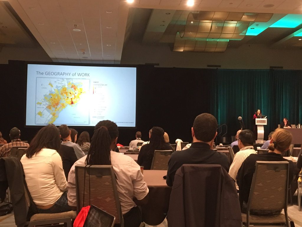
Leveraging Open Data: International perspectives presented at URISA’s GIS-Pro 2016 conference

This is a cross-post from Geothink co-applicant Dr. Claus Rinner‘s website, written by Geothink student Sarah Greene, Ryerson University. Sarah is Candidate for the Master’s of Spatial Analysis at Ryerson University. Her research focusses on open data.

By Sarah Greene

This past week, URISA held its 54th annual GIS-Pro conference in Toronto, bringing together GIS professionals and businesses from around the world. The conference provided many interesting sessions including one focused entirely on open data. This session, titled “Leveraging Open Data”, included government as well as private sector perspectives.

The session began with a presentation from the Government of North Carolina, discussing the importance of metadata. They are currently collaborating with a number of agencies to create and share a metadata profile to help others open up their data and understand how to implement the standards suggested. They have produced a living document which can be accessed through their webpage.

The next speaker at the session represented Pitkin County in Colorado. They represent an open data success story with a number of great resources available for download on their website including high quality aerial imagery. An important aspect to their open data project was their engagement with their local community to understand what data should be opened, and then marketing those datasets which were released.

The Government of Ontario was also present as this session, presenting on the current status of open data for the province. The Ontario Government promotes an Open by Default approach and currently has over 500 datasets from 49 agencies available to download through their portal. They are working towards continuing to increase their open datasets available.

A presentation by MapYourProperty provided an interesting perspective from the private sector using open data to successfully run their business. They heavily depend on visualizing open data to provide a web-based mapping application for the planning and real estate community to search properties, map zoning information and create a due diligence report based on the information found. This is one example of many that exist in the private sector of open data helping build new companies, or help existing companies thrive.

Lastly, a representative from Esri Canada’s BC office wrapped up the session reminding us all of the importance of opening data. This included highlighting the seemingly endless benefits to open data, including providing information to help make decisions, supporting innovation, creating smart cities and building connections. Of course, open data is big business for Esri too, with the addition of ArcGIS Open Data as a hosted open data catalog to the ArcGIS Online platform.

This session showcased some great initiatives taking place in Canada and the United States that are proving the importance of opening up data and how this can be done successfully. It is exciting to see what has been taking place locally and internationally and it will be even more exciting to see what happens in the future, as both geospatial and a-spatial data products continue to become more openly available.

A talk at the GIS Pro 2016 conference. Photo credit: Claus Rinner

A talk at the GIS Pro 2016 conference. Photo credit: Claus Rinner

See the original post here

Potentials and Pitfalls of Civic Engagement through Pokémon GO, Augmented Reality, and Gamification

By Peck Sangiambut

Media coverage in recent months may be focusing on Niantic’s continuous battle with Pokémon GO exploits and the game’s apparent demise, but here at Geothink we still see great potential in augmented reality (AR) games to promote community engagement. Our research examines communities and citizen-government engagement, particularly through geospatial technologies such as the geoweb. At the height of the craze, Pokémon GO resulted in conspicuous movements of people through engagement with a location-based service. This provides us with a convenient case study of the potential effects of a location-based service that causes movement of people through gamification. Geothink has also investigated gamification in urban planning and citizen engagement through platforms such as Minecraft and the precursor to Pokémon GO, Ingress. A recent publication from Geothink student, Lisa Mather Ward, and her supervisor, Dr. Pamela Robinson, has looked at Minecraft’s potential for public consultation.

Pokémon GO and Geography

Geothink co-applicant Dr. Claus Rinner (Ryerson University, Department of Geography and Environmental Studies) has written a post introducing geographic analysis concepts with Pokémon GO. In it, he writes about geographic distribution, catchment areas, and links them to geospatial analysis methods such as buffering, distance decay, and suitability mapping. Some of the built-in distributions of Pokémon (such as having certain types of Pokémon available for certain types of terrain, weather, continents, and time of day) are similar to what we look for in ecological species distribution. The same concepts and techniques are widely used by corporations conducting market research, retail analysis, and location intelligence. As such, Pokémon Go is a great way to introduce basic geographic concepts to students and the interested public.

A Medium for Contestation of Urban Places?

Movements of people that are a direct result of their interaction with a mobile app could result in new contestations of space and place. Pokémon GO is potentially one tool that influences and reassigns cultural identity and platial meaning. In downtown Montreal, we have seen a regular congregation of Pokémon trainers develop around Cabot Square to catch Pokémon, level up, and wrestle for control over its gym. Will this new influx of people change the identity of Cabot Square? Or has this already happened?
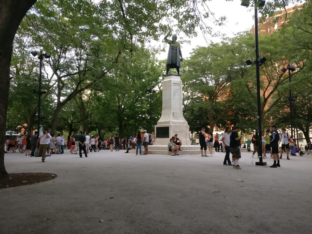
Pokémon Go (right) versus swing dancing (left) - is location-based gaming a new tool to contest space and place? Photo credit: Suthee Sangiambut

Pokémon Go (right) versus swing dancing (left) – is location-based gaming a new tool for contesting space and place? Photo credit: Suthee Sangiambut

Geothink Head, Dr. Renee Sieber (McGill University, Department of Geography and School of Environment), has spoken of the potential abuses or biases that may result from the placement of Pokémon and pokéstops on the map. Algorithms are the determinant for a pokéstop and Pokémon spawn locations. However, as Sieber emphasises, technology itself should never be assumed to be neutral. Implicit biases may be injected by programmers, managers of the technology, and the underlying data. For example, it has been noted that certain neighbourhoods are poorer in pokéstops, potentially due to the distribution biases in crowdsourced contributions that formed a part of the underlying pokéstop dataset.

On the other hand, does location-based gaming have the potential for real-world community building? Are players actually exploring their own communities?

Geothink co-applicant Dr. Stéphane Roche (Université Laval, Département des sciences géomatiques) and his PhD student, Territutea Quesnot have studied landmarks and wayfinding, particularly through social networks with gamified interactions such as FourSquare. As Roche notes, the concept of ‘checking in’ to a location is not new. Pokémon GO’s uniqueness is in its content and in overlaying the Pokémon universe over the real world (such as through the camera feature) with more integration than Ingress. For Roche, such movements of people could also be a form of contestation or appropriation of places. He defines an urban place as “an equation between a physical location, an event, and the name associated with the phenomenon”. Landmarks in the city can therefore have multiple ‘places’ depending on their usage. For example, a pond has one use during the summer, but turns into an ice skating rink during the winter. Pokémon GO, Roche says, “has created new urban places, in a location where existing places were already there”. Roche cautions us to not immediately condemn the phenomenon of Pokémon GO players congregating in large groups, as contestation and appropriation of urban places is not a new process. Pokémon GO itself has not had an entirely negative effect on urban environments and has been attributed as a factor in revitalising the Brussels community after this year’s terrorist attacks.

Roche is optimistic that “gamification and technology has the potential to improve our understanding of the world, improve our skills, including spatial skills, and could help people to discover new components of the world”, but also echoes Sieber’s concerns over algorithmic regulation where, “because of the choices that are embedded in the code and algorithms, there is a kind of orientation and social classification…and it becomes more and more difficult to discover new things”.

For Rinner, government should not have to resort to gamification to promote community engagement or citizen-government interaction, but he admits,

“I am afraid that it will soon be necessary to get anyone to do anything good. So, yes, I expect that government will soon use gamification to motivate people to engage in planning questions or politics. And more concerningly, I expect that businesses will use geolocation games to steer people to the right, or maybe wrong, places.”

AR and Gamification: Potential for Civic Engagement in Urban Planning

Regardless of Pokémon GO’s success, Geothink is looking to investigate the potential of AR in promoting civic engagement at the municipal level. Geothink co-applicant Dr. Pamela Robinson (Ryerson University, School of Urban and Regional Planning) has brought together a group of six masters’ of urban planning graduate students to investigate AR’s potential for the City of Toronto. Their mission is:

To explore the potential of AR technology in relation to public consultation & civic engagement by local governments and to provide a framework for analyzing future engagement opportunities

According to the students, AR has a high potential due to its fusing of the digital and physical. Unlike Virtual Reality (VR), AR does not completely remove the physical world and users can still interact with each other face-to-face, rather than being restricted to a virtual environment.

Currently at a preliminary stage of their project, the students have investigated the distribution of pokéstops and urban accessibility to pokéstops to examine the geographic reach of the game in the city. The density and location of check-in locations for any gamified service are crucial when attempting to attract people to a particular location, such as the location of a public consultation or town hall meeting and also important for evaluating how inclusive the tool can be in terms of reaching residents. The students discovered that a player’s experiences of Pokémon GO can really differ depending on where they live in Toronto.

Team PokéPlan (as they have named themselves) is also looking at other issues that a municipality will be concerned with, such as legal considerations (privacy, liability), language barriers, issues of service coverage and accessibility (the digital divide), and how to reach broad and target audiences, and finally gamification. According to Geothink student Corinna Prior, the City of Toronto has already begun to experiment with more flexible types of consultation such as the Planners in Public Spaces programme where planners go to the people. For Prior, “gamification is a really powerful tool. The potential to get people out and about is really powerful”. If AR and gamification could be used to support public consultation processes, we may experience radical changes in how citizens interact with their municipal governments.

More updates on TeamPokéPlan once their project ramps up. In November, Team PokéPlan will host a World Town Planning Day breakfast (November 8th), be the guest speakers at Civic Tech Toronto’s Hack Night (November 15th) and present their final report on November 22nd. For more information about their work please contact Pamela Robinson.
GIS & the Global Community: Humanitarian Mapping

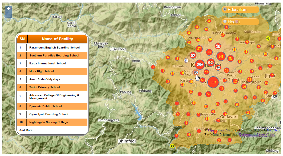
Image of KLL team on balcony of new headquarters

KLL team outside their new headquarters. Photo courtesy Kathmandu Living Labs.

By Naomi Bloch


Today, November 18, marks the 16th annual GIS Day. Throughout the week, Geothink has been presenting a series of posts looking at some of the ways in which our collaborators, partners, and friends around the world are critically examining and using GIS as a tool for civic engagement and understanding.
The community snapshots presented this week highlight diverse perspectives and uses for GIS. We conclude our series with the following piece on humanitarian mapping and OpenStreetMap.

This past March, Nama Budhathoki, a long-time contributor to OpenStreetMap, announced his candidacy for the Humanitarian OpenStreetMap Team (HOT) Board of Directors. Budhathoki, the executive director of Nepal’s Kathmandu Living Labs (KLL), posted a manifesto that — in the months following Nepal’s April 25 earthquake — seemed beyond prescient. In it, he proposed his vision for HOT, and for the crowdsourced mapping community around the world.

Budhathoki’s principal message is two-fold. 1) Humanitarian mapping can be more effective by transitioning from being primarily a reactive community to one that encourages mapping communities to develop where they’re most needed — before crisis strikes. 2) A unique benefit of crowdsourced mapping stems from its role in community engagement and capacity building.

OpenStreetMap’s U.S. Chapter is a Geothink partner. Geothink recently caught up with Budhathoki while he was visiting Washington D.C. as the invited featured speaker at the launch of Mapping for Resilience: Turning Data into Decisions, a new program that aims to support geospatial data development in areas of need using OpenStreetMap.

Mapping as civic engagement

The challenge that KLL has been addressing for several years now in Kathmandu is the lack of decent spatial data and maps for the region. The small team has been tackling the problem by collaborating with educational institutions in Nepal, training students how to map their local environment in OpenStreetMap. In 2013, for example, they went out into the field to collect exposure data at the individual building level for over 2,000 schools, colleges and universities, as well as 350 health facilities in Kathmandu Valley. They mapped this data on OpenStreetMap so that the information could be downloaded and used by government and other organizations developing risk assessments and plans.

For Budhathoki, the act of mapping is a mechanism for engaging citizens and building local knowledge and awareness. “I keep emphasizing this, but I can’t stress it enough. Mapping is not just about the final product — you know, the map itself. The act of mapping is important; it’s about engaging the community,” Budhathoki said. “In the process of conducting these activities, you are talking to people in the community, sensitizing them to the issues, preparing them in advance to think about it.”

Budhathoki notes that one of the most important reasons to have active, capable mapping communities on the ground in high-risk regions is so that they can build trust within their communities before disaster strikes. “KLL has been working with the government, working with organizations in the community, and with different aid organizations for several years,” Budhathoki said. “So when the earthquake hit, we not only had the local knowledge and the capacity so that we could open the situation room within 24 hours of the earthquake, but we also had the trust of all these organizations. In my experience, this element of trust is very important.”

Mobilizing the global community

Within 48 hours following the first earthquake, over 1,500 mappers around the world had responded to the call to support Nepal. Kathmandu Living Labs coordinated the effort together with HOT. This October, KLL posted a timeline capturing the milestones of their six-month journey since April.

As is typically the case on crowdsourced projects, while some contributors signed on only briefly, other mappers dedicated themselves to the cause. These core mappers, Budhathoki believes, tended to be those with a longer history on OSM and HOT projects, because they typically have a better understanding of the types of commitments and challenges involved.

“In principle, because OSM is a crowdsourcing geo platform, it is by definition designed to have a low barrier to entry,” Budhathoki explained. “Anyone should be able to begin mapping. That’s in principle. But in reality, there are tasks that require more knowledge. So for example, users with more OpenStreetMap experience handle validation tasks.

“GIS experts anywhere in the world should be able to adapt to the OpenStreetMap environment even if it is new for them. For GIS experts, OSM is a pretty simple tool, generally. They can contribute expertise that is useful, that contributes to quality of the information. But not everyone is comfortable in a crowdsourced environment.”

Where local meets global

Geothink co-applicant Claus Rinner, a professor and chair of Ryerson University’s Department of Geography and Environmental Studies, coordinated several Mapping for Nepal workshops in Toronto after the first quake struck. Rinner worked with a group of students with varying degrees of mapping experience as well as local GIS professionals to help map the affected areas. Following his experiences, he posted some reflections regarding the current slippery boundaries between traditional GIS and OpenStreetMap as a crowdsourced mapping platform — and highlighted the need for more formal education opportunities that incorporate OSM as a tool. More recently, Rinner noted that high school students have been expressing an interest in Ryerson’s mapping events for Nepal. “My main observation here is that OSM/HOT mapping is a type of community activity that uses the students’ study-related expertise,” Rinner said, “rather than being something that anyone could do.”

Budhathoki sees the work of the global OSM community as valuable on a number of levels, but also highlights the importance of local knowledge. “Virtual mappers without advanced knowledge can do fundamental tasks like mapping the road network,” Budhathoki said, “but then who can provide the name of the road? It’s the local community. And different countries categorize roads differently, so it is difficult to know what road is a highway, for example. You can’t just assume this based on the width of the road.

“So, local understanding is always going to be important — particularly in these situations, where the information is needed by humanitarian organizations and is being used on the ground right away.”

If you have any questions for Nama or the KLL team, you can reach them on Twitter here: @KTMLivingLabs

To get a quick sense of KLL and OSM’s work in Nepal since April, check out the Kathmandu Living Labs: Six-Months of Earthquake Response timeline.


If you have thoughts or questions about this article, get in touch with Naomi Bloch, Geothink’s digital journalist, at naomi.bloch2@gmail.com.

GIS on Campus: Join Claus Rinner for GIS Day at Ryerson

By Naomi Bloch


This Wednesday, November 18, marks the 16th annual GIS Day. Throughout the week, Geothink will present a series of posts looking at some of the ways in which our collaborators, partners, and friends around the world are critically examining and using GIS as a tool for civic engagement and understanding.
The community snapshots presented this week highlight diverse perspectives and uses for GIS. 

If you’re looking for a way to introduce friends to the wide-ranging sphere of GIS, look no further than Toronto’s Ryerson University campus on Wednesday.

Geothink’s Claus Rinner along with GIS and Map Librarian Dan Jakubek have a full afternoon of events scheduled for GIS Day. They’ve lined up three keynote presentations, each of which will explore very different GIS applications: Senior Landscape Ecologist Dr. Namrata Shrestha will discuss her work with the Toronto & Region Conservation Authority; Andrew Lyszkiewicz from the City of Toronto’s Information & Technology Division brings in the municipal GIS perspective; while the Toronto Star’s Matthew Cole and William Davis are on hand to cover the growing role of GIS, mapping, open data, and data analysis in the media.

Apart from keynotes, there will be a poster session, geovisualization project displays, as well as several practical demonstrations of GIS and geoweb tools in action. Neptis Foundation, a Geothink partner, is one of the participating organizations. According to the Neptis Foundation’s Adrien Friesen, he and colleague Vishan Guyadeen will be demonstrating their soon-to-be-launched geoweb platform, “an integrative web mapping tool for the Greater Golden Horseshoe, created to help residents, researchers and decision makers better understand what shapes our urban and rural environments. It allows users to select different spatial layers that they can overlay and view different infrastructure, political boundaries, and protected areas (among many other things), to visualize the region in which they live.”

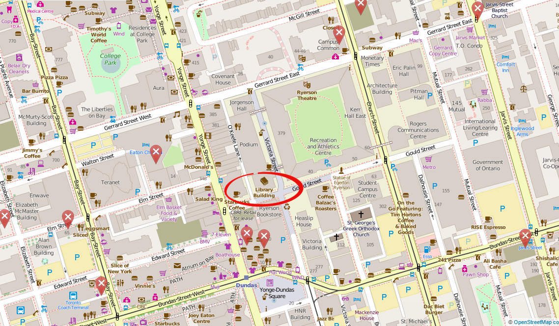
A full itinerary of the afternoon’s events can be found on the Geospatial Map & Data Centre website. While you’re on campus, you might want to check out the Geospatial Map & Data Centre itself. Ryerson Library’s communal lab is a dedicated space designed to support collaborative work with GIS, data, and related geospatial and statistical software packages.

Date: Wednesday, November 18, 2015
Time: 1:00 pm–5:00 pm
Location: Library Building, LIB-489, 4th Floor, 350 Victoria Street

For more of Geothink’s GIS Day coverage, see:

If you have thoughts or questions about this story, get in touch with Naomi Bloch, Geothink’s digital journalist, at naomi.bloch2@gmail.com.


Geothink Video Interview 3: Our Experts Take on Crowdsourcing

Screen Shot 2016-02-24 at 8.34.20 PMBy Drew Bush

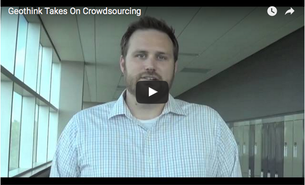
We’re excited to bring you our long-awaited video interview that features Geothink’s experts discussing issues of authenticity and accuracy with crowdsourced data.  Data collected through crowdsourcing methods increasingly has replaced traditional forms of data collection.

This video features Geothink Head Renee Sieber, associate professor in McGill University’s Department of Geography and School of Environment; Daren Brabham, assistant professor in the University of Southern California Annenberg School of Journalistm and Communication; Scott Bell, a professor of Geography and Planning at University of Saskatchewan; And, Claus Rinner,a professor and chair of Ryerson University’s Department of Geography and Environmental Studies.

We hope you enjoy this video as much as we enjoyed making it. Afterwards, leave us a comment and tell us what you think about this important area of debate concerning crowdsourced data.

You can also learn more about crowdsourcing by reading our post on this central topic to our 2015 Summer Institute, listening to these lectures from the Summer Institute, or listening to our experts talk about the topic over lunch last June. 

If you have thoughts or questions about this video, get in touch with Drew Bush, Geothink’s digital journalist, at drew.bush@mail.mcgill.ca.

Open Everything

Theme 4: Open Everything

Hello, I am Dr. Claus Rinner, an Associate Professor in the Department of Geography and program director of the Master of Spatial Analysis (MSA) at Ryerson University. My research focuses on the decision support function of maps and geographic information systems (GIS), and the underlying concepts of cartography, geovisualization, public participation, and multi-criteria decision analysis. I plan to contribute to the GeoThink research partnership through students at all levels of study.

Edgar Baculi, a second-year undergraduate student in Ryerson’s BA in Geographic Analysis, is co-funded by Geothink and the Ontario work-study program. Edgar started an exploration of the City of Toronto’’s open data portal, toronto.ca/open, with attention to the data formats and data types available for download. He found that 91 of Toronto’’s 133 open datasets have a geospatial component. About one half of these are available in ESRI’’s shapefile format. Edgar plans to extend his contents analysis to the open data catalogues of other municipal partners of GeoThink. This complements a planned longitudinal survey of municipal open data initiatives by two other GeoThink researchers, Dr. Peter Johnson and Dr. Pamela Robinson, within Theme 4. Edgar will also start to examine the demand side of open data in terms of their use by local journalists in news reporting and by Ryerson professors in Geography classes and GIS labs.

Together with Dr. Pamela Robinson of Ryerson’’s School of Urban and Regional Planning, I am also collaborating with the Neptis Foundation, a key GeoThink partner. With funding from Neptis, incoming MSA student Michael Markieta has upgraded and installed the Neptis Geoweb tool on a Ryerson server for use in research and by other GeoThink partners. The tool includes a mapping interface with a rich collection of datasets for the Toronto region, including a settlement development layer that Neptis combined from the individual land-use plans of dozens of Ontario municipalities. The tool also includes a discussion forum, and Michael’’s Master’’s research will examine the analytical and decision support function of such participatory Geoweb tools.

My PhD student Victoria Fast will also be involved in the GeoThink project. Victoria recently presented a novel framework for understanding volunteered geographic information (VGI) through a ““systems perspective”” (http://digitalcommons.ryerson.ca/geography/47/). On this basis and a survey of existing VGI projects, Victoria wants to outline a path for effective deployment of the Neptis Geoweb tool in climate change adaptation planning, an important consideration for municipalities and regions worldwide.

If you’ would like to participate in research around mapping tools for land use planning and decision support, open data formats, implications of participatory mapping for news media, or tools for urban and regional climate change adaptation, please contact me at crinner at ryerson dot ca.