Category Archives: In The News

Geothinkers at the Spatial Knowledge and Information-Canada (SKI) conference in Banff

This year’s Spatial Knowledge and Information – Canada (SKI) conference will be held in Banff, AB on 24-25 February 2017. Several Geothink co-applicants and students will be presenting on their research, ranging from open data for public engagement and police-citizen interaction to the health and wellbeing of the homeless. Geothink Head, Dr. Renee Sieber, will also be making a keynote speech. Stay tuned for updates from the conference!

For the full programme, see here.

New Ryerson University Class from parternship between Dr. Pamela Robinson and Civic Tech Toronto

Ryerson University has an exciting new class in The Chang School of Continuining Education. Geothink co-applicant Dr. Pamela Robinson (Ryerson University School of Urban and Regional Planning) has partnered with Civic Tech Toronto to create CVUP 110: Digital Government and Civic Tech. This is a non-credit university course aimed specifically at teaching civil servants about digital-driven change in the public sector. The course covers prototyping, human-centred design, and agile project management.

The course will be held during the Spring/Summer 2017 term, from 8 March to 19 April.

To find out more about the course, you can attend a free information session to be held on 9 February, or see the course description here.

New Geothink graduate: Dr. Harrison Smith

Dr. Harrison Smith recently completed his PhD at the University of Toronto’s Faculty of Information under the supervision of David J. Phillips and co-supervised by Geothink co-applicant Dr. Leslie Shade (University of Toronto). In this article, he tells us how his research examined the impact of location data in marketing. Dr. Smith’s next endeavour is a post doctoral research position at Newcastle University’s Global Urban Research Unit in the UK under the direction of Roger Burrows and Steve Graham.

By Harrison Smith

My dissertation, “The Mobile Distinction: Economies of Intimacy in the Field of Location Based Marketing”, examines the cultural and economic significance of location data in new kinds of marketing applications. When you survey existing research on location-based media, you tend to see a focus on user-centric studies that examines how these new interfaces can produce new kinds of intimacies and affective relationships between people and places. While certainly important, I argue there is a gap in our understanding of the political economy of locative media, and in turn the geo-spatial web, particularly with respect to how audiences are commodified and classified into specific segments through location data. I hypothesized that marketers are using location data to measure consumer lifestyles and tastes in ways that are similar to geodemographic classification. Traditionally, audiences are segmented by postal codes; in my dissertation, I sought to understand how location data can be used in a similar way to measure and classify lifestyles along particular hierarchies of cultural and economic worth. This allows us to theorize a broader political and cultural economy of the geo-spatial web, and questions certain dominant beliefs concerning the relationship between interactive cartography, big data, and power, particularly as urban environments are increasingly mediated by mobile for a variety of civic and commercial applications.

I focused specifically on the emergence of location based marketing using Pierre Bourdieu’s conceptual framework of habitus, capital, and field. I gathered my data through qualitative interviews with mobile and location-based marketers, participant observations of marketing conferences, as well as document analysis of mobile and location based marketing literature.

I asked two basic questions:

  1. What is the political economy of location data in mobile and location-based marketing?
  2. What are the underlying values, beliefs, philosophies of location data in the field of location based marketing?

These two questions are complimentary because the economic value of location data is contingent upon how marketers can successfully imbricate audiences into new fields of cultural production by appealing to specific logics of consumer lifestyles and practices through mobile media. Put differently, I discovered that the potential success of location based marketing depends on audience consent to participate and interact with marketers. This is important because it reveals a deeper level of understanding about geo-locative media and data that is structured by social, cultural, and economic relationships between consumers and institutional forces such as marketers.

I was particularly interested in understanding the specific values and philosophies that marketers are trying to enact in order to reveal how location data can inform geodemographic classifications using new kinds of metrics. I discovered that marketers employ numerous strategies for collecting location data from audiences that extend beyond GPS sensing. Sometimes, audiences may not even realize this is happening on an everyday basis because of the numerous methods it is possible to collect or infer location data from smartphones without our knowledge. For example, in some cases, location data is not actually collected by marketers themselves, but instead harvested from third party advertising exchanges during routine advertisement requests. When that happens, location data can be used to measure the efficacy of advertising. Third parties analyze the extent to which mobile advertising can drive audiences into particular stores, effectively offering a mobile measurement for audience conversion rates, namely by driving audiences into particular locations.

Furthermore, this can also be done through the passive collection of MAC (media access control) addresses, which are unique identifiers for hardware that are broadcast by smartphones on regular intervals. This is interesting because it represents a non-intrusive method for collecting location data. It is also worth considering how this kind of location data could also be used by non-commercial institutions, such as urban planners. In fact, there are many examples in which public spaces such as parks are now layered with sensors that collect location data from visitors, and can measure who they are, where they came from, and what other places they visited.

However, this is not an inevitable trend in the future of smart cities, as I argue that the capacity for collecting location data depends on the production of consent or the negotiation of resistance. A lot of work and investment must be done to convince large brands and individual stores of the value of targeting consumers in this way. The smartphone is a very personal, intimate device, and there may be resistance from consumers to letting marketers track them all the time, with ubiquitous access to their location history, or the ability to send targeted push notifications to mobile audiences in specific locations. This necessarily brings up important ethical questions around surveillance and privacy, as well as the kinds of lifestyles and consumer practices that are encouraged through mobile media. In my own interviews, many marketers side-stepped the issue of privacy by focusing instead on the inherent value exchange of data for various kinds of rewards or distinctions.

We will definitely see many different conversations emerge around how location data intersects with our values and attitudes towards surveillance in increasingly automated urban environments. In an interdisciplinary context such as Geothink, this will allow us to ask better questions concerning the value of location data, and be more critical on these issues.

I would like to thank my supervisory committee, which includes David Phillips, Leslie Shade, and Ronda McEwan. I also want to thank Geothink, particularly for the friendships I have developed on the team, and which has helped me appreciate the broader significance of my research.

Potentials and Pitfalls of Civic Engagement through Pokémon GO, Augmented Reality, and Gamification

By Peck Sangiambut

Media coverage in recent months may be focusing on Niantic’s continuous battle with Pokémon GO exploits and the game’s apparent demise, but here at Geothink we still see great potential in augmented reality (AR) games to promote community engagement. Our research examines communities and citizen-government engagement, particularly through geospatial technologies such as the geoweb. At the height of the craze, Pokémon GO resulted in conspicuous movements of people through engagement with a location-based service. This provides us with a convenient case study of the potential effects of a location-based service that causes movement of people through gamification. Geothink has also investigated gamification in urban planning and citizen engagement through platforms such as Minecraft and the precursor to Pokémon GO, Ingress. A recent publication from Geothink student, Lisa Mather Ward, and her supervisor, Dr. Pamela Robinson, has looked at Minecraft’s potential for public consultation.

Pokémon GO and Geography

Geothink co-applicant Dr. Claus Rinner (Ryerson University, Department of Geography and Environmental Studies) has written a post introducing geographic analysis concepts with Pokémon GO. In it, he writes about geographic distribution, catchment areas, and links them to geospatial analysis methods such as buffering, distance decay, and suitability mapping. Some of the built-in distributions of Pokémon (such as having certain types of Pokémon available for certain types of terrain, weather, continents, and time of day) are similar to what we look for in ecological species distribution. The same concepts and techniques are widely used by corporations conducting market research, retail analysis, and location intelligence. As such, Pokémon Go is a great way to introduce basic geographic concepts to students and the interested public.

A Medium for Contestation of Urban Places?

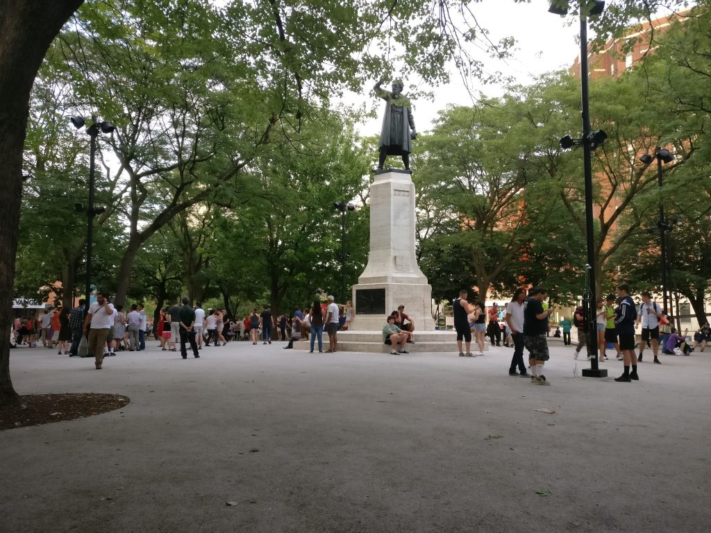
Movements of people that are a direct result of their interaction with a mobile app could result in new contestations of space and place. Pokémon GO is potentially one tool that influences and reassigns cultural identity and platial meaning. In downtown Montreal, we have seen a regular congregation of Pokémon trainers develop around Cabot Square to catch Pokémon, level up, and wrestle for control over its gym. Will this new influx of people change the identity of Cabot Square? Or has this already happened?

Pokémon Go (right) versus swing dancing (left) - is location-based gaming a new tool to contest space and place? Photo credit: Suthee Sangiambut

Pokémon Go (right) versus swing dancing (left) – is location-based gaming a new tool for contesting space and place? Photo credit: Suthee Sangiambut

Geothink Head, Dr. Renee Sieber (McGill University, Department of Geography and School of Environment), has spoken of the potential abuses or biases that may result from the placement of Pokémon and pokéstops on the map. Algorithms are the determinant for a pokéstop and Pokémon spawn locations. However, as Sieber emphasises, technology itself should never be assumed to be neutral. Implicit biases may be injected by programmers, managers of the technology, and the underlying data. For example, it has been noted that certain neighbourhoods are poorer in pokéstops, potentially due to the distribution biases in crowdsourced contributions that formed a part of the underlying pokéstop dataset.

On the other hand, does location-based gaming have the potential for real-world community building? Are players actually exploring their own communities?

Geothink co-applicant Dr. Stéphane Roche (Université Laval, Département des sciences géomatiques) and his PhD student, Territutea Quesnot have studied landmarks and wayfinding, particularly through social networks with gamified interactions such as FourSquare. As Roche notes, the concept of ‘checking in’ to a location is not new. Pokémon GO’s uniqueness is in its content and in overlaying the Pokémon universe over the real world (such as through the camera feature) with more integration than Ingress. For Roche, such movements of people could also be a form of contestation or appropriation of places. He defines an urban place as “an equation between a physical location, an event, and the name associated with the phenomenon”. Landmarks in the city can therefore have multiple ‘places’ depending on their usage. For example, a pond has one use during the summer, but turns into an ice skating rink during the winter. Pokémon GO, Roche says, “has created new urban places, in a location where existing places were already there”. Roche cautions us to not immediately condemn the phenomenon of Pokémon GO players congregating in large groups, as contestation and appropriation of urban places is not a new process. Pokémon GO itself has not had an entirely negative effect on urban environments and has been attributed as a factor in revitalising the Brussels community after this year’s terrorist attacks.

Roche is optimistic that “gamification and technology has the potential to improve our understanding of the world, improve our skills, including spatial skills, and could help people to discover new components of the world”, but also echoes Sieber’s concerns over algorithmic regulation where, “because of the choices that are embedded in the code and algorithms, there is a kind of orientation and social classification…and it becomes more and more difficult to discover new things”.

For Rinner, government should not have to resort to gamification to promote community engagement or citizen-government interaction, but he admits,

“I am afraid that it will soon be necessary to get anyone to do anything good. So, yes, I expect that government will soon use gamification to motivate people to engage in planning questions or politics. And more concerningly, I expect that businesses will use geolocation games to steer people to the right, or maybe wrong, places.”

AR and Gamification: Potential for Civic Engagement in Urban Planning

Regardless of Pokémon GO’s success, Geothink is looking to investigate the potential of AR in promoting civic engagement at the municipal level. Geothink co-applicant Dr. Pamela Robinson (Ryerson University, School of Urban and Regional Planning) has brought together a group of six masters’ of urban planning graduate students to investigate AR’s potential for the City of Toronto. Their mission is:

To explore the potential of AR technology in relation to public consultation & civic engagement by local governments and to provide a framework for analyzing future engagement opportunities

According to the students, AR has a high potential due to its fusing of the digital and physical. Unlike Virtual Reality (VR), AR does not completely remove the physical world and users can still interact with each other face-to-face, rather than being restricted to a virtual environment.

Currently at a preliminary stage of their project, the students have investigated the distribution of pokéstops and urban accessibility to pokéstops to examine the geographic reach of the game in the city. The density and location of check-in locations for any gamified service are crucial when attempting to attract people to a particular location, such as the location of a public consultation or town hall meeting and also important for evaluating how inclusive the tool can be in terms of reaching residents. The students discovered that a player’s experiences of Pokémon GO can really differ depending on where they live in Toronto.

Team PokéPlan (as they have named themselves) is also looking at other issues that a municipality will be concerned with, such as legal considerations (privacy, liability), language barriers, issues of service coverage and accessibility (the digital divide), and how to reach broad and target audiences, and finally gamification. According to Geothink student Corinna Prior, the City of Toronto has already begun to experiment with more flexible types of consultation such as the Planners in Public Spaces programme where planners go to the people. For Prior, “gamification is a really powerful tool. The potential to get people out and about is really powerful”. If AR and gamification could be used to support public consultation processes, we may experience radical changes in how citizens interact with their municipal governments.

More updates on TeamPokéPlan once their project ramps up. In November, Team PokéPlan will host a World Town Planning Day breakfast (November 8th), be the guest speakers at Civic Tech Toronto’s Hack Night (November 15th) and present their final report on November 22nd. For more information about their work please contact Pamela Robinson.

Catching up with former Geothink Project Manager, Alex Taciuk

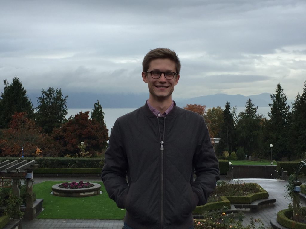
Geothink’s former Project Manager, Alexander Taciuk, has just begun the next step of his career in Vancouver. Geothink caught up with him to find out where he has been and where he is headed.

alex-taciuk
By Peck Sangiambut

What have you been up to since you left Geothink?
I went on a three month trip around the world. Southeast Asia for a couple of months and then Europe for a month. Saw everything I could see, explored cities, ate everything that came across my plate, to varying results. Now I have just started my studies here in Vancouver, at the School of Community and Regional Planning at the University of British Columbia. I learned so much at Geothink, there were times that it was intense, and it was all a wonderful experience.

What made you decide on a degree in planning?
I’ve toyed with the idea for a long time. It’s part of why I did a degree in urban geography at McGill University. The time that I had in Geothink gave me the chance to actually speak to a lot of city officials and Geothink partners, and see what they do. That reinforced my desire to work in a municipal field, work with citizens, and find ways to make government and citizens coexist in a productive and harmonious way. The decision to go into planning really came about during my time in Geothink, and so far I think it has been the right decision.

Did Geothink help shape your views on the urban planning issues most important to you?
Yes. One of my personal interests is in transportation. Although transportation issues didn’t represent themselves heavily in Geothink, it was always exciting to hear about work on transportation. It was really cool to hear about Prof. Scott Bell’s work on voluntary cellphone tracking in Saskatoon and what he found when buses went on strike in the middle of their experiment, which produced a sort of natural break [in transportation flows].

Would be able to bring what you’ve learned from Geothink, such as open data and open government, to your new field?
Absolutely. I think that being able to learn about open government, open data, crowdsourcing, and smart cities, the various urban issues discussed in Geothink will add a lot of richness to my new degree. Hopefully I’ve gained enough to create more nuanced views of urban planning issues, which I can convey to planners.

Geothink has also looked at city-to-citizen interaction. Do you see yourself working towards improving these efforts in urban planning from what you’ve learned here?
I hope so. I think that the work that Geothink has done on public consultations and citizen participation could add a lot to what we are doing in the planning world. One of the classes I’m in, called Planning Practices and Methods, is about learning a toolkit on how to solve multi-criteria, multi-stakeholder, very complex problems. You learn how to come up with objectives for them, develop alternatives, and when you need to ask the public a ‘value’ question or when you need to bring in technical experts. I already see some parallels with Geothinkers’ research such as in Spatial Decision Support Decisions. To have public consultations on issues to develop what the public thinks their values are, and not just do that from face-to-face meetings, but to be able to do that digitally in a constructive way, that is the value that Geothink could bring to planning.

Are there any skills you learned while at Geothink that you are bringing forward?
There were a lot of soft skills I learned in terms of organisation, connecting with people, and trying to bring people onboard with new ideas that they may not yet see a connection to. The events that I really enjoyed doing were the Summer Institutes, I absolutely loved them, there were points during them where I couldn’t believe that this was my job. I learned a lot about organising events, and seeing things run smoothly, students coming in and actually getting something out of it, such as the one we did last year where the students were consulting for the City of Ottawa – learning how to create that was such a great process.

What was the best experience you had at Geothink? What will you miss the most?
I’ll miss the people in Geothink. No government mandated that we need to study open cities or open government. It was a bunch of professors, and partners, that came together and said ‘hey this is a really good topic and something we should investigate’. So they just did it. And so being able to get on the phone and speak with academics and research partners from around Canada and hear about the work they are doing – that was really great. I had a lot of conversations with Prof. Jon Corbett where we discussed his projects and various ways of doing them, and just having the opportunity to be that sounding board was a fantastic experience. That’s what I’ll miss.

I like to say a huge ‘thank you’ to Dr. Renee Sieber. I learned a lot under her mentorship, and it was great working under her. I also want to give a big thank you to all our researchers and partners for allowing me to work with them. I am confident that we will continue to get brilliant output from you all, and am incredibly excited to see how Geothink progresses in its final stages.

Paulina Marczak – looking back on her co-op at Open North

paulina-marczak

As she is now embarking on a Master’s degree, I interviewed Paulina Marczak (former Geothink student) to reflect on her four month co-op with Geothink partner, Open North.

What have you been up to since your internship at Open North?
After Open North, I did another co-op in the fall term with Dr. Derek Robinson under an NSERC USRA [Natural Sciences and Engineering Resource Council Undergraduate Student Research Award] grant, where I looked at variations in aboveground vegetative carbon storage across different spatial resolutions within Southwestern Ontario.
I just finished my undergraduate degree at the University of Waterloo. My undergraduate thesis looked at landscape configurations with wetlands in the boreal plains and asked: Is there a relationship between geology and wetland landscape configuration?

Right now I have just begun pursuing a Master’s degree in Geography at Queen’s University in Kingston. So I went into another sub-field still related to geography, but diverging from open data.

Your work in open data and open government are quite removed from your current course
Yes. I wanted to go into climate change after my undergrad, particularly through GIS and remote sensing. However, this summer I had the opportunity to work for the Canadian Open Data Exchange (ODX) and got to help develop their plans for commercialization of open data. They wanted someone who understood the value of open data.

What do you think you got out of your time at Open North?
I learned a lot. I started out from zero experience with open data. You know, it’s easy to fall down the rabbit hole of open data and explore one particular aspect of it, like metadata, without even touching another aspect Being able to co-author white papers that contribute to a global-scale initiative, and interview people from around the world, that was a really valuable and unique experience.

What was it like working for a non-profit?
James, Stéphane, and everyone at Open North were really great. It was different because all my previous co-ops were in government, federal and municipal. They were very structured. Open North was smaller, and it required you to be more. They want you to be a part of that team. They make you feel like you are a critical component of the team, not to mention the valuable mentorship they provide. Infomediaries, they prod governments, they speak on behalf of and give a voice to the people. That’s why I think their work is impactful. Working at Open North also gave me the opportunity to attend the Canadian Open Data Summit 2015 in Ottawa, where I got to meet various members of the open data community and speak to panelists.

What skills did you bring from Open North to your current position?
Being able to critically research, and experience with technologies such as APIs and R (statistical software). Most important is writing. At Open North I learned to write on a deadline, such as our OGP [Open Government Partnership] white papers, and I also learned about academic writing from Professor Renee Sieber.

It’s been interesting as a new Master’s student. I was talking to a librarian here in Kingston and they were interested in the idea of open data, but were surprisingly satisfied with the very restrictive data agreements that are currently in place…there is more work to be done on the advocacy side. On the other hand, I was able to talk to the City of Kingston and they are about to roll out a new open data initiative, per Council approval. From my interactions with the librarian, I realized that I could talk about this topic now and I had some idea of how things should be done. In fact, they were looking to me for advice, which was a new milestone for me.

It sounds like you may be interested in advocating for open data in your new environment?
Sure. I can talk about it, but I don’t feel I have the capacity and knowledge to spearhead it. But I do feel it is my responsibility to inform people if they don’t know what open data is or want to learn about some of current issues surrounding open data these days.

Do you feel more confident in talking about open data now?
Yes, but I don’t feel like I’m the expert. I feel like I’m an apprentice. Constantly learning.

The New Geothink Brochure

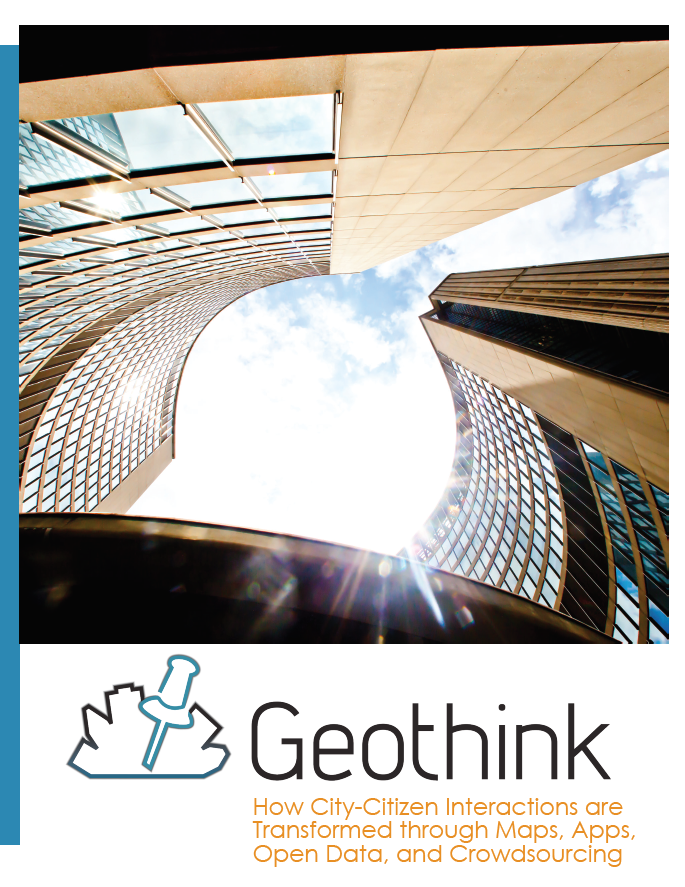
I am pleased to announce that we have just published a new Geothink brochure highlighting some of our research. You may be seeing some physical copies at Geothink events. In the meantime, please feel free to click the image below and download a copy for yourself. It is also available on this website under the Resources section.

brochure-screenshot

The Future of AR: Negotiating Virtual Space Guided Movements


This is a guest post from Geothink student Wei Jiang at the University of Ottawa, Faculty of Law, under the supervision of Professor Teresa Scassa.


By Wei Jiang

While not everyone is out to catch ‘em all, few people in Canadian cities and in many countries around the world are unaffected by the recent Pokémon Go craze. Alongside the wide range of more or less amusing incidents that have been reported arising out of Pokémon Go, articles have also explored the current legal ramifications of this popular Artificial Reality (AR) app. In this blog post, I explore the possible legal developments that may be necessary in response to the potential explosion of AR apps like Pokémon Go.

Though the Pokémon Go craze appears to be fading, the impact of the popular AR app, which overlays virtual critters (Pokémon) on the geography of the real world, is likely to remain. Already, Niantic and other app developers are working on the next wave of games that redefine how we interact with our physical surroundings. Furthermore, as Virtual Reality (such as Oculus Rift and HTC Vive) and wearable technologies mature, AR apps could see a further boost in popularity.

Currently, legal analysis of Pokémon Go focus mainly on the impacts of the app in terms of the existing legal framework. These include legal actions like trespass, nuisance, and infringements of intellectual property (IP) rights. Homeowners not only face the prospect of trespassers damaging their property, but could also be responsible for harm that trespassers sustain on their property as part of their occupier liability. Indeed, with homeowners responsible for the conditions of sections of the sidewalk in many Canadian cities, the increase in the number of pedestrians playing Pokémon Go could present a significant risk. At the root of these potential legal actions is one fundamental reality: someone has altered the qualities of a physical space (be it a home, park, or restaurant) by designating it as a virtual landmark known as a “Pokéstop” or “gym”.

In broader terms, the challenge posed by AR apps is who can decide the qualities of the virtual space that overlays the physical world. Although future AR apps may not turn real world locations into “Pokéstops” and “gyms”, the core attraction of AR remains unchanged: the juxtaposition of the real world geography with a set of virtual meanings and rules. Currently, it is Niantic (the company behind the overlaying of virtual materials over physical geography) that asserts the right to determine the meanings associated with virtual space, presumably because the virtual space is a part of an application over which they have IP rights.

There is, however, a danger in applying a purely intellectual property framework to the situation of AR apps. IP ownership is only one aspect of overlaying a virtual space on top of a physical one. Other aspects of this behaviour, mainly issues of allocation of risk in case something bad happens, are often separated from the beneficial aspects. Such is the situation with Pokémon Go: while profiting from the IP aspects of Pokéstops and gyms, Pokémon Go developers subtly avoid confronting the issue of why property owners should bear increased risks associated with the same action of designating a location as a Pokéstop and gym.

The development history of Pokémon Go’s Pokéstops and gyms serves to illustrate the interests in keeping the IP and risk dimensions of Pokémon Go separate. Pokémon Go developed relatively quickly by importing a network of virtual landmarks from Niantic’s previous AR app – “Ingress”. These virtual landmarks were submitted by the users of “Ingress”, but did not draw much attention because of the relatively smaller player-base of that app. Any risk of legal liabilities was passed on to the app’s users through the terms of service. With Pokémon Go’s success, however, the developers are beginning to monetize their virtual landmarks by selling the right to become a “Pokéstop” or “gym” to businesses. For example, McDonald’ s in Japan was the first business to sign on to the “sponsored locations” scheme. In spite of the app’s recent decline in popularity, businesses are still signing on to this model.

Presumably, the logic of sponsored locations is that businesses can leverage the success of Pokémon Go’s brand to increase their own revenues. However, this IP-focused interpretation narrows in on only the commercial aspect of being designated a virtual landmark and keeps the other, potentially less positive, dimensions separate. In reality, when McDonald’ s signed on to the sponsored locations scheme, the full range of consequences was probably considered and accounted for: the increase in occupier liability, the possible nuisance created by the swarming players, and the possibility of attracting unwanted app users. People living on or near virtual landmarks imported from Ingress, however, often did not even know that they were affected by the app and thus did not have the opportunity to negotiate the placement of the marker. Risk was allocated to them without their knowledge or consent.

Indeed, considering that Pokémon Go’s successful system depends on these virtual landmarks, it could even be argued that the company took advantage of someone else’s rights without paying compensation. The problem with this assertion is that there are no rights to the virtual space that exists at a particular location. While some thinkers have began questioning whether real property rights should extend to the virtual space on top of it, few have explored this idea in detail.

One way to think about this question is to compare the placing of a virtual landmark to the placing of a sign on a physical space: both markers transmit information, impact the physical location, and have value because of the qualities of that physical location. The difference between signs on the internet and these virtual landmarks in an AR app is precisely that AR apps depend on and affect these physical locations.

Unlike advertising on the internet, virtual landmarks, where information is embedded in a location in virtual space as part of an AR app, are intricately bound up with the physical location on which they sit. Pokéstops are often established on top of landmarks and scenic locations because Pokémon Go advertises itself as an application that guides people to explore interesting locations in the real world. In addition, a certain concentration of virtual landmarks is required for the game to function properly (which is part of the reason why Pokémon Go is so difficult to play in rural regions). In both instances, Pokéstops derive value for the game based on attributes of the physical space on top of which they are placed.

Simultaneously, the benefit derived by Pokémon Go from placing these virtual landmarks also has an impact on the underlying physical space. The main impact is the increase in the number of people visiting a particular location, which carries with it associated consequences like increased noise levels, congestion on sidewalks, loitering, and the risk of harm. Only certain kinds of businesses can appropriately leverage the increase in visitors. For most residential areas, the result of being designated a virtual landmark is negative. Indeed, any potentially positive aspects of being designated a virtual landmark, such as possible increases in real estate value, could turn out to be less certain since the app developers can decide to remove the virtual landmark at their discretion.

Finally, the impact of layering information on top of a physical location is not to be underestimated. The Auschwitz Holocaust Museum incident, where a Pokémon Go player snapped a picture of a poison-gas Pokémon inside the museum, is a good example of how losing control of the ability to determine the meaning associated with a property publicly could undermine important aspects of the property, especially those with cultural significance. The Chinese takeover of the Pokémon Gym on top of Japan’s Yasukuni Shrine is another example of how dramatically an AR app could interfere with an owner or community’s ability to determine and preserve the meaning of a physical property. While everyone is free to hold their own opinions about what things mean, the overlaying of information through AR presents a new realm that resides in between the public display and the private mind.

Many of these issues exist because the legal dimensions of AR applications are ill-defined. As AR continues to develop, essential questions to be considered include “what is a virtual object” and “where is a virtual location”? Two legal frameworks come to mind. First, rights to physical space could be extended to the overlaid virtual space. This essentially makes the virtual space on top of a physical location an additional wall or sign area that is available for transmitting information, thus giving owners the ability to bargain for its use. Second, defining aspects of AR applications (such as virtual landmarks) as objects that could interact with the physical world may allow property owners to better defend themselves through the trespass framework, as they could now resist the placement of the virtual objects pre-emptively rather than wait for the scattered trespasses and nuisances that occur as a consequence of the placement of that object.

These developments could come either as a result of legislation or with courts interpreting virtual property into the existing property law frameworks. Another potential development in response to AR is the regulation of public space. With AR apps sending more people onto streets and into public spaces, issues of overcrowding in downtown spaces by AR players may prompt governments to regulate how AR developers guide player movement. As Professor Renee Sieber points out, the algorithms for Pokémon Go are not objective and contain biases that affect where people playing the game are attracted to. How the movement aspect of AR apps is regulated can have significant implications not only for issues of discrimination, but also for issues of access to public spaces and the gentrification of space. Developers and regulators should be aware of not only how AR apps create movement and gatherings, but also who the AR app users are pushing out of particular spaces, so as to avoid doing damage to already marginalized groups.

Wei Jiang is a J.D. student at the University of Ottawa, Faculty of Law. He is a Geothink student under the supervision of Professor Teresa Scassa.