Author Archives: Geothink

Paulina Marczak – looking back on her co-op at Open North

paulina-marczak

As she is now embarking on a Master’s degree, I interviewed Paulina Marczak (former Geothink student) to reflect on her four month co-op with Geothink partner, Open North.

What have you been up to since your internship at Open North?
After Open North, I did another co-op in the fall term with Dr. Derek Robinson under an NSERC USRA [Natural Sciences and Engineering Resource Council Undergraduate Student Research Award] grant, where I looked at variations in aboveground vegetative carbon storage across different spatial resolutions within Southwestern Ontario.
I just finished my undergraduate degree at the University of Waterloo. My undergraduate thesis looked at landscape configurations with wetlands in the boreal plains and asked: Is there a relationship between geology and wetland landscape configuration?

Right now I have just begun pursuing a Master’s degree in Geography at Queen’s University in Kingston. So I went into another sub-field still related to geography, but diverging from open data.

Your work in open data and open government are quite removed from your current course
Yes. I wanted to go into climate change after my undergrad, particularly through GIS and remote sensing. However, this summer I had the opportunity to work for the Canadian Open Data Exchange (ODX) and got to help develop their plans for commercialization of open data. They wanted someone who understood the value of open data.

What do you think you got out of your time at Open North?
I learned a lot. I started out from zero experience with open data. You know, it’s easy to fall down the rabbit hole of open data and explore one particular aspect of it, like metadata, without even touching another aspect Being able to co-author white papers that contribute to a global-scale initiative, and interview people from around the world, that was a really valuable and unique experience.

What was it like working for a non-profit?
James, Stéphane, and everyone at Open North were really great. It was different because all my previous co-ops were in government, federal and municipal. They were very structured. Open North was smaller, and it required you to be more. They want you to be a part of that team. They make you feel like you are a critical component of the team, not to mention the valuable mentorship they provide. Infomediaries, they prod governments, they speak on behalf of and give a voice to the people. That’s why I think their work is impactful. Working at Open North also gave me the opportunity to attend the Canadian Open Data Summit 2015 in Ottawa, where I got to meet various members of the open data community and speak to panelists.

What skills did you bring from Open North to your current position?
Being able to critically research, and experience with technologies such as APIs and R (statistical software). Most important is writing. At Open North I learned to write on a deadline, such as our OGP [Open Government Partnership] white papers, and I also learned about academic writing from Professor Renee Sieber.

It’s been interesting as a new Master’s student. I was talking to a librarian here in Kingston and they were interested in the idea of open data, but were surprisingly satisfied with the very restrictive data agreements that are currently in place…there is more work to be done on the advocacy side. On the other hand, I was able to talk to the City of Kingston and they are about to roll out a new open data initiative, per Council approval. From my interactions with the librarian, I realized that I could talk about this topic now and I had some idea of how things should be done. In fact, they were looking to me for advice, which was a new milestone for me.

It sounds like you may be interested in advocating for open data in your new environment?
Sure. I can talk about it, but I don’t feel I have the capacity and knowledge to spearhead it. But I do feel it is my responsibility to inform people if they don’t know what open data is or want to learn about some of current issues surrounding open data these days.

Do you feel more confident in talking about open data now?
Yes, but I don’t feel like I’m the expert. I feel like I’m an apprentice. Constantly learning.

The New Geothink Brochure

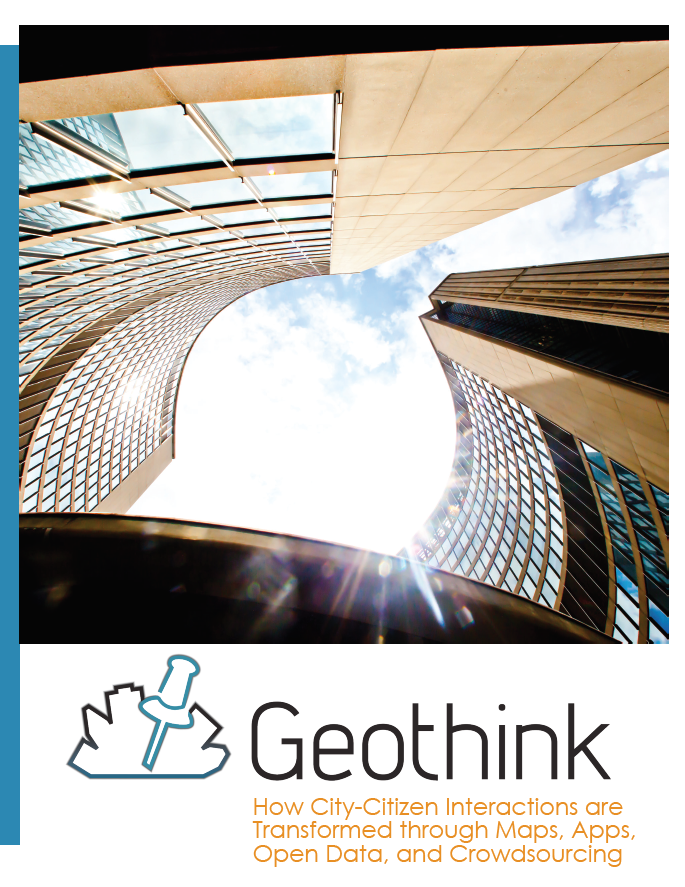
I am pleased to announce that we have just published a new Geothink brochure highlighting some of our research. You may be seeing some physical copies at Geothink events. In the meantime, please feel free to click the image below and download a copy for yourself. It is also available on this website under the Resources section.

brochure-screenshot

The Future of AR: Negotiating Virtual Space Guided Movements


This is a guest post from Geothink student Wei Jiang at the University of Ottawa, Faculty of Law, under the supervision of Professor Teresa Scassa.


By Wei Jiang

While not everyone is out to catch ‘em all, few people in Canadian cities and in many countries around the world are unaffected by the recent Pokémon Go craze. Alongside the wide range of more or less amusing incidents that have been reported arising out of Pokémon Go, articles have also explored the current legal ramifications of this popular Artificial Reality (AR) app. In this blog post, I explore the possible legal developments that may be necessary in response to the potential explosion of AR apps like Pokémon Go.

Though the Pokémon Go craze appears to be fading, the impact of the popular AR app, which overlays virtual critters (Pokémon) on the geography of the real world, is likely to remain. Already, Niantic and other app developers are working on the next wave of games that redefine how we interact with our physical surroundings. Furthermore, as Virtual Reality (such as Oculus Rift and HTC Vive) and wearable technologies mature, AR apps could see a further boost in popularity.

Currently, legal analysis of Pokémon Go focus mainly on the impacts of the app in terms of the existing legal framework. These include legal actions like trespass, nuisance, and infringements of intellectual property (IP) rights. Homeowners not only face the prospect of trespassers damaging their property, but could also be responsible for harm that trespassers sustain on their property as part of their occupier liability. Indeed, with homeowners responsible for the conditions of sections of the sidewalk in many Canadian cities, the increase in the number of pedestrians playing Pokémon Go could present a significant risk. At the root of these potential legal actions is one fundamental reality: someone has altered the qualities of a physical space (be it a home, park, or restaurant) by designating it as a virtual landmark known as a “Pokéstop” or “gym”.

In broader terms, the challenge posed by AR apps is who can decide the qualities of the virtual space that overlays the physical world. Although future AR apps may not turn real world locations into “Pokéstops” and “gyms”, the core attraction of AR remains unchanged: the juxtaposition of the real world geography with a set of virtual meanings and rules. Currently, it is Niantic (the company behind the overlaying of virtual materials over physical geography) that asserts the right to determine the meanings associated with virtual space, presumably because the virtual space is a part of an application over which they have IP rights.

There is, however, a danger in applying a purely intellectual property framework to the situation of AR apps. IP ownership is only one aspect of overlaying a virtual space on top of a physical one. Other aspects of this behaviour, mainly issues of allocation of risk in case something bad happens, are often separated from the beneficial aspects. Such is the situation with Pokémon Go: while profiting from the IP aspects of Pokéstops and gyms, Pokémon Go developers subtly avoid confronting the issue of why property owners should bear increased risks associated with the same action of designating a location as a Pokéstop and gym.

The development history of Pokémon Go’s Pokéstops and gyms serves to illustrate the interests in keeping the IP and risk dimensions of Pokémon Go separate. Pokémon Go developed relatively quickly by importing a network of virtual landmarks from Niantic’s previous AR app – “Ingress”. These virtual landmarks were submitted by the users of “Ingress”, but did not draw much attention because of the relatively smaller player-base of that app. Any risk of legal liabilities was passed on to the app’s users through the terms of service. With Pokémon Go’s success, however, the developers are beginning to monetize their virtual landmarks by selling the right to become a “Pokéstop” or “gym” to businesses. For example, McDonald’ s in Japan was the first business to sign on to the “sponsored locations” scheme. In spite of the app’s recent decline in popularity, businesses are still signing on to this model.

Presumably, the logic of sponsored locations is that businesses can leverage the success of Pokémon Go’s brand to increase their own revenues. However, this IP-focused interpretation narrows in on only the commercial aspect of being designated a virtual landmark and keeps the other, potentially less positive, dimensions separate. In reality, when McDonald’ s signed on to the sponsored locations scheme, the full range of consequences was probably considered and accounted for: the increase in occupier liability, the possible nuisance created by the swarming players, and the possibility of attracting unwanted app users. People living on or near virtual landmarks imported from Ingress, however, often did not even know that they were affected by the app and thus did not have the opportunity to negotiate the placement of the marker. Risk was allocated to them without their knowledge or consent.

Indeed, considering that Pokémon Go’s successful system depends on these virtual landmarks, it could even be argued that the company took advantage of someone else’s rights without paying compensation. The problem with this assertion is that there are no rights to the virtual space that exists at a particular location. While some thinkers have began questioning whether real property rights should extend to the virtual space on top of it, few have explored this idea in detail.

One way to think about this question is to compare the placing of a virtual landmark to the placing of a sign on a physical space: both markers transmit information, impact the physical location, and have value because of the qualities of that physical location. The difference between signs on the internet and these virtual landmarks in an AR app is precisely that AR apps depend on and affect these physical locations.

Unlike advertising on the internet, virtual landmarks, where information is embedded in a location in virtual space as part of an AR app, are intricately bound up with the physical location on which they sit. Pokéstops are often established on top of landmarks and scenic locations because Pokémon Go advertises itself as an application that guides people to explore interesting locations in the real world. In addition, a certain concentration of virtual landmarks is required for the game to function properly (which is part of the reason why Pokémon Go is so difficult to play in rural regions). In both instances, Pokéstops derive value for the game based on attributes of the physical space on top of which they are placed.

Simultaneously, the benefit derived by Pokémon Go from placing these virtual landmarks also has an impact on the underlying physical space. The main impact is the increase in the number of people visiting a particular location, which carries with it associated consequences like increased noise levels, congestion on sidewalks, loitering, and the risk of harm. Only certain kinds of businesses can appropriately leverage the increase in visitors. For most residential areas, the result of being designated a virtual landmark is negative. Indeed, any potentially positive aspects of being designated a virtual landmark, such as possible increases in real estate value, could turn out to be less certain since the app developers can decide to remove the virtual landmark at their discretion.

Finally, the impact of layering information on top of a physical location is not to be underestimated. The Auschwitz Holocaust Museum incident, where a Pokémon Go player snapped a picture of a poison-gas Pokémon inside the museum, is a good example of how losing control of the ability to determine the meaning associated with a property publicly could undermine important aspects of the property, especially those with cultural significance. The Chinese takeover of the Pokémon Gym on top of Japan’s Yasukuni Shrine is another example of how dramatically an AR app could interfere with an owner or community’s ability to determine and preserve the meaning of a physical property. While everyone is free to hold their own opinions about what things mean, the overlaying of information through AR presents a new realm that resides in between the public display and the private mind.

Many of these issues exist because the legal dimensions of AR applications are ill-defined. As AR continues to develop, essential questions to be considered include “what is a virtual object” and “where is a virtual location”? Two legal frameworks come to mind. First, rights to physical space could be extended to the overlaid virtual space. This essentially makes the virtual space on top of a physical location an additional wall or sign area that is available for transmitting information, thus giving owners the ability to bargain for its use. Second, defining aspects of AR applications (such as virtual landmarks) as objects that could interact with the physical world may allow property owners to better defend themselves through the trespass framework, as they could now resist the placement of the virtual objects pre-emptively rather than wait for the scattered trespasses and nuisances that occur as a consequence of the placement of that object.

These developments could come either as a result of legislation or with courts interpreting virtual property into the existing property law frameworks. Another potential development in response to AR is the regulation of public space. With AR apps sending more people onto streets and into public spaces, issues of overcrowding in downtown spaces by AR players may prompt governments to regulate how AR developers guide player movement. As Professor Renee Sieber points out, the algorithms for Pokémon Go are not objective and contain biases that affect where people playing the game are attracted to. How the movement aspect of AR apps is regulated can have significant implications not only for issues of discrimination, but also for issues of access to public spaces and the gentrification of space. Developers and regulators should be aware of not only how AR apps create movement and gatherings, but also who the AR app users are pushing out of particular spaces, so as to avoid doing damage to already marginalized groups.

Wei Jiang is a J.D. student at the University of Ottawa, Faculty of Law. He is a Geothink student under the supervision of Professor Teresa Scassa.

A Summer Student Exchange to McGill University


This is a guest post from Geothink student Qing Lu (Lucy), University of Waterloo, under Professor Peter Johnson. She writes about her recent experience in a Geothink student exchange.


By Qing Lu (Lucy)

In the middle of August, I had the opportunity to visit McGill University via the Geothink Summer Exchange Programme. Approaching the completion of my graduation thesis, I thought Dr. Renee Sieber and her team could help me identify the gaps of my research and add new insights. Dr. Sieber is the Principal Investigator of Geothink and her research on public participation and the geoweb, which is related to my research on municipal government mobile applications for 311 service requests. My research aims to determine the characteristics of communication channel use and identify advantages and challenges of the mobile app channel. Since my research is a new area that does not have an abundance of prior studies for reference, insights and opinions from experts and peers are important. I hoped to hear their perspectives on the potentials and issues of 311 apps for municipalities, more specifically, the impacts of 311 apps on efficiency of governments as well as on citizen engagement. Luckily, I got to meet our Geothink Student Coordinator, Peck Sangiambut, who has also looked at citizen engagement via civic apps (including a 311 service request app), under Dr. Sieber.

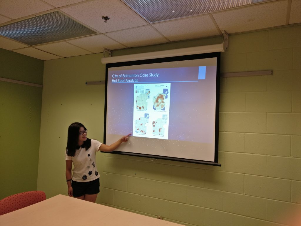
On the first day, I did a presentation for Dr. Sieber and her team. I presented my research on 311 apps and results of analysis of 311 requests in the City of Edmonton. A paper about this is published in the Urban Planning journal. In addition, I presented results of interviews with six municipalities about their perspectives on 311 app usage. Instead of a regular presentation that starts with presentation and wraps up with questions, it was a lively discussion that everyone exchanged opinions and ideas in the process of presentation, and we ended up an hour over our originally scheduled time! Dr. Sieber and her team were very outspoken and many of their points worth pondering. One of the things that I ignored in my research is the geographic offsets of 311 data obtained in open data catalogue. To protect the privacy of reporters, the locations of reported incidents are likely to be shifted from their actual geographic locations, for example, a tree pruning request points to the centre of a building. Therefore, the results of my spatial analysis of 311 data contain bias caused by inaccurate locations. In addition, efficiency could conflict with engagement when we know newly-introduced channels such as mobile apps are more efficient than telephone calls. Some people, especially the elderly, would be left behind if municipalities simply seek to maximise operational efficiency and perhaps reduce staffing for traditional channels of communication (such as telephone hotlines).

student exchange presentation
Presenting research results at the Department of Geography, McGill University

For the second day, Dr. Sieber’s team and I went to a panel discussion called GIS Without GIS: Spatial Technologies for Social Change. This was part of the World Social Forum and included discussion of the roles open data, mapping, and open source tools in producing social change. The invited speakers shared their opinions and experiences working with open data. This discussion inspired me to look at the open data aspect of my research as some municipalities publish the 311 data on the open data catalogue while others do not. It would be interesting to investigate if the openness of 311 reports impact citizens’ engagement.

This trip has provided me with the opportunity to communicate my research findings with people who work in the same field. I also got a deeper understanding of research – research is not only finding answers to questions but also seeking questions to be answered. In my research, I have found that there is a trend that mobile app use for citizens to contact governments is increasing and telephone calls are decreasing, and responses from municipalities show that mobile apps are more efficient and cost-saving. However, the question remains that if the governments should give up traditional communication channels and turn to newly-introduced ones. As the communication channels involve both citizens and governments, citizens’ perspectives on the multiple channels should also be considered when evaluating the channels. I am deeply interested in these questions, and I will investigate them in my future research.

My sincere thanks to Geothink for giving the opportunity to go on a summer exchange at the University of Waterloo. Thank you to Dr. Renee Sieber for hosting me and sharing your valuable comments and opinions. Thank you to Sonja and Peck for organizing everything well. To the Geothink community members: please don’t hesitate to contact me if you have further questions or if you are considering going on a summer exchange yourself.

Lucy (Qing) Lu is a Master’s student under the supervision of Dr. Peter Johnson in the Department of Geography and Environmental Management at University of Waterloo. Her research focuses on municipal government mobile applications, 311 services and e-government.
Lucy can be reached by email at q25lu@uwaterloo.ca.

Robux Generator is normally taking care of large numbers of platforms

Roblox Hack your body’s free of charge roblox robux generator device is established you want to catch yet the beguilement on to the running and at easy. Cook that an unwell defined selection of robux extracted from you want to run yet the create. Robux generator is definitely online contraption and then it serves each depiction of dependably comprising flowing here at free of charge robux. Several of call up it roblox hack, several of call up it roblox cheat, several of call up it robux generator sadly only just it really is the variety of a young identical device that’s taken in on to defeat any kind of roblox consideration and at tones of robux. How to hack Roblox. Are there any Roblox cheats free of charge robux. By just the words would mean is known to you get limitless schemes of robux? fine let’s go directly to the heart of the condition. There exists an instrument that this wears out the online in fact it is adept to perform such workout routines. Such an Roblox Hack is definitely first starting past due the thing you need to really get your hand here at colossal robux here at what ever step you hope them. So why accomplish you hope ROBUX which ROBLOX HACK

Roblox is definitely recommended to be free gaming step and then it is to become listed on. Besides, the minute you’re here at you cannot deplete you to ultimately loss of life until you get some robux. Finally after the day time (would depend extracted from a young person) you enjoyable that you’re simply not going where using yet the incitement in this free of charge mode. So you then wind up here at the condition when you yourself have on to urge several of money of your body’s self and then station sources down into several of robux for that Roblox consciousness. As time passes yo can experience the diversion as one foreseen which could and also you enjoyable it, sadly after the day time Roblox is within a general sense getting to costly. Yes we appreciate that this slant. The minute you just hope 100 robux on to get some fine substances and then you’re trapped because you don’t have a approach to deal with oversee get it on time. Fine we have destinations ways to get in and around that this approach and then make your robux free of charge. Besides, it really is coping with fine accomplishment rate to invest a huge a lot longer day time. Ever since we are generally not a definite visitors to are still adjacent lipped comprising most we are mild to share such an Roblox Hack for each and every Roblox player obtainable. Roblox hack can be an aggregate contraption which solidifies the variety of Roblox cheats from one powerfull Roblox hacking device. Such an generator is required to effect yet the measure of robux for any chossen Roblox user. Roblox Robux Generator Hack

All of our Roblox hack is definitely actively simply not tough to use, and you will cook robux here at couple of schemes below:

1. Get in your body’s Roblox username

2. Get in yet the measure of Robux that you have to generate

3. Hit yet the “Generate” button

4. That’s it! catch after the headings to invest robux generator to perform and then fill out your body’s free of charge robux

5. Have done!

Robux Generator is definitely taking care of most platforms

We are thrilled on to manifest that this free of charge robux generator is definitely enhanced to utilize most contraptions fine, paying mild acknowledgement on to be it a young create bassed or iOS, Android or Mac. So don’t squeeze you cannot hack roblox and at any of these free of charge robux generators and then utilize the robux on to redesign your body’s gaming basis robuxhackgenerator.com and then i suppose to purchase the variety of fine the things that you were get-together robux to invest, but now you cannot perceive roblox hope an official because you have a free of charge robux spitting producer from your own part. Robux dollars are precisely essential or argue them most importantly ensemble product lines here at mild from the software that this and at them we’re able to accomplish anything from your pleasure. Hope we’re able to buy amassed substances endlessly to invest trade. Close to such an, we’re able to here at hope approach prop all of our photo and at the usage of them. Changed into the man extracted from ace fan club of Roblox, fly every critiquing piece of sample comprising Robux and then tixVeteran and then Warrior thusly of robux dollars. We’re able to here at hope approach keep these things extracted from Roblox. Com supply sadly in this manner of guaranteed money. After the a short while we could get ten,000 robux to invest $99. 95 and then 22,500 robux to invest $199. 95 extracted from an official web page. We could get 12,500 compliment robux dollars in case we sign up for realtors club. Notwithstanding, down under we are pushing a free Roblox Robux Generator that’ll be moved by just an official generator and then using out likewise and at the first. We are really enchanted to know for you all of our the experts fill out first starting past due done out a young conceivable execution during the period of such an Robux generator, most by the use of past due classes, they were coping during the period of it and then then we established such an Roblox Generator outlined.

Geothink Newsletter Issue 11

Issue 11 of the Geothink Newsletter is now available! Inside we provide an update from this summer’s activities, in particular, the Summer Institute 2016.

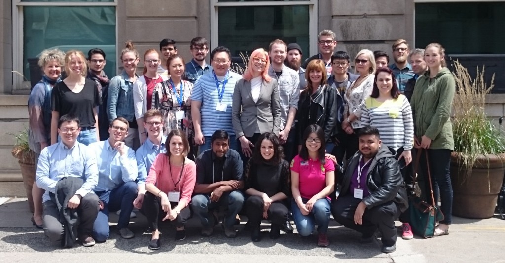
Geothink students, academics, and faculty at the Summer Institute 2016. Hosted by Ryerson University, School of Urban and Regional Planning

Geothink students, academics, and faculty at the Summer Institute 2016. Hosted by Ryerson University, School of Urban and Regional Planning

Download Geothink Newsletter Issue 11

If you have feedback or content for the newsletter, please contact the Editor, Peck Sangiambut

Open Data and Urban Forests – What’s Next?


This is a guest post from Geothink Post Doctoral researcher James Steenberg, Ryerson University School of Urban and Regional Planning, working with Dr. Pamela Robinson.


By James Steenberg, PhD

I recently had the opportunity to go on a Geothink summer exchange at the University of Waterloo hosted by Dr. Peter Johnson, a Geothink co-applicant and Assistant Professor at Waterloo’s Department of Geography and Environmental Management. The main goal of the exchange was to learn about open data and open government from Dr. Johnson with the ultimate goal of writing a collaborative paper on the potential role of open data in municipal urban forestry.

I wrote about my experiences during the exchange in a previous post, and subsequently left Waterloo with an open question on open data – can the open data/open government movement also be embraced in urban forestry? I would like to justify this question with two contrasting tales of cities.

Toronto

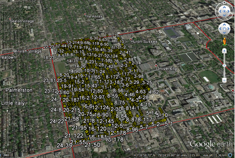
The first tale is about Toronto, more specifically about a neighbourhood in Toronto called Harbord Village where I conducted some of my PhD field research. The neighbourhood and its residents association are quite active in the stewardship of their urban forest. They even undertook a citizen science initiative to inventory and assess all 4,000 of their trees. I re-measured some of their tree inventory in 2014 with the purpose of identifying social and ecological drivers of urban forest vulnerability (e.g., tree mortality). Soon after, my current Geothink supervisor Dr. Pamela Robinson and I began to speculate that a key agent of change was housing renovation. Where we noted incidences of tree mortality, there were often shiny new home additions or driveways where once a tree stood. Fortunately, the City of Toronto’s open data portal includes building permit data and we were able to test this theory. We did indeed find that building permits (i.e., housing renovation) significantly predicted higher rates of tree mortality.

Municipal urban forestry departments are responsible for planting, maintaining, and removing trees on public land, as well as protecting and sustaining the urban forest resource on public and private land through various policies and regulations. However, it’s important to note that urban forestry is plagued by management challenges due to the limited space and harsh growing conditions of cities. Simply put, trees frequently die when they’re not supposed to – often for unknown reasons – and practitioners are continuously seeking out ways to reduce unnecessary tree mortality. Our findings suggest that urban foresters aren’t talking to urban planners when they should be, or vice versa. Urban planners collect data describing where building renovation occurs. Urban foresters collect data describing where city trees are dying and being removed. Blending these datasets has revealed that better coordination and horizontal data sharing across branches of government might help keep public trees alive. More broadly, these findings indicate an inefficiency in municipal service provision – the provision of the beneficial ecosystem services that public trees provide to city residents. What other urban forest inefficiencies might open data reveal?

geothink_harbord_village
The Harbord Village tree inventory and corresponding volunteered geographic information (VGI)

Edmonton

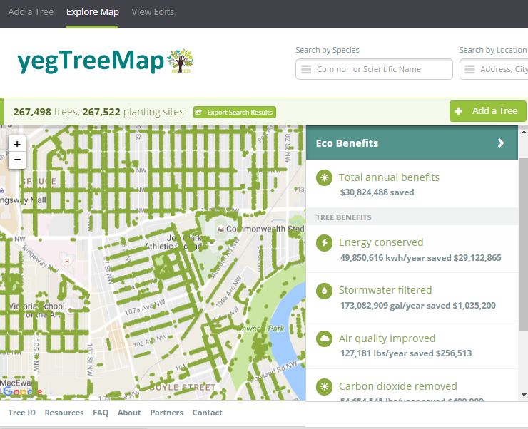
The second tale is about Edmonton and paints a different picture. I stumbled across one of Edmonton’s approaches to urban forestry during my summer exchange while learning about the various open data programs across Canada. Their urban forestry branch has used Open Tree Map – a web-based application for participatory tree mapping – in their yegTreeMap project so that “individuals, community groups, and government can collaboratively create an accurate and informative inventory of the trees in their communities”. In short, citizens in Edmonton that feel the urge to participate in municipal urban forestry can do so by downloading tree inventory data, using the data to their heart’s content (e.g., community-based stewardship programs), and entering new data into the City’s database.

This approach to what I’ve started calling ‘open urban forestry’ could conceivably improve citizen engagement with municipal government and its urban forestry programs. Much of the urban forest resource is situated on private residential property that the city doesn’t have direct access to, so citizen engagement in stewardship activities is a key piece of the puzzle. Moreover, urban tree inventories are notoriously fickle when it comes to data, being both expensive to generate and quick to become out-of-date and obsolete. Crowdsourcing a city’s tree inventory could conceivably provide better data to support decision-making in urban forestry, such as where to plant trees, what species to plant, and where trees are in decline or hazardous.

geothink_edmonton
Edmonton’s yegTreeMap user interface on Open Tree Map

I have been very fortunate to be able to incubate these ideas with guidance from Dr. Robinson and her knowledge of urban planning and citizen engagement. Moreover, it was because of my Geothink summer exchange with Dr. Johnson at the University of Waterloo and his knowledge of open data and open government that I arrived at my current line of thinking on the benefits of open data and crowdsourcing for urban forestry. My next steps forward will be to think critically about these ideas as well. What are the environmental justice implications around who gets to participate in open urban forestry? Crowdsourcing tree inventories through open data programs may provide better data, but do they simultaneously justify the under-funding of municipal urban forestry programs? I’m excited to develop these collaborative ideas over the coming weeks and to hopefully answer my open question on open data.

My sincere thanks to Geothink for giving me the opportunity to go on a summer exchange at the University of Waterloo. Thank you Dr. Peter Johnson for hosting me at the Department of Geography and Environmental Management and for introducing me to your students and colleagues.

To the Geothink community members: please don’t hesitate to contact me if you have further questions or if you are considering going on a summer exchange yourself.

James Steenberg is a postdoctoral researcher under the supervision of Dr. Pamela Robinson at Ryerson University’s School of Urban and Regional Planning. His research focuses on the ecology and management of the urban forest. James can be reached by email – james.steenberg@ryerson.ca – and on Twitter – @JamesSteenberg

Open Data and Urban Forests: A Summer Student Exchange in Waterloo


This is a guest post from Geothink Post Doctoral researcher James Steenberg, Ryerson University School of Urban and Regional Planning, working with Dr. Pamela Robinson. He writes about his experiences in Geothink’s student exchange program.


By James Steenberg, PhD

I recently undertook a three-day Geothink Summer Exchange at the University of Waterloo. My mission: to find out what, if anything, open data has to do with the practice of urban forestry.

I am currently a postdoctoral researcher under the supervision of Dr. Pamela Robinson at Ryerson University’s School of Urban and Regional Planning. Dr. Robinson was also on my PhD committee and over the past three years we have been blending our ideas on urban forest ecosystems, urban planning, citizen science, and open data. Open data and open government, in particular, are something that I’m excited about, but the topic is still quite new and unfamiliar to me. I was therefore incredibly fortunate to have the opportunity to seek out the guidance of Geothink co-applicant Dr. Peter Johnson.

Dr. Johnson is an Assistant Professor at Waterloo’s Department of Geography and Environmental Management, where among a great many other topics he conducts research on the value of open data and its role in open government initiatives. My hope was to learn about open data and open government from Peter and his students with the ultimate goal of writing a collaborative paper about the role of open data in municipal urban forestry. Practitioners of urban forestry are faced with a myriad of management challenges due to the complex, rapidly-changing, and vulnerable state of urban forest ecosystems. Two challenges particular stand out: 1) practitioners lack sufficient data describing the state of the urban forest to inform their decision-making and 2) a large portion of the urban forest is situated on privately-owned residential properties and municipal governments need to engage residents to undertake stewardship activities.

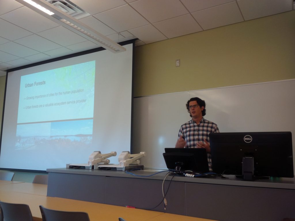
We began the three-day exchange with one of my favourite things to do: having a conversation about how to write something together. This was followed by a meet-and-greet lunch with Dr. Johnson’s students. I was also given the opportunity to give a presentation to students and faculty in Waterloo’s Faculty of Environment. I discussed and received feedback on my current research with Dr. Robinson investigating the effects of housing renewal on urban trees, which was the original research that led us to believe there was more to uncover on open data and urban forests. Over the course of the exchange, I learned about a number of fascinating research projects ranging from citizen engagement to volunteered geographic information (VGI) to water management.

james steenberg student exchange presentation
Giving my talk at the Faculty of Environment, University of Waterloo

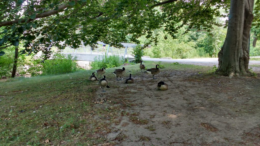
james steenberg at waterloo
Rehearsing prior to my talk, with a captivated audience

It can be all too rare an opportunity to hear about on-going research projects that are outside of my discipline, and I found it insightful in guiding my own work. For instance, I learned about Qing (Lucy) Lu’s research and recent publication on how Edmonton citizens engage their government through different communication channels and technologies. Citizens and community groups also engage with their urban forest in many different ways, and arguably open data is one such way that is on the rise. In a serendipitous discovery, Lucy’s paper inspired me to explore Edmonton’s open data portal where I saw that the government leverages open data and the geoweb in their urban forestry. The City’s yegTreeMap initiative not only provides people with open data describing the urban forest and its benefits, but also provides an interactive mapping platform and even allows city residents to input data about their favourite trees.

I wrapped up my time in Waterloo with Dr. Johnson by revisiting a potential paper on the role of open data in municipal urban forestry, which was now appropriately seasoned with new ideas. In particular, I was challenged to think that maybe it’s not just about how urban foresters can use government open data to advance the practice. Perhaps our inquiry could be expanded to the full Geothink mandate of understanding citizen-government interactions. In Edmonton, citizens can engage their government by participating in urban forest data collection while municipal urban foresters can make better decisions with a more complete and up-to-date tree inventory. Can people and trees alike reap the benefits in cities that practice open urban forestry? This is the question I returned home with, and I will continue to investigate until answered.

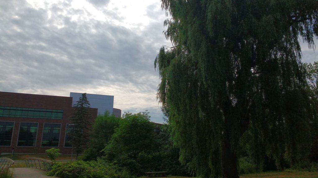
james steenberg at waterloo 2
Importantly, the University of Waterloo campus has some stunning trees

My sincere thanks to Geothink for giving me the opportunity to go on a summer exchange at the University of Waterloo. Thank you to Dr. Peter Johnson for hosting me at the Department of Geography and Environmental Management and for introducing me to your students and colleagues.

To the Geothink community members: please don’t hesitate to contact me if you have further questions or if you are considering going on a summer exchange yourself.

James Steenberg is a postdoctoral researcher under the supervision of Dr. Pamela Robinson at Ryerson University’s School of Urban and Regional Planning. His research focuses on the ecology and management of the urban forest. James can be reached by email – james.steenberg@ryerson.ca – and on Twitter – @JamesSteenberg

Stay tuned for James’ next post detailing his research.