Author Archives: Geothink

Geothink in the Okanagan: A Winter Student Exchange


This is a guest post from Geothink Student Tenille Brown, Faculty of Law, University of Ottawa. She writes about her experiences as the first student in Geothink’s student exchange program.


By Tenille Brown

This past winter, I had the opportunity to be the inaugural ‘student visiting researcher’ through a new Geothink learning initiative focusing on student exchanges. Geothink is a Canada wide, multi-disciplinary grant. In practical terms this means there are university partners in disciplines as diverse as GIScience, urban planning, geography, communication and law. The visiting researcher programme has been established to give students the opportunity to see how other disciplines work. Through this programme, I — a graduate student in law at the University of Ottawa, and member of the Human Rights Research and Education Centre — found myself at a lab at UBC Okanagan. Professor Jon Corbett, a Geothink co-applicant, hosted me as I learnt about the lab, university and the city of Kelowna.

The SPICE Lab: Spatial Information for Community Mapping

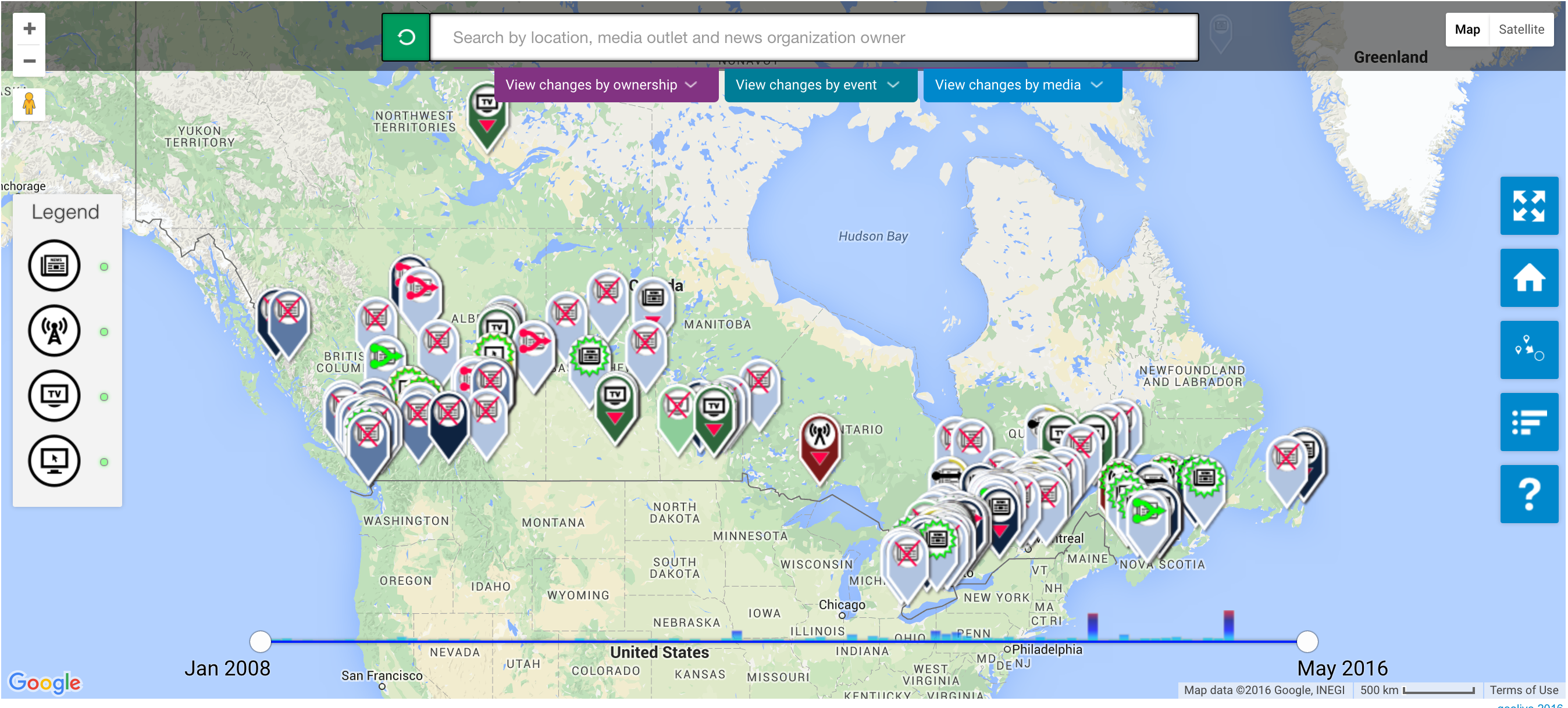
The SPICE Lab, Spatial Information for Community Mapping, is housed at the Centre for Social, Spatial and Economic Justice (CSSEJ) at the University of British Columbia, Okanagan campus. Led by Professor Corbett, the Centre looks at digital cartographic processes and tools that can be used by local communities to help express their relationship to, and knowledge of, their land and resources. A mapping tool that we have heard about at Geothink in the past, Geolive, was developed here. I was able to get an inside look at the mechanics of the Geolive system and learned about the process of collecting and coding the mapped information. As well as learning about the huge amount of resources that go into maintaining a system like Geolive (important information for the arm-chair geo-cartographers out there). I was also fortunate to get a preview of a recent collaboration between the Geolive team and Professor April Lindgren, an associate professor at the Ryerson School of Journalism and, academic director of the Ryerson Journalism Research Centre, and Geothink partner. Their project map titled, “The Local News Map: Tell us what is happening to local news in your community,” explores the issue of news poverty in Canada at a time of significant disruption in the news industry. The crowdsourced map will be available to the public so people can add information about the closure, launch or merger of local news outlets in their community. This collaboration between journalism and mapping was conceived at the 2015 Geothink AGM and will go live in the coming weeks (read more about it here).

Geolive news poverty map

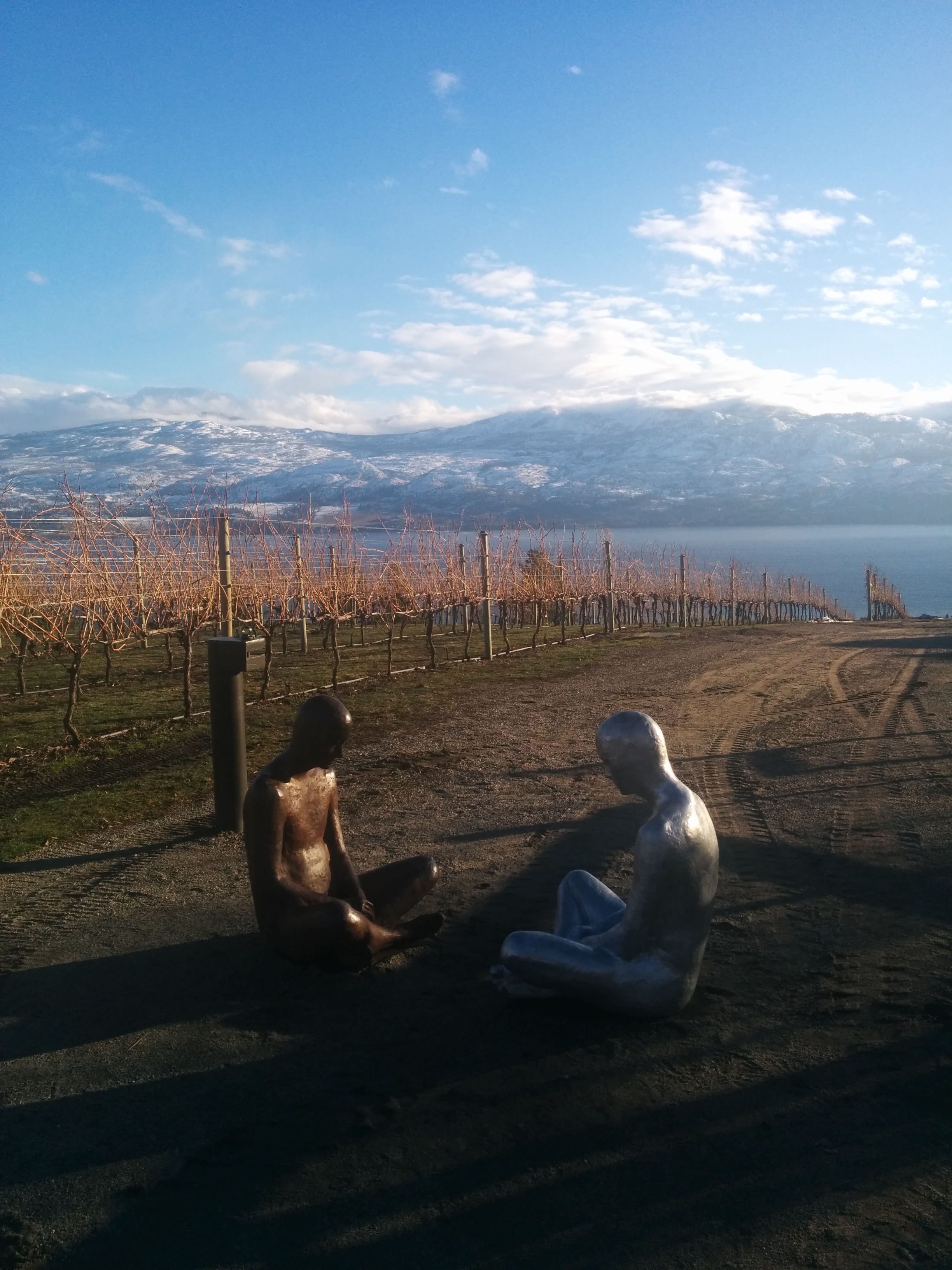
Other activities I got involved in during my short stay in BC, included, observing community interviews carried out by Ailsa Beischer a student of Professor Corbett as she interviewed public health offices about food security (you can read about her work in a recent publication here). My visit coincided with a graduate programme lecture in Indigenous research methodology hosted by the En’owkin Centre, a First Nations community centre in the Okanagan valley. Of course, I got the chance to visit local Okanagan cultural sites.

Okanagan Vineyards
So, what’s a law student to do in a geo-spatial lab?

One of the core aims of Geothink is interdisciplinary research. This is a logical research objective given how integral multiple perspectives are to citizen-engagement; but from the often-siloed academy, surprisingly difficult to implement. My research is focused on property law and liability issues. I ask questions about ownership and legal adjudication of land and property, but from an interdisciplinary – law and geography – perspective. Adopting insights put into practice by the SpICE lab, I ask how cyber-cartography and the geoweb could be adopted to support individual and community experiences of property and land in ways beyond typical legal adjudication. In particular, the work of Geolive provides an opportunity to look at how community needs can be documented, raising the potential for critical insights about governance of land.

The visiting researcher position provided me with the opportunity to learn about the research processes of another discipline, in ways that I do not get to in my daily research schedule. In practical terms, I am deeply interested in both the utility and accuracy of information contained in the geoweb, and how programmers navigate the pressures of coding information to capture communities’ perspectives. These considerations – of accuracy and perspective – are of course long standing preoccupations of the legal field. But seeing the disciplinary similarities was apparent to me by visiting the SpICE lab and seeing the development process first hand. Having the opportunity to engage directly with the processes of researching and realizing digital-mapping projects, has been an impactful experience for my academic research, collaborations with Geothink researchers and personally.

Thank you to the Geothink team for sending me to UBC Okanagan. A huge thank you to Professor Corbett and his wonderful community of the CSSEJ for their support for my visit.

If you would like more information about my visit, or are a Geothink student thinking about going but still have questions, then please reach out to me.

Tenille E. Brown is a PhD Candidate under Professor Elizabeth F. Judge at the Faculty of Law, University of Ottawa, where she is also a student member of the Human Rights Research and Education Centre. Tenille’s research is in the areas of legal geography, including property, spatial and citizen engagement. Tenille can be reached via email at, tenille.brown@uottawa.ca, and on Twitter, @TenilleEBrown

Can Citizen Science Help Cities Address Climate Change?

Photo of people taking noise level readings.

Mapping for Change supports citizen science inquiries into environmental and social issues. Here, participants take noise level readings in regions around a London airport. Photo courtesy Mapping for Change.

By Naomi Bloch

If you were following the recent climate change talks in Paris, you may have noticed a recurring theme: policymakers acknowledging the leadership of subnational governments in addressing climate change. Canada’s own delegation to the conference included representatives from the Canadian Federation of Municipalities, as well as provincial and indigenous leaders.

While the 2015 United Nations Climate Change Conference focused on political negotiations, critics have been quick to remind legislators that more efforts are needed to involve citizens in decision-making. It’s hardly a new idea, but how can civic participation function at a global scale? Activities at the local level may hold the key. Municipalities often have established mechanisms to involve the public in deliberative activities. Cities and their citizens can also collaborate on the evidence-gathering needed to make informed decisions.

Geothink collaborator Muki Haklay is the director of the University College London’s Extreme Citizen Science group and a professor of Geographic Information Science in the Department of Civil, Environmental and Geomatic Engineering. In 2008, he co-founded Mapping for Change, an organization that uses participatory mapping and citizen science to address environmental and social issues in cities.

Headshot of Muki Haklay

Muki Haklay, professor of Geographic Information Science in the Department of Civil, Environmental and Geomatic Engineering, University College London.

“I see the value of citizen science as part of wider environmental democracy, going back to the Rio conference in 1992,” Haklay explained in an email interview with Geothink. Principle 10 of the Rio Declaration on Environment and Development states that, at national levels, citizens should have “appropriate access to information concerning the environment that is held by public authorities, including information on hazardous materials and activities.” At the community level, the Declaration calls for active and informed public participation in environmental decision-making processes.

Citizen science invites non-professionals to participate in data gathering and the production of new scientific knowledge. “I see citizen science as a new part of the picture,” said Haklay, “where people also participate in creating environmental information that will influence their lives.”

In Haklay’s view, citizen science has particular benefits that can complement traditional research. “The various changes that have occurred in society and technology mean that we can open environmental decision-making further and make it more inclusive and participatory.” As with all research, appropriate rigor and attention to methodology are required. “Not all data should come from citizen science,” said Haklay. “In terms of data quality, citizen science requires us to use appropriate quality assurance methods.”

Mapping for Change provides some helpful exemplars. One collaboration with local organizations has seen thirty different communities across London measuring and mapping air quality data for their neighbourhoods. “We used a whole range of methods: wipe samples, where we checked for heavy metals in dust on different surfaces; diffusion tubes which measure NO2 levels; and bio-indicators — lichens and leaves,” Haklay said. The project’s findings provide location-specific data that can help alert authorities to potential problem zones. “The local authority responded to the results by promising to do their own monitoring in the area and consider how they can manage the traffic in the area.”

Particularly when expensive equipment or lab analysis is needed, resource limitations can create challenges. However, Haklay points out some unique benefits. “Citizen science provides additional information about the context — local knowledge about the place where the monitoring is taking place,” said Haklay. “Participants can also put equipment in their own homes, which is complex for researchers or government agencies.” The citizen science water study in Flint, Michigan, is a good example of this.

Constraints, of course, are not just funding-related. “Not all people would want to do it, and not everyone will have the skills, though we need to consider how to help people in developing them,” Haklay said. “The limitations are the knowledge that people have, their perception of science and their own capabilities, and the abilities of those who manage citizen science projects to engage at such levels. We shouldn’t expect all scientists to be able to facilitate the whole process on their own.”

Haklay suggests that government agencies looking to incorporate citizen science in their data gathering processes should consult the report, Choosing and Using Citizen Science, produced by the UK’s Centre for Ecology and Hydrology. The report reviews resource and management issues, political issues, as well as scientific issues.

The key to citizen science is that it can involve a range of activities. “Participants can help in setting the research question, create protocols that are suitable to their local culture and needs, analyze the information, participate in the production of reports and papers — in short, in everything,” Haklay said. “The value is in making science more open and more collaborative.”

Interested in learning more about Muki Haklay’s citizen science work? Follow him on Twitter: @mhaklay
If you have thoughts or questions about this article, get in touch with Naomi Bloch, Geothink’s digital journalist, at naomi.bloch2@gmail.com.

Citizen Science and Intellectual Property: A Guide for the Perplexed

citizen science image

Citizen scientists help researchers transcribe historical climate records and photograph natural phenomena.

By Naomi Bloch

The concept of the science hobbyist —­ the backyard astronomer staring up at the sky or the amateur ornithologist taking part in the annual Christmas bird count — is hardly a new one. What is notable today, however, is the scale and scope of new collaborations between research institutions and volunteer citizen scientists. These kinds of citizen science partnerships have inspired a new study by Geothink co-applicant Teresa Scassa and doctoral candidate Haewon Chung, called “Managing Intellectual Property Rights in Citizen Science: A Guide for Researchers and Citizen Scientists.”

Chung, now a Geothink Ph.D. student researcher at the University of Ottawa’s Faculty of Law, is interested in intellectual property (IP) law with a particular focus on digital ethics. Scassa is a Canada Research Chair in Information Law at the University of Ottawa. The two researchers will participate in a panel discussion and launch of their new work at the Wilson Center Commons Lab, in Washington, D.C., on December 10.

Teresa Scassa head shot

Teresa Scassa, Canada Research Chair in Information Law at the University of Ottawa

“Part of the point of the guide is to encourage people to take a proactive approach and think about what they want to get out of the citizen science project, and what they need to get out of the citizen science project,” Scassa said. “For example, if you need to publish your research results, or if you need to keep your data confidential because you’ve got private sector funding that requires that, how do you structure the IP side of things so that you can do that?”

Citizen science, broadly construed, involves the participation of non-professional scientists in scientific data gathering and the production of new scientific knowledge. In the realm of Geothink, this generally takes place in the context of volunteered geographic information (VGI) and contributions to geographic knowledge. Some projects may involve volunteers helping with laborious tasks such as transcribing historical climate data. In other cases, participants may be sharing geocoded photos or video footage, recording audio, or producing text narratives. In countries like the U.S. and Canada, such original, creative efforts are inherently protected by copyright law — something participants themselves may not even realize.

Do you copy?

The 80-page report is divided into three parts, beginning with a concise review of relevant areas of intellectual property law including copyright, patent, trademark and trade secret law, as well as specific considerations involved in the protection of traditional knowledge. Though copyright law differs around the world, essentially copyright grants certain exclusive rights to the authors of creative works. These rights usually include the right to control how work is distributed, reproduced, and re-used. “It’s also significant because it arises inadvertently,” said Scassa.

Unlike other types of intellectual property such as patents, in many countries the creator is automatically granted copyright protections without taking any specific legal actions. “There are going to be copyright issues with respect to any website that’s created, and with respect to many different types of contributions that users might make, whether they’re text-based or photographs or video clips or whatever they might be,” Scassa said. “There are copyright issues with respect to compilations of data. And then, of course, those copyright issues are relevant if, for example, the researcher decides to publish in a closed access journal and the participants want access to those research results, and all these sorts of things.”

When institutional researchers initiate citizen science projects, there are commonly expectations regarding eventual publication of findings, data sharing, posting information online, as well as educational and civic aims. “Depending on the nature of the project, the users may expect to have total access to the research results — to any publications, but maybe also to all of the data that’s been gathered,” said Scassa. “So we encourage the researchers who are creating citizen science research projects to think about what the user community may be expecting from them in terms of the project design.”

Ethics and law in the balance

In the second section of the study, the authors explore some of the ethical issues that arise in light of IP law. This includes everything from appropriate attribution to uses of participants’ contributions as well as research output. “If you’re going to be collecting stories or traditional knowledge from a community, for example, then that’s going to result in some intellectual property,” Scassa said. “And the ethical requirements may be different from the bare legal requirements. Part of it is being aware of what the legal defaults are and how those might need to be altered in the context of the relationship that you have with your participants.”

Scassa notes that researchers’ relationship with citizen scientists is generally one among many. “Researchers at universities have a complex web of relationships,” Scassa said. “Their universities have IP policies; those IP policies might provide that all IP stemming from this research may belong to the university and not the researcher, so they may not be able to promise certain things in their projects. Their funders may have expectations, and their publishers may have expectations. They may also have expectations in terms of the ability, perhaps, at some point in the future to patent some of their research. So they have this complex web of relationships and their relationship with citizen scientists is one of those relationships. We encourage them to think about this web of relationships and these expectations and try and design accordingly.”

To help with this process, the third section of the study guides readers through the various types of licensing options that can be applied. The authors provide diverse examples from real-world citizen science projects both local and global, and a toolset to help project designers as well as participants understand their options. “We don’t want to create barriers,” Scassa said. “It’s a really complex area. We’re trying to make it as accessible and as useful as possible, just to try to get people thinking about these ideas.”

The Wilson Center panel discussion, “Legal Issues and Intellectual Property Rights in Citizen Science,” takes place at the Wilson Center Commons Lab, Washington, D.C., Wednesday, Dec. 10, 11am –12:30pm ET. There will be a live webcast of the event.

Interested in learning more about intellectual property law and citizen science? Reach out to Teresa Scassa on Twitter: @TeresaScassa.

If you have thoughts or questions about this article, get in touch with Naomi Bloch, Geothink’s digital journalist, at naomi.bloch2@gmail.com.

Geothink Newsletter Issue 9

For our last update of 2015, we have a Research Profile of Dr. Claus Rinner (Ryerson University) and his recently graduated Ph.D. student Victoria Fast. The Geothink Newsletter will return in Q1 2016 with more updates on Geothink. Until then, we wish you all a good holiday season.

Claur Rinner research spheres

Download Geothink Newsletter Issue 9

If you have feedback or content for the newsletter, please contact the Editor, Peck Sangiambut

Mapping Inclusive Employment: Community Engagement on the Participatory Geoweb

Project partners exploring the interactive map

Participants were asked to draw pictures representing the five stakeholder groups. The drawings formed the basis for the icons used on the map markers. Photo courtesy the SpICE Lab (Spatial Information for Community Engagement)


By Naomi Bloch

In British Columbia, researchers have been using a crowdsourced mapping tool to capture positive employment experiences of individuals with intellectual disabilities. Geothink co-applicant Jon Corbett, an associate professor at the University of British Columbia’s Okanagan campus, is one of several UBC contributors to the participatory research project. Recently, the group published findings from its two-year pilot program.

The project is a collaboration between government agencies, the University of British Columbia, as well as self-advocates with intellectual disabilities and community partners. It demonstrates how government and citizens can employ the geoweb and participatory mapping to address community issues. “What we wanted to do specifically,” said Corbett, “was create a crowdsourced tool that would enable people to share their positive experiences, so that other people with intellectual disabilities and their family members and employers and also service providers could come to the site and they could actually see examples of positive employment. And so then they could emulate that, and they could strategize around that.”

This required developing an online environment that could engage all the identified stakeholder groups. To accomplish this, the initiative turned to the GeoLive participatory mapping tool, developed by Corbett’s Spatial Information for Community Engagement (SpICE) Lab. The GeoLive platform is a key component of a number of Geothink partner projects.

According to Corbett, GeoLive was initially conceived as a means to better support excluded and marginalized populations. “We know that when we share information on the cloud we have no idea how that information will be re-purposed, re-used, or stored,” Corbett said. “It can reappear in ways where we might least expect it in the future. So we wanted to get away from that and provide a certain level of guarantee that the information that people shared through the map is actually uniquely stored on our own servers, and should they wish to delete it they can delete it and it will be deleted forever.”

Corbett and GeoLive programmer Nick Blackwell are able to work directly with community members to customize the platform based on user needs. The software, which is built around the familiar Google Maps API,  is now used both by community groups as well as academic researchers. In the process of working with their inclusive employment partners, Corbett and his colleagues gained new insights regarding some of the usability challenges on the participatory geoweb. These included spatial literacy issues, the need to make the platform more mobile-friendly and less reliant on keyboard interaction, as well as accommodating users who have limited familiarity with today’s social media conventions.

Self advocates with intellectual disabilities and other stakeholders collaborated with Corbett’s team to design, evaluate, and further customize the online mapping tool. The group then worked with individuals and organizations throughout the province to collect stories of successful and inclusive employment. Over eighty narratives are now included on the map. While some markers have simple text descriptions, others include video, audio, as well as photos.

The map now serves as a shared space for community engagement. At the same time, university researchers associated with the project have been able to analyze the collected stories to identify some of the common features described in participants’ positive employment experiences. Map contributors discuss issues such as the challenges of finding a job, as well as the social and practical factors that create an enriching work environment. These findings are expected to help inform best practice guidelines that can support employment services for people with intellectual disabilities in the future.

The map is now public, and anyone can contribute their own relevant experiences or explore other people’s stories at http://www.mappinginclusiveemployment.ca/.

Reference: Hole, R., Corbett, J., Cook, S., & de Raaf, S. (2015). Mapping inclusive employment practices for individuals with developmental disabilities: A participatory research mapping project. The BC Centre for Employment Excellence, 32 pages.

If you have thoughts or questions about this article, get in touch with Naomi Bloch, Geothink’s digital journalist, at naomi.bloch2@gmail.com.

Twitter Chat: Civic Participation on the Geoweb

We Grow Food Trading Table ...   #FoodisFree #WeGrowFood

For her Ph.D. research, Victoria Fast explored how urban food assets can be crowdsourced onto the geoweb — civic participation in action.

All cylinders were firing by the time we wrapped up our Nov. 23 Twitter chat on meaningful civic participation on the geoweb. There were many parallel conversations that we hope will continue among participants and the wider Geothink community into the future. Here we share a few highlights, as well as a transcript of the chat.

  • We should ask what criteria define “civic participation”? Even passive or unknowing involvement may qualify as meaningful participation.
  • Intermediaries (infomediaries) are major mediators of the geoweb — leading projects, supporting learning, and providing citizens with tools and open data access. Librarians were identified as important infomediaries.
  • The geoweb can enable citizen participation on all levels of ‘meaning’. Yet we need to be mindful of who is being left out & not blame the excluded.
  • There can be different benefits from short-term engagements such as hackathons and long-term involvement such as contributing to OpenStreetMap. But both can trigger enduring civic interest.
  • It can be useful to consider when geoweb contributions using open data do not qualify as civic participation.
  • Both time-decay (sustainability) and distance-decay (activities concentrating around intermediary’s location) are issues that can affect civic participation on the geoweb.

Transcript


Spotlight on Recent Publications: Open Data and Official Language Regimes

screenshotCanadian  open government website

The bilingual federal Open Government portal

By Naomi Bloch

Teresa Scassa is a Geothink co-applicant researcher and Canada Research Chair in Information Law at the University of Ottawa. In a recently published paper, Scassa and co-author Niki Singh consider some of the challenges that arise for open data initiatives operating in multilingual regions. The authors use Canada’s federal open data initiative as a case study to examine how a government body in an officially bilingual jurisdiction negotiates its language obligations in the execution of its open data plan.

The article points out two areas for potential concern. First, private sector uses of government data could result in the unofficial outsourcing of services that otherwise would be the responsibility of government agencies, “thus directly or indirectly avoiding obligations to provide these services in both official languages.” Second, the authors suggest that the push to rapidly embrace an open data ethos may result in Canada’s minority language communities being left out of open data development and use opportunities.

According to Statistics Canada’s 2011 figures, approximately 7.3 million people — or 22 percent of the population — reported French as their primary language in Canada. This includes over a million residents outside of Quebec, primarily in Ontario and New Brunswick. Canada’s federal agencies are required to serve the public in both English and French. This obligation is formalized within Canada’s Charter of Rights and Freedoms, as well as the Official Languages Act. Government departments are provided with precise guidelines and frameworks  to ensure that they comply with these regulatory requirements in all of their public dealings and communications.

Scassa and Singh reviewed the various components of the federal open data initiative since the launch of the program to determine how well it is observing bilingual requirements. The authors note that while the open data infrastructure as a whole largely adheres to bilingual standards, one departure is the initiative’s Application Programming Interface (API). An API provides a set of protocols and tools for software developers. In this case, the API supports automated calls for open data housed in government databases. According to the authors, “As this open source software is not developed by the federal government, no bilingualism requirements apply to it.” While professional developers may be accustomed to English software environments even if they are francophones, the authors point out that this factor presents an additional barrier for French-language communities who might wish to use open data as a civic tool.

In their analysis of the data portal’s “apps gallery,” Scassa and Singh observed that the majority of apps or data tools posted thus far are provided by government agencies themselves. These offerings are largely bilingual. However, at the time of the authors’ review, only four of the citizen-contributed apps supported French. In general, public contributions to the federal apps gallery are minimal compared to government-produced tools.

As part of their analysis, the authors also looked at the two Canadian Open Data Experience (CODE) hackathon events sponsored by the government in order to promote civic engagement with open data. Communications leading up to the events were provided in English and French. Government documentation also indicated strong participation from Quebec coders at the CODE hackathons, though native language of the coders is not indicated. Interestingly, the authors note, “In spite of the bilingual dimensions of CODE it has produced apps that are for the most part, English only.”

The 2015 event, which was sponsored by government but organized by a private company, had a bilingual website and application process. However, Scassa and Singh found that social media communications surrounding the event itself were primarily in English, including government tweets from the Treasury Board Secretariat. Given this, the authors question whether sufficient effort was made to attract French-Canadian minorities outside of Quebec, and if specific efforts may be needed to gauge and support digital literacy in these minority communities.

While it is still early days for Canada’s open data initiative, this case study serves to highlight the challenges of supporting an open data platform that can meet both legal obligations and broader ethical objectives. The authors conclude that, “In a context where the government is expending resources to encourage the uptake and use of open data in these ways, the allocation of these resources should explicitly identify and address the needs of both official language communities in Canada.”

Abstract

The open data movement is gathering steam globally, and it has the potential to transform relationships between citizens, the private sector and government. To date, little or no attention has been given to the particular challenge of realizing the benefits of open data within an officially bi- or multi-lingual jurisdiction. Using the efforts and obligations of the Canadian federal government as a case study, the authors identify the challenges posed by developing and implementing an open data agenda within an officially bilingual state. Key concerns include (1) whether open data initiatives might be used as a means to outsource some information analysis and information services to an unregulated private sector, thus directly or indirectly avoiding obligations to provide these services in both official languages; and (2) whether the Canadian government’s embrace of the innovation agenda of open data leaves minority language communities underserved and under-included in the development and use of open data.

Reference: Scassa, T., & Singh, Niki. (2015). Open Data and Official Language Regimes: An Examination of the Canadian Experience. Journal of Democracy & Open Government, 7(1), 117–133.

If you have thoughts or questions about this article, get in touch with Naomi Bloch, Geothink’s digital journalist, at naomi.bloch2@gmail.com.