Tag Archives: open data

Geothoughts Conversations 4: Ringing in the New Year with A Look Back at the Geothink Partnership Grant

Geothoughts Conversations 4 explores our key research outcomes and influences, and was held near McGill University’s downtown campus in Montreal, Quebec. (Image courtesy of http://jeannesauve.org)

By Sam Lumley

We’re excited to present our 4th episode of Geothoughts Conversations!

This episode recounts a conversation held in June 2018 in the Montreal, QC home of Geothink Head Renee Sieber, a McGill University associate professor in the Department of Geography and School of Environment. It highlighted key research outcomes and influences over Geothink’s journey from beginning to end.

We were joined by Sieber, then Project Manager Sonja Solomon (a doctoral candidate in McGill University’s School of Information Studies) and current Project Manager Drew Bush (a postdoctoral researcher in McGill University’s Department of Geography and School of Environment).

You can find  this episode below! You can also subscribe to our Podcasts by finding it on iTunes where it will also soon be available.

Thanks for tuning in. And we hope you subscribe with us at Geothoughts on iTunes.

Happy Holidays from everyone here at Geothink!

###

If you have thoughts or questions about this podcast, get in touch with Sam Lumley, Geothink’s digital journalist, at sam.lumley@mail.mcgill.ca.

Reflections on the First Geothink Grant: Checking in With Geothink’s Community of Innovators

Image result for montreal bridge construction

A new bridge is currently under construction next to Montreal’s Champlain Bridge. With Local Logic’s innovative approach, future planning decisions about bridges could be informed through detailed analysis of their impact on surrounding roads and neighborhoods.

By Drew Bush

When Local Logic co-founder and CEO Vincent Charles Hodder stopped by Geothink’s 2017 Summer Institute last year at McGill University in Montreal, QC, his presentation was a highlight for many of the students, faculty, and staff in attendance. Hodder’s company applies an innovative approach to improving the policies and practices of governments and their citizens through the use of urban geospatial data and modeling.

“We call ourselves urban planners turned data scientists,” Hodder told Geothink last summer. “So we’re really at the intersection of planning, data, data science, and then technology.”

Hodder told students his company was born out of his master’s work in McGill University’s School of Urban Planning and collaboration with students and faculty. At the time, the Canada Social Sciences and Humanities Research Council (SSHRC) Geothink partnership grant did not exist. But it would have been quite useful during his studies, he noted.

“Having people think about these issues while they’re in school I think is really important,” Hodder said. “And I think there is a lot of space for innovation in terms of cities, in terms of smart cities, and in using technology and having an impact on cities. So much so that we actually started a Meet-Up group in Montreal called Cities and Tech.”

Hodder and his colleagues have done more than start this group. His company has more than 15 full-time staff—including a former Geothink student. In the past few years, Local Logic has also expanded on its initial contributions to improving how urban development takes place or citizens choose their lodging. (His company’s approach allows you to know things like if your next prospective host on Airbnb might be located on a quiet or noisy street.)

Local Logic’s new ventures have moved beyond private real estate to focus on impacting municipal and urban planning and policy. He argues that his company stands at a crossroads. Their task is to redefine how governments create and present physical projects and accompanying policies so that individual citizens will better understand the impacts on their own lives.

“A lot of times these very large investments in public transportation, for example, are hard to understand for the citizen because it’s really difficult to kind of see the concrete impact on your life and on your daily activities,” Hodder said. “So, using our data we’ll be able to bring it down to that level of analysis and really see the difference in terms of, you know, housing values, lifestyle, and access to specific modes of transportation.”

“[Local Logic] mak[es] it much easier for people to understand the type of impact it will have on their lives,” he added. “For them, the citizens, to be able to make better decisions on whether or not to support these initiatives.”

Hodder’s company takes urban geospatial data collected in cities from now ubiquitous sensors and digital technologies such as smartphones. From this data, he and his colleagues work to painstakingly build models of urban spaces. This work starts with each individual street segment. On each street segment, coders must input all types of attributes relevant to a given project. These might include the width of streets, the height of buildings, the tree canopy, or how streets connect to adjoining infrastructure.

The resulting model has held a 94 percent confidence rate when applied to practical situations. It has been used to determine how best to place Bixi Bike locations in Montreal and to help housing developers better understand the needs of their potential customers. Future work may even evolve to include decision-makers in the federal government.

“We thought, what if we applied this way of analyzing the city to these kind of more macro issues as well,” Hodder said. “And then we realized there was this huge opportunity and there’s all this data available.”

Check out a video of Local Logic Co-Founder and CEO Vincent Charles Hodder talking at the 2017 Geothink Summer Institute in the second half of this video also featuring SmartHalo Co-Founder Xavier Peich.

Take a not-so-hypothetical situation as an example. Imagine one day that city officials in Quebec City and surrounding regions are planning a new bridge to cross from the North Shore to the South Shore of the Saint Lawrence River. Wouldn’t it be beneficial for governmental officials and their citizens to know how an automobile bridge versus one meant for bus rapid transit or rail affects traffic in surrounding neighborhoods and roads?

Local Logic’s effort to bring together academic researchers and stakeholders (who use technology to tackle urban problems) reflects an aim shared with the now concluding Geothink partnership research grant. The company’s work mirrors many of the lessons learned by Geothink’s researchers, students, and nonprofit, industry, and municipal partners. This helped to make Hodder’s presentation last summer quite compelling.

“It’s exciting to say,” he said. “But maybe we’ll have a real impact on the ways that cities are actually being built.”

###

If you have thoughts or questions about the article, get in touch with Drew Bush, Geothink’s digital journalist, at drew.bush@mail.mcgill.ca.

Geothink Newsletter Issue 13

Issue 13 of the Geothink Newsletter has been released!

Download Geothink-Newsletter-Issue-13.

In this issue, we celebrate the start of a new year by reflecting upon five successful Geothink&Learn webinars and highlighting exciting new Geothink research.

We catch up with Geothink Co-Applicant Teresa Scassa about her work on data deficits
in the sharing economy; Geothink Collaborator Muki Haklay about his new open course
on Citizen Science; former Geothink student Julia Conzon about her recent appointment
at Employment and Social Development Canada; and other grant news.

If you have feedback or content for the newsletter, please contact the Editor, Sam Lumley.

Geothink Newsletter Issue 12

Issue 12 of the Geothink Newsletter has been released!

Download Geothink Newsletter Issue 12.

Inside this fall’s edition we celebrate the transition to the ultimate year of the Geothink partnership research grant.

We also bring updates on recent Geothink research, including the announcement of Geothink Student Shelley Cook as the awardee of the Dr. Alexander Aylett Scholarship in Urban Sustainability and Innovation.

If you have feedback or content for the newsletter, please contact the Editor, Sam Lumley.


New International Open Data Standards Directory Launched by GovEx and Geothink Partnership

Geothink and the Center for Government Excellence (GovEx) at Johns Hopkins University launched a first-of-its-kind Open Data Standards Directory today that identifies and assembles standards for open data shared by governments.

By Sam Lumley

Geothink and the Center for Government Excellence (GovEx) at Johns Hopkins University launched a first-of-its-kind Open Data Standards Directory today that identifies and assembles standards for open data shared by governments. The new directory provides guidance on the best format for sharing specific types of data to ensure its interoperability across local, regional and national jurisdictions.

The site began as a Geothink project led by McGill University student Rachel Bloom and was supervised by Geothink Head Renee Sieber, an associate professor in McGill University’s Department of Geography and School of Environment. For her undergraduate honors research in the Department of Geography, Bloom developed a tool for searching and querying relevant open data standard for a diverse range of municipal open data. In partnership with GovEx, Julia Conzon and Nicolas Levy as McGill undergraduate students contributed to the project via visualizing and researching the directory.

Former McGill University student Rachel Bloom initiated the Open Data Standards Directory as her undergraduate honors project.

“I think one of the biggest challenges was providing this information in a way that was easily accessible in a dashboard format,” Bloom said. “It was difficult because the standards are complex and it’s hard to capture all of the desired information about them in an easy visual style based around our users.”

“The standards directory helps people not only know what’s out there,” she added. “But based on a systematic approach, it allows people to also evaluate the standard and help them on their decision of which one to adopt. So I think that’s really valuable.”

This initiative has been further developed by The Center for Government Excellence (GovEx) at Johns Hopkins University in partnership with Geothink and members of the open data community. It now represents the first ever international data standards directory. It helps governments provide data in formats that will most effectively support informed decision-making and the provision of services.

“There’s a serious need for coordination on how governments at all levels classify different types of open data,” Sieber said. “A collaboration with McGill University, this directory provides a comprehensive inventory of how data on transit, road construction, public facilities and more has been classified. It also allows evaluation of different standards to help guide governments in choosing the most useful ones.”

The project emphasizes a collaborative approach that opens a two-way dialogue with municipalities. This allows its creators to better understand what is valued within the decision-making process and to encourage the adoption of specific standards for how open data is released. Users around the world are able and encouraged to contribute additional information and update existing standards.

“Open data improves the lives of hundreds of millions of people, many incrementally and some dramatically,” Andrew Nicklin, GovEx Director of Data Practices, said. “Our new directory will encourage global standards for how data is organized for more effective production and consumption at scale. This will insure an even greater impact on the local government services level.”

Historically, city governments and others have faced several challenges in dealing with open data sets. Among these challenges is a lack of agreement and coordination on how data sets should be structured to best serve the public that are intended to be able to access them. The establishment and organisation of common standards can address this problem by encouraging practices that ensure data is accessible and usable by citizens. It can also ensure that datasets released by differing municipalities will be interoperable.

“The directory’s inventory helps simplify and demystify choices for governments and citizens by answering the question ‘what’s out there?’ but also takes it a step further by assessing the value of these standards to a city’s data provision,” said Jean-Noé Landry, Executive Director of OpenNorth, a Geothink partner in this work. “The directory allows us to align data practices, join up data, and enable emergent data uses. Data interoperability is one key to unlocking open data’s innovation potential and we believe this inventory is a very important step towards it.”

Currently there are over 60 standards on the directory from around the world and in multiple languages. GovEx hope to expand these efforts to continually broaden its range of standards, languages and user-bases.

To find out more about the open data standards directory project, you can listen to Geothink’s podcast on the initial project, catch an update on GovEx’s latest Datapoints podcast or visit the GovEx Beta Data Standards Directory website.

###

If you have thoughts or questions about the article, get in touch with Sam Lumley, Geothink’s newsletter editor, at sam.lumley@mail.mcgill.ca.

Geothink Award Winner’s Research Brings Focus to City of Kelowna’s Homelessness Plan and Services to Those in Need

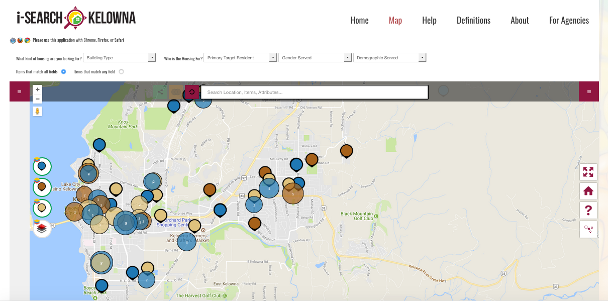
The iSearch Kelowna website is designed to assist individuals looking for low-income rentals, supportive housing or emergency shelters in the City of Kelowna.

By Drew Bush

One of the major challenge faced by anyone who finds themselves homeless involves finding shelter at places operated by a multitude of religious, goverment and nonprofit organizations. Thanks to the doctoral work of one Geothink student, that task just became a bit easier for those struggling with it in the City of Kelowna.

Shelley Cook, a Ph.D. Candidate at the University of British Columbia (UBC)-Okanagan, has worked with Geothink Co-Applicant Jon Corbett, an associate professor at UBC-Okanagan’s Department of Community, Culture and Global Studies, to design iSearch Kelowna. Via the app and website, individuals seeking low-income rentals, emergency shelter and drop-in services are able to search for live, user-specific information about resource availability within the city of Kelowna.

Shelley Cook, a University of British Columbia-Okanagan Ph.D. Candidate, developed the iSearch Kelowna site for her dissertation work.

“As we’ve moved out of phase one of our project, its morphing into another phase as it’s getting picked up as an important tool to inform this homelessness strategy, and people are running with it,” Cook said. In fact, this past summer the City of Kelowna decided to make iSearch Kelowna a central part of their strategy on homelessness. This highlighted Cook’s developing collaboration with the city on a project already supported by a team of reseachers, funders and partner organizations.

“It’s what we anticipated as what could happen and it’s lined up that way,” Cook said. “We’re maximising the benefit of the work that we’ve done, which is fantastic. It’s really in a strange way in its infancy, in terms of where it’s going to end up going, because it keeps evolving. So that’s been fantastic also.”

Cook’s work was recently recognized through Geothink’s first Dr. Alexander Aylett Scholarship in Urban Sustainability and Innovation (La Bourse Dr. Alex Aylett en Durabilité Urbaine et Innovation). The award was established in Aylett’s memory to provide vital support to graduate students sharing Aylett’s passion for, and commitment to, sustainable urban development.

Early feedback on iSearch Kelowna indicates that it is already providing users with a sense of ownership and advocacy over their own well-being and simplifying access to shelter information.

“It’s really about promoting empowerment, a greater sense of fairness and equity on the distribution of resources,” Cook said. “What we’ve done in terms of evaluation is directly talk to people who were formerly homeless or struggling with issues of maintaining adequate safe housing for themselves. That’s the one big thing they’ve talked about. And there’s lots of different elements around the interface that make it really usable and accessible.”

Speaking with Geothink during the Summer 2017 Summer Institute, Corbett added that issues of social and spatial justice motivate the research he and Cook have undertaken.

“There’s I think 84 different organizations that work on social justice related issues in and around the City of Kelowna,” Corbett said. “Which is kind of shocking because the population of Kelowna is only 185,000 people. So the fact that you’ve got 84 different organizations working is indicative of how serious the problem really is.”

He noted that the city and funding organizations for these services had started to notice that each individual service providers was acting in isolation. As a result, there was no centralized place to find specific services across the city such as a hot meal or housing if you are over 55-years-old.

The initial tool Corbett envisioned was going to be aimed at service-providers using real-time data to help coordinate where to send homeless people for specific services. That evolved as Corbett and Cook began discussing the project with the City of Kelowna. It now includes portals for a variety of different types of users—including the homeless themselves.

“For us, it’s been a whole set of reasonable technical challenges,” Corbett added. “But we’ve also been dealing obiviously with this very, very important social question.”

There are also endless applications for how the open data collected as a part of the project can make services more accessible and comprehensive for those in need. One worry has always been how to make what is a digital application accessible to a population that might not always have internet access.

“The main branch of the Kelowna library, a main point around Kelowna’s homeless community, has a dedicated monitor station during opening hours, is accessible for people to be able to search,” Cook said. “So it’s really about promoting service equity, and a greater sense of fairness and equity around the distribution of resources.”

“They now possess the knowledge,” she added of the homeless people using the site. “And what we know is they didn’t have the knowledge of all of [the city’s services]. So what that does is—the creating these forms of open data—opens up services to people and creates a more level playing field. Which is an incredibly powerful use of tools like this and was one thing that we weren’t necessarily anticipating.”

In the future, Cook plans to include more types of homeless services in the database and expand the site and offerings to other cities that have already expressed an interest in it.

“The final piece is an awareness raising and an ongoing partnership,” Cook said. “We’re doing presentations where communities have an interest in British Columbia and Alberta at this point. We can be of assistance in helping them develop a similar process and mentoring in that way.”

For Corbett and Cook, this means getting the project into the hands of city officials where it will live and exist for the community in perpetuity.

“So from the perspective of urban sustainability, we’re seeing municipalities, more so than in the past, getting involved with complex social issues like homelessness, and taking a lead role around these things,” Cook said. “Having a technological backbone that can help function not only to generate important information but to help people come together under a collective virtual umbrella. That’s a very powerful way to maximise and sustain existing community resources, and find innovative ways to create linkages and partnerships through tools and technology like iSearch Kelowna.”

###

If you have thoughts or questions about the article, get in touch with Drew Bush, Geothink’s digital journalist, at drew.bush@mail.mcgill.ca.

Geothink Student Shelley Cook Awarded Dr. Alexander Aylett Graduate Scholarship in Urban Sustainability and Innovation for Her Work Empowering Homeless Populations

Shelley Cook, a Ph.D. Candidate at the University of British Columbia (UBC)-Okanagan, will be the recipient of Geothink’s first Dr. Alexander Aylett Scholarship in Urban Sustainability and Innovation (La Bourse Dr. Alex Aylett en Durabilité Urbaine et Innovation).

By Sam Lumley

Shelley Cook, a University of British Columbia-Okanagan Ph.D. Candidate and the first Geothink Dr. Alexander Aylett scholarship recipient.

Shelley Cook, a Ph.D. Candidate at the University of British Columbia (UBC)-Okanagan, will be the recipient of Geothink’s first Dr. Alexander Aylett Scholarship in Urban Sustainability and Innovation (La Bourse Dr. Alex Aylett en Durabilité Urbaine et Innovation). Her project empowers homeless populations in the city of Kelowna by building new connections with homeless service providers such as community housing organizations.

“I think It’s hard for me to articulate how much it means to me,” Cook said of this honour. “I’m utterly blown away by the privilege.”

Cook’s research was recognized because it closely aligns with the late Dr. Aylett’s vision for urban sustainability. His legacy for creative and durable solutions to social justice issues in cities lives on in Cook’s work. Dr. Aylett passed away on July 23, 2016 from cancer leaving behind a rich legacy of research into how cities can provide solutions on topics such as climate change and social justice using digital technology and open data.

Geothink’s Dr. Alexander Aylett Scholarship in Urban Sustainability and Innovation was established in his memory, to provide vital support to graduate students sharing Aylett’s passion for, and commitment to, sustainable urban development.

“I think after spending my entire career working with extremely marginalized populations, I think it’s difficult work,” Cook said. “And it’s work that I’ve seen over the years—you know, people working with the most vulnerable in society—it’s work that’s often not acknowledged. So I think, for me, I’m utterly blown away by the privilege and the fact that it is for work that is helping people who are the most vulnerable in the community. And I just feel incredibly honored in that respect.”

The award recognizes exceptional research contributing to the field of urban sustainability, and represents one way in which Dr. Aylett’s work is continuing to generate innovative, far-reaching impacts.

“Alex was an exceptional person and his presence seems to continue to surround those who knew and loved him,” Richard Aylett, his father, said. “And so, it is important that an award in his name goes to a project of value.”

Alex’ family is equally honoured to award Cook’s research noting in a e-mail to Geothink that “her work on mapping resources for homelessness in British Columbia corresponds with volunteer work that Alex did for street youth in Vancouver and is thus very appropriate.”

Cook’s work addresses an important issue faced by many communities where homeless populations are not able to efficiently locate suitable temporary shelter. Housing seekers and service providers have often lacked access to centralised, searchable information on gender-specific services, housing location and capacity.

Geothink Co-Applicant Alexander C.E. Aylett who passed away July of last year.

To confront this problem, Cook developed the i-Search Kelowna web map application (app). Supervised by Geothink Co-Applicant Jon Corbett, an associate professor in Community, Culture and Global Studies at UBC-Okanagan, Cook’s work is also supported by a team of researchers, funders and partners. Via the app, individuals seeking low-income rentals, emergency shelter and drop-in services are able to search for live, user-specific information about resource availability within the city of Kelowna.

Early feedback on the tool indicates that it is already providing users with a sense of ownership and advocacy over their own well-being and simplifying access to shelter information.

“It’s really about promoting empowerment, a greater sense of fairness and equity on the distribution of resources,” Cook said.

The project mirrors past volunteer work undertaken by Aylett that supported marginalised communities and contributed to his vision of cities as thriving, safe, and inspiring places for everyone to live. These are all values which Cook shares in her own work.

Cook emphasizes that partnerships formed between researchers, municipalities, businesses and community members are crucial to the development and durability of the project. By deeply routing themselves in the community, the researchers have made sure that their work has progressed to meet evolving needs and issues.

“I think again diverse groups with common interests can come together and create something that benefits the broader community,” Cook explains.

“Homelessness takes different forms over time, so we needed to make sure this tool was responsive and continuously informing strategies and approaches to the long-term issues,” she adds.

In this respect, the project has so far enjoyed a large amount of success. The City of Kelowna has embraced the platform to not only provide housing services but to inform its homelessness strategies and decision-making processes.

The generous support from the Dr. Alexander Aylett Scholarship in Urban Sustainability and Innovation is invaluable for ensuring continued commitment to the idea of cities as sustainable and equitable sites for innovation and development.

###

If you have thoughts or questions about the article, get in touch with Sam Lumley, Geothink’s newsletter editor, at sam.lumley@mail.mcgill.ca.

Geothoughts Conversations 3: Defining Smart Cities and the Human Relationship to New Decision-Making Processes

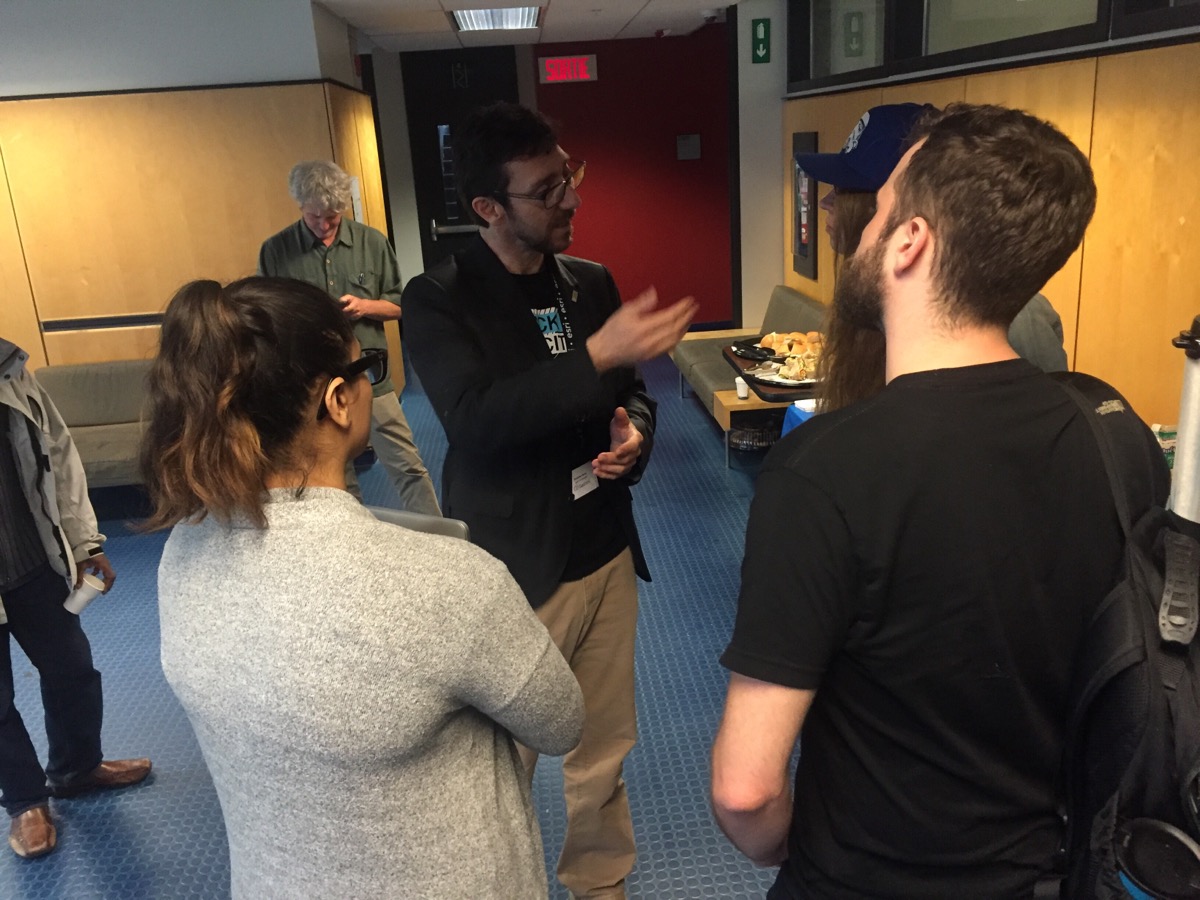
Geothink Co-Applicant Stéphane Roche, associate professor in University Laval’s Department of Geomatics, chats with students during a coffee break at Geothink’s 2017 Summer Institute at McGill University in Montreal, QC.

By Drew Bush

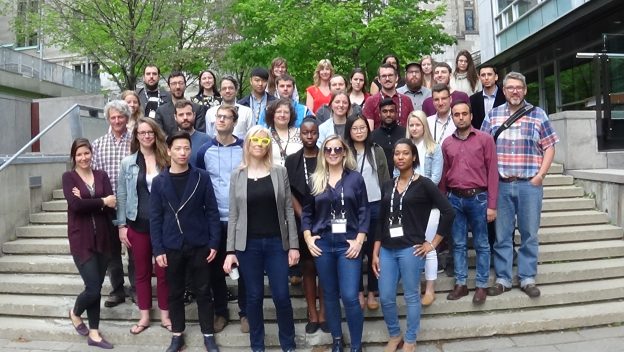
One of the hallmarks of any academic conference are the conversations that take place in-between sessions, in hallways and over meals. In our third Geothink Conversations, we aim to give you a flavor of these discussions at Geothink’s now concluded 2017 Summer Institute.

The theme of this year’s Institute was “Smart City: Toward a Just City.” An interdisciplinary group of faculty and students tackled many of the policy, legal and ethical issues related to smart cities. Each of the three days of the Summer Institute combined workshops, panel discussions and hands-on learning modules that culminated in a competition judged by Montreal city officials and local tech entrepreneurs.

The topic of our conversation was how to make sure human concerns remain paramount in the design of increasingly digital smart cities. It features Open North Executive Director Jean-Noé Landry; Geothink Co-Applicant Stéphane Roche, associate professor in University Laval’s Department of Geomatics; and, Victoria Fast, an assistant professor at University of Calgary’s Department of Geography. And, of course, I’m Drew Bush and I’ll be helping steer the conversation along.

To start us off, Roche got the conversation rolling on how to understand smart cities as a transition from urban living as it has been portrayed since the early 18th century to a new type of city based upon social organization and community that is aided by open data and digital technology.

Thanks for tuning in. And we hope you subscribe with us at Geothoughts on iTunes.

###

If you have thoughts or questions about this podcast, get in touch with Drew Bush, Geothink’s digital journalist, at drew.bush@mail.mcgill.ca.