Tag Archives: Muki Haklay

Geothink Newsletter Issue 13

Issue 13 of the Geothink Newsletter has been released!

Download Geothink-Newsletter-Issue-13.

In this issue, we celebrate the start of a new year by reflecting upon five successful Geothink&Learn webinars and highlighting exciting new Geothink research.

We catch up with Geothink Co-Applicant Teresa Scassa about her work on data deficits
in the sharing economy; Geothink Collaborator Muki Haklay about his new open course
on Citizen Science; former Geothink student Julia Conzon about her recent appointment
at Employment and Social Development Canada; and other grant news.

If you have feedback or content for the newsletter, please contact the Editor, Sam Lumley.

Can Citizen Science Help Cities Address Climate Change?

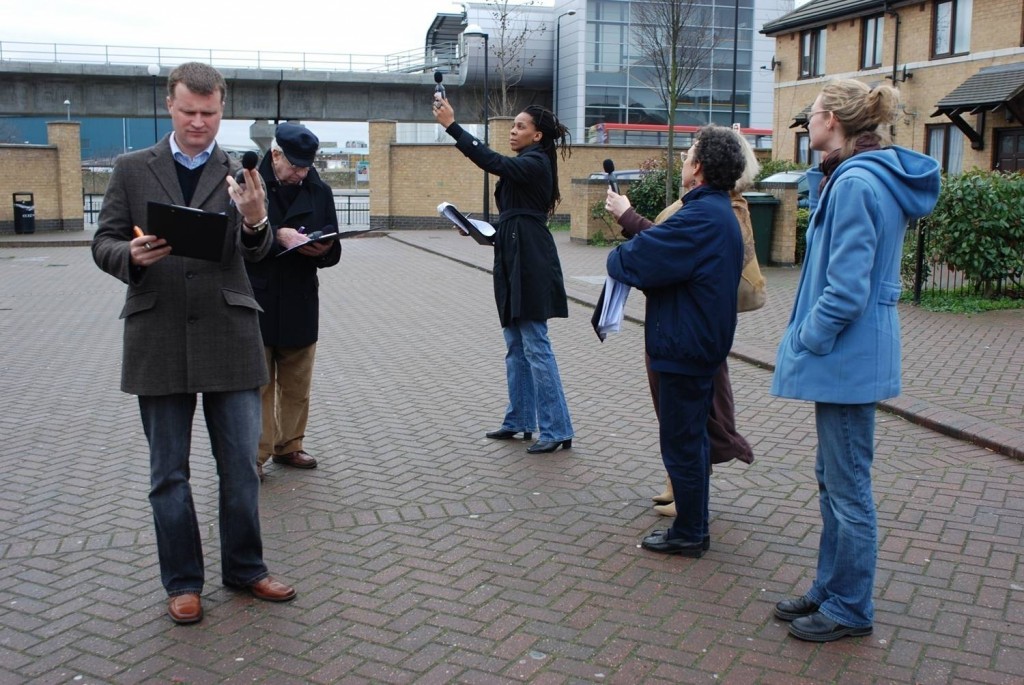
Photo of people taking noise level readings.

Mapping for Change supports citizen science inquiries into environmental and social issues. Here, participants take noise level readings in regions around a London airport. Photo courtesy Mapping for Change.

By Naomi Bloch

If you were following the recent climate change talks in Paris, you may have noticed a recurring theme: policymakers acknowledging the leadership of subnational governments in addressing climate change. Canada’s own delegation to the conference included representatives from the Canadian Federation of Municipalities, as well as provincial and indigenous leaders.

While the 2015 United Nations Climate Change Conference focused on political negotiations, critics have been quick to remind legislators that more efforts are needed to involve citizens in decision-making. It’s hardly a new idea, but how can civic participation function at a global scale? Activities at the local level may hold the key. Municipalities often have established mechanisms to involve the public in deliberative activities. Cities and their citizens can also collaborate on the evidence-gathering needed to make informed decisions.

Geothink collaborator Muki Haklay is the director of the University College London’s Extreme Citizen Science group and a professor of Geographic Information Science in the Department of Civil, Environmental and Geomatic Engineering. In 2008, he co-founded Mapping for Change, an organization that uses participatory mapping and citizen science to address environmental and social issues in cities.
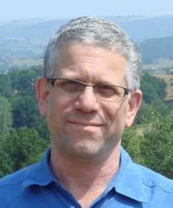
Headshot of Muki Haklay

Muki Haklay, professor of Geographic Information Science in the Department of Civil, Environmental and Geomatic Engineering, University College London.

“I see the value of citizen science as part of wider environmental democracy, going back to the Rio conference in 1992,” Haklay explained in an email interview with Geothink. Principle 10 of the Rio Declaration on Environment and Development states that, at national levels, citizens should have “appropriate access to information concerning the environment that is held by public authorities, including information on hazardous materials and activities.” At the community level, the Declaration calls for active and informed public participation in environmental decision-making processes.

Citizen science invites non-professionals to participate in data gathering and the production of new scientific knowledge. “I see citizen science as a new part of the picture,” said Haklay, “where people also participate in creating environmental information that will influence their lives.”

In Haklay’s view, citizen science has particular benefits that can complement traditional research. “The various changes that have occurred in society and technology mean that we can open environmental decision-making further and make it more inclusive and participatory.” As with all research, appropriate rigor and attention to methodology are required. “Not all data should come from citizen science,” said Haklay. “In terms of data quality, citizen science requires us to use appropriate quality assurance methods.”

Mapping for Change provides some helpful exemplars. One collaboration with local organizations has seen thirty different communities across London measuring and mapping air quality data for their neighbourhoods. “We used a whole range of methods: wipe samples, where we checked for heavy metals in dust on different surfaces; diffusion tubes which measure NO2 levels; and bio-indicators — lichens and leaves,” Haklay said. The project’s findings provide location-specific data that can help alert authorities to potential problem zones. “The local authority responded to the results by promising to do their own monitoring in the area and consider how they can manage the traffic in the area.”

Particularly when expensive equipment or lab analysis is needed, resource limitations can create challenges. However, Haklay points out some unique benefits. “Citizen science provides additional information about the context — local knowledge about the place where the monitoring is taking place,” said Haklay. “Participants can also put equipment in their own homes, which is complex for researchers or government agencies.” The citizen science water study in Flint, Michigan, is a good example of this.

Constraints, of course, are not just funding-related. “Not all people would want to do it, and not everyone will have the skills, though we need to consider how to help people in developing them,” Haklay said. “The limitations are the knowledge that people have, their perception of science and their own capabilities, and the abilities of those who manage citizen science projects to engage at such levels. We shouldn’t expect all scientists to be able to facilitate the whole process on their own.”

Haklay suggests that government agencies looking to incorporate citizen science in their data gathering processes should consult the report, Choosing and Using Citizen Science, produced by the UK’s Centre for Ecology and Hydrology. The report reviews resource and management issues, political issues, as well as scientific issues.

The key to citizen science is that it can involve a range of activities. “Participants can help in setting the research question, create protocols that are suitable to their local culture and needs, analyze the information, participate in the production of reports and papers — in short, in everything,” Haklay said. “The value is in making science more open and more collaborative.”

Interested in learning more about Muki Haklay’s citizen science work? Follow him on Twitter: @mhaklay
If you have thoughts or questions about this article, get in touch with Naomi Bloch, Geothink’s digital journalist, at naomi.bloch2@gmail.com.

Crosspost: Being Philosophical About Crowdsourced Geographic Information

This Geo: Geography and Environment blog post is cross-posted with permission from the authors, Renée Sieber (McGill University, Canada) and Muki Haklay (University College London, UK).
By Renée Sieber and Muki Haklay

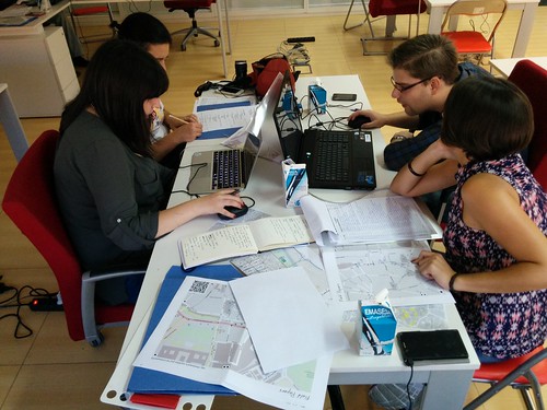
Our recent paper, The epistemology(s) of volunteered geographic information: a critique, started from a discussion we had about changes within the geographic information science (GIScience) research communities over the past two decades. We’ve both been working in the area of participatory geographic information systems (GIS) and critical studies of geographic information science (GIScience) since the late 1990s, where we engaged with people from all walks of life with the information that is available in GIS. Many times we’d work together with people to create new geographic information and maps. Our goal was to help reflect their point of view of the world and their knowledge about local conditions, not always aim for universal rules and principles. For example, the image below is from a discussion with the community in Hackney Wick, London, where individuals collaborated to ensure the information to be captured represented their views on the area and its future, in light of the Olympic works that happened on their doorstep. The GIScience research community, by contrast, emphasizes quantitative modelling and universal rules about geographic information (exemplified by frequent mentioning of Tobler’s first law of Geography). The GIScience research community was not especially welcoming of qualitative, participatory mapping efforts, leaving these efforts mostly in the margins of the discipline.

Photo of 2007 participatory mapping contributors working together in Hackney Wick, London, 2007

Participatory Mapping in Hackney Wick, London, 2007

Around 2005, researchers in GIScience started to notice that when people used their Global Positioning System (GPS) devices to record where they took pictures or used online mapping apps to make their own maps, they were generating a new kind of geographic information. Once projects like OpenStreetMap and other user-generated geographic information came to the scene, the early hostility evaporated and volunteered geographic information (VGI) or crowdsourced geographic information was embraced as a valid, valuable and useful source of information for GIScience research. More importantly, VGI became an acceptable research subject, with subjects like how to assess quality and what motivates people to contribute.

This about-face was puzzling and we felt that it justified an investigation of the concepts and ideas that allowed that to happen. Why did VGI become part of the “truth” in GIScience? In philosophical language, the questions ‘where does knowledge come from? how was it created? What is the meaning and truth of knowledge?’ is known as epistemology and our paper evolved into an exploration of the epistemology, or more accurately the multiple epistemologies, which are inherent in VGI. It’s easy to make the case that VGI is a new way of knowing the world, with (1) its potential to disrupt existing practices (e.g. the way OpenStreetMap provide alternative to official maps as shown in the image below) and (2) the way VGI both constrains contributions (e.g., 140 chars) and opens contributions (e.g., with its ease of user interface; with its multimedia offerings). VGI affords a new epistemology, a new way of knowing geography, of knowing place. Rather than observing a way of knowing, we were interested in what researchers thought was the epistemology of VGI. They were building it in real-time and attempting to ensure it conformed to existing ways of knowing. An analog would be: instead of knowing a religion from the inside, you construct your conception of it, with your own assumptions and biases, while you are on the outside. We argue that construction was occurring with VGI.

OpenStreetMap mapping party (Nono Fotos)

OpenStreetMap mapping party (Nono Fotos)

We likewise were interested in the way that long-standing critics of mapping technologies would respond to new sources of data and new platforms for that data. Criticism tends to be grounded in the structuralist works of Michel Foucault on power and how it is influenced by wider societal structures. Critics extended traditional notions of volunteerism and empowerment to VGI, without necessarily examining whether or not these were applicable to the new ‘ecosystem’ of geospatial apps companies, code and data. We also were curious why the critiques focussed on the software platforms used to generate the data (e.g., Twitter) instead of the data themselves (tweets). It was as if the platforms used to create and share VGI are embedded in various socio-political and economic configurations. However, the data were innocent of association with the assemblages. Lastly, we saw an unconscious shift in the Critical GIS/GIScience field from the collective to the personal. Historically, in the wider field of human geography, when we thought of civil society mapping together by using technology, we looked at collective activities like counter-mapping (e.g., a community fights an extension to airport runway by conducting a spatial analysis to demonstrate the adverse impacts of noise or pollution to the surrounding geography). We believe the shift occurred because Critical GIS scholars were never comfortable with community and consensus-based action in the first place. In hindsight, it probably is easier to critique the (individual) emancipatory potential as opposed to the (collective) empowerment potential of the technology. Moreover, Critical GIS researchers have shifted their attention away from geographic information systems towards the software stack of geospatial software and geosocial media, which raises question about what is considered under this term. For all of these reasons and more we decided to investigate the “world building” from both the instrumentalist scientists and from their critics.

We do use some philosophical framing—Borgmann has a great idea called the device paradigm—to analyse what is happening, and we hope that the paper will contribute to the debate in the critical studies of geographical information beyond the confines of GIScience to human geography more broadly.

About the authors: Renée E. Sieber is an Associate Professor in the Department of Geography and the School of Environment at McGill University. Muki Haklay is Professor of Geographical Information Science in the Department of Civil, Environmental and Geomatic Engineering at University College London.

Crosspost: Geoweb, crowdsourcing, liability and moral responsibility

This post is cross-posted with permission from Po Ve Sham – Muki Haklay’s personal blog. Muki is a Geothink collaborator at the University College London and the co-director of ExCiteS.

By Muki Haklay

Yesterday [March 3rd, 2015], Tenille Brown led a Twitter discussion as part of the Geothink consortium. Tenille opened with a question about liability and wrongful acts that can harm others

If you follow the discussion (search in Twitter for #geothink) you can see how it evolved and which issues were covered.

At one point, I have asked the question:

It is always intriguing and frustrating, at the same time, when a discussion on Twitter is taking its own life and many times move away from the context in which a topic was brought up originally. At the same time, this is the nature of the medium. Here are the answers that came up to this question:


You can see that the only legal expert around said that it’s a tough question, but of course, everyone else shared their (lay) view on the basis of moral judgement and their own worldview and not on legality, and that’s also valuable. The reason I brought the question was that during the discussion, we started exploring the duality in the digital technology area to ownership and responsibility – or rights and obligations. It seem that technology companies are very quick to emphasise ownership (expressed in strong intellectual property right arguments) without responsibility over the consequences of technology use (as expressed in EULAs and the general attitude towards the users). So the nub of the issue for me was about agency. Software does have agency on its own but that doesn’t mean that it absolved the human agents from responsibility over what it is doing (be it software developers or the companies).

In ethics discussions with engineering students, the cases of Ford Pinto or the Thiokol O-rings in the Discovery Shuttle disaster come up as useful examples to explore the responsibility of engineers towards their end users. Ethics exist for GIS – e.g. the code of ethics of URISA, or the material online about ethics for GIS professional and in Esri publication. Somehow, the growth of the geoweb took us backward. The degree to which awareness of ethics is internalised within a discourse of ‘move fast and break things‘, software / hardware development culture of perpetual beta, lack of duty of care, and a search for fast ‘exit’ (and therefore IBG-YBG) make me wonder about which mechanisms we need to put in place to ensure the reintroduction of strong ethical notions into the geoweb. As some of the responses to my question demonstrate, people will accept the changes in societal behaviour and view them as normal…

See the original post here. twitter