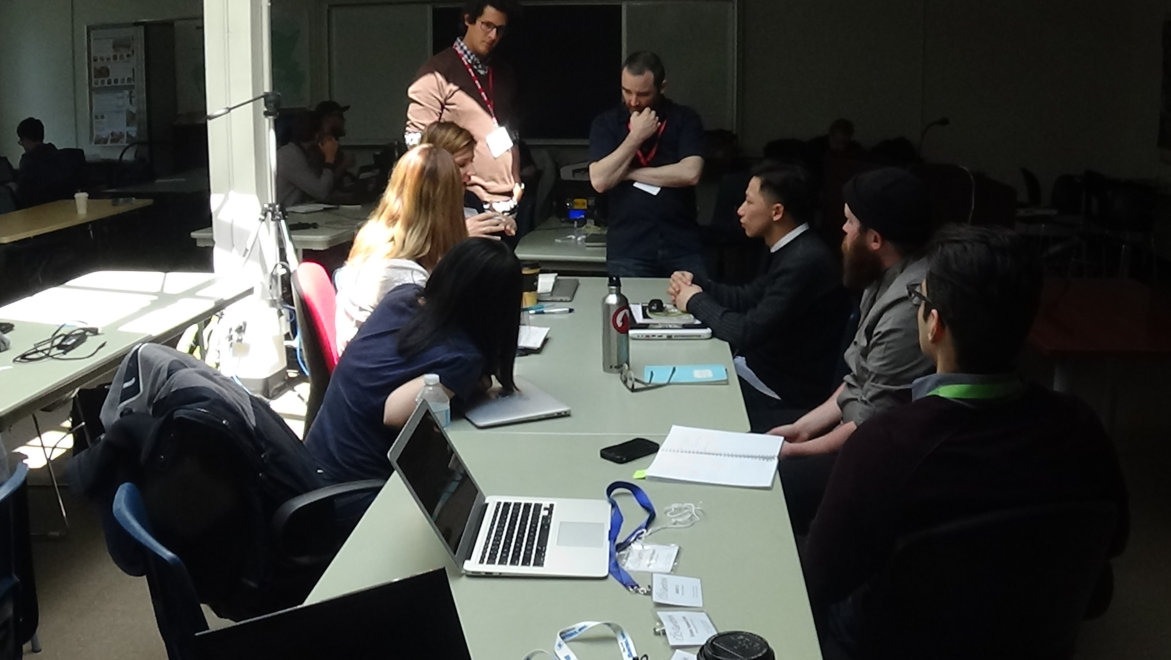
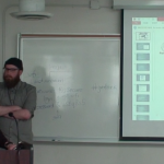
Richard Pietro and James Steenberg discuss one group’s open data application with them at Geothink’s 2016 Summer Institute.
By Drew Bush
The 2016 Geothink Summer Institute kicked off on May 9 with introductions from Geothink Head Renee Sieber, associate professor in McGill University’s Department of Geography and School of Environment, and Pamela Robinson, associate professor in Ryerson University’s School of Urban and Regional Planning. By that afternoon, the 35 students attending had gotten their hands dirty conceptualizing applications for real open data.
Students at this year’s institute learned difficult lessons about applying actual open data to civic problems through group work and interactions with Toronto city officials, local organizations, and Geothink faculty. The last day of the institute culminated in a writing-skill incubator that gave participants the chance to practice communicating even the driest details of work with open data in a manner that grabs the attention of the public.
Held annually as part of a five-year Canadian Social Sciences and Humanities Research Council (SSHRC) partnership grant, each year the Summer Institute devotes three days of hands-on learning to topics important to research taking place in the grant. This year, each day of the institute alternated lectures and panel discussions with work sessions where instructors mentored groups one-on-one about the many aspects of open data.
On day one, students learned about open data during an Open Data Iron Chef event with Toronto-based open data expert, Richard Pietro, who affectionately calls himself an open government and open data fanboy. He’s known for twice riding his motorcycle across Canada to raise awareness of open data, his film Open, and the company he founded OGT Productions. All of this work has led him to a unique view of open data and open government.
“It [open data and open government] allows people to customize their government,” Pietro said between sessions. “It’s as simple as that. And whenever anybody asks what it means: It just allows people to customize their government. Very similarly it does what social media did in 2004 to our relationships with our friends and companies and celebrities. Open data and open government is like social media but ten years ago.”
“It’s very new,” he added. “Some people understand its potential but nobody really understands how much it’s going to change everything about how people interact with their government and how government interacts with people. So it’s going to have incredible transformative powers.”
Watch a clip of Pietro introducing the Open Data Iron Chef event on day one here:
After Pietro’s introduction to open data, James Steenberg, a postdoctoral researcher at Ryerson University with Robinson, walked students through the different file types open data is often released in, what an actual data set might look like, and how to go about working with such data.
“I think it would be more useful if I just went through all the questions I would have if I was literally doing an Iron Chef by myself at home in the kitchen, which I did,” Steenberg told students. “Small apartment, my work desk happened to be pretty much in my kitchen, so I was able to draw some inspiration.”
“And I put together some slides and questions and answers based on just the questions I had starting from scratch,” he continued. “So going to the open data portal, downloading them, opening them up, what kind of file formats are we looking at and so forth. So that’s what I’m going to do today, I’m going to bounce around from a few different files as you saw. But basically I’d like to just develop my own civic app here of what I hope can be a useful function in the city.”
The majority of the day was then given over to students actually finding data they wished to work with (Pietro gave a wide variety of examples during his presentation), a close examination of their chosen datasets, and determining novel uses for which the data could be used to improve city services or better engage citizens. At the end of the day, students presented their proposals that included an analysis of gaps in open data (in availability and quality) and what data was needed to be able to create an open data solution to a chosen real-world problem.
-
- The first student group conceptualized an application that would help facilitate urban resilience in the face of natural hazards.
-
- The second student group conceptualized an application to help predict burst water pipes.
-
- The third student group conceptualized an application to help in apartment searches.
-
- The fourth student group conceptualized an application that would help people tell when they’re in range of a survellience camera.
-
- The fifth student group conceptualized a project to help municipal decision-makers better understand the changing short-term rental market.
For one student group, this meant taking a closer look at data pertaining to water main breaks within the City of Toronto. In particular, they hoped to determine if any spatial pattern existed with water main breaks in comparison to aspects of the built or natural environments that might influence this phenomenon. The group felt such data could be used to help predict future break sites and facilitate repair before a rupture occurs.
Experiences with this type of work within the group varied widely.
“I don’t have a lot of background in some of this mapping stuff, so I come at it from a very different perspective,” Shelley Cook, from the University of British Columbia, Okanagan, said.
Her group-mate, in contrast, felt quite comfortable with the project the group had chosen.
“So I’ve had a lot of experience doing research on sort of the geographic side of open data, looking at geographic content,” Edgar Baculi, from Ryerson University, added. “I like this activity. This is a great experience. One question that comes to mind right now is why the quality of the data isn’t what I want it to be. In the future, I’d like to see the quality of the data better released, better published from municipal governments to help better answer questions we have as citizens in the decision-making process and in making things better for everyone else.”
Stay tuned for more iTunes podcasts from the Summer Institute here, check back on Geothink for synopses of days two and three, and, of course, watch more of our video clips (which we’ll be uploading in coming days) here.
If you have thoughts or questions about this article or video, get in touch with Drew Bush, Geothink’s digital journalist, at drew.bush@mail.mcgill.ca.