A Minecraft version of Toronto’s CN Tower.
By Drew Bush
We’re very excited to present you with our 12th episode of Geothoughts. You can also subscribe to this Podcast by finding it on iTunes.
In this episode, we take a look at two Geothink researchers who are investigating how the popular video game Minecraft can be used to improve local and regional planning processes. In particular, we talk with Ryerson University Gold Medal award winner Lisa Ward Mathers, and Ryerson master’s student Jacky Li. Both have worked with Geothink Co-Applicant Pamela Robinson, associate dean in Ryerson University’s School of Urban and Regional Planning.
Thanks for tuning in. And we hope you subscribe with us at Geothoughts on iTunes. A transcript of this original audio podcast follows.
TRANSCRIPT OF AUDIO PODCAST
Welcome to Geothoughts. I’m Drew Bush.
[Geothink.ca theme music]
“We also wanted to build, how do you say, just an open web kind of thing where you can log on and start building away at the city of Toronto. So the vision was to have all of Toronto built in Minecraft and that’s where I came in. I tried to—they hired me to get the program up and going. But I didn’t know how to start. So my research basically consisted of how we would do something like this.”
That’s Ryerson University Master’s Student Jacky Li talking about his work with Minecraft. Li is a student with Geothink Co-Applicant Pamela Robinson, associate dean in Ryerson University’s School of Urban and Regional Planning. Last summer, he interned with the City of Toronto’s Office of the Chief Planner.
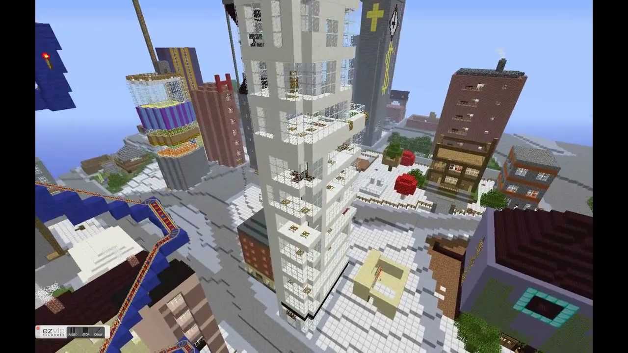
Minecraft isn’t so much a game but rather a destination, a technical tool, and a cultural scene all rolled into one program. Children who use it can engineer complex machines; model the world in cube-like form; shoot and post YouTube videos of their work; and setup servers where they can hang out with their friends. The software, initially launched by Mojang (a Swedish game studio) in 2009, now boasts more than 100 million users. Microsoft recently bought it and Mojang for a record $2.5 billion.
“So I looked at examples of, in Sweden, they had really good one with between the architects and the government where they just focused on a suburb and they had users go in and start building. And then last summer, the graduating class of Niagara College [in Welland, Ontario] translated some GIS data into Minecraft. And I contacted them and they taught me how to do it.”
“Yeah so, at the end of it what I made for the city of Toronto was a report that said how to build like the sub-server thing, how to host it, and some potential programming they can do with children such as like a floor area ratio exercise where you can imagine density. So if you’re given solar power, how many blocks can you build different kinds of built forms depending on the criteria of the exercise . Yeah and just stuff like that.”
Li grew up as part of the Minecraft generation. For him, “It’s just a popular computer game where you basically craft things. It’s kind of like Lego, but on your computer, or on your Xbox or PlayStation, or on your mobile phone.”
His work was inspired by another student at Ryerson who wrote a report for the City of Toronto on the educational potential of a tool such as Minecraft that engages students with sometimes complex computer science in an immersive environment. Li is not alone in Geothink as a researcher working to determine how Minecraft can empower communities in urban planning decisions.
“From there I asked them specifically about different contexts within which Minecraft could potentially be used. Different scales, like for instance, a committee of adjustment or, you know, larger scales from there like an official plan review. I’m sort of asking what do you think, would this work in this context. What are your sort of initial impressions?”
That’s Lisa Ward Mather on her master’s research project she completed in 2014 at Ryerson University also with Robinson. She’s describing her work interviewing 12 planning officials to determine the usefulness of Minecraft for those working in regional and local urban planning.
In 2014, she graduated as the recipient of the Ryerson Gold Medal for her thesis work that was cited for combining academic proficiency with community engagement in a meaningful way.
“It wasn’t an interview with Minecraft experts by any means. A few of my respondents had encountered the game in a very, you know, not very intensive setting. I mean no one had really sat down and played extensively. But luckily Minecraft is a not a terribly difficult thing to explain to someone, especially with visuals. And I was able to get some really interesting observations from the people I spoke to.”
Her project interrogated whether planners felt open to using Minecraft and whether they thought it would engage the public. She also asked what possible benefits and obstacles they foresaw in specific applications. Her findings largely showed that it could be a useful tool for engaging the public in planning decisions, but obstacles such as it’s cost as well as the cost of equipment needed to support it could limit use.
Mather’s work did not stop after her graduation.
“I was in communication with a staff member from the office of the chief planner at the city of Toronto. And they, as you know, they are interested in trying new tools and using new tools in different ways, and engaging people in ways maybe they’re not used to being engaged. And so they were interested in seeing what could be done with the game.
“So, we, after some discussion, concluded that one possibility would be to have them send me some SketchUp files, Google SketchUp files, of a corridor in Toronto. And to produce a Minecraft world that had both what that corridor looks like right now, what it would like in the near future when there are more mid-rise buildings lining the sides of the streets, and then the in the far future when the entire corridor is lined with mid-rise buildings. So, I, after a fair amount of experimentation, and, uh, and this is something I had never done before. So I looked at what various tools that were available online and I was able to produce those three models within the same Minecraft world.”
“And I built a little rail car down the middle of the street so that the user rode from the present to the near future and then to the far future. And I made a movie of that which then they played at an event that they were holding from the Office of the Chief Planner.”
This small project has opened interesting possibilities for the City of Toronto to engage citizens with a unique tool like Minecraft. From Sweden to Canada, the Minecraft generation may one-day grow up to design the cities of the future.
[Geothink.ca theme music]
[Voice over: Geothoughts are brought to you by Geothink.ca and generous funding from Canada’s Social Sciences and Humanities Research Council.]
###
If you have thoughts or questions about this podcast, get in touch with Drew Bush, Geothink’s digital journalist, at drew.bush@mail.mcgill.ca.