Category Archives: Geothink News

Geothoughts 6: Who Stands to Gain in Canada’s Sharing Economy?

This July, Alberta residents were warned that drivers who use Uber’s car-sharing service may not have appropriate insurance coverage, with potential risks to both drivers and passengers.

This July, Alberta residents were warned that drivers who use Uber’s car-sharing service may not have appropriate insurance coverage, with potential risks to both drivers and passengers.

By Naomi Bloch

The rise of the web-enabled sharing economy is leading to much hope about potentially new sources of income and new ways for communities to connect and share resources. In the process, however, more consumers appear to be turning to global tech companies to acquire convenient, local services.

This July, Alberta residents were warned that drivers who use Uber’s car-sharing service may not have appropriate insurance coverage, with potential risks to both drivers and passengers. Earlier this month in Ontario’s Kitchener-Waterloo region, the local cab company Waterloo Taxi released its new mobile app. The company hopes the app will help it to maintain its edge against Uber, a recent—and not entirely legal—entry to the local marketplace. Meanwhile, starting this fall, Quebec will begin regulating the online home rental service Airbnb.

In this podcast, we interview Geothink co-applicant Leslie Regan Shade, associate professor in the University of Toronto’s Faculty of Information. Together with PhD candidate Harrison Smith, Shade has been exploring the “cartographies of sharing,” situating the geoweb in the sharing economy of Canada. Shade is particularly interested in the political economic questions now surfacing in the media, in policy circles, and in academia. She and Smith are focusing on three inter-related questions:

  1. What is the state of the sharing economy in Canada, particularly with respect to the fundamental opportunities and challenges currently facing municipal regulators in Canada?
  2. What particular benefits and challenges has the sharing economy brought to Canadian economies, particularly key urban centres?
  3. How is the geoweb contributing to the rise of the sharing economy in Canada?


If you have thoughts or questions about this podcast, get in touch with Naomi Bloch, Geothink’s digital journalist, at naomi.bloch2@gmail.com.

Geothink Video Interview 3: Our Experts Take on Crowdsourcing

Screen Shot 2016-02-24 at 8.34.20 PMBy Drew Bush

We’re excited to bring you our long-awaited video interview that features Geothink’s experts discussing issues of authenticity and accuracy with crowdsourced data.  Data collected through crowdsourcing methods increasingly has replaced traditional forms of data collection.

This video features Geothink Head Renee Sieber, associate professor in McGill University’s Department of Geography and School of Environment; Daren Brabham, assistant professor in the University of Southern California Annenberg School of Journalistm and Communication; Scott Bell, a professor of Geography and Planning at University of Saskatchewan; And, Claus Rinner,a professor and chair of Ryerson University’s Department of Geography and Environmental Studies.

We hope you enjoy this video as much as we enjoyed making it. Afterwards, leave us a comment and tell us what you think about this important area of debate concerning crowdsourced data.

You can also learn more about crowdsourcing by reading our post on this central topic to our 2015 Summer Institute, listening to these lectures from the Summer Institute, or listening to our experts talk about the topic over lunch last June. 

If you have thoughts or questions about this video, get in touch with Drew Bush, Geothink’s digital journalist, at drew.bush@mail.mcgill.ca.

Geothoughts 5: Helping Bring Equitable Access to Healthcare to All Canadians

This week's Geothoughts podcast examines how spatial data can be used to improve access to healthcare for all Canadians.

This week’s Geothoughts podcast examines how spatial data can be used to improve access to healthcare for all Canadians.

By Drew Bush

We’re very excited to present you with our fifth episode of Geothoughts. You can also subscribe to this Podcast by finding it on iTunes.

This episode features a look at how spatial data can be used to improve access to healthcare for all Canadians. In it we talk with Scott Bell from the Department of Geography and Planning at University of Saskatchewan.

Thanks for tuning in. And we hope you subscribe with us at Geothoughts on iTunes. A transcript of this original audio podcast follows.

TRANSCRIPT OF AUDIO PODCAST

This week we sit down with Professor Scott Bell from the Department of Geography and Planning at University of Saskatchewan to discuss his research using geospatial data to help create better healthcare access for all Canadians.

[Geothink.ca theme music]

Welcome to Geothoughts. I’m Drew Bush.

“From a GIS, GIScience perspective, I sort of went extreme in the access to location, or the location aspects of access. So looking at the arrangements of doctors just to get a sense of, just at the physical level, is there an equitable arrangement of doctors. And we know pretty clearly that that’s not true across Canada, at different scales and at the scale of the nation.”

To draw this conclusion, Bell brings a Geographic Information Systems (GIS) perspective to the context of a broad variety of areas of interest in human health. For example, he has collaborated on interdisciplinary health, environmental, and social science research that uses both public and private data.

“My interest in health really has broadened areas of interest to look at access to a variety of things that effect our health.”

This year alone he has worked with the University of Saskatchewan’s College of Dentistry and also examined the accessibility of Canadian food in terms of finding healthy eating options. But collecting such data can sometimes be onerous work owing to the fact that different provincial colleges of physicians and surgeons have varying standards for their data, he must collect population data from Statistics Canada for comparison, and sometimes he might even collect his own data using surveys to gain insight.

“So we integrate data across a variety of sources, mostly publicly available not always in the sort of true and honest definition of open data…We collect our own sometimes using telephone surveys of people to get an idea of what’s controlling or what’s affecting their access to healthcare.”

What’s important is figuring out what particular issues might impact how people access doctors. These include aspects of a given doctor’s services, such as the number of patients they take, or the personal concerns of the consumer or patient.

“We as just members of the public when we look for a doctor, access can be affected by our own personal opinions, or beliefs, or worldviews, or preferences. So if I prefer to be seen by a male doctor and my neighborhood is filled with female doctors, a physical measure of access might show that there are lots of doctors near me and I should have great accessibility. But I’m not willing to see any of those doctors.”

[Geothink.ca theme music]

[Voice over: Geothoughts are brought to you by Geothink.ca and generous funding from Canada’s Social Sciences and Humanities Research Council.]

###

If you have thoughts or questions about this podcast, get in touch with Drew Bush, Geothink’s digital journalist, at drew.bush@mail.mcgill.ca.

Improving Access to Canadian Healthcare Using Open Data with Scott Bell

By Drew Bush

Scott Bell is a professor in the Department of Geography and Planning at the University of Saskatchewan.

Scott Bell is a professor in the Department of Geography and Planning at the University of Saskatchewan.

If you ask a Canadian what makes them most proud of their country, free and easily accessible healthcare would often be near the top of the list. But for one Geothink researcher, this commonly held narrative has been disproven and led him to help those in need of better healthcare.

“People in the north and some rural areas just don’t have that many doctors per person or have very low rates of doctors per 1,000 people,” Scott Bell, a professor of Geography and Planning at University of Saskatchewan, said. “And I think one of the things that really captured my interest here is that as Canadians and in Canada, we sort of expect equitable healthcare. And I think a lot of people—who have easy access to healthcare, are happy with their doctor’s care, and their ability to make appointments, and things like that—don’t think too much about the fact that not all Canadians have access to the free healthcare services we should all have access to. So that’s kind of a guiding principle.”

To draw the above conclusions, Bell brings a Geographic Information Systems (GIS) perspective to examine a broad variety of areas in human health. For example, he has collaborated on interdisciplinary health, environmental, and social science research that uses both public and private data including from surveys he has conducted himself and data he’s collected from provincial colleges of physicians and surgeons.

To get a sense of which populations are being served or not served by healthcare, his research compares the above data against population data from Statistics Canada (particularly, he says, the 2006 Long Form Census). This year he has worked with the University of Saskatchewan’s College of Dentistry and also examined the accessibility of Canadian food in terms of finding healthy eating options.

“My interest in health research really is focused on disparities in accessibility, and accessibility is a word that people use in day-to-day conversations a lot,” he told Geothink. “In terms of health, it’s a pretty complicated concept that is related not just to services themselves, where and when they’re available, when a clinic might be open, and how many doctors are there, and how many bookings they can take, or have open for drop-in or scheduling. But is also related to the patients themselves.”

It’s these consumer issues that can complicate how healthcare services can be made more accessible.

“Access can be affected by our own personal opinions, or beliefs, or worldviews, or preferences,” he said. “So if I prefer to be seen by a male doctor and my neighborhood is filled with female doctors, the physical measure of access might show that there are lots of doctors near me and I should have great accessibility. But I’m not willing to see any of those doctors.”

He has also found that when GIS is used to look at extreme situations in specific locations in Canada by just the arrangement of doctors, it’s not true that everyone has access to healthcare across the country. But identifying such a problem by locating those most in need often is the first step in starting a conversation to correct such problems.

If you have thoughts or questions about this article, get in touch with Drew Bush, Geothink’s digital journalist, at drew.bush@mail.mcgill.ca.

Mapping to Empower Excluded Populations with Jon Corbett at University of British Columbia

Jon Corbett is an associate professor in the University of British Columbia's Community, Culture and Global Studies program and co-director of the Centre for Social, Spatial and Economic Justice.

Jon Corbett is an associate professor in the University of British Columbia’s Community, Culture and Global Studies program and co-director of the Centre for Social, Spatial and Economic Justice.

By Drew Bush

In our daily usage, most maps contain a logical representation of a city’s streets or a forest’s hiking trails that allows us to safely navigate to new locations. For many indigenous and excluded populations, maps can play a more fundamental role.

Jon Corbett, an Associate Professor in Community, Culture and Global Studies at the University of British Columbia, has spent decades investigating how cartographic processes and tools used by local communities help express their relationships to and knowledge of land and resources. Corbett has worked in Australia, Indonesia, the Philippines, and in British Columbia with several First Nations communities.

“Often maps, although they are powerful tools, they don’t tell the full story because a lot of indigenous knowledge and a lot of local knowledge is tied up in storytelling, and histories, and is built around specific landmarks within a particular town within a particular place,” he told Geothink last June.

To better capture this relationship with the land, Corbett and his graduate student Nicholas Blackwell first began building their Geolive platform in 2008. Geolive is an online interactive mapping interface based on the Google Maps API that allows administrators to create public maps and place user-generated information on those maps while users can add content and communicate.

In other words, users of this platform can add attributes to specific locations on the map using text, photos, video or other media to show how specific places get used by the community. As the platform has gotten more sophisticated, users have gained the ability to moderate each other, filter info with key words, and use mobile devices to contribute short videos or photos.

The most important element is that users take ownership of the place they live and contribute important local knowledge. Corbett got his start doing this type of work before programs such as Google Earth existed. In fact, he literally used sticks, sand and stones when he began thinking about how to empower often excluded communities with maps during his Ph.D. research in Borneo.

“I am really interested in how maps can become transformative agents in change, particularly social change,” he said. “So my research in the past has involved working with a lot of excluded populations, often indigenous population in different places in the world. Looking at how mapping can become a tool to express a different relationship, or a different set of experiences, or a different set of stories as it relates to that particular group and the land on which they live.”

His work has evolved from using sketch mapping where participants draw rivers, streets, and watershed boundaries from memory to scale mapping where they add or fill in locally-based information on scale maps or three-dimensional modelling where participants build a physical, tactile terrain map. Of the digital, he comments that some elements can be lost from a process that once involved using what was on the ground.

“There is this funny thing that occurs as you move from more tactile, more tangible forms of participation mapping into the digital world,” he said after enumerating the many advantages of digital mapping with communities. “In a sense, your own relationship to those types of projects diminishes as you become more virtual.”

If you have thoughts or questions about this article, get in touch with Drew Bush, Geothink’s digital journalist, at drew.bush@mail.mcgill.ca.

Geothink Video Interview 2: Ever Wondered Why Geothink?

Screen Shot 2016-02-24 at 8.35.55 PM

By Drew Bush

Geothinkers, have you ever wondered how Geothink got its start? Or perhaps you are someone who just stumbled on this site and might be wondering what is Geothink?

Wonder no longer. Today we bring you two video interviews with Geothink Head Renee Sieber, associate professor in McGill University’s Department of Geography and School of Environment. She’ll not only put to rest where Geothink came from but also talk about how today’s technology has fundamentally altered our relationship with the cities we live in.

Watch the longer interview here:

In a rush? Get the quick answers on who and what Geothink is right here:

If you have thoughts or questions about these videos, get in touch with Drew Bush, Geothink’s digital journalist, at drew.bush@mail.mcgill.ca.

Geothoughts Conversations 1: Debating and Defining the Emergent Field of Crowdsourcing Civic Governance

Our second Geothoughts Conversations piece takes a look at crowdsourcing, the topic of the 2015 Summer Institute.

Our first Geothoughts Conversations piece takes a look at crowdsourcing, the topic of the 2015 Summer Institute.

By Drew Bush

One of the hallmarks of any academic conference are the conversations that take place in-between sessions, in the hallways and over meals. In our first Geothink Conversations we aim to give you a flavor of these discussions at Geothink’s now concluded 2015 Summer Institute.

This month’s conversation features Geothink Head Renee Sieber, associate professor in McGill University’s Department of Geography and School of Environment; Robert Goodspeed, assistant professor of Urban Planning at the University of Michigan’s Taubman College of Architecture and Urban Planning; Daren Brabham, assistant professor in the University of Southern California Annenberg School of Journalism and Communication; and Monica Stephens, assistant professor in the Department of Geography at State University of New York at Buffalo. And, of course, I’m Drew Bush and I’ll be helping steer the conversation along.

Each day of the institute alternated morning lectures, panel discussions and in-depth case studies on topics in crowdsourcing with afternoon work sessions where professors worked with student groups one-on-one on their proposal to meet a challenge posed by the City of Ottawa. For more on the Institute, check out our web site at geothink.ca.

To start us off, Brabham gets the group rolling on what exactly defines the boundaries of crowdsourcing, the topic of many conversations overheard during the three-day conference.


If you have thoughts or questions about this podcast, get in touch with Drew Bush, Geothink’s digital journalist, at drew.bush@mail.mcgill.ca.

Geothink Researcher Peter Johnson Honored with Early Researcher Award from the Government of Ontario

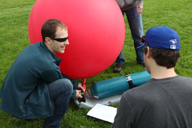
Peter Johnson undertakes the Public Lab of Open Technology and Science (PLOTS, or simply ‘Public Lab’) balloon mapping technique to test it for future use in a class.

Peter Johnson undertakes the Public Lab of Open Technology and Science (PLOTS, or simply ‘Public Lab’) balloon mapping technique to test it for future use in a class.

By Drew Bush

Peter Johnson, assistant professor of Geography and Environmental Management at the University of Waterloo, was honoured with the Ontario Government’s Early Researcher Award for his project, Measuring the Value and Impact of Open Data. Johnson was one of two professors in his department that were funded.
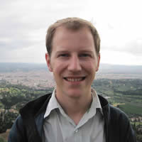
Peter Johnson, assistant professor in the University of Waterloo Department of Geography and Environmental Management, was recently awared Ontario's Young Researcher Award.

Peter Johnson, assistant professor in the University of Waterloo Department of Geography and Environmental Management, was recently awarded Ontario’s Early Researcher Award.

In the project, Johnson will build partnerships with stakeholders, develop case studies to measure the impact of open data initiatives, and assess how open data generates economic and social benefits. Ontario’s provincial and municipal governments now prioritize the sharing of open government data, like many North American communities.

And right now is a key time for evaluating the impacts of such data, Johnson told Geothink this past June at the University of Waterloo.

“I think we’ve reached a spot in open data provision where we understand the technical challenges to providing open data and some of the organizational challenges as well,” he said of his and his students’ work. “But it’s trying to understand what is the impact that open data provision is having. So trying to follow data from just being provided on a web site and a download portal to understanding are community groups using it, is the private sector using it, are other governments using it, or even is it being used internal to the government that’s providing it?”

Johnson’s research may impact how Ontario and other governments one day share open data and the way private developers, nonprofits, and citizens build applications and businesses using such data.

Other areas of research for Johnson and his students include looking at the use of government 311 applications that help citizens report overflowing garbage cans in a local park or if a particular sidewalk might need to be shoveled. Their research questions why governments are developing these applications and using them, the type of data such applications gather, and how this data can be used to improve government processes.

“Is this an opportunity for citizens to express their opinions on different potential developments or to connect with their elected officials?” he asked. “And how does this official channel compare to something that’s unofficial like Twitter?”

“What I’m really interested in is looking at is balancing citizen input that is delivered in these different ways,” he added. “So which one gets the results? Tweeting at your counselor or using the official government branded app to report your pothole at the end of your street?”

In addition to this research, Johnson published a paper with Geothink Head Renee Sieber, associate professor in McGill’s Deptartment of Geography and School of Environment,  this past July in Government Information Quarterly entitled “Civic open data at a crossroads: Dominant models and current challenges.

On his personal Web site, he writes that in this piece, “We take a look at the dominant models of open data provision by government and start to lay out what the challenges are for delivering open data. We tried to make this both a reflective look at where open data is, and also to push civic open data forward, examining how open data works as part of open government strategies.” Find a pre-print copy available here and also find the abstract below.

The award, given to 822 early career researchers since 2005, was given by the Ontario Ministry of Research and Innovation and The Ontario Research Fund – Small Infrastructure programs. The province will spend $209 million this year to support research projects and talent at research institutions across the province. This year’s successful 280 successful projects were chosen based on their research excellence and their economic and societal benefits for Ontario.

If you have thoughts or questions about this article, get in touch with Drew Bush, Geothink’s digital journalist, at drew.bush@mail.mcgill.ca.

Abstract
Civic open data at a crossroads: Dominant models and current challenges.
As open data becomes more widely provided by government, it is important to ask questions about the future possibilities and forms that government open data may take. We present four models of open data as they relate to changing relations between citizens and government. These models include; a status quo ‘data over the wall’ form of government data publishing, a form of ‘code exchange’, with government acting as an open data activist, open data as a civic issue tracker, and participatory open data. These models represent multiple end points that can be currently viewed from the unfolding landscape of government open data. We position open data at a crossroads, with significant concerns of the conflicting motivations driving open data, the shifting role of government as a service provider, and the fragile nature of open data within the government space. We emphasize that the future of open data will be driven by the negotiation of the ethical-economic tension that exists between provisioning governments, citizens, and private sector data users.