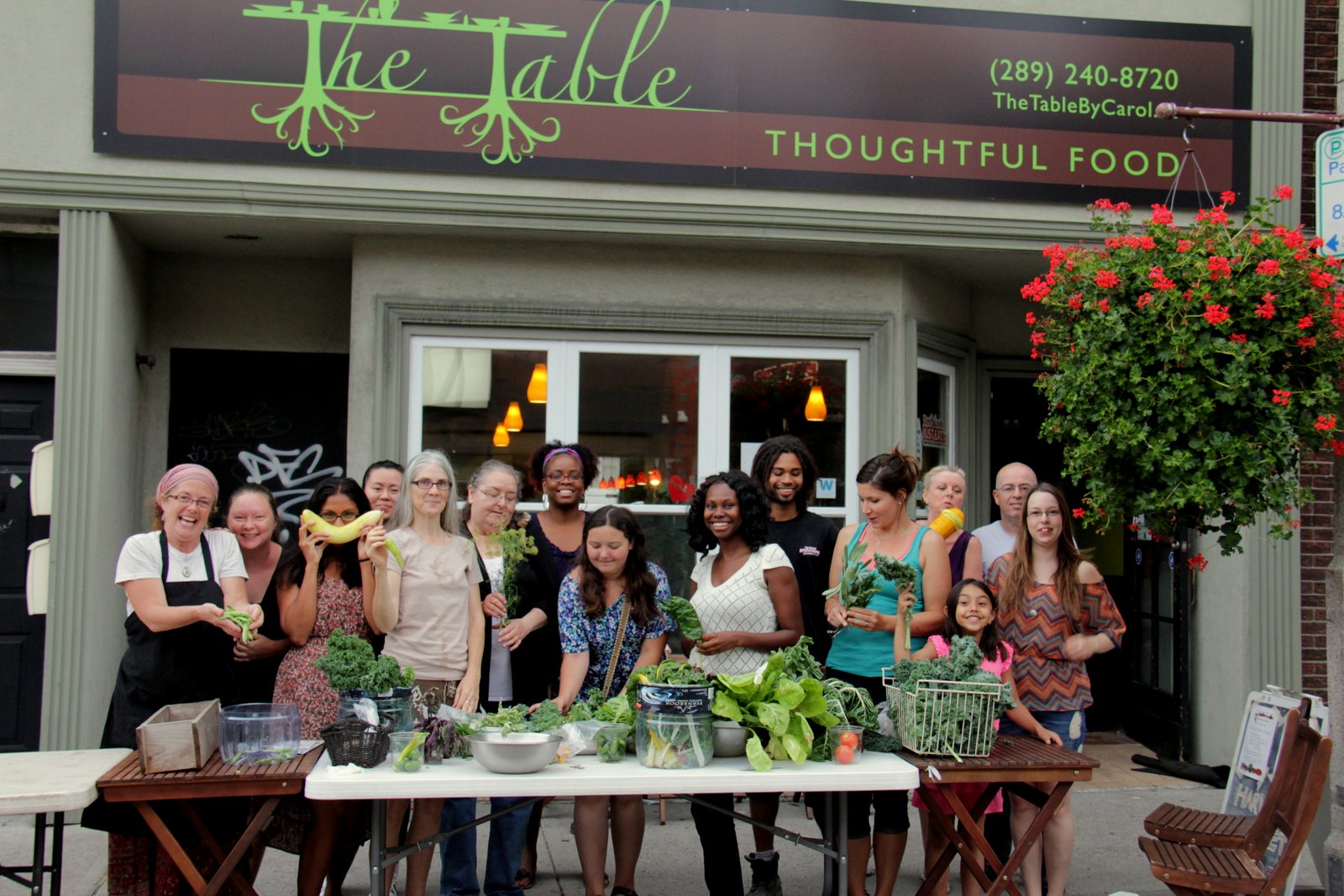
For her Ph.D. research, Victoria Fast explored how urban food assets can be crowdsourced onto the geoweb — civic participation in action.
All cylinders were firing by the time we wrapped up our Nov. 23 Twitter chat on meaningful civic participation on the geoweb. There were many parallel conversations that we hope will continue among participants and the wider Geothink community into the future. Here we share a few highlights, as well as a transcript of the chat.
- We should ask what criteria define “civic participation”? Even passive or unknowing involvement may qualify as meaningful participation.
- Intermediaries (infomediaries) are major mediators of the geoweb — leading projects, supporting learning, and providing citizens with tools and open data access. Librarians were identified as important infomediaries.
- The geoweb can enable citizen participation on all levels of ‘meaning’. Yet we need to be mindful of who is being left out & not blame the excluded.
- There can be different benefits from short-term engagements such as hackathons and long-term involvement such as contributing to OpenStreetMap. But both can trigger enduring civic interest.
- It can be useful to consider when geoweb contributions using open data do not qualify as civic participation.
- Both time-decay (sustainability) and distance-decay (activities concentrating around intermediary’s location) are issues that can affect civic participation on the geoweb.
Transcript
Hi all. Our chat is underway! It will last ~1hr. By way of intro's, are you a #geoweb participant? How so? Pls. respond using #Geothink.
— Geothink.ca (@geothinkca) November 23, 2015
Welcome to the #geothink chat on meaningful civic participation on the geoweb
— RE Sieber (@re_sieber) November 23, 2015
.@geothinkca I'll start us off, #geothink studies how the #geoweb is changing #Citizen – #City interactions
— Geothink.ca (@geothinkca) November 23, 2015
Interested in mapping, civic participation, geoweb? Join the conversation Use #geothink.
— RE Sieber (@re_sieber) November 23, 2015
I research civic participation on the geoweb. I'm the PI of #geothink. & I occasionally contrib points (eg OSM) & particip in hackathons.
— RE Sieber (@re_sieber) November 23, 2015
Welcome to the #geothink chat on meaningful civic participation on the geoweb
— RE Sieber (@re_sieber) November 23, 2015
How do you participate on the goeweb, @oditoronto? #geothink
— Geothink.ca (@geothinkca) November 23, 2015
Interested in meaningful use of #opendata (esp the geolocated kind) & its abil to expand participation? Join us @ #geothink
— RE Sieber (@re_sieber) November 23, 2015
Good Q to start w: Just what is civic participation on the geoweb/using #opendata?#geothink
— RE Sieber (@re_sieber) November 23, 2015
Let’s lay some groundwork. Q1. What do you see as the #geoweb? #Geothink
— Geothink.ca (@geothinkca) November 23, 2015
.@geothinkca – one way is tying physical spaces and assets to political topics – i.e. Affordable housing #geothink
— ODI Toronto (@oditoronto) November 23, 2015
@geothinkca Geoweb can be online maps, geog apps (eg using #opendata), tweeting ab location #geothink
— RE Sieber (@re_sieber) November 23, 2015
.@oditoronto Does bringing that online to the geoweb strengthen those ties? #geothink
— Geothink.ca (@geothinkca) November 23, 2015
@geothinkca it adds a layer of information – if someone is interested they can learn more #geothink
— ODI Toronto (@oditoronto) November 23, 2015
.@oditoronto Interesting pt. Is being locationally aware, better connected to community = civic participation? #geothink
— RE Sieber (@re_sieber) November 23, 2015
Civic particip varies, from contrib point (OSM), co-design map, write app in hackathon, passively (unknowingly) contrib w phone #geothink
— RE Sieber (@re_sieber) November 23, 2015
.@re_sieber Civic participation on #geoweb could be contributing #VGI or creating/sharing maps of dog parks for other dog owners #geothink
— Geothink.ca (@geothinkca) November 23, 2015
@re_sieber Who participates on the geoweb? #geothink
— Geothink.ca (@geothinkca) November 23, 2015
.@re_sieber yes – in public consultation, maps have been used very frequently – they create a common point of reference #geothink
— ODI Toronto (@oditoronto) November 23, 2015
.@re_sieber @oditoronto Or are citizens expected to contribute something new to the #geoweb to 'participate'? #geothink
— Geothink.ca (@geothinkca) November 23, 2015
.@geothinkca Who participates on the geoweb? Knowingly or unknowingly? If latter then almost everyone #geothink
— RE Sieber (@re_sieber) November 23, 2015
@re_siebe Does "passively/unknowingly" constitute *meaningful* participation? (If so, how so?) #geothink
— Geothink.ca (@geothinkca) November 23, 2015
.@geothinkca @re_sieber I think they can add new things via discussion and story-telling but they don't all have to. #geothink
— ODI Toronto (@oditoronto) November 23, 2015
.@oditoronto Ppl can particip on geoweb even if they're not doing it digitally. Pts on map = ok #geothink
— RE Sieber (@re_sieber) November 23, 2015
If @mappingmashups makes a useful map, but no one engages with it (unlikely!), was this participation meaningful? #geothink
— Geothink.ca (@geothinkca) November 23, 2015
.@geothinkca here's a mapping + online civic engagement combo – timely! #geothink https://t.co/WsUIOTtqdB
— ODI Toronto (@oditoronto) November 23, 2015
If @mappingmashups makes a useful map, but no one engages with it (unlikely!), was this participation meaningful? #geothink
— Geothink.ca (@geothinkca) November 23, 2015
@geothinkca @mappingmashups Tree falls in the forest applied to particip on the geoweb ! #geothink
— RE Sieber (@re_sieber) November 23, 2015
.@geothinkca here's a mapping + online civic engagement combo – timely! #geothink https://t.co/WsUIOTtqdB
— ODI Toronto (@oditoronto) November 23, 2015
.@re_sieber exactly 🙂 and now we have more and more tools that make it easier to transfer that info online, if desired. #geothink
— ODI Toronto (@oditoronto) November 23, 2015
.@terra_tenney What are example criteria for meaningful particip on geoweb? I'd argue it's deliberative #geothink
— RE Sieber (@re_sieber) November 23, 2015
@oditoronto @re_sieber If users are learning about their cities, learning = participation, even if not actively contributing? #geothink
— Geothink.ca (@geothinkca) November 23, 2015
@geothinkca Passive/Unknowing participation often captures the most candid responses.Hard to get in an age of Digital aspirations.#geothink
— Dipto Sarkar (@DiptoSrkr) November 23, 2015
.@oditoronto Is it ok that geoweb merely becomes new medium 4maps? Or is there something new (eg reach, scale, accessibility, viz) #geothink
— RE Sieber (@re_sieber) November 23, 2015
@oditoronto @re_sieber If users are learning about their cities, learning = participation, even if not actively contributing? #geothink
— Geothink.ca (@geothinkca) November 23, 2015
Q2 – At #ignite2015, @carolinetanbee: "potholes are the gateway drug to #civicengagement." Cute or true? How so? #geothink
— Geothink.ca (@geothinkca) November 23, 2015
@geothinkca @re_sieber Yes. And they may take that info and use it to inform advice they share at a public meeting. #geothink
— ODI Toronto (@oditoronto) November 23, 2015
.@terra_tenney @DiptoSrkr Can you elaborate on that framework? #geothink
— Geothink.ca (@geothinkca) November 23, 2015
@re_sieber New things = 1. User-generated content shared in a consultation. e.g.: Drop pins and send photos of good urban planning #geothink
— ODI Toronto (@oditoronto) November 23, 2015
.@oditoronto @re_sieber .@oditoronto @re_sieber Good point. What about meaningful participation outside of government? #geothink
— Geothink.ca (@geothinkca) November 23, 2015
.@geothinkca @carolinetanbee"potholes gateway drug to civic engagement"Yes, when it moves byond indiv interest to collective int #geothink
— RE Sieber (@re_sieber) November 23, 2015
@geothinkca @re_sieber See lots of opportunity. Non-profit sector just getting going here but lots of interest #geothink
— ODI Toronto (@oditoronto) November 23, 2015
@geothinkca #geothink pic.twitter.com/7j1uRpzpmj
— Dipto Sarkar (@DiptoSrkr) November 23, 2015
.@oditoronto @re_sieber @VVFast How about mapping wheelchair accessibility? Meaningful if it doesn't touch government? #geothink
— Geothink.ca (@geothinkca) November 23, 2015
.@geothinkca @oditoronto Ex of meaningful particip outside governance can be social mobilization ab buying local, locavore #geothink
— RE Sieber (@re_sieber) November 23, 2015
@geothinkca @re_sieber @VVFast Hugely. AXS Map https://t.co/0blvdI3nFw + IRL products like StopGap https://t.co/h92wLMRgnP #geothink
— ODI Toronto (@oditoronto) November 23, 2015
P1. @KTMLivingLabs' @namabudhathoki says part of #civicengagement is mappers need to interact w physical space to understand it. #geothink
— Geothink.ca (@geothinkca) November 23, 2015
.@geothinkca @oditoronto @VVFast Mapping wheelchair accessibility touches gov when we want to do something w maps #geothink
— RE Sieber (@re_sieber) November 23, 2015
.@re_sieber @oditoronto Hamilton's bike share program is another example https://t.co/fRDFFpEb9a, meaningful for transportation #geothink
— Geothink.ca (@geothinkca) November 23, 2015
#geothink perhaps one question worth asking – is can "meaningful participation emerge from only the geoweb?"
— Matthew Tenney (@terra_tenney) November 23, 2015
Shoutout to poststructuralists, Foucaldians: is there something intrinsic to Geoweb that enables particip? #geothink
— RE Sieber (@re_sieber) November 23, 2015
P2. Is this exploration of real-world, physical space universally the case for participants in #geoweb? #geothink
— Geothink.ca (@geothinkca) November 23, 2015
AccessNow crowdsourced resource for the public https://t.co/2b00z62Kn5; responding to lack of action of govt around accessibility #geothink
— Vic (@VVFast) November 23, 2015
.@re_sieber @oditoronto Hamilton's bike share program is another example https://t.co/fRDFFpEb9a, meaningful for transportation #geothink
— Geothink.ca (@geothinkca) November 23, 2015
.@terra_tenney Meaningful particip doesn't only emerge from geoweb but geoweb is sold as open, accessible, democratic #geothink
— RE Sieber (@re_sieber) November 23, 2015
.@geothinkca There is another big layer about the space between points – how it's used, how things move. #geothink
— ODI Toronto (@oditoronto) November 23, 2015
.@re_sieber Well if *almost* anyone can make a map, that enables participation #geothink
— Geothink.ca (@geothinkca) November 23, 2015
@terra_tenney Great Q.. #geoweb is generally connected to social or personal needs/desires that are not necessarily spatial. #geothink
— Geothink.ca (@geothinkca) November 23, 2015
.@geothinkca Another big one is the people around the places and things – demographics layered on and around physical assets #geothink
— ODI Toronto (@oditoronto) November 23, 2015
Participation occurs in the space between the points! #geothink https://t.co/kJ0YhN6sw1
— RE Sieber (@re_sieber) November 23, 2015
Do we assume 'just bc a data set is crowdsourced & made avail to everyone that everyone is contributing?' (from @agaleszczynski) #geothink
— RE Sieber (@re_sieber) November 23, 2015
@terra_tenney Right. As I often ask: How can my 80-year-old mother participate on the #geoweb? #geothink?
— Geothink.ca (@geothinkca) November 23, 2015
AccessNow suffers same prob as DurhamFoodMap (https://t.co/7H2THaS7XH): distance decay. Action centred around intermediary #geothink
— Vic (@VVFast) November 23, 2015
#geothink Id argue participation is a process towards an ends. It can use the geoweb but does not necessarily do +/- or arise because of
— Matthew Tenney (@terra_tenney) November 23, 2015
.@geothinkca – this is @sachac 's winning entry from @torontolibrary hackathon – mapping people and assets #geothink https://t.co/vCUdzELA4v
— ODI Toronto (@oditoronto) November 23, 2015
.@terra_tenney Big distinction btwn PGIS & PPGIS: In former particip is the sole focus, means & end #geothink
— RE Sieber (@re_sieber) November 23, 2015
@terra_tenney if we insist the process be collective – we have less participation on the geoweb. #geothink
— Matthew Tenney (@terra_tenney) November 23, 2015
.@geothinkca which leads to new thing #2 – better engagement WITH and BY community assets through mapping #geothink
— ODI Toronto (@oditoronto) November 23, 2015
.@VVFast Is there a time-decay as well? #Geothink
— Geothink.ca (@geothinkca) November 23, 2015
.@geothinkca 'if *almost* anyone can make map' assumes everyone can map; assumes there's prob w you if you cant use tech to map #geothink
— RE Sieber (@re_sieber) November 23, 2015
.@oditoronto @sachac @torontolibrary Great example of an #infomediary tech. Does this mean we can replace librarians w/ apps? #geothink
— Geothink.ca (@geothinkca) November 23, 2015
See I fail adding participatory hashtag #geothink – I end up talking to myself. Is this tree participation? https://t.co/RiOyC65EEE
— Matthew Tenney (@terra_tenney) November 23, 2015
@re_sieber @agaleszczynski I think the ? may be who assumes that crowdsourced data represents "everyone"? gov't? public? crowd? #geothink
— Geothink.ca (@geothinkca) November 23, 2015
See I fail adding participatory hashtag #geothink – I end up talking to myself. Is this tree participation? https://t.co/RiOyC65EEE
— Matthew Tenney (@terra_tenney) November 23, 2015
.@terra_tenney Democracy, 1 # at a time. But, if it's easy to miss-hastag something, imagine problems w/ mre complex participation #geothink
— Geothink.ca (@geothinkca) November 23, 2015
.@geothinkca @oditoronto @sachac @torontolibrary @pjrplan argues that librarians are important intermediaries in #opendata, geoweb #geothink
— RE Sieber (@re_sieber) November 23, 2015
@terra_tenney #geothink so the key is to not be technodeterministic but connect #geoweb to 'real world' …
— Geothink.ca (@geothinkca) November 23, 2015
So… Q3 How can the #government play a role in meaningful #civic #participation? #Geothink #cdnpoli
— Geothink.ca (@geothinkca) November 23, 2015
@re_sieber @oditoronto @sachac @torontolibrary @pjrplan librarians certainly can be. More ed in LIS schools would help /w this. #geothink
— Geothink.ca (@geothinkca) November 23, 2015
@geothinkca @sachac @torontolibrary Not at all. That tool is great to help strengthen library services to match local needs #geothink
— ODI Toronto (@oditoronto) November 23, 2015
.@geothinkca Gov can support meaningful particip if they dont treat it as a. tokenistic or b. lk new datasource #geothink
— RE Sieber (@re_sieber) November 23, 2015
@VVFast @oditoronto @sachac @torontolibrary librarians don't supplant other leaders, but have tools/ethos/envm't to play sig role. #geothink
— Geothink.ca (@geothinkca) November 23, 2015
.@pjrplan @oditoronto @sachac @torontolibrary Librarians could also play roll assisting in citizens in participation beyond OD #geothink
— Geothink.ca (@geothinkca) November 23, 2015
Too many qs; too little time. How is particip in a hackathon (eg w #opendata) diff from eg contrib to OSM? #geothink
— RE Sieber (@re_sieber) November 23, 2015
We’ll be wrapping up ~ 2pm. Any closing thoughts? Later we’ll post a summary of the #Geothink chat.
— Geothink.ca (@geothinkca) November 23, 2015
.@oditoronto @sachac @torontolibrary Could such apps eventually affect lib operations eg predicting inventories based on searches? #geothink
— Geothink.ca (@geothinkca) November 23, 2015
Final thoughts: Useful to consider when something on geoweb, w #opendata is NOT civic participation #geothink
— RE Sieber (@re_sieber) November 23, 2015
@re_sieber oooooh this is interesting. conceptual/process-oriented ideas (hack) vs. lasting asset improvement (OSM) #geothink
— ODI Toronto (@oditoronto) November 23, 2015
@re_sieber Good point! Any examples quickly? #geothink
— Geothink.ca (@geothinkca) November 23, 2015
@geothinkca @sachac @torontolibrary Yes, and potentially even moreso based on demographics (language of materials/services) #geothink
— ODI Toronto (@oditoronto) November 23, 2015
.@oditoronto hadn't even thought of the temporal aspect of it! Consider that hackathons are considered short-lived #geothink
— RE Sieber (@re_sieber) November 23, 2015
.@geothinkca self-serving Yelp reviews #geothink
— RE Sieber (@re_sieber) November 23, 2015
@geothinkca Final thought: mapping is not *that* accessible. Easy to go from zero to one with a KML file, not so with shapefiles #geothink
— ODI Toronto (@oditoronto) November 23, 2015
.@oditoronto Some poss axes of geoweb particip: active/passive, locationally aware v location-contributing, what defines a user? #geothink
— RE Sieber (@re_sieber) November 23, 2015
@re_sieber Far more projects are short lived, even when not a hackathon. Sustainability issues. #geothink
— Vic (@VVFast) November 23, 2015
City of Boston seeks partners for open-data initiative https://t.co/KiRZtN2rdB @knightfdn #geothink apropos twitter chat tday @oditoronto
— Pamela Robinson (@pjrplan) November 23, 2015
.@oditoronto Some poss axes of geoweb particip: active/passive, locationally aware v location-contributing, what defines a user? #geothink
— RE Sieber (@re_sieber) November 23, 2015
City of Boston seeks partners for open-data initiative https://t.co/KiRZtN2rdB @knightfdn #geothink apropos twitter chat tday @oditoronto
— Pamela Robinson (@pjrplan) November 23, 2015
Final thought: The geoweb can enable #citizen participation on all levels of 'meaning'. Be mindful of who is being left out #geothink
— Geothink.ca (@geothinkca) November 23, 2015
@geothinkca Final thoughts: intermediaries play huge role in mediating all thinks #geothink
— Vic (@VVFast) November 23, 2015
Thanks everyone for a thought-provoking #geothink twitterchat on meaningful civic participation!
— RE Sieber (@re_sieber) November 23, 2015
@geothinkca Final thought: mapping is not *that* accessible. Easy to go from zero to one with a KML file, not so with shapefiles #geothink
— ODI Toronto (@oditoronto) November 23, 2015
Final thoughts: Useful to consider when something on geoweb, w #opendata is NOT civic participation #geothink
— RE Sieber (@re_sieber) November 23, 2015
@oditoronto @re_sieber real time, interaction of a hack can lead to civic engagagement alchemy #geothink
— Pamela Robinson (@pjrplan) November 23, 2015
@geothinkca Final thoughts: intermediaries play huge role in mediating all thinks #geothink
— Vic (@VVFast) November 23, 2015
@oditoronto @re_sieber real time, interaction of a hack can lead to civic engagagement alchemy #geothink
— Pamela Robinson (@pjrplan) November 23, 2015
That's all we have time for, alas. Thanks everyone! #geothink
— Geothink.ca (@geothinkca) November 23, 2015
Phrase of the day "civic engagement alchemy" #geothink https://t.co/5ZGLA7AZ5l
— RE Sieber (@re_sieber) November 23, 2015
Where civic engagement & #opendata intersect: #smartcities https://t.co/RIGs6L1hoZ #geothink
— RE Sieber (@re_sieber) November 23, 2015
 @geothinkca
  @cheryldpower
  @mappingmashups
  @re_sieber
  @notgregorypeck
  @AmrEldib
  @mhaklay
  @JamesLMilner
  @TenilleEBrown
  @ClausRinner
  @geolytica