Tag Archives: Montreal

Tackling The Thornier Issues Plaguing Smart Cities – Geothink Summer Institute Day 2

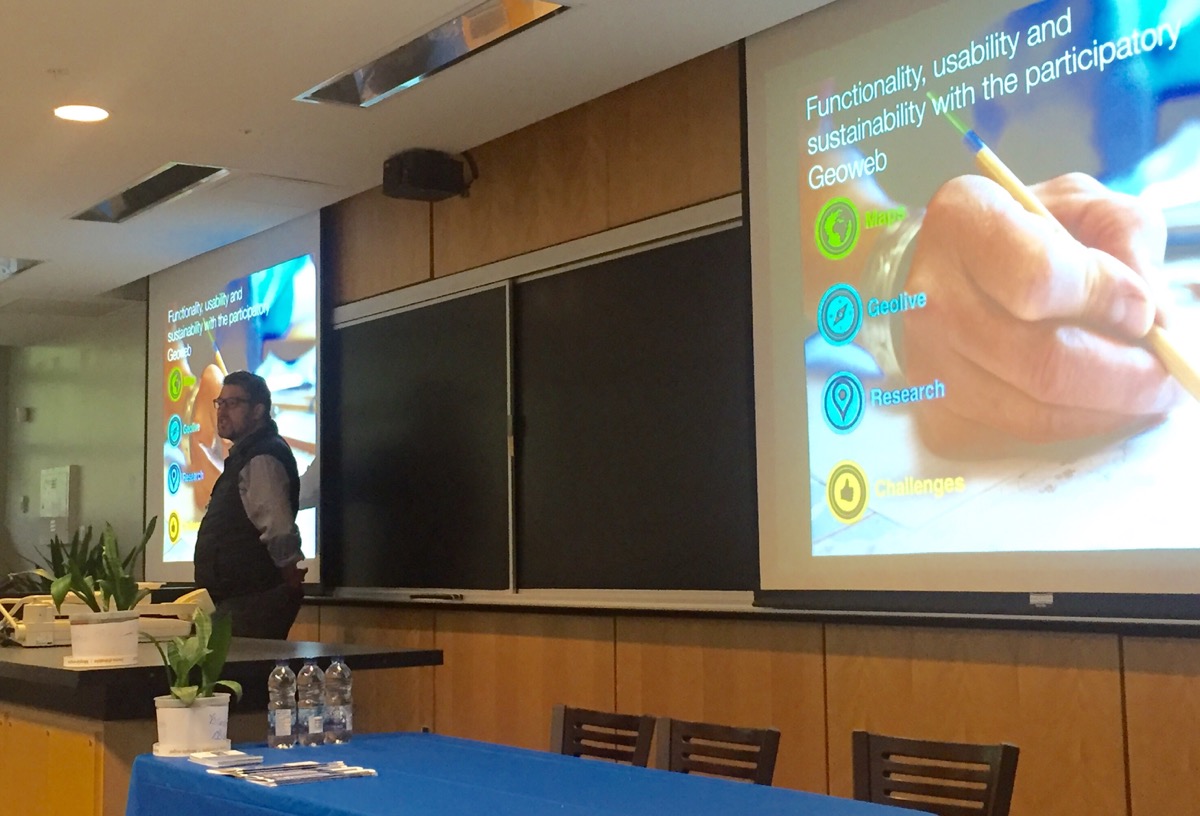
Day two of Geothink’s 2017 Summer Institute at McGill University in Montreal, QC featured presentations by faculty on the pressing issues facing smart cities.

By Drew Bush

On day two of Geothink’s 2017 Summer Institute at McGill University in Montreal, QC, students got their hands dirty investigating the important issues facing smart cities. Each group presented unique findings in answer to a question they were asked to investigate from the disciplines of law, geomatics and geography.

The theme of this year’s Institute was “Smart City: Toward a Just City.” An interdisciplinary group of faculty and students tackled many of the policy, legal and ethical issues related to smart cities. Each of the three days of the Summer Institute combined workshops, panel discussions and hands-on learning modules that culminated in a competition judged by Montreal city officials and tech entrepreneurs. The goal of the competition was for student groups to develop and assess the major principles guiding Montreal’s 2015-2017 Montréal Smart and Digital City Action Plan.

Before undertaking their own research, students heard from Institute faculty with expertise in each of the areas they were asked to investigate during half-hour presentations. This began with a presentation on the online, participatory mapping tool, GeoLive, by Geothink Co-Applicant Jon Corbett, associate professor in University of British Columbia at Okanagan’s Department of Geography. He was followed by Geothink Co-Applicant Teresa Scassa, Canada research chair in University of Ottawa’s Faculty of Law, who talked about the legal issues surrounding the development of applications (APPs) in smart cities. Geothink Co-Applicant Stéphane Roche, associate professor in University Laval’s Department of Geomatics, finished the morning by talking about ethics in smart cities.

“So law is in many respects about relationships, and certainly in this context is about relationships,” Scassa told students during her presentation. “And so one of the things you need to do when you are looking at and thinking about legal issues in this context is to think about what particular legal relationship or relationships you are talking about and you are thinking about. So, for example, a city may be thinking about entering into a contract with a particular service provider for a smart city’s service or a smart city’s APP. And that—there will be a relationship defined in legal terms between the city and the service provider at that point. And so that’s one relationship.”

“And there are going to have to be certain things worked out in the context of that particular relationship between the city and the service provider,” Scassa added. “The city that enters into a contract for that service may then also have a relationship with the users of that service. And so that’s another relationship. And it’s a relationship the city has to think about in terms of how it wants to define that relationship with its users.”

“There are two things that I really appreciate,” Geothink Co-Applicant Stéphane Roche, associate professor in University Laval’s Department of Geomatics, said. “The first one is the idea of talking about and thinking about smart cities without talking about smart cities. And that was the case this morning. And especially by—with the first presentation by [Jon Corbett]. I guess that what Jon has presented, you know, about participatory mapping for a community was and is really valuable for our reflection about smart cities.”

“It’s not a question of technology,” Roche added before noting that the second thing he appreciated was the interdisciplinarity of the presentations and students. “The main issue is involving community. The main issue is designing solutions that are in line with their view of space—[a community’s] view of their relationship with space.”

At the conclusion of the presentations, each student group was presented with a unique question that they had to answer. Questions were derived from each discipline and speaker’s presentation. They asked students to conduct research on how society should evaluate the usability and functionality of smart city APPs and how the additional data and APPs from a smart city create legal liability for cities that doesn’t fit within the policy structure that already exists.

“We are assessing the impact of like, I guess, the Geolive initiative,” Selasi Dokenoo, an undergraduate student at Ryerson University, said. “To clarify what it’s like and how do we assess the impact and benefits of this type of program.”

A different group worked with another site, iSearch Kelowna, for their question. The Web site makes use of open data to aid people in finding low-income rentals, supportive housing or emergency shelters within the City of Kelowna.

“For the exercise, the question is related to feedback,” Ali Afghanteloee, a doctoral student at Laval University, said. “Evaluating the functionality and usability of the web services about Kelowna. First of all, we’ve found out what is the criteria [for] evaluation. And, second, what are the tools to evaluate this kind of criteria. It’s just—we decided that, I think, that the quality criteria is very important because we decided that the user is very important. The usability. And spatially whether creating this site to find out what the services are—whether this is useable or not.”

The day concluded with each group presenting findings on what they had found during their research. For many, this proved enlightening and related well to their own work back at their home university.
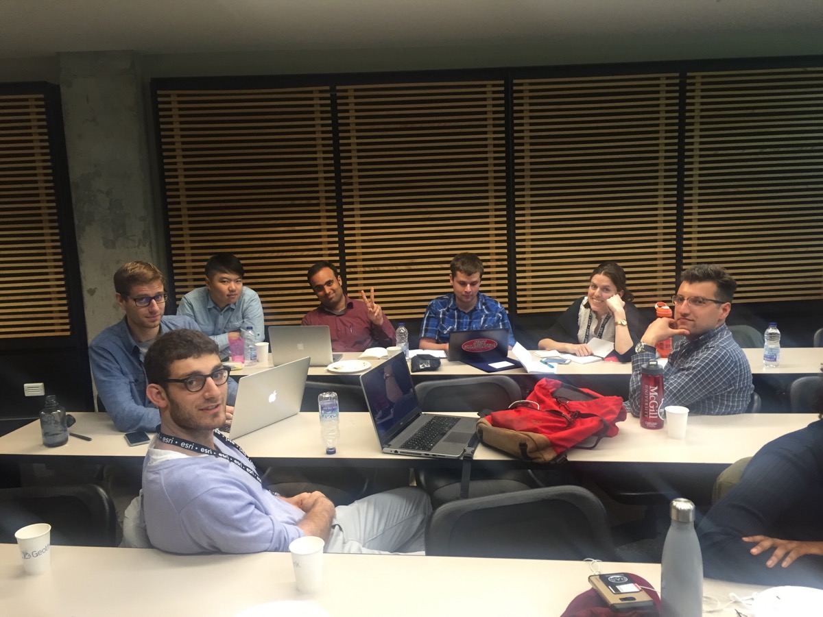
Student groups worked on day two to answer research questions posed by the panelists about smart cities.

“Well, I’m interested in policy mobility,” Brennan Field, a doctoral student at University of Saskatchewan, said. “So it’s been interesting in the past few days just looking at how smart cities, in terms of an urban policy space, have become mobile and have been spreading. And so in the case of the Montreal it was interesting hearing [Harout Chitilian] speaking of how the police department is using open data to report crime. And then their initial reticence and then kind of opening up to it. So I was already familiar with that—basically that has been how police departments generally respond to that particular policy. The policy of open data related to reporting police activity.”

“And seeing how a lot of it is cross-overs between how open data as urban policy has become mobile and how smart cities as urban policy has become mobile,” Field added. “So there are a lot of similarities and cross-overs with my research. So that’s what I’ve learned.”

###

If you have thoughts or questions about the article, get in touch with Drew Bush, Geothink’s digital journalist, at drew.bush@mail.mcgill.ca.

Geothink Summer Institute On Smart Cities Convenes May 25, 2017

The 2017 Geothink Summer Institute on smart cities will convene May 25 to May 27 on McGill University’s downtown campus in Montreal, Quebec. (Image courtesy of http://jeannesauve.org)

By Drew Bush

As 22 Geothink students pack their bags and get ready for this year’s three-day 2017 Summer Institute “Smart Cities: Toward a Just City” their host city (and Geothink partner) will be preparing as well. This year’s Summer Institute will kick-off May 25 to May 27 in Montreal as celebrations for the municipalities 375th anniversary shift into high gear.

The timing couldn’t be more serendipitous: Strategic plans overseen by Montreal’s Smart and Digital City Office call for making the municipality a world renowned leader among smart cities by 2017. This year’s Summer Institute will bring together an interdisciplinary group of students and faculty—from law, geography, planning and more—to learn about issues facing smart cities and meet with key leaders in Montreal’s work toward becoming a leader in this field.

“It’s essential that students appreciate the ways in which smart technology can lead to fairer and just city-citizen interactions,” said Geothink Head Renee Sieber, associate professor in McGill University’s Department of Geography and School of Environment. “Students in this Summer Institute will learn about accessibility in smart cities, the promotion of social justice in this new environment and the integration of technology into city processes.”

Each of the three days of the Summer Institute will combine workshops, panel discussions and hands-on learning modules that will culminate in a competition judged by city officials. The goal of the competition will be for student groups to develop novel uses for Montreal’s open data to improve accessibility in the city.

The first day of the Institute will introduce the idea of smart cities during a panel discussion with Sieber and Geothink Co-Applicants Jon Corbett, associate professor in University of British Columbia at Okanagan’s Department of Geography; Stéphane Roche, associate professor in University Laval’s Department of Geomatics; Pamela Robinson, associate professor in Ryerson University’s School of Urban and Regional Planning; Rob Feick, associate professor in Waterloo University’s School of Planning; and Teresa Scassa, Canada Research Chair in University of Ottawa’s Faculty of Law. Later that day, students will be introduced to the problem they are trying to solve and hear from Montreal City Council Chairman, M. Harout Chitilian.

On day two, students will learn about legal issues relating to smart cities from Scassa, ethical considerations from Roche and social justice issues from Corbett. Multiple sessions throughout the day will also be devoted to group work on projects.

Finally, on day three, two separate talks will be headlined by Jean-Noé Landry, executive director of Open North, and Xavier Peich, a co-founder of Smarthalo. After time to work on project presentations, the day will conclude with the competition.

“Students will be exposed to smart city issues from a variety of perspectives, including government, non-profits, local tech entrepreneurs, planners and, of course, academia,” Geothink Student Coordinator Suthee Sangiambutt said. “This is going to be a fun event. Student attendees are from all sorts of disciplines and there will be a great opportunity to learn new skills and perspectives around smart city problems.”

The summer institute is hosted by Geothink, a five-year partnership grant awarded by the Canadian Social Sciences and Humanities Research Council (SSHRC) in 2012. The partnership includes researchers in different institutions across Canada, as well as partners in Canadian municipal governments, non-profits and the private sector. The expertise of the group is wide-ranging and includes aspects of social sciences as well as humanities such as geography, GIS/geospatial analysis, urban planning, communications, and law.

“We’re really fortunate to have such an interdisciplinary group of students who can unpack the term ‘smart’ from multiple angles to better understand both the challenges and opportunities that cities face today,” Geothink Project Manager Sonja Solomun said.

If you have thoughts or questions about the article, get in touch with Drew Bush, Geothink’s guest digital journalist, at drew.bush@mail.mcgill.ca.

Gethoughts 8: How Technology is Reshaping Citizen Interactions on Climate Change

pic32-e1435343808697

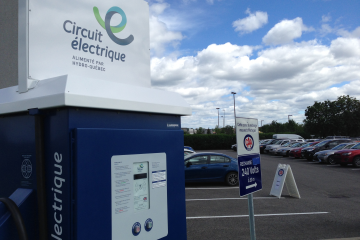
Hydro Quebec is setting up a new circuit of public electric charging stations, one of many changes in the works as cities across Canada prepare for more environmentally friendly futures.

By Drew Bush

We’re very excited to present you with our eighth episode of Geothoughts. You can also subscribe to this Podcast by finding it on iTunes.

In this episode, we examine what role Canada’s cities play in international solutions to climate change as well as how new technologies shape interactions in neighbourhoods and between neighbours on environmental issues. In it, we talk with Geothink researcher Alexander Aylett, a professor and researcher at the Institut national de la recherche scientifique.

Thanks for tuning in. And we hope you subscribe with us at Geothoughts on iTunes. A transcript of this original audio podcast follows.

TRANSCRIPT OF AUDIO PODCAST

Welcome to Geothoughts. I’m Drew Bush.

[Geothink.ca theme music]

Last week on Geothink.ca, we brought you a look at how open data and digital technology are reshaping the way cities plan for sustainable futures and how to act on issues such as climate change. Today we dive deeper into the changes taking place locally and internationally on this topic.

“One of the things I’m most excited about here in Montreal, is electrification of mobility in the city. So something in the order of 40 percent of Montreal’s GHG emissions come from moving people and things around in the city. Trucks, cars, trains—to a certain extent—all of those things. And what we’re seeing now is a real scaling up of, I guess, work that’s been happening over the past four or five years to electrify as much of that as we can.”

That’s the opinion of one expert who has been studying these issues from his office in Montreal, Quebec. We spoke with him over Skype this month.

“Alexander Aylett, I’m a professor of urban sustainability governance and innovation at the Center for Urbanization, Culture, and Society of the National Institute for Scientific Research or the proper French title is Institut National de la Recherche Scientifique in Montreal.”

Aylett believes the time has come for changes that make transit, buildings, and energy more efficient in cities. That’s because cities can play an outsized role in confronting the important environmental issues of today by mixing a curious blend of new technology, empowered citizen groups, and long-term planning. The first signs heralding these changes are here.

“So we have Hydro Quebec that’s setting up la route verte où route bleu of publicly accessible charging points. And it started of with like two, three, four, five and you know now we’re aiming for a few thousand in the city within the next couple of years. And we’re seeing the launch of things like Téo taxi, where there is going to be, their plan, is—if I’m right about their deadlines—by next December is to have something like 2,000 new electric vehicles on the roads of Montreal. So a big private player dramatically increasing the number of electric vehicles that we’ve got on the roads. Similar action happening in big players like CommunAuto.” 

Such changes are not purely financial. Cultural shifts have occurred before in Montreal. Not long ago when the city began planning for the introduction of Bixi bike sharing, they didn’t tinker around the margins. Instead they created many more bike paths that were safer for riders and that have since been adopted by many residents. On environmental issues like climate change a similar transition may soon take place.

“We’ll see gas burning vehicles sort of being retired. New institutional players like taxis, for example, buying electric. Private citizens buying electric. But also private citizens realizing that the increased convenience of smart taxi services like Uber, and Téo, and Car-to-go, and other car sharing networks means that people don’t need to have a private vehicle in a lot of cases anymore. People who are sort of on the borderline zone of needing a car regularly but not every morning for their commute I think will be in a position to just abandon the private automobile in favor of convenient access to different mobility providers.”

Such changes would bode well for those who would see Canada reduce greenhouse gas emissions or GHGs. More cooperation is needed between actions taken by cities and those being coordinated on national and international levels. The 2015 Paris Agreement and the prominent role of cities in it means such a future is not just possible but likely, according to Aylett.

“Coming out of COP21 what we have is a much more open understanding of the fact that cities are a critical partner for states, provinces, and national governments. And I think—and this is why it’s such an exciting period right now, like particularly this next sort of six months—I think that we what we should be seeing is more effective partnerships between those different players. More funding coming down especially in Canada given the commitments our government has to fund urban infrastructure projects…Spreading from city to city to city effective interventions into different aspects of our urban environmental footprints. That’s fantastic.”

In a future where cities help solve climate change, different cities will each contribute a piece of the solution. In Montreal it may be innovations in transport technology and the manner in which individuals book transit, Vancouver may continue leading in green building efforts that incorporate “reach codes” so each step in efficiency serves to enhance the next, and Toronto may utilize new models and data to better plan where to locate parks and green roofs.

Some technological changes will undoubtedly allow citizens to contribute their expertise and opinions to solutions while others will focus on overcoming small barriers in daily life that could have a dramatic impact on environmental issues such as climate change.

“Basically we’re talking about reducing friction and reducing barriers to use where the simplicity of jumping into your car, and driving somewhere—even if in the end it creates congestion, it’s an un-enjoyable experience—it’s almost a knee-jerk reaction for some people because it’s so simple. And the public transit in some situations is more complex because you need to transfer, you need to use, maybe you need to use Bixi and the Metro and the bus. Things that are when you look at it seems more complicated. But having an interface like Transit App that just lays it all out for you means that from a user point of view, it reduces the barrier to switching from one type of behavior—driving in your car—to another type of behavior—which is getting there by any other, you know, means of mobility.”

“And the next phase of that, and this is something that we’re seeing already being considered in some places, like Singapore for example, is just to stop charging people for individual modes of transportation and start charging people for reaching their destination. And so the difference would be you open up your app, for example, and say, ‘I’m here and I need to get there.’ And the application uses smart open data about different modes of transportation to calculate for you a couple of different routes and charges you for the route. And so you just pay to get from your house to school or from your house to work or from your house to the art gallery.”

But that’s not all. New information technologies and open data platforms have a habit of helping citizens to organize to solve problems. Environmental issues like climate change are no different once the right data sets and support are in place.

“If you wanted to start talking about how you can manage a community energy transition, having good online platforms that are a tool that’s used in public mobilization and engagement strategies makes it possible to be more effective at the local level but also then to scale up quite well from local action to action in other local areas either in the same city or other cities.”

Aylett believes that such networked communities can bring together individuals who may have never known each other on topics of mutual concern. Such collaborative work can lead to a snowballing effect where changes to how cities respond to environmental issues might some day become inevitable.

[Geothink.ca theme music]

[Voice over: Geothoughts are brought to you by Geothink.ca and generous funding from Canada’s Social Sciences and Humanities Research Council.]

###

If you have thoughts or questions about this podcast, get in touch with Drew Bush, Geothink’s digital journalist, at drew.bush@mail.mcgill.ca.


Envisioning An Environmentally Sustainable Urban Future Using Clean Digital Technologies


By Drew Bush

Imagine a world where electric taxis crowd Montreal’s downtown streets, green buildings efficiently manage energy consumption for Vancouverites, and Toronto’s city leaders monitor differences in neighbourhood surface heat emissions to best position green roofs. Now imagine the environmental and social impacts of such shifts when scaled-up for all of Canada’s cities.

That future—one that makes use of digital technology, citizen-sensors, and open data to manage urban areas more sustainable—may already be here according to some experts. In coming years, the company Téo taxi will bring the first fleet of electric taxis to Montreal’s streets while Hydro Quebec has also begun work to bring thousands of electric charging stations to the province of Quebec.

Globally, changes triggered by digital technologies and open data have already begun to impact how city leaders make decisions and engage with communities on environmental issues. One outcome of these new mediums for exchanging information has been enhanced capacity of cities to use citizens and resources to strategically tackle issues such as climate change.

I think it will be a noticeable difference on the streets of Montreal when you walk out and you see the white and green Téo taxis you know all through the downtown core,” said Geothink researcher Alexander Aylett, a professor and researcher at the Institut national de la recherche scientifique.You know we’re talking about a really large pool of electric vehicles. And the shift is an environmental one, but it’s also a social and a cultural one where people start to have direct experience with electric mobility. It will be really profound.”

Aylett noted that 40 percent of Montreal’s greenhouse gas (GHG) emissions derive from moving people and things around the city. Efforts to scale-up the ability of cities across Canada to manage and change truck, car, and train traffic is one of several goals city leaders across North America are pursuing, he added in a recent interview with Geothink.ca.

“So instead of just having one city that’s really strong in transit and another city that’s really strong in green buildings, we are seeing a shift—I think it’s a slow shift but I think we’re headed in that direction—where cities are approaching sustainability and trying be leaders in multiple sectors,” Aylett said. “So buildings, transit, energy—all of it.”

The City of the Future

City leaders around the world are aware that municipalities themselves only control a very small percent of the urban infrastructure that directly and indirectly can lead to environmental damage. Cities also cause environmental damages well beyond their geographic scope making it more difficult for them to reduce impacts. Consequently, solutions that rely on taxation or legislation may have limited ability to dramatically shift the myriad social behaviors tied to environmental issues like climate change.

Technology makes possible not only harnessing the individual abilities of citizens—think transit engineers, architects, and software developers—in networked communities but also new understandings of how urban systems impact local and international environmental problems.

Take, for example, the urban heat island effect. Described by scientists, it concerns the process by which urban surfaces absorb more solar energy and re-admit it as thermal energy (primarily at night) than do surrounding non-paved areas. Better modelling of local and regional climatological processes using citizen sensors can allow cities to pin-point which neighbourhoods are most susceptible to this problem and plan strategically.

Technology may also one day revolutionize how environmental issues are managed locally. The release of open data on neighbourhood energy consumption, water use, and waste disposal make it possible for cities to work with the private sector, non-profits, and academics to better manage flows of materials, goods, and energy in urban areas. Researchers sometimes call such measurement work “urban metabolism.”

“All of those things are being enabled in a way that we’ve never seen before by new technology,” Aylett said. “So the output is becoming a much deeper understanding of how our cities function and the impacts that they have. And where, if you want to think about it like acupuncture, where you can take strategic action in one space that will cause sort of systemic shifts in those impacts.”

He added that visualization and cartographic technologies now make it possible to take information that’s quite complex and make it understandable even for non-experts. What’s more difficult to assess is how such technological tools make possible collaborative action that builds around specific issues as they spread through a community.

Cities in International Climate Politics

Individual cities around the world have shown international and national climate change negotiators what’s possible in tackling climate change mitigation and adaptation, according to Aylett. This despite the inability of some provincial/state and federal governments to incorporate and engage with such local solutions, he added.

Yet much work remains. In an inventory of the open data portals of 20 of the largest Canadian cities Aylett completed last summer, he determined that things like parks and green spaces are well represented while others such as energy consumption or air quality are entirely absent. Aylett hopes the addition of such data will increasingly play an important role in urban environmental management. But it’s still “early days” for this type of open data, he repeated often during the interview, noting that researchers in public health could make a similar complaint.

“So far cities in Canada are not providing on their open data web sites the basic ingredients for innovation around urban sustainability or for you know effective action within the municipality,” he cautioned. “There is a lot of good data that cities have that so far hasn’t been made available. And what that means—it’s a negative and it’s a positive. It means that there is huge potential for the cities that decide to be strategic about it to lay the groundwork for a really interesting period in municipal policy making, and innovation, and experimentation here in Canada.”

Stay tuned for our audio podcast with Alex Aylett to hear him talk about cities and international solutions to climate change as well as how new technologies shape interactions in neighbourhoods and between neighbours on environmental issues.

Also tweet him at @openalex_ and check him out at Open Alex.

Photo Credits:
Slide 1 – Roulez Électrique
Slide 2 – Gladki Planning Associates
Slide 3 – VanCity Buzz

If you have thoughts or questions about this article, get in touch with Drew Bush, Geothink’s digital journalist, at drew.bush@mail.mcgill.ca.

Spotlight on Recent Publications: Exploring the Hyperbole Behind Crisis Mapping Through Chronic Community Development Issues

By Drew Bush

McGill University Masters Student Ana Brandusescu, lead author on the paper "Confronting the hype: The use of crisis mapping for community development."

McGill University Masters Student Ana Brandusescu, lead author on the paper “Confronting the hype: The use of crisis mapping for community development.”

In a paper published this month, Geothink researchers critically examined the role that crisis mapping software such as Crowdmap can play when used to instead facilitate development issues in three Canadian communities in Vancouver and Montreal. They argue that such platforms hold many technological constraints, including an intrinsic short-term feel that makes it difficult to deploy on the chronic, long-term issues common to community development.

Entitled “Confronting the hype: The use of crisis mapping for community development,” the paper was published in Convergence: The International Journal of Research into New Media Technologies by McGill University Masters Student Ana Brandusescu and Associate Professor Renee Sieber along with Université du Quebec à Montréal Professor Sylvie Jochems. Please find the abstract below.

Each of the case studies examined in the paper involved a different set of circumstances. In Montreal, the researchers worked with a community of low-income immigrants in single-family homes who predominantly spoke French. In contrast, one community in Vancouver consisted of young middle-class families living in subsidized student housing while the other was an ethnically diverse low-income community living in rented housing. Both Vancouver communities predominantly spoke English.

“The Vancouver cases had issues resembling crises, for example, immediate rezoning, antidensification, and loss of social housing,” the researchers wrote in the paper. “The Montreal organizers wished to address longer term issues like the recording of community assets.”

In each community, the researchers prepared participants at initial community meetings by using storyboards or comic books to explain the process of mapping. Furthermore, a manual they created helped application managers and community members understand how to manage the application, submit reports (via texts, tweets, Web reports, e-mails and smartphone message), geolocate reports, and handle messages that might contain personal identifiers or foul language. In Vancouver, the managers consisted of community activists while in the Montreal case the managers were part-time professional community organizers.

Although each community differed in their implementation of the mapping software and program, the findings were striking.

“In this article, we explored the reality behind the hype of crisis mapping and revealed that hype through its repurposing to community development,” they write in their conclusion. “We confronted the zero-cost argument and found numerous technology constraints, which confirmed the challenges of introducing a new technological medium to community development processes.”

“Burns asserted that knowledge politics concerns the role of power in developing a map but the politics also refers to the overall hype to which we so easily succumb,” they add later in their conclusion in reference to a paper by a researcher at the University of Washington, Ryan Burns, entitled Moments of closure in the knowledge politics of digital humanitarianism. “If we acknowledge and then work past the hype then perhaps we will achieve more meaningful and sustainable systems.”

Abstract
Confronting the hype: The use of crisis mapping for community development
This article explores the hyperbole behind crisis mapping as it extends into more long term or ‘chronic’ community development practices. We critically examined developer issues and participant (i.e. community organization) usage within the context of local communities. We repurposed the predominant crisis mapping platform Crowdmap for three cases of community development in Canadian anglophone and francophone. Our case studies show mixed results about the actual cost of deployment, the results of disintermediation, and local context with the mapping application. Lastly, we discuss the relationship of hype, temporality, and community development as expressed in our cases.

If you have thoughts or questions about the article, get in touch with Drew Bush, Geothink’s digital journalist, at drew.bush@mail.mcgill.ca.