This Wednesday, November 18, marks the 16th annual GIS Day. Throughout the week, Geothink will present a series of posts looking at some of the ways in which our collaborators, partners, and friends around the world are critically examining and using GIS as a tool for civic engagement and understanding.
The community snapshots presented this week highlight diverse perspectives and uses for GIS.
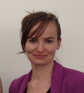
In the winter 2016 term, Geothink’s Tenille Brown, a Ph.D. candidate in the University of Ottawa’s Faculty of Law, will be teaching a new course called Law and Geography. The seminar course will be offered as a first-year elective option for J.D. students. “It’s really exciting because it will be the first law and geography course in a Faculty of Law in Canada that I am aware of,” said Brown.
The intention of the course is to introduce new law students to the emerging field of legal geography, which focuses on spatial and place-based aspects of law and legal regulation. The course description highlights several focus areas, including public and private spaces; property and the city; critical perspectives of identity, racism and the law; gender, property and the law; indigenous peoples and the environment; and globalization. “There’s a wide variety of topics,” said Brown, “and within that I have a couple of classes which will look at issues of GIS and a lot of the themes of Geothink in relation to legal geography scholarship and in relation to the law.”
Brown notes that GIS is addressed in the legal literature to some extent, but such discussion is in its nascent stages. For example, the field of technology law deals with liability issues in relation to GIS, and issues such as copyright and privacy. “And there’s a little bit of GIS analysis in relation to understanding crime, and criminality,” said Brown. “That’s a big area of research, but I think there are many, many, many GIS narratives which are not captured at all.”
All of these GIS-oriented legal issues will play a role in her course, however she’s also hoping to draw in some students who have previous practical experience with GIS technologies. “If there are students who have a particular interest in GIS or have skills in GIS, and they’re willing, then we can explore not just legal liability in relation to GIS but also, how can we use GIS to help the functioning of the legal system? So really opening it up for those skills to be brought into the classroom.”
“I’m interested in knowing how information about a place, which is maybe more than property-related, can influence how we regulate or understand a particular area of a city, for example,” Brown said. “How can we bring in different information about a city that is not captured by a property title deed, or a traditional survey that we might have? We see a lot of non-traditional information collection right now. That is, it’s non-traditional from a legal perspective — information about how people use a place. Typically the law doesn’t care about that. Typically the law just wants to know who has the title deed, and that’s it.”
Brown offers the example of First Nations groups in Canada, who are currently using GIS and GIS technologies to collect oral histories and map out their histories spatially. “There’s a big push from indigenous communities, and a willingness and a desire to engage with GIS technologies to capture these different narratives,” Brown said. “And they’re wanting to use it to support land claims. That’s their whole aim.
“So it’s important to figure out how modern information can be incorporated into a legal system which relies on historical treaties,” Brown explained. “There’s a lot of legal questions about using that information and the strength of that kind of information from an evidentiary perspective. The law has a very non-GIS approach — a non-tech approach — to adjudication. So I think one of the really important questions is, how can we get this modern GIS counter-narrative and make sure that it’s solid as evidence that is effective for the legal system?”
For Brown, encouraging students with a GIS or geography background to consider how their knowledge can contribute to the legal process is just one motivation for her course. “They’re first-year law students,” Brown said, “so they’re just beginning to get to grips with what takes place in the Faculty of Law. They’re in shock a little bit, at this point. With this class, I’m really hoping to open it up for students that already have an undergraduate degree in something spatial-related. If there’s anyone who’s done work with GIS, that will definitely enrich the classes.”
Do you have questions about Tenille’s course or research? Contact her on Twitter at: @TenilleEBrown Tenille Brown is a PhD candidate in the Faculty of Law at the University of Ottawa. She is a Geothink student member, and a member of the university’s Human Rights Research and Education Centre. Her research is in the areas of legal geography, including property, spatial and citizen engagement in the Ottawa context.For more of Geothink’s GIS Day coverage, see:
- GIS in the City: Toronto on the Map
- GIS on Campus: Join Claus Rinner for GIS Day at Ryerson
- GIS & the Global Community: Humanitarian Mapping


