Category Archives: Geothink News

Crosspost: In Search of the Mother of GIS? Thoughts on Panel Session 1475 Gender & GIScience at AAG 2016

http://b-i.forbesimg.com/yec/files/2013/06/mentors.jpg

Female mentors in GIS abound at the 2016 American Association of Geographers (AAG) Annual Meeting.

By Victoria Fast


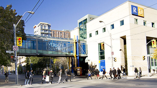
This post was originally published on GIS2 at Ryerson University: Geographic Information Science and Systems on April 6, 2016. We re-publish it here with permission of Dr. Victoria Fast who presented at this year’s Annual Meeting of the American Association of Geographers (AAG).


Roger Tomlinson has passed, and Mike Goodchild is in (a very active) retirement. So, this panel made me consider: are we searching for a new father of GIS? In fact, do we need a father of GIS? Would a mother of GIS balance the gender scales? It seems all disciplines need leaders, and the powerful panellists in this session—populated with many of my mentors and leaders in the field, including Renee Sieber, Nadine Schuurman, Sarah Elwood, Agnieszka Leszczynski, Britta Ricker, and Matthew Wilson—demonstrates that we indeed have strong leadership in GIScience. This mostly female panel is a reminder that, in fact, there are many influential female scholars. But do we hear these influences? Do we hear them equally? Have we heard them in the past? Based on the discussion in this session, the answer in overwhelmingly ‘no’.

The discussion in this session revolved around the ways in which our science has been heavily masculinized, epitomized by the commonly accepted ‘Father of GIS’ notion. The discipline has been dominated by all-male panels, focused on programming and physical science, subdued critical or theoretical work, and “straight up misogyny in GIScience” (Renee Sieber’s words). Female scholars are less frequently cited, underrepresented as researchers in the field, and almost absent in the representation of the history of the discipline.

This made me think of deep-rooted masculinization I have faced in my GIS journey, as a student and now as an educator. Issues related to working in the ‘old boys club’ aside, masculinization was especially predominant when I taught a second year Cartography course. The textbook “Thematic Cartography and Geovisualization” contains a chapter of the History of Cartography. Without sounding ‘…ist’ myself, the chapter largely recognized the contribution of older, white males. I didn’t feel comfortable teaching my students that narrow history of Cartography, so instead went looking for my own resources to populate a ‘History of Cartography’ lecture.

I was delightfully surprised that there are so many resources available that show multi-faceted sides of cartography (and GISci more broadly). These perspectives and resources are often shared via disparate sources in journal articles, blogs, and discussion forums. For example, Monica Stephens has a great publication on Gender and the Geoweb in Geojournal [2013, 78(6)]. City Labs also has a great series on the Hidden Histories of Maps Made by Women (thanks for sharing Alan McConchie): http://www.citylab.com/design/2016/03/women-in-cartography-early-north-america/471609/. Unfortunately, they refer to it as the “little seen contributions to cartography”, but panels like this help address that while they’re little seen, they are highly impactful contributions. Over time, these blog posts, journal articles, and conference panels will (hopefully) amass and make their way to more formalized forms of textbook knowledge. (There was a great deal of interest by those attending this session in a published version of these compiled resources. Given the overwhelming response, I’m considering compiling a manuscript… stay tuned.)

I recognize that it is impossible to undo the deep-rooted masculinization that has persisted in GIScience. However, we can change how we address it moving forward. Let’s recognize that we don’t need a father (or mother) of GIS; we need leaders, visionaries, and mentors of all shapes, sizes, colours, backgrounds, and genders. I challenge all those who are GI Professionals in training to look for the untold story, the hidden history of GIS, and the little-seen influences on the discipline. I challenge those who teach GIS to go beyond the ‘truth’ presented in the textbooks. And lastly, I want to conclude by saying thank you to the powerful female mentors on this panels and ones not represented here; mentors who transcend the need for a ‘Mother of GIS’.

Dr. Victoria Fast is a recent doctoral graduate of the Department of Geography and Environmental Studeis at Ryerson University. Contact her at vfast (at) ryerson.ca.

Geothoughts 9: Geothink Project Measures Open Data Standards for Consumer and Publisher Uses

Geothink's Open Data Standards Project helps publishers and consumers better use open data.

Geothink’s Open Data Standards Project helps publishers and consumers better use open data.

By Drew Bush

We’re very excited to present you with our ninth episode of Geothoughts. You can also subscribe to this Podcast by finding it on iTunes.

In this episode, we examine a Geothink project on open data that officially kicked off in February 2015 with a Geothink teleconference call. Project lead Rachel Bloom, an undergraduate student in the Geothink Rapid Response Think Tank at McGill University, began this research one year ago. She worked with Geothink Head Renee Sieber, associate professor in McGill University’s Department of Geography and School of Environment.

It recently culminated in a white paper written on two spread sheets (1) an examination of high-value open datasets Canadian cities use; And (2) an inventory of open data standards published by open data providers. Listen in as Bloom explains to partners who publish open data how to know what standards exist and who uses them for which datasets.

Thanks for tuning in. And we hope you subscribe with us at Geothoughts on iTunes. A transcript of this original audio podcast follows.

TRANSCRIPT OF AUDIO PODCAST

Welcome to Geothoughts. I’m Drew Bush.

[Geothink.ca theme music]

“This project is about investigating open data domain specific standards at the Canadian municipal level, which I guess is kind of a mouthful. But basically I’ve created two spreadsheets to figure out how Canadian municipalities are publishing their data and how the level of conformity is per the guidelines for open data standards.”

That’s Rachel Bloom, an undergraduate student in Geothink’s Rapid Response Think Tank at McGill University, talking about domain specific data from sectors like transportation and city budgets. She’s working with Geothink Head Renee Sieber, associate professor in McGill University’s Department of Geography and School of Environment.

“To begin this project I chose ten domains to focus on. These domains came from open knowledge foundation spreadsheets. They are considered high value, and I thought these were interesting. I thought they were important to public use. So I chose them as the basis to create these spreadsheets.”

In late February, Bloom conducted a teleconference for the project’s partners in several Canadian cities. In it, Bloom discusses the project, each spreadsheet, and answers questions from those on the call. She starts with the first spreadsheet.

“It’s called ‘Adoption of Open Data Standards By Cities.’ So what we did for this is we have the 10 domains on the side on the y-axis, and then we have kind of nested between these certain metrics of how the municipality names the dataset, the file format, the structuration of the data, any metadata associated with the dataset or description of the data, and if theses data sets for each domain are already using specific data standards—open data standards. And these were taken from each municipality’s open data catalogues.”

“And it helped for eventually comparing whether the ways that data is being published is even kind of compatible with the semantic and schematic guidelines dictated by available open data standards.”

Participants then examined a specific example from the spreadsheet, building permits for the City of Toronto. The call then proceeded to the next spreadsheet developed.

“It’s called ‘Inventory and Evaluation of Open Data Standards.’ Here we have on the y-axis these are individual open data standards that are kind of domain specific so they are pegged to certain domains and they cover the ten domains used for the other table. Though there is two extra domains…the metrics you find kind of on the top, are an innovation on my part. They were chosen by me based on the demand of data publishers and consumers I found in my research which came from all different types of mediums.

“I’ve even read e-mail correspondences of people talking about what they want when they are structuring their datasets. They also come from reinforcing that these standards are open. So what does it mean to be open? They have to be open, they have to be consensus driven, they have to have to multi-stakeholder participation so theirs metrics have to account for that.”

Bloom again takes participants through a specific example, this time a budget data package, going through all the metrics to give participants a sense of the quality of standard in terms of making data interoperable. When she finishes, Linda Low, Open data lead for the City of Vancouver, interrupts her to ask:

“Rachel can you talk a little about the criteria for whether or not it’s open or not again, it’s whether multi-stakeholders contribute to it, and there was something else too, right, that you said?

“So when we talk about multi-stakeholders we’re talking about people who contribute that are from different facets of society. So the private sector, the public sector, civil societies, and also the obvious which is that open implies that there should be no royalties or fees associated with using the standard. It should be repurposable, they should be able to extend it how they wish, it should have a license that is open so that there is legal ramification for using the standard as you please. You’re right it’s not explicitly mentioned which of these kind of contribute to defining openness but all of these are good fundamental metrics for an open standard I would think.”

The teleconference proceeds as Bloom and the call’s participants discuss the spreadsheets and white paper, stopping to elaborate on specific examples or details in more depth. Toward the end of the 40-minute call, Bloom shares the vision and goals for this project.

“There’s metrics that can help publishers, but there’s also metrics that can help consumers who would want to voice how they want to structure the data which is really part of the open process. So I think it can be used as multiple, for multiple purposes, really so it’s flexible in that way. So I’m not sure if there’s a very specific way of using it cause it really depends on the goals of the person using the resource.”

She’s followed-up by Sieber who firsts asks a question and then provides insight into how the project’s goals were determined.

“A standard is likely to be viewed much differently if you want to do something for internal government use like business intelligence as oppose to external use. And depending upon the audience, if you’re doing something for realtors it might be viewed quite differently than if you’re trying to do it for, I don’t know, low information voters.”

At the conclusion, Low offers the municipal publishers perspective on how constantly updated and revised standards make it hard to know which one a municipality should adopt in differing domains such as city budgets, crime statistics, or waste removal services.

“When do we say this is justifiable for us without doing a whole bunch of research and wasting the effort afterward. That was the thing I always keep struggling about.”

Bloom doesn’t hesitate with an answer.

“There are so many options too and ways of approaching it. I mean, I don’t know–it’s really about the interests of the person who is publishing the data and the goals. I think at the end of the day, it’s going to, different governments are going to have reconcile what their goals are and how they want to go about it. Which is the hardest part.”

This project is ongoing and next steps will continue to look at the landscape of open data standards in Canada.

[Voice over: Geothoughts are brought to you by Geothink.ca and generous funding from Canada’s Social Sciences and Humanities Research Council.]

###

If you have thoughts or questions about this podcast, get in touch with Drew Bush, Geothink’s digital journalist, at drew.bush@mail.mcgill.ca.

Geothink Summer Institute to Kick Off May 9, 2016

Geothink’s 2016 Summer Institute will take place at Ryerson University in downtown Toronto.

By Drew Bush

Are you curious about the use of open data by municipalities and their citizens? Geothink’s 2016 Summer Institute will kick off May 9 to May 11 at Ryerson University in Toronto and combine practical data handling and communications skills with a unique breadth of critical discussions.

“We’re really excited about the structure this year, where students will be able to get their hands dirty with open data and then get to learn and interrogate how it’s made,” Geothink Project Manager Alexander Taciuk said.

The first day will be headed by the Open Data Iron Chef Richard Pietro and students will accelerate from learning the basics of open data to developing open data-fuelled solutions to real world problems. On the second day, lectures and discussions with open data experts will give students unique perspectives on and access to Toronto’s open data makers and doers. The final day will be a writing skill-incubator that combines writing tips “that no one ever teaches you in school” to teach how to communicate a clear message.

Hands-on group work will be interspersed with speakers exploring topics on local and Canadian issues. The Summer Institute aims to give all attendees a multifaceted perspective on the value of open data, and will include hands-on data exploration, hearing from Geothink professors and experts, and discussions with key members of the Toronto open data community.

“It’s essential that students appreciate the many definitions of open in open data and the numerous ways in which open data can be valued,” said Geothink Head Renee Sieber, associate professor in McGill University’s Department of Geography and School of Environment. “This Summer Institute will give students approaches to measure quantifiable values like economic development and business intelligence as well as the less quantifiable values such as democracy, participation, transparency, and accountability.”

The institute will be held at one of the Ryerson planning studios at the Ryerson School of Urban and Regional Planning. It is open to Geothink students at all levels, undergrad to post-doc. If you are graduating this April, or starting new next term, you are also welcome to attend.

“I’m excited to be bringing the Geothink students together once again to tackle an idea from a variety of angles,” Suthee Sangiambut, Geothink Summer Institute organizer and newsletter editor, said. “I know the variety in expertise each student brings and I expect the Summer Institute to be a forum for ideas and a great collaborative learning experience. The more Geothink students present, the better the discussion will be. Guaranteed.”

The summer institute is hosted by Geothink, a five-year partnership grant awarded by the Canadian Social Sciences and Humanities Research Council (SSHRC) in 2012. The partnership includes researchers in different institutions across Canada, as well as partners in Canadian municipal governments, non-profits and the private sector. The expertise of our group is wide-ranging and includes aspects of social sciences as well as humanities such as: geography, GIS/geospatial analysis, urban planning, communications, and law.

If you have thoughts or questions about the article, get in touch with Drew Bush, Geothink’s digital journalist, at drew.bush@mail.mcgill.ca.

Gethoughts 8: How Technology is Reshaping Citizen Interactions on Climate Change

pic32-e1435343808697

Hydro Quebec is setting up a new circuit of public electric charging stations, one of many changes in the works as cities across Canada prepare for more environmentally friendly futures.

By Drew Bush

We’re very excited to present you with our eighth episode of Geothoughts. You can also subscribe to this Podcast by finding it on iTunes.

In this episode, we examine what role Canada’s cities play in international solutions to climate change as well as how new technologies shape interactions in neighbourhoods and between neighbours on environmental issues. In it, we talk with Geothink researcher Alexander Aylett, a professor and researcher at the Institut national de la recherche scientifique.

Thanks for tuning in. And we hope you subscribe with us at Geothoughts on iTunes. A transcript of this original audio podcast follows.

TRANSCRIPT OF AUDIO PODCAST

Welcome to Geothoughts. I’m Drew Bush.

[Geothink.ca theme music]

Last week on Geothink.ca, we brought you a look at how open data and digital technology are reshaping the way cities plan for sustainable futures and how to act on issues such as climate change. Today we dive deeper into the changes taking place locally and internationally on this topic.

“One of the things I’m most excited about here in Montreal, is electrification of mobility in the city. So something in the order of 40 percent of Montreal’s GHG emissions come from moving people and things around in the city. Trucks, cars, trains—to a certain extent—all of those things. And what we’re seeing now is a real scaling up of, I guess, work that’s been happening over the past four or five years to electrify as much of that as we can.”

That’s the opinion of one expert who has been studying these issues from his office in Montreal, Quebec. We spoke with him over Skype this month.

“Alexander Aylett, I’m a professor of urban sustainability governance and innovation at the Center for Urbanization, Culture, and Society of the National Institute for Scientific Research or the proper French title is Institut National de la Recherche Scientifique in Montreal.”

Aylett believes the time has come for changes that make transit, buildings, and energy more efficient in cities. That’s because cities can play an outsized role in confronting the important environmental issues of today by mixing a curious blend of new technology, empowered citizen groups, and long-term planning. The first signs heralding these changes are here.

“So we have Hydro Quebec that’s setting up la route verte où route bleu of publicly accessible charging points. And it started of with like two, three, four, five and you know now we’re aiming for a few thousand in the city within the next couple of years. And we’re seeing the launch of things like Téo taxi, where there is going to be, their plan, is—if I’m right about their deadlines—by next December is to have something like 2,000 new electric vehicles on the roads of Montreal. So a big private player dramatically increasing the number of electric vehicles that we’ve got on the roads. Similar action happening in big players like CommunAuto.” 

Such changes are not purely financial. Cultural shifts have occurred before in Montreal. Not long ago when the city began planning for the introduction of Bixi bike sharing, they didn’t tinker around the margins. Instead they created many more bike paths that were safer for riders and that have since been adopted by many residents. On environmental issues like climate change a similar transition may soon take place.

“We’ll see gas burning vehicles sort of being retired. New institutional players like taxis, for example, buying electric. Private citizens buying electric. But also private citizens realizing that the increased convenience of smart taxi services like Uber, and Téo, and Car-to-go, and other car sharing networks means that people don’t need to have a private vehicle in a lot of cases anymore. People who are sort of on the borderline zone of needing a car regularly but not every morning for their commute I think will be in a position to just abandon the private automobile in favor of convenient access to different mobility providers.”

Such changes would bode well for those who would see Canada reduce greenhouse gas emissions or GHGs. More cooperation is needed between actions taken by cities and those being coordinated on national and international levels. The 2015 Paris Agreement and the prominent role of cities in it means such a future is not just possible but likely, according to Aylett.

“Coming out of COP21 what we have is a much more open understanding of the fact that cities are a critical partner for states, provinces, and national governments. And I think—and this is why it’s such an exciting period right now, like particularly this next sort of six months—I think that we what we should be seeing is more effective partnerships between those different players. More funding coming down especially in Canada given the commitments our government has to fund urban infrastructure projects…Spreading from city to city to city effective interventions into different aspects of our urban environmental footprints. That’s fantastic.”

In a future where cities help solve climate change, different cities will each contribute a piece of the solution. In Montreal it may be innovations in transport technology and the manner in which individuals book transit, Vancouver may continue leading in green building efforts that incorporate “reach codes” so each step in efficiency serves to enhance the next, and Toronto may utilize new models and data to better plan where to locate parks and green roofs.

Some technological changes will undoubtedly allow citizens to contribute their expertise and opinions to solutions while others will focus on overcoming small barriers in daily life that could have a dramatic impact on environmental issues such as climate change.

“Basically we’re talking about reducing friction and reducing barriers to use where the simplicity of jumping into your car, and driving somewhere—even if in the end it creates congestion, it’s an un-enjoyable experience—it’s almost a knee-jerk reaction for some people because it’s so simple. And the public transit in some situations is more complex because you need to transfer, you need to use, maybe you need to use Bixi and the Metro and the bus. Things that are when you look at it seems more complicated. But having an interface like Transit App that just lays it all out for you means that from a user point of view, it reduces the barrier to switching from one type of behavior—driving in your car—to another type of behavior—which is getting there by any other, you know, means of mobility.”

“And the next phase of that, and this is something that we’re seeing already being considered in some places, like Singapore for example, is just to stop charging people for individual modes of transportation and start charging people for reaching their destination. And so the difference would be you open up your app, for example, and say, ‘I’m here and I need to get there.’ And the application uses smart open data about different modes of transportation to calculate for you a couple of different routes and charges you for the route. And so you just pay to get from your house to school or from your house to work or from your house to the art gallery.”

But that’s not all. New information technologies and open data platforms have a habit of helping citizens to organize to solve problems. Environmental issues like climate change are no different once the right data sets and support are in place.

“If you wanted to start talking about how you can manage a community energy transition, having good online platforms that are a tool that’s used in public mobilization and engagement strategies makes it possible to be more effective at the local level but also then to scale up quite well from local action to action in other local areas either in the same city or other cities.”

Aylett believes that such networked communities can bring together individuals who may have never known each other on topics of mutual concern. Such collaborative work can lead to a snowballing effect where changes to how cities respond to environmental issues might some day become inevitable.

[Geothink.ca theme music]

[Voice over: Geothoughts are brought to you by Geothink.ca and generous funding from Canada’s Social Sciences and Humanities Research Council.]

###

If you have thoughts or questions about this podcast, get in touch with Drew Bush, Geothink’s digital journalist, at drew.bush@mail.mcgill.ca.


Geothoughts Conversations 2: The Nature of Democracy in the Age of Open Data

Geothoughts Conversations 2 explores the nature of democracy in an age of open data.

Geothoughts Conversations 2 explores the nature of democracy in an age of open data.

By Drew Bush

The largest grant investigating two-way exchanges of locational information between citizens and their city governments, Geothink makes possible countless collaborations and discussions. This month, Geothoughts Conversations brings you a look at one such conversation that took place this past January on the wintry downtown campus of McGill University in Montreal, QC.

We sat down with Geothink head Renee Sieber, associate professor in McGill University’s Department of Geography and School of Environment, and Daniel Paré, associate professor in the Department of Communication and School of Information Studies at the University of Ottawa, where he also serves as an associate director at the Institute for Science, Society, and Policy.

The topics: The nature of democracy and public participation and, later, how city platforms that utilize open data impact democratic processes and citizen engagement. Often hailed as a panacea for making government transparent and the political process more open and inclusive, Paré and Sieber discuss the inaccuracies in this narrative along with how open data has changed the roles of cities and citizens in today’s democracies.

To start us off Sieber dispels the idea that democracy itself requires public participation and discusses the wide spectrum of democractic systems that exist.

Thanks for tuning in. And we hope you subscribe with us at Geothoughts on iTunes.

If you have thoughts or questions about this podcast, get in touch with Drew Bush, Geothink’s digital journalist, at drew.bush@mail.mcgill.ca.

Envisioning An Environmentally Sustainable Urban Future Using Clean Digital Technologies


By Drew Bush

Imagine a world where electric taxis crowd Montreal’s downtown streets, green buildings efficiently manage energy consumption for Vancouverites, and Toronto’s city leaders monitor differences in neighbourhood surface heat emissions to best position green roofs. Now imagine the environmental and social impacts of such shifts when scaled-up for all of Canada’s cities.

That future—one that makes use of digital technology, citizen-sensors, and open data to manage urban areas more sustainable—may already be here according to some experts. In coming years, the company Téo taxi will bring the first fleet of electric taxis to Montreal’s streets while Hydro Quebec has also begun work to bring thousands of electric charging stations to the province of Quebec.

Globally, changes triggered by digital technologies and open data have already begun to impact how city leaders make decisions and engage with communities on environmental issues. One outcome of these new mediums for exchanging information has been enhanced capacity of cities to use citizens and resources to strategically tackle issues such as climate change.

I think it will be a noticeable difference on the streets of Montreal when you walk out and you see the white and green Téo taxis you know all through the downtown core,” said Geothink researcher Alexander Aylett, a professor and researcher at the Institut national de la recherche scientifique.You know we’re talking about a really large pool of electric vehicles. And the shift is an environmental one, but it’s also a social and a cultural one where people start to have direct experience with electric mobility. It will be really profound.”

Aylett noted that 40 percent of Montreal’s greenhouse gas (GHG) emissions derive from moving people and things around the city. Efforts to scale-up the ability of cities across Canada to manage and change truck, car, and train traffic is one of several goals city leaders across North America are pursuing, he added in a recent interview with Geothink.ca.

“So instead of just having one city that’s really strong in transit and another city that’s really strong in green buildings, we are seeing a shift—I think it’s a slow shift but I think we’re headed in that direction—where cities are approaching sustainability and trying be leaders in multiple sectors,” Aylett said. “So buildings, transit, energy—all of it.”

The City of the Future

City leaders around the world are aware that municipalities themselves only control a very small percent of the urban infrastructure that directly and indirectly can lead to environmental damage. Cities also cause environmental damages well beyond their geographic scope making it more difficult for them to reduce impacts. Consequently, solutions that rely on taxation or legislation may have limited ability to dramatically shift the myriad social behaviors tied to environmental issues like climate change.

Technology makes possible not only harnessing the individual abilities of citizens—think transit engineers, architects, and software developers—in networked communities but also new understandings of how urban systems impact local and international environmental problems.

Take, for example, the urban heat island effect. Described by scientists, it concerns the process by which urban surfaces absorb more solar energy and re-admit it as thermal energy (primarily at night) than do surrounding non-paved areas. Better modelling of local and regional climatological processes using citizen sensors can allow cities to pin-point which neighbourhoods are most susceptible to this problem and plan strategically.

Technology may also one day revolutionize how environmental issues are managed locally. The release of open data on neighbourhood energy consumption, water use, and waste disposal make it possible for cities to work with the private sector, non-profits, and academics to better manage flows of materials, goods, and energy in urban areas. Researchers sometimes call such measurement work “urban metabolism.”

“All of those things are being enabled in a way that we’ve never seen before by new technology,” Aylett said. “So the output is becoming a much deeper understanding of how our cities function and the impacts that they have. And where, if you want to think about it like acupuncture, where you can take strategic action in one space that will cause sort of systemic shifts in those impacts.”

He added that visualization and cartographic technologies now make it possible to take information that’s quite complex and make it understandable even for non-experts. What’s more difficult to assess is how such technological tools make possible collaborative action that builds around specific issues as they spread through a community.

Cities in International Climate Politics

Individual cities around the world have shown international and national climate change negotiators what’s possible in tackling climate change mitigation and adaptation, according to Aylett. This despite the inability of some provincial/state and federal governments to incorporate and engage with such local solutions, he added.

Yet much work remains. In an inventory of the open data portals of 20 of the largest Canadian cities Aylett completed last summer, he determined that things like parks and green spaces are well represented while others such as energy consumption or air quality are entirely absent. Aylett hopes the addition of such data will increasingly play an important role in urban environmental management. But it’s still “early days” for this type of open data, he repeated often during the interview, noting that researchers in public health could make a similar complaint.

“So far cities in Canada are not providing on their open data web sites the basic ingredients for innovation around urban sustainability or for you know effective action within the municipality,” he cautioned. “There is a lot of good data that cities have that so far hasn’t been made available. And what that means—it’s a negative and it’s a positive. It means that there is huge potential for the cities that decide to be strategic about it to lay the groundwork for a really interesting period in municipal policy making, and innovation, and experimentation here in Canada.”

Stay tuned for our audio podcast with Alex Aylett to hear him talk about cities and international solutions to climate change as well as how new technologies shape interactions in neighbourhoods and between neighbours on environmental issues.

Also tweet him at @openalex_ and check him out at Open Alex.

Photo Credits:
Slide 1 – Roulez Électrique
Slide 2 – Gladki Planning Associates
Slide 3 – VanCity Buzz

If you have thoughts or questions about this article, get in touch with Drew Bush, Geothink’s digital journalist, at drew.bush@mail.mcgill.ca.

Bridging Differences in Open Data: Coming up with standards at Open North

Open North has quietly released two reports on open data over the past year.

By Drew Bush

In case you missed either report, over the last year Open North has quietly put out an inventory of open data globally and, in a separate report, recommended baseline international standards for open data catalogs. The first report is entitled Gaps and opportunities for standardization in OGP members’ open data catalogs while the second is entitled Identifying recommended standards and best practicesfor open data.

Their work was completed as part of the Open Government Partnership (OGP) Working Group, a group that aims to support governments seeking transparency through open data. Both reports aim to help the 69 countries in the partnership to improve their ability to share open data by standardizing how it’s made available.

The first report, which inventories open data in OGP’s member countries, notes that most members’ open data initiatives consist largely of open data catalogues. To assess each of these different catalogues, the authors wrote automated scripts to collect, normalize, and analyze them. This process allowed them to set a baseline across countries and identify gaps and opportuni­ties for standardization.

“The analysis simply states the choices that OGP members have made with respect each area for standardization; it makes no judgment as to whether these choices are best practices,” they write in laying out the objectives for the report.

In the second report, the authors address a specific research question: “What baseline standards and best practices for open data should OGP members adopt?” But first they diagnose the problem open data faces globally without any standards.

“The lack of standardization across ju­risdictions is one major barrier; it makes discovering, accessing, using, and integrating data cumbersome and expensive, above the expected return,” they write. “A lack of knowledge about existing standards and a lack of guidance for their adoption and implementation contribute to this situation.”

The majority of the report then seeks to address these problems by outlining baseline standards and best practices for open data catalogs, while taking into account the dif­ferences between jurisdictions that make the global adoption and implementation of standards challenging. In particular, the report concludes with 33 recommendations that member countries should undertake including that governments should provide their agencies a list of acceptable data formats or that they should avoid file compression without good support for it.

To find more of our previous coverage about Open North’s work on open data, check out our previous Geothink.ca story here.

If you have thoughts or questions about this article, get in touch with Drew Bush, Geothink’s digital journalist, at drew.bush@mail.mcgill.ca.

Using Data to Revolutionize How We Make Decisions

Community members taking part in a planning process as part of Robert Goodspeed's doctorl work in Dripping Springs, Texas.

Robert Goodspeed, assistant professor of Urban Planning at the University of Michigan’s Taubman College of Architecture and Urban Planning, examined how decision support systems could be applied to urban planning processes during his doctoral work. This photo is of one such process in Dripping Springs, Texas.

By Drew Bush

The decision support market, a segment of the healthcare industry, made financial headlines when estimation of its global value by 2019 reached USD 239 billion, a jump of almost 38 billion since 2012. According to a new report, major players in the industry have poured money into new technologies that can take advantage of big data.

Digital health initiatives like those led by Canada Health Infoway have led to the creation of a network of systems that securely connect and share health information. Decision Support Systems like this one utilize computer-based data to aid in individual decision-making by supplying a massive bank of previous cases that aid in choosing the most likely answer or predicting trends. Most consist of interactive computer-based systems that utilize data and models to solve problems requiring geographically or temporally dispersed information.

In healthcare, IBM’s Watson system has been leading the trend to improve decisions made by doctors. “Watson knows what tests are relevant to further characterize a particular patient condition and what tests are not,” the report states. “It is a great help to physicians to have an assistant that is able to have read the latest journal articles and is loaded with medical information to recommend what tests may be relevant in a particular situation.”

An estimated 30 percent of all costs incurred for healthcare delivery come from tests that are either of little value in a patient’s case or sometimes outright wrong, according to some reports. Like platforms offered in other industries, the decision support system engineered by IBM offers the promise of more nuanced testing to enable better decisions on which medical tests can be best applied to specific patient conditions.

Robert Goodspeed, assistant professor of Urban Planning at the University of Michigan’s Taubman College of Architecture and Urban Planning, studies decision support systems.

Robert Goodspeed, assistant professor of Urban Planning at the University of Michigan’s Taubman College of Architecture and Urban Planning, studies decision support systems.

Using decision support systems to analyze data and make better decisions has helped to improve processes in many industries. Geothink 2015 Summer Institute Instructor Robert Goodspeed, assistant professor of Urban Planning at the University of Michigan’s Taubman College of Architecture and Urban Planning, has studied this trend.

Although Goodspeed doesn’t work in healthcare, his research examines what he refers to as “planning support systems.” His work has looked at how we can use information technology to improve processes that engage community members in urban planning decisions. During his doctoral work, he created a process that allowed individuals to access information about their neighborhood and city to improve discussions.

This research involved community members placing stickers on maps to categorize specific areas for different land uses. This data was then transferred to digital form with one person entering the data as it was called out. Interactions such as this ensured entering the data could be reviewed by the group as a whole and reflected the ideas that they had discussed.

“The participants reported learning quite a bit and I could observe their plans evolving,” Goodspeed said. “So that’s just one example of the sorts of tools and practices that I think or feel we need. Especially as we’re facing issues like climate change where we want to quantify things and create indicators, and know how the plans we are creating are going to do or how they’ll perform against these different indicators.”

The Varied Uses of Decision/Planning Support Systems

In more recent research, Goodspeed has taken his work with planning support systems and applied it to improve environmental-decision-making processes surrounding North America’s Great Lakes ecosystems. Work he’s done as part of the Great Lakes Aquatic Habitat Framework project have used GIS datasets to examine aquatic habitats such as streams, rivers, and lakes in the region. The process also supplies a “big pile of data” for decision-makers in the fisheries and environmental management departments in Canada and the United States.

Unlike in planning where professional tasks follow a somewhat structured process, ecosystem-based management systems must consider a whole variety of information and tasks, Goodspeed said. Work in the project has included leading participatory design workshops for professionals north and south of the border to aid in the development of a tool that will one day allow easy digital examination off all the information on the Great Lakes collected for the project.

Community participation in planning processes that help to envision the possible future often result in a final product that’s inherently more understandable, Goodspeed added.

“And really it requires that kind of combination of creativity but being specific about what you think will happen and what you think will work,” he said of his work with decision-support systems. As big data is increasingly used to inform decision-making, this trend will only continue to grow beyond the industries of healthcare and environmental planning.

Tweet him @rgoodspeed.

If you have thoughts or questions about this article, get in touch with Drew Bush, Geothink’s digital journalist, at drew.bush@mail.mcgill.ca.