Category Archives: Academic Output

Mobile Feedback Applications for Base Map Editing

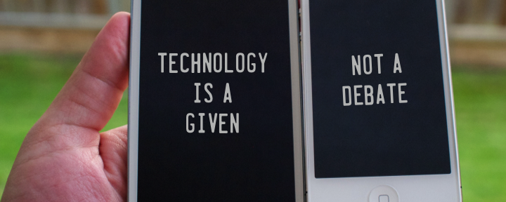
If governments wish to maximize citizen contributions on issues as varied as fixing maps, reporting potholes and commenting on social housing, they likely need easy-to-use tools for citizens to do so. One answer could be on mobile phones. Tool-building is more than a technical issue. Mobile devices have an increasingly central role in our daily activities; they become intermediaries for our interactions with each other, the environment, businesses, and institutions. Recent advances in mobile device and computerized mapping (geographic information system, or GIS) technology have presented us with the potential to develop applications that mediates citizen interactions with government, using geographic base maps as a conduit. This project asks how mobile device technology can allow citizens to contribute to the updating and editing of official maps of their home city. This asserted information would then be incorporated into an authoritative map product. We move beyond the simple citizen-as-sensor or crowdsourcing paradigm to explore how governments not only accept volunteered citizen content (volunteered geographic information, or VGI) delivered through a mobile device, but how citizens become partners with government. This two-way relationship can be formalized through the development of a specific workflow where government workers verify citizen map edits and provide feedback to citizens. In this way, VGI may be integrated into formal governance and decision-making channels.

We anticipate that mobile applications will be the next generation platform for Open 311 and open government. Many issues will arise about their utility and around authentication of data. We want your ideas about and participation in this research! Contact Peter Johnson, pa2johns@uwaterloo.ca, or Rob Feick, robert.feick@uwaterloo.ca.

Geoweb and Open Data in Canada: Mapping the Terrain

There is much hope expressed about the cultural, economic, political and social opportunities afforded by Geoweb and open data initiatives. Much of the fanfare focuses on how best to harness the power of information and communication technologies in order to beget the economic, political, and socio-cultural benefits that supposedly will follow. Such a view gives rise to two concerns. First, it places technology as the primary agent, or driver, of change. Second, it advances a form of historical amnesia about expectations for the democratic, economic, political, and social virtues of previous communication technologies, from electrification, through telegraph, radio, television, and the Internet, to mobile phones (see, Marvin 1990; Mattelart 1996; Mosco 2004; Standage 1998).

Geoweb and open data initiatives may enhance efficiencies, bring about greater transparency and foster enhanced levels of civic engagement. But this does not capture all the complexity. Such initiatives, and the technologies that enable them, are inherently political and their politics are directly impacted by the contexts within which stakeholder decisions are made about such things as the platforms to employ and the policies to implement. A cursory examination of the history of technology teaches us that, if we are to succeed in unraveling the myths about the supposed progressive and emancipatory powers of Geoweb and open data initiatives we need to be much more precise than all too frequently is advanced in mainstream accounts. Geoweb and open data initiatives operate within specific socio-economic and socio-cultural contexts.

We are collaborating with a graduate student from the University of Ottawa and colleagues from the Faculty of Information (iSchool) at the University of Toronto. The objective of
our project is to begin “mapping” the complex soci-political and economic terrain within which policy decisions about open data are made at federal, provincial and municipal levels. In these early stages the project has two principal objectives: identify key stakeholders (government, industry, civil society) in open data in Canada at federal, provincial and municipal levels; and create an electronic depository of policy documents, company reports, and NGO reports relating to open data in Canada.

Admin note: An underlying question at Geothink is whether there is there anything new with these geographically based Web 2.0 technologies? And do we believe that technology will rescue us from long-standing and difficult to realize processes like civic participation? At the same time, the technology appears new because it allows non-experts to share information—for us, geographically tagged information—and to contribute from anywhere, at anytime and do so anonymously. With the open data movement, government has taken unprecedented steps to release the raw data undergirding decision-making. Geothink will help us and help local governments to understand if there’s anything new going on.

If you have thoughts on this, please email Daniel Paré, dpar2@uOttawa.ca, and Leslie Shade, leslie.shade@utoronto.ca.

Making Waves

Making Waves: Developing, Testing and Deploying a Smart Phone App to Share Examples of Good and Poor Water Conservation in the Okanagan Valley, British Columbia by Prof. Jon Corbett

Here at the University of British Columbia, Okanagan Campus, we have just hired two students, Andrew Barton and Emily Millard, to work on the Geothink project. They are being co-financed by Geothink and the British Columbia Work Study program. Together with our SSHRC partner, the Okanagan Basin Water Board, and a new partner, the Okanagan Science Centre, we have co-developed a proposal that we have submitted to the Real Estate Foundation of British Columbia entitled “Making Waves: Developing, testing and deploying a smart phone app to share examples of good and poor water conservation in the Okanagan Valley.” We are proposing to work directly with youth (age 10 -13) in the North and Central Okanagan to co-design and develop a mobile application that will allow members of the public to share photographs and short commentaries of good and poor water conservation. The app will work in conjunction with existing web-based mapping software (http://geolive.ca) that we developed for a prior grant; it also will include discussion tools. The resulting information, displayed on a website, will make this volunteered information accessible to the general public as a means to make them more aware of water conservation in the valley and provide them with a direct medium through which to engage with this issue.

The Okanagan has among the highest per capita water demands and lowest per capita water supplies in Canada. The environment is semi-arid, and the southern portions of the watershed include Canada’s only designated desert.  Research conducted by Dr. Stewart Cohen and other scientists at UBC and partner institutions have projected serious impacts of climate change on the Okanagan water supply. Yet, the sense among the general public and visitors is that the valley is rich with water. One of the greatest challenges faced by the Okanagan Basin Water Board (OBWB) is to make people more aware of the increasing need to conserve water. As a result OBWB has developed the Okanagan Waterwise program that has the clear mandate to bring residents of the Okanagan valley together with the understanding that the valley’s water source is connected — and that all residents share the same resource. Hopefully it would increase awareness among valley residents about water issues in the Okanagan, support Okanagan residents in making positive changes in their own water habits that will protect the quality and quantity of the valley’s water, and share ideas about how all the valley’s residents can do something to preserve the unique character of the region.

Our proposed project will bring together three leading organization in the region to directly address these four established, and much needed, objectives. Our proposed project and the Water Conservation app will act as a medium to bring together members from throughout the valley to share their views and perspectives on current water use, to increase awareness of all users of both their own and others use of water; for example users might contribute photographs and their perspectives on xeriscape gardening or low water use public facilities. Through raising this awareness our hope is to support change toward more efficient water use in order to create a more sustainable water management practice in the future.

We welcome your participation in this and other projects, especially since we hope that this project can be generalized to other activities. If you’d like more information or a status report, please email Emily Millard (emilyloumillard@gmail.com), Andrew Barton (andrew@redshift.bc.ca) or their supervisor, Jon Corbett (jon.corbett@ubc.ca)

PhD students at work in GeoThink – Harrison Smith

Read Harrison’s biography athttp://www.fis.utoronto.ca/students/harrison-smith I am a third year PhD student at the University of Toronto’s Faculty of Information (http://www.fis.utoronto.ca).

My research is broadly oriented around geo-locative social media and consumer surveillance to theorize new practices of social sorting and digital discrimination within mobile and cartographic information infrastructures. My PhD thesis specifically researches geo-locative and mobile based dating services due to their significant investment in collecting and analyzing personal information, as well as their emphasis on creating affective relationships with surveillance databases. I have worked as a research assistant broadly situated within political economy and surveillance studies. For this project I will be researching the political economy of the geoweb under the direction of Dr. Leslie Regan Shade. This project research will focus on the institutional forces and power relations at play within geoweb infrastructures. The forces and relations will show up largely through understanding the processes of ownership, control and labour, as well as considering alternate forms of geoweb applications that might transcend private sector models. I am very excited to be part of this project, and hope to continue researching mobile and geoweb infrastructures as a core part of my academic research interests.

Admin Note: This research is in Theme 6, the political economy (www.britannica.com/EBchecked/topic/467600/political-economy) of the geoweb, but you can see many of our themes will overlap. Harrison’s research will have aspects related to Theme 3, on law and public policy related to the geoweb, especially where it concerns privacy. It is difficult to talk about the political economy without acknowledging the huge privacy implications of placing so much of our personal information on the web and being able to mine that and other datasets. This is a challenge to be faced by society at large and for governance at all levels of government. We’d appreciate your thoughts on this research and would welcome your participation. Please email harrison [dot] smithatmail [dot] utoronto [dot] ca or leslie [dot] shade [at] utoronto [dot] ca.

Accuracy, Authenticity and Technical Aspects of Privacy

At the Universities of Laval and Waterloo, we are interested in what is often seen as the “virtuous cycle” of citizens’ increasing use of open government data and, potentially, for governments to actively leverage information that the public creates. Our work centers on issues of accuracy, authenticity and privacy in citizen-generated spatial data and the changing relationships between governments and citizens in data provision and use. In Year 1, we are concentrating on assembling baseline information that will help us understand how citizens use open data from governments and the extent that Canadian governments’ currently leverage citizen-contributed data. In this first phase, we will assemble a literature review and survey government partners at local, provincial and national levels to:

  1. Identify and characterize the main current open data initiatives (e.g., who is providing what data, in which forms?) and what data standards are used at local and provincial levels (if any?),
  2. Identify existing as well as potential practices for: a) using crowdsourced data (including barriers and opportunities) and, b) for validating crowdsourced data,
  3. Explore the linkages between open data (as a product and as practice) and crowdsourcing at the municipal and provincial levels (e.g. open data not only a service provided by the organization but also a way to improve data and by feedback loops in practice).

Two PhD students (Ashley Zhang – Waterloo, Teriitutea Quesnot – Laval) have been hired to jointly complete the literature review, survey administration and analysis and also participate in reporting the results through a journal paper. Teriitutea Quesnot is from French Polynesia. Teriitutea received his bachelor and masters in France and he has strong geocomputing and programming skills as well as consulting experience. Ashley is from China and has completed her Masters at the University of Georgia with a thesis focus on exploring spatio-temporal changes in the sociao-spatial structure of Beijing. Currently, her PhD research is centred on public engagement and place-making in smart cities. Since our government partners operate in both English and French, the survey will be bilingual to allow a pan-Canadian assessment to be developed. This information relating to current opportunities and barriers will help us develop new methods for promoting and visualizing data authenticity and accuracy. We anticipate that it also will contribute to project-wide efforts to develop best practices for Canadian governments to manage citizen-generated in light of data privacy and quality concerns.

We know that many of our partners and others have considerable experience in utilizing crowdsourced data. Even if you don’t then you probably have questions you’d like explored.

We encourage you to get in touch with us to enrich our research. Feel free to email stephane.roche@scg.ulaval.ca and robert.feick@uwaterloo.ca.