Tag Archives: Robert Feick

Geothoughts 15: Reflections from Geothink’s Researchers at the Conclusion of the Grant

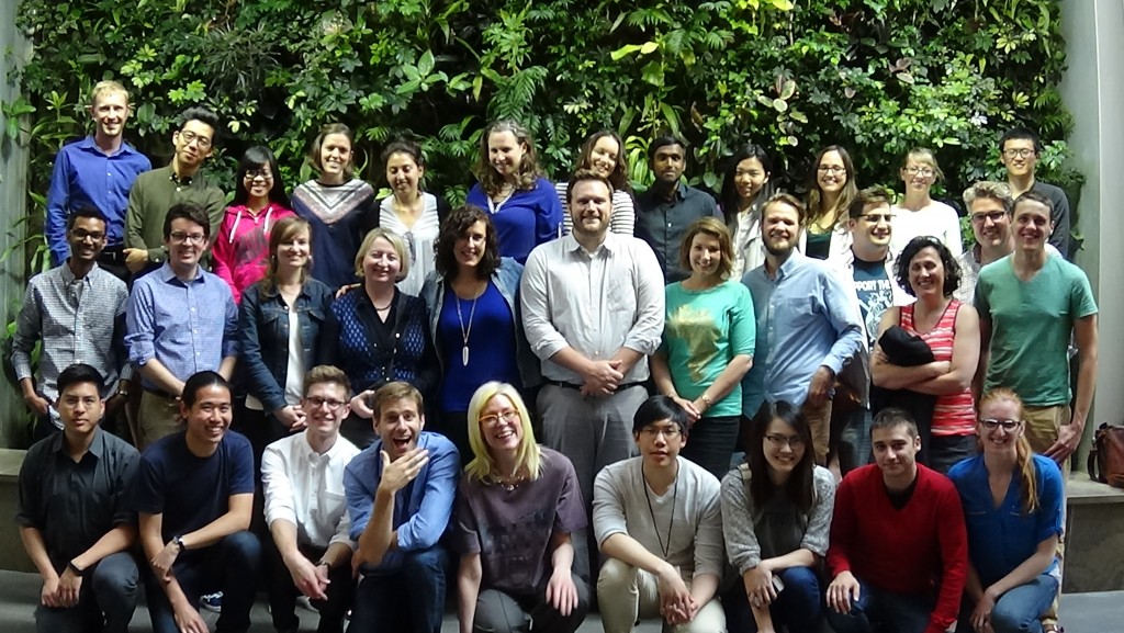
2015 Geothink Summer Institute students, faculty and staff

By Sam Lumley

We’re excited to present our 15th episode of Geothoughts. You can also subscribe to this Podcast by finding it on iTunes.

In this episode, we take a look back over five years of fruitful Geothink research. We spoke to Geothink Head Renee Sieber, Co-Applicants Rob Fieck, Daniel Paré and Stéphane Roche, and Geothink students Rachel Bloom and Edgar Baculi about their most memorable experiences with the grant.

Thanks for tuning in. And we hope you subscribe with us at Geothoughts on iTunes. A transcript of this original audio podcast follows.

TRANSCRIPT OF AUDIO PODCAST

Welcome to Geothoughts. I’m Sam Lumley.

[Geothink.ca theme music]

“The Geothink grant that was funded by the social science and humanities research council of Canada is coming to an end. We have done great work in terms of creating new theories, new frameworks, new applications, new data sets new collaborations.”

That was Geothink Head Renee Sieber, an associate professor at McGill University’s Department of Geography and School of Environment. Funded by Canada’s Social Sciences and Humanities Research Council, the Geothink partnership grant has involved 26 researchers and 30 partners, while also training more than 100 students. As the grant wraps up, we’ve been hearing from our researchers and students as they reflect on their involvement in the grant over the past five years.

We started off by speaking to former Geothink student Rachel Bloom about her most memorable experiences with the grant.

“I was the lead of Geothink’s Open Data Standards project when I was a student at McGill University. The most memorable Geothink experience would have to be designing a survey that I delivered to open data publishers at cities in north america about open-data standards. It’s memorable because it was a really challenging process due to my research topic being so new. And it also helped me develop my skills as a researcher for the future.”

The Geothink grant has brought together researchers from many different backgrounds and from different parts of the world. It was this point that Geothink co-applicant Rob Feick, an associate professor in Waterloo University’s School of Planning, emphasised while talking about the influence of Geothink on his own work.

“My research has really benefited from my work with Geothink in a few ways, one of which is Geothink is really a multi disciplinary network. It’s a network of people that span disciplines from geography, law, planning and a host of others. And having these different types of expertise around the table has really helped ground my research.”

“It’s also very applied work we’re working with local regional governments on problems that matter to people, both problems that matter to people right now and those that people are seeing both in the research community and in applied context, coming down the pipe in future years. So one of the ways, just using special data quality as of those areas that a number of us have been looking at and that that I have really benefited from in my exposure in Geothink, is understanding that it is far less of a technical matter and it’s a combination of technical and a social and governance matter, and we’re starting to understand that something that we thought was relatively simple, of spatial data quality, is much more complex.”

This interdisciplinary approach was also highlighted by Sieber, as being essential to  exploring how interactions between citizens and government are mediated by technology.

“It’s been marvelous in terms of the interdisciplinary of bringing together geographers lawyers, people in the private sector, people in government to work on issues of what’s happening to the conversations between citizens and cities. And on how can we make sure the technology is not an impediment, but actually enhances that conversation”

Working alongside people from different academic fields can help to offer a broader perspective on the big issues facing citizens and governments.  It also led some Geothink researchers to shift their own own research interests. This was the case for Geothink Co-Applicant Stéphane Roche, an associate professor in University Laval’s Department of Geomatics, who talked about his focus moving from the technical to the ethical over the course of the grant.

“My main interest within Geothink was more about social inclusion within a smart city context, spatial justice and ethics, which was quite far from what I was supposed to do at the beginning. So in my case, the move was quite big. Geothink is as a network different sectors, different disciplines, different expertise, and working on these issues around the relationship between spatial and social justice, cities and technology. And that that was really remarkable. I really enjoyed and appreciated the the dynamism and the motivation of our group of students, some of them coming from law, some others from engineering some from social science. And it was really rich in term of interaction.”

Throughout the grant new partnerships and opportunities have emerged, and co-applicant Daniel Paré, an associate professor in the University of Ottawa’s Department of Communication and School of Information Studies, highlighted his new collaborations with the Open Government Partnership.

“My involvement with Geothink has influenced my research in so much as it has opened the door towards getting to work with OGP partnership. So based on my Geothink work in open data and open government, that’s transformed, if you will, into the role with the OGP. Where I’m responsible for overseeing assessments of the implementation of Ontario’s Open Data Action Plan.”

We went on to ask Paré about his most memorable experiences as part of the grant.

“I think the most memorable experience has been working with the great team that was put together, and that includes our great team of students that are brought together every year in terms of the student based meetings and such. So for me that’s always been a highlight of the team actually getting together physically and meeting over a period of three to four days. That’s been key; those sessions always been so rich on multiple levels.”

Opportunities for collaboration and exchange were facilitated by the four Geothink summer institutes. Many collaborators and partners emphasised how helpful it was to bring researchers, partners and students together under one roof. Feick pointed to 2015 Summer Institute held at McGill University as being his most memorable moment.

“I’ve had a lot of memorable moments in this in this project over the years, but I think the one that sticks with me the most was at a summer institute that we had for the Geothink students here at waterloo. The summer institutes are opportunities where students from a variety of different universities could come together and work on an applied problem and learn about a particular aspect of geospatial information and its interfacing with society.”

“Students in this particular summer institute had the task of developing an application. We had teams of students that hadn’t met before that came together over the course of a week and put together some really fantastic applications. And these applications, I think, spurred a lot of their own research that they were going to continue on with, but also was really interesting to see how again the different perspectives that the students brought, along with those people that were assisting them through the SI, actually came to fruition.”

The summer institutes also stood out to former Geothink student Edgar Baculi, now a graduate researcher in Ryerson’s Department of Geography.

“We have all these disciplines and I remember benefing greatly from talking to the economics student, sociologist, communication and journalism students on the topic open data and it opened my mind to the idea of, if we’re talking about open data it’s not just going to be the GIS people who are going to benefit or the academics, it’s going to be the sociology students, it’s going to be a journalist from the Toronto Star, it’s going to be all these people who need to understand what open-data is from their perspective and from other perspectives.”

“So, I would say, Geothink was very important in letting me know the inside from other perspectives. And as for networking, that’s a lot of disciplines to go through, and we were all from across canada, and I think actually a few of us were from the States, if I remember correctly, so it was a great networking experience. Many of them are still friends of mine on twitter and LinkedIn, so, great experience.”

The five-year Geothink Partnership Grant may be coming to its conclusion, but the research and its applications will continue. We asked Sieber what lay in store for Geothink’s research themes, the community the partnership helped to foster and the grant’s continuing work.

“We have transformed, I’m happy to say, the lives of over 100 students. I’d like to think that we transformed the lives of many people in the public sector and the private sector across canada. I know it has certainly transformed my life. It has transformed the life of the researchers involved in this project.”

“So while this grant ends, that doesn’t mean that Geothink as a concept, and a research trajectory has ended. Many of our apps will live on beyond us. Certainly our research and our own research trajectories have been changed as a result, so that work’s going to go on even after the grant ends. And, of course, we’re also looking for new grants to pursue this research!”

[Geothink.ca theme music]

[Voice over: Geothoughts are brought to you by Geothink.ca supported by generous funding from Canada’s Social Sciences and Research Council and generous donations from our grant partners.]

###

If you have thoughts or questions about this podcast, get in touch with Sam Lumley, Geothink’s digital journalist, at sam.lumley@mail.mcgill.ca.
 

Getting a Better Handle on Geosocial Data with Geothink Co-Applicant Robert Feick

 Images and text from sites like Flickr (the source of this image) provide geosocial data which University of Waterloo Associate Professor Robert Feick and his graduate students work to make more useful to planners and citizens.

Images and text from sites like Flickr (the source of this image) provide geosocial data that University of Waterloo Associate Professor Robert Feick and his graduate students work to make more useful to planners and citizens.

By Drew Bush

A prevailing view of volunteered geographic information (VGI) is that large datasets exist equally across North American cities and spaces within them. Such data should therefore be readily available for planners wishing to use it to aid in decision-making. In a paper published last August in Cartography and Geographic Information Science, Geothink Co-Applicant Rob Feick put this idea to the test.

He and co-author Colin Robertson tracked Flickr data across 481 urban areas in the United States to determine what characteristics of a given city space correspond to the most plentiful data sets. This research allowed Feick, an associate professor in the University of Waterloo’s School of Planning, to determine how representative this type of user generated data are across and within cities.

The paper (entitled Bumps and bruises in the digital skins of cities: Unevenly distributed user-generated content across U.S. urban areas) reports that coverage varies greatly between downtown cores and suburban spaces, as may be expected, but also that such patterns differ markedly between cities that appear similar in terms of size, function and other characteristics.

“Often it’s portrayed as if these large data resources are available everywhere for everyone and there aren’t any constraints,” he told Geothink.ca recently about this on-going research. Since these data sets are often repurposed to learn more about how people perceive places, this misconception can have clear implications for those working with such data sets, he added.

“Leaving aside all the other challenges with user generated data, can we take an approach that’s been piloted let’s say in Montreal and assume that’s it going to work as well in Hamilton, or Calgary, or Edmonton and so on?” he said. Due to variations in VGI coverage, tools developed in one local context may not produce the same results elsewhere in the same city or in other cities.

The actual types of data used in research like Feick’s can vary. Growing amounts of data from social media sites such as Flickr, Facebook, and Twitter, and transit or mobility applications developed by municipalities include geographic references. Feick and his graduate students work to transform such large datasets—which often include many irrelevant (and unruly) user comments or posts—into something that can be useful to citizens and city officials for planning and public engagement.

“My work tends to center on two themes within the overall Geothink project,” Feick said. “I have a longstanding interest in public engagement and participation from a GIS perspective—looking at how spatial data and tools condition and, hopefully, improve public dialogue. And the other broad area that I’m interested in is methods that help us to transform these new types of spatial data into information that is useful for governments and citizens.”

“That’s a pretty broad statement,” he added. “But in a community and local context, I’m interested in both understanding better the characteristics of these data sources, particularly data quality, as well as the methods we can develop to extract new types of information from large scale VGI resources.”

Applying this Research Approach to Canadian Municipalities

Much of Feick’s Geothink related research at University of Waterloo naturally involves work in the Canadian context of Kitchener, Waterloo, and the province of Ontario. He’s particularly proud of the work being done by his graduate students, Ashley Zhang and Maju Sadagopan. Both are undertaking projects that are illustrative of Feick’s above-mentioned two areas of research focus.

Many municipalities offer Web map interfaces that allow the public to place comments in areas of interest to them. Sadagopan’s work centres on providing a semi-automated approach for classifying these comments. In many cases, municipal staff have to read each comment and manually view where the comment was placed in order to interpret a citizen’s concerns.

Sadagopan is developing spatial database tools and rule-based logic that use keywords in comments as well as information about features (e.g. buildings, roads, etc.) near their locations to filter and classify hundreds of comments and identify issues and areas of common concern. This work is being piloted with the City of Kitchener using data from a recent planning study of the Iron Horse Trail that that runs throughout Kitchener and Waterloo.

Zhang’s work revolves around two projects that relate to light rail construction that is underway in the region of Waterloo. First, she is using topic modeling approaches to monitor less structured social media and filter data that may have relevance to local governments.

“She’s doing work that’s really focused on mining place-based and participation related information from geosocial media as well as other types of popular media, such as online newspapers and blogs, etc.,” Feick said. “She has developed tools that help to start to identify locales of concern and topics that over space and time vary in terms of their resonance with a community.”

“She’s moving towards the idea of changing public feedback and engagement from something that’s solely episodic and project related to something that could include also this idea of more continuous forms of monitoring,” he added.

To explore the data quality issues associated with VGI use in local governments, they are also working on a new project with Kitchener that will provide pedestrian routing services based on different types of mobility. The light rail project mentioned above has disrupted roadways and sidewalks with construction in the core area and will do so until the project is completed in 2017. Citizen feedback on the impacts of different barriers and temporary walking routes for people with different modes of mobility (e.g. use of wheelchairs, walkers, etc.) will be used to study how to gauge VGI quality and develop best practices for integrating public VGI into government data processes.

The work of Feick and his students provides important insight for the Geothink partnership on how VGI can be used to improve communication between cities and their citizens. Each of the above projects has improved service for citizens in Kitchener and Waterloo or enhanced the way in which these cities make and communicate decisions. Feick’s past projects and future research directions are similarly oriented toward practical, local applications.

Past Projects and Future Directions

Past projects Feick has completed with students include creation of a solar mapping tool for Toronto that showed homeowners how much money they might make from the provincial feed-in-tariff that pays for rooftop solar energy they provide to the grid. It used a model of solar radiation to determine the payoff from positioning panels on different parts of a homeowner’s roof.

Future research Feick has planned includes work on how to more effectively harness different sources of geosocial media given large data sizes and extraneous comments, further research into disparities in such data between and within cities, and a project with Geothink Co-Applicant Stéphane Roche to present spatial data quality and appropriate uses of open data in easy-to-understand visual formats.

If you have thoughts or questions about this article, get in touch with Drew Bush, Geothink’s digital journalist, at drew.bush@mail.mcgill.ca.

Abstract of Paper mentioned in the above article:

Bumps and bruises in the digital skins of cities: Unevenly distributed user-generated content across U.S. urban areas
Abstract
As momentum and interest builds to leverage new user-generated forms of digital expression with geographical content, classical issues of data quality remain significant research challenges. In this paper we highlight the uneven textures of one form of user-generated data: geotagged photographs in U.S. urban centers as a case study into representativeness. We use generalized linear modeling to associate photograph distribution with underlying socioeconomic descriptors at the city-scale, and examine intra-city variation in relation to income inequality. We conclude with a detailed analysis of Dallas, Seattle, and New Orleans. Our findings add to the growing volume of evidence outlining uneven representativeness in user-generated data, and our approach contributes to the stock of methods available to investigate geographic variations in representativeness. We show that in addition to city-scale variables relating to distribution of user-generated content, variability remains at localized scales that demand an individual and contextual understanding of their form and nature. The findings demonstrate that careful analysis of representativeness at both macro and micro scales simultaneously can provide important insights into the processes giving rise to user-generated datasets and potentially shed light into their embedded biases and suitability as inputs to analysis.


Mobile Feedback Applications for Base Map Editing

If governments wish to maximize citizen contributions on issues as varied as fixing maps, reporting potholes and commenting on social housing, they likely need easy-to-use tools for citizens to do so. One answer could be on mobile phones. Tool-building is more than a technical issue. Mobile devices have an increasingly central role in our daily activities; they become intermediaries for our interactions with each other, the environment, businesses, and institutions. Recent advances in mobile device and computerized mapping (geographic information system, or GIS) technology have presented us with the potential to develop applications that mediates citizen interactions with government, using geographic base maps as a conduit. This project asks how mobile device technology can allow citizens to contribute to the updating and editing of official maps of their home city. This asserted information would then be incorporated into an authoritative map product. We move beyond the simple citizen-as-sensor or crowdsourcing paradigm to explore how governments not only accept volunteered citizen content (volunteered geographic information, or VGI) delivered through a mobile device, but how citizens become partners with government. This two-way relationship can be formalized through the development of a specific workflow where government workers verify citizen map edits and provide feedback to citizens. In this way, VGI may be integrated into formal governance and decision-making channels.

We anticipate that mobile applications will be the next generation platform for Open 311 and open government. Many issues will arise about their utility and around authentication of data. We want your ideas about and participation in this research! Contact Peter Johnson, pa2johns@uwaterloo.ca, or Rob Feick, robert.feick@uwaterloo.ca.

Accuracy, Authenticity and Technical Aspects of Privacy

At the Universities of Laval and Waterloo, we are interested in what is often seen as the “virtuous cycle” of citizens’ increasing use of open government data and, potentially, for governments to actively leverage information that the public creates. Our work centers on issues of accuracy, authenticity and privacy in citizen-generated spatial data and the changing relationships between governments and citizens in data provision and use. In Year 1, we are concentrating on assembling baseline information that will help us understand how citizens use open data from governments and the extent that Canadian governments’ currently leverage citizen-contributed data. In this first phase, we will assemble a literature review and survey government partners at local, provincial and national levels to:

  1. Identify and characterize the main current open data initiatives (e.g., who is providing what data, in which forms?) and what data standards are used at local and provincial levels (if any?),
  2. Identify existing as well as potential practices for: a) using crowdsourced data (including barriers and opportunities) and, b) for validating crowdsourced data,
  3. Explore the linkages between open data (as a product and as practice) and crowdsourcing at the municipal and provincial levels (e.g. open data not only a service provided by the organization but also a way to improve data and by feedback loops in practice).

Two PhD students (Ashley Zhang – Waterloo, Teriitutea Quesnot – Laval) have been hired to jointly complete the literature review, survey administration and analysis and also participate in reporting the results through a journal paper. Teriitutea Quesnot is from French Polynesia. Teriitutea received his bachelor and masters in France and he has strong geocomputing and programming skills as well as consulting experience. Ashley is from China and has completed her Masters at the University of Georgia with a thesis focus on exploring spatio-temporal changes in the sociao-spatial structure of Beijing. Currently, her PhD research is centred on public engagement and place-making in smart cities. Since our government partners operate in both English and French, the survey will be bilingual to allow a pan-Canadian assessment to be developed. This information relating to current opportunities and barriers will help us develop new methods for promoting and visualizing data authenticity and accuracy. We anticipate that it also will contribute to project-wide efforts to develop best practices for Canadian governments to manage citizen-generated in light of data privacy and quality concerns.

We know that many of our partners and others have considerable experience in utilizing crowdsourced data. Even if you don’t then you probably have questions you’d like explored.

We encourage you to get in touch with us to enrich our research. Feel free to email stephane.roche@scg.ulaval.ca and robert.feick@uwaterloo.ca.