Geothink and the Center for Government Excellence (GovEx) at Johns Hopkins University launched a first-of-its-kind Open Data Standards Directory today that identifies and assembles standards for open data shared by governments.
By Sam Lumley
Geothink and the Center for Government Excellence (GovEx) at Johns Hopkins University launched a first-of-its-kind Open Data Standards Directory today that identifies and assembles standards for open data shared by governments. The new directory provides guidance on the best format for sharing specific types of data to ensure its interoperability across local, regional and national jurisdictions.
The site began as a Geothink project led by McGill University student Rachel Bloom and was supervised by Geothink Head Renee Sieber, an associate professor in McGill University’s Department of Geography and School of Environment. For her undergraduate honors research in the Department of Geography, Bloom developed a tool for searching and querying relevant open data standard for a diverse range of municipal open data. In partnership with GovEx, Julia Conzon and Nicolas Levy as McGill undergraduate students contributed to the project via visualizing and researching the directory.

Former McGill University student Rachel Bloom initiated the Open Data Standards Directory as her undergraduate honors project.
“I think one of the biggest challenges was providing this information in a way that was easily accessible in a dashboard format,” Bloom said. “It was difficult because the standards are complex and it’s hard to capture all of the desired information about them in an easy visual style based around our users.”
“The standards directory helps people not only know what’s out there,” she added. “But based on a systematic approach, it allows people to also evaluate the standard and help them on their decision of which one to adopt. So I think that’s really valuable.”
This initiative has been further developed by The Center for Government Excellence (GovEx) at Johns Hopkins University in partnership with Geothink and members of the open data community. It now represents the first ever international data standards directory. It helps governments provide data in formats that will most effectively support informed decision-making and the provision of services.
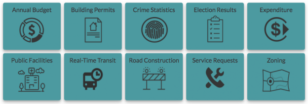
“There’s a serious need for coordination on how governments at all levels classify different types of open data,” Sieber said. “A collaboration with McGill University, this directory provides a comprehensive inventory of how data on transit, road construction, public facilities and more has been classified. It also allows evaluation of different standards to help guide governments in choosing the most useful ones.”
The project emphasizes a collaborative approach that opens a two-way dialogue with municipalities. This allows its creators to better understand what is valued within the decision-making process and to encourage the adoption of specific standards for how open data is released. Users around the world are able and encouraged to contribute additional information and update existing standards.
“Open data improves the lives of hundreds of millions of people, many incrementally and some dramatically,” Andrew Nicklin, GovEx Director of Data Practices, said. “Our new directory will encourage global standards for how data is organized for more effective production and consumption at scale. This will insure an even greater impact on the local government services level.”
Historically, city governments and others have faced several challenges in dealing with open data sets. Among these challenges is a lack of agreement and coordination on how data sets should be structured to best serve the public that are intended to be able to access them. The establishment and organisation of common standards can address this problem by encouraging practices that ensure data is accessible and usable by citizens. It can also ensure that datasets released by differing municipalities will be interoperable.
“The directory’s inventory helps simplify and demystify choices for governments and citizens by answering the question ‘what’s out there?’ but also takes it a step further by assessing the value of these standards to a city’s data provision,” said Jean-Noé Landry, Executive Director of OpenNorth, a Geothink partner in this work. “The directory allows us to align data practices, join up data, and enable emergent data uses. Data interoperability is one key to unlocking open data’s innovation potential and we believe this inventory is a very important step towards it.”
Currently there are over 60 standards on the directory from around the world and in multiple languages. GovEx hope to expand these efforts to continually broaden its range of standards, languages and user-bases.
To find out more about the open data standards directory project, you can listen to Geothink’s podcast on the initial project, catch an update on GovEx’s latest Datapoints podcast or visit the GovEx Beta Data Standards Directory website.
###
If you have thoughts or questions about the article, get in touch with Sam Lumley, Geothink’s newsletter editor, at sam.lumley@mail.mcgill.ca.