Last month, Geothink took part in the GIScience 2016 conference in Montreal, a biennial conference for academics in the field of GIS and geography. Geothink was present as a sponsor. Additionally, multiple Geothink academics were present to engage in academic discussion, and members of Geothink were also involved in the organisation of the conference.
One of our volunteers, Lesley Johnson, reports her experience of the conference.
By Lesley Johnson
The 9th installment of the International GIScience conference was held in Montreal (27-30 September) – the first time the conference has been held in Canada. The conference was ambitious as it covered a lot of ground in 4 days: from a workshop on Machine Learning on Tuesday, to the impact of human intention on geospatial data quality on Thursday, and then finally to the definition and meaning of GIScience itself on Friday.
Perhaps the overarching goal of the conference was to put the sheer breadth of this challenging, shapeshifting, but most of all, exciting, field of study into perspective. How do we categorize GIScience? Where does it fall in the tree of science? Is it indeed a discipline in its own right?
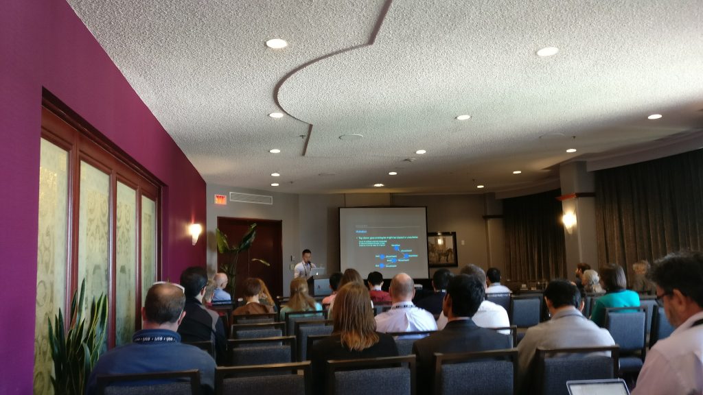
To answer these questions, over 250 attendees from across the globe came together to debate these questions and find out about the latest advances in the field. The conference kicked off on Tuesday with hands-on workshops (“Understanding Spatial Data (big and Small) with Visual Analytics”, “Machine learning methods for spatial and temporal analysis”). Attendees in the Machine Learning tutorial were taught by University College of London’s James Haworth on how to use Support Vector Machine regressions to analyze datasets; an important skill for any budding or experienced GIScientist to have in their back pocket.
Wednesday’s schedule was packed full of exciting and diverse sessions. Following the keynote on the “Internet of Mobile Things”, the Cognition and Place session was held, where attendees were asked to think about “place” beyond the positivist notion of “space”. The importance of spatial scale and cell resolution was also emphasized and re-examined in the Raster Models and Modelling session, moderated by Memorial University’s Rodolphe Devillers. Barbara Buttenfield’s research “measuring distance as the horse runs” was especially interesting, as I had personally never heard of the term before. Differences in spatial resolution can affect distance calculations. Even at local scales, it is important to account for factors such as the curvature of terrain.
Thursday’s keynote on “Artistry in GIScience” by Deniis Hlynsky (Rhode Island School of Design) sparked many an interesting conversation. It pushed scientists to think outside of the academic box, and think about what great beauty there is in the phenomena that we study everyday: from starlings flying across the sky each wing beat captured and superimposed, to cartographic design. Does GIScience always need to be about …science? Can GIArt be a discipline in its own right?
As the conference came to a close on Friday, a final panel of GIScientists was brought together and were asked by Dr. Renee Sieber, one of the main conference organizers, “what is GIScience?” The question led to other questions, such as “Does the title of a researcher determine their funding opportunities, or does the research speak for itself regardless?” and “What name would bring the most attention to a higher education program: spatial data sciences or geographic information sciences?” As a graduate student, most of the conversation seemed pointless: Can’t we just do research and not worry about the semantics of it? I then realized that gaining funding and disseminating your research are crucial to doing research after graduate school. Maybe I do indeed need to think about the implications of the title on my business card a bit more.
Collaboration is also needed between the Geographic Information Systems and the Geographic Information Science; between those who are engaged in GIScience questions (such as those relating to spatial data accuracy), and those who use Geographic Information Systems software for specific domain questions.
Finally, congratulations go to Dr. Renee Sieber, for receiving the Canadian Association of Geographers Lifetime Achievement and GIScience Excellence Award!
The conference was, in short, wide in scope and ambitious in its depth. It achieved its goal of bringing GIScientists (or spatial data analysts, if you will) from across the globe, and pushing the definition of GIScience itself. Needless to say, I look forward to the tenth installment of the GIScience conference – hopefully I’ll have figured out what to call myself by then.