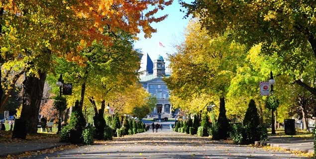
Geothoughts Conversations 4 explores our key research outcomes and influences, and was held near McGill University’s downtown campus in Montreal, Quebec. (Image courtesy of http://jeannesauve.org)
By Sam Lumley
We’re excited to present our 4th episode of Geothoughts Conversations!
This episode recounts a conversation held in June 2018 in the Montreal, QC home of Geothink Head Renee Sieber, a McGill University associate professor in the Department of Geography and School of Environment. It highlighted key research outcomes and influences over Geothink’s journey from beginning to end.
In this episode, we take a look back over five years of fruitful Geothink research. We spoke to Geothink Head Renee Sieber, Co-Applicants Rob Fieck, Daniel Paré and Stéphane Roche, and Geothink students Rachel Bloom and Edgar Baculi about their most memorable experiences with the grant.
Thanks for tuning in. And we hope you subscribe with us at Geothoughts on iTunes. A transcript of this original audio podcast follows.
TRANSCRIPT OF AUDIO PODCAST
Welcome to Geothoughts. I’m Sam Lumley.
[Geothink.ca theme music]
“The Geothink grant that was funded by the social science and humanities research council of Canada is coming to an end. We have done great work in terms of creating new theories, new frameworks, new applications, new data sets new collaborations.”
That was Geothink Head Renee Sieber, an associate professor at McGill University’s Department of Geography and School of Environment. Funded by Canada’s Social Sciences and Humanities Research Council, the Geothink partnership grant has involved 26 researchers and 30 partners, while also training more than 100 students. As the grant wraps up, we’ve been hearing from our researchers and students as they reflect on their involvement in the grant over the past five years.
We started off by speaking to former Geothink student Rachel Bloom about her most memorable experiences with the grant.
“I was the lead of Geothink’s Open Data Standards project when I was a student at McGill University. The most memorable Geothink experience would have to be designing a survey that I delivered to open data publishers at cities in north america about open-data standards. It’s memorable because it was a really challenging process due to my research topic being so new. And it also helped me develop my skills as a researcher for the future.”
The Geothink grant has brought together researchers from many different backgrounds and from different parts of the world. It was this point that Geothink co-applicant Rob Feick, an associate professor in Waterloo University’s School of Planning, emphasised while talking about the influence of Geothink on his own work.
“My research has really benefited from my work with Geothink in a few ways, one of which is Geothink is really a multi disciplinary network. It’s a network of people that span disciplines from geography, law, planning and a host of others. And having these different types of expertise around the table has really helped ground my research.”
“It’s also very applied work we’re working with local regional governments on problems that matter to people, both problems that matter to people right now and those that people are seeing both in the research community and in applied context, coming down the pipe in future years. So one of the ways, just using special data quality as of those areas that a number of us have been looking at and that that I have really benefited from in my exposure in Geothink, is understanding that it is far less of a technical matter and it’s a combination of technical and a social and governance matter, and we’re starting to understand that something that we thought was relatively simple, of spatial data quality, is much more complex.”
This interdisciplinary approach was also highlighted by Sieber, as being essential to exploring how interactions between citizens and government are mediated by technology.
“It’s been marvelous in terms of the interdisciplinary of bringing together geographers lawyers, people in the private sector, people in government to work on issues of what’s happening to the conversations between citizens and cities. And on how can we make sure the technology is not an impediment, but actually enhances that conversation”
Working alongside people from different academic fields can help to offer a broader perspective on the big issues facing citizens and governments. It also led some Geothink researchers to shift their own own research interests. This was the case for Geothink Co-Applicant Stéphane Roche, an associate professor in University Laval’s Department of Geomatics, who talked about his focus moving from the technical to the ethical over the course of the grant.
“My main interest within Geothink was more about social inclusion within a smart city context, spatial justice and ethics, which was quite far from what I was supposed to do at the beginning. So in my case, the move was quite big. Geothink is as a network different sectors, different disciplines, different expertise, and working on these issues around the relationship between spatial and social justice, cities and technology. And that that was really remarkable. I really enjoyed and appreciated the the dynamism and the motivation of our group of students, some of them coming from law, some others from engineering some from social science. And it was really rich in term of interaction.”
Throughout the grant new partnerships and opportunities have emerged, and co-applicant Daniel Paré, an associate professor in the University of Ottawa’s Department of Communication and School of Information Studies, highlighted his new collaborations with the Open Government Partnership.
“My involvement with Geothink has influenced my research in so much as it has opened the door towards getting to work with OGP partnership. So based on my Geothink work in open data and open government, that’s transformed, if you will, into the role with the OGP. Where I’m responsible for overseeing assessments of the implementation of Ontario’s Open Data Action Plan.”
We went on to ask Paré about his most memorable experiences as part of the grant.
“I think the most memorable experience has been working with the great team that was put together, and that includes our great team of students that are brought together every year in terms of the student based meetings and such. So for me that’s always been a highlight of the team actually getting together physically and meeting over a period of three to four days. That’s been key; those sessions always been so rich on multiple levels.”
Opportunities for collaboration and exchange were facilitated by the four Geothink summer institutes. Many collaborators and partners emphasised how helpful it was to bring researchers, partners and students together under one roof. Feick pointed to 2015 Summer Institute held at McGill University as being his most memorable moment.
“I’ve had a lot of memorable moments in this in this project over the years, but I think the one that sticks with me the most was at a summer institute that we had for the Geothink students here at waterloo. The summer institutes are opportunities where students from a variety of different universities could come together and work on an applied problem and learn about a particular aspect of geospatial information and its interfacing with society.”
“Students in this particular summer institute had the task of developing an application. We had teams of students that hadn’t met before that came together over the course of a week and put together some really fantastic applications. And these applications, I think, spurred a lot of their own research that they were going to continue on with, but also was really interesting to see how again the different perspectives that the students brought, along with those people that were assisting them through the SI, actually came to fruition.”
The summer institutes also stood out to former Geothink student Edgar Baculi, now a graduate researcher in Ryerson’s Department of Geography.
“We have all these disciplines and I remember benefing greatly from talking to the economics student, sociologist, communication and journalism students on the topic open data and it opened my mind to the idea of, if we’re talking about open data it’s not just going to be the GIS people who are going to benefit or the academics, it’s going to be the sociology students, it’s going to be a journalist from the Toronto Star, it’s going to be all these people who need to understand what open-data is from their perspective and from other perspectives.”
“So, I would say, Geothink was very important in letting me know the inside from other perspectives. And as for networking, that’s a lot of disciplines to go through, and we were all from across canada, and I think actually a few of us were from the States, if I remember correctly, so it was a great networking experience. Many of them are still friends of mine on twitter and LinkedIn, so, great experience.”
The five-year Geothink Partnership Grant may be coming to its conclusion, but the research and its applications will continue. We asked Sieber what lay in store for Geothink’s research themes, the community the partnership helped to foster and the grant’s continuing work.
“We have transformed, I’m happy to say, the lives of over 100 students. I’d like to think that we transformed the lives of many people in the public sector and the private sector across canada. I know it has certainly transformed my life. It has transformed the life of the researchers involved in this project.”
“So while this grant ends, that doesn’t mean that Geothink as a concept, and a research trajectory has ended. Many of our apps will live on beyond us. Certainly our research and our own research trajectories have been changed as a result, so that work’s going to go on even after the grant ends. And, of course, we’re also looking for new grants to pursue this research!”
[Geothink.ca theme music]
[Voice over: Geothoughts are brought to you by Geothink.ca supported by generous funding from Canada’s Social Sciences and Research Council and generous donations from our grant partners.]
###
If you have thoughts or questions about this podcast, get in touch with Sam Lumley, Geothink’s digital journalist, at sam.lumley@mail.mcgill.ca.
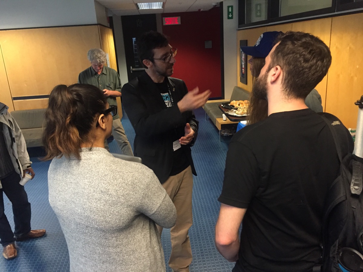
Geothink Co-Applicant Stéphane Roche, associate professor in University Laval’s Department of Geomatics, chats with students during a coffee break at Geothink’s 2017 Summer Institute at McGill University in Montreal, QC.
By Drew Bush
One of the hallmarks of any academic conference are the conversations that take place in-between sessions, in hallways and over meals. In our third Geothink Conversations, we aim to give you a flavor of these discussions at Geothink’s now concluded 2017 Summer Institute.
The theme of this year’s Institute was “Smart City: Toward a Just City.” An interdisciplinary group of faculty and students tackled many of the policy, legal and ethical issues related to smart cities. Each of the three days of the Summer Institute combined workshops, panel discussions and hands-on learning modules that culminated in a competition judged by Montreal city officials and local tech entrepreneurs.
The topic of our conversation was how to make sure human concerns remain paramount in the design of increasingly digital smart cities. It features Open North Executive Director Jean-Noé Landry; Geothink Co-Applicant Stéphane Roche, associate professor in University Laval’s Department of Geomatics; and, Victoria Fast, an assistant professor at University of Calgary’s Department of Geography. And, of course, I’m Drew Bush and I’ll be helping steer the conversation along.
To start us off, Roche got the conversation rolling on how to understand smart cities as a transition from urban living as it has been portrayed since the early 18th century to a new type of city based upon social organization and community that is aided by open data and digital technology.
In this episode, we take a look back at Geothink’s 2017 Summer Institute at McGill University in Montreal, QC from May 25-27. The theme of this year’s Institute was “Smart City: Toward a Just City.” An interdisciplinary group of faculty and students tackled many of the policy, legal and ethical issues related to smart cities.
Each of the three days of the Summer Institute combined workshops, panel discussions and hands-on learning modules that culminated in a competition judged by Montreal city officials and tech entrepreneurs. The goal of the competition was for student groups to develop and assess the major principles guiding Montreal’s 2015-2017 Montréal Smart and Digital City Action Plan.
“Smart cities, what do we even need humans for anymore? As you can see from this morning’s panel, smart cities are more than urban engineering, they’re more than the sensors, they’re more than efficiency. Part of going beyond these things, part of creating empathy—my provocation at the beginning of the break—was…is to engage citizens. And how we actually do that, and how we actually do that in the context of a smart city will be discussed by Pamela Robinson and Rob Feick.”
That’s Geothink Head Renee Sieber, associate professor in McGill’s School of Environment and Department of Geography, addressing Geothink’s 2017 Summer Institute that just concluded this past May 2017. She was kicking off the afternoon presentations and work sessions on day one of Geothink’s annual Summer Institute this year held at McGill University in Montreal, QC from May 25-27. The theme: “Smart City: Toward a Just City.”
Each of the three days of the Summer Institute combined workshops, panel discussions and hands-on learning modules that culminated in a competition judged by Montreal city officials and tech entrepreneurs. The goal of the competition was for student groups to develop and assess the major principles guiding Montreal’s 2015-2017 Montréal Smart and Digital City Action Plan.
“All right, all right, so we’re going to take a few minutes and talk about this idea of civic engagement and how we might conceptualize that in the smart city context. How it might be different from how we think about engagement and civic participation in the pre smart city world. Ok. So. Interesting times: We have a lot of problems. That isn’t meant to get you depressed. I want you to be thinking of this as challenges. So there a lot of interesting, tough challenges that all of us need to apply ourselves to in some way or another.”
Pamela Robinson, associate professor in Ryerson University’s School of Urban and Regional Planning, added to this call for action by presenting the work of her graduate students who created an evaluative framework for smart cities as part of Geothink.
“Ok. So I’m asking everyone to dig into your blue bags and pull out the piece of paper that looks like this. And I’m going to transition from Rob’s talk about broad ways of thinking about civic engagement in the smart city to transitioning to a tool that was created by graduate students of mine as part of this project last fall as part of Geothink. And we wanted to share it for a couple of reasons. One, one of the challenges I think when you bring people together of different disciplinary backgrounds is that people have different ways of talking about the same kinds of issues.”
“And one of the things we hope that you’ll have kind of expanded capacity over the course of this two and a half days is you’re going to learn how to listen and talk to each other slightly differently. And one of the ways we want to accelerate that is by giving you something to think about. The other reason I want to bring it forward is I’m really proud of the work these students did. And I think it’s a good way of showing you as students inside this grant that your work can make a difference.”
This theme of empowering the next generation of academics and practitioners to build more just and sustainable smart cities of the future was woven throughout the three days of sessions. It grew more tangible later in the first day when students heard from Montreal City Council Chairman Harout Chitilian. In an interview after his talk, he expressed a need for people to hire who possess unique skillsets and competencies important to designing services for smart cities such as his.
“Process improvement is a very complex and difficult task. Like I said, technology is the easy part. And process improvement takes those skillsets that I mentioned [in my talk]. For example, you know, very talented project and program managers that can put in place transformational projects to rethink the services of the city of Montreal. You need to have also different competencies—not only technological. But, for example, legal backgrounds, regulatory backgrounds—to make sure that your future new and improved processes comply with the legislation and the and regulatory framework in which that you are operating in. So, biggest challenge, bar none for me, is to hire, to retain, and to train the best skilled workers. Because skillsets, competency is the main ingredient to achieving all these different exciting initiatives.”
In Montreal, plans include improving the cities smart offerings in a variety of areas that require trained workers.
“I think we need to make very strong progress in the transit domain, so have real-time data of all the transit assets of the city of Montreal. We need to also have real-time data, like I said, for beach goers. For using the different beaches now. The portals are setting up. There is one in Verdun. So environments—so water quality data, air quality data. So that is very very important going forward. And last but not least for me, we also need to have democracy related data that is available to our citizens. For example, how your elected official voted on a certain subject.”
Chitilian set the stage for the three-day Institute but its faculty and participants kept each talk and activity lively and engaging. Thanks to Geothink’s five-year length as a grant, many relationships have been shaped by years of collaboration between co-applicants, collaborators, partners and students. As a result, the Summer Institute can be a good time to reflect.
For one former Geothink graduate student who is now an assistant professor in the Department of Geography at University of Calgary, that means considering the progress Geothink has made educating her peers on topics such as smart cities, open data, crowdsourcing and volunteered geographic information. Those have been the topics of the four summer institutes hosted by the grant—each of which Victoria Fast has attended.
“Actually, interestingly, something we haven’t touched upon yet is the synergy between all of them. You know, Institute number one in Waterloo was volunteered geographic information (VGI) and crowdsourcing, the second one in Toronto was crowdsourcing, and this one is smart cities. And all of those concepts are just so fundamentally embedded in each other. And for—I think students who have been to all of them really get this diverse and rich perspective on Geothink from these kind of very relevant topical areas.”
[Geothink.ca theme music]
[Voice over: Geothoughts are brought to you by Geothink.ca and generous funding from Canada’s Social Sciences and Humanities Research Council.]
###
If you have thoughts or questions about this podcast, get in touch with Drew Bush, Geothink’s digital journalist, at drew.bush@mail.mcgill.ca.
Geothoughts is back! In this episode of the podcast we sit down with two Geothink research partners, Open North and Ajah, to talk about the challenges they face in Canada’s current open data and open government environment. Jean-Noe Landry (of Open North) and Michael Lenczner (of Ajah) are some of the original advocates for open data in Montreal and continue on their mission to bring positive change and innovation to government. Our guests spoke of their background advocating for open data in the (now closed) non-profit, Montreal Ouvert, and the current challenges they face in their respective organisations. They stressed the need for well-defined missions for advocacy, and for continued support from government and non-governmental funders.
We also have a new host, and some new intro music. If you have feedback on this podcast, please contact me at suthee.sangiambut@mail.mcgill.ca
Thank you for tuning in. We hope you subscribe to Geothoughts on iTunes, and follow us on Twitter @geothinkca
In this episode, we take a look at two Geothink researchers who are investigating how the popular video game Minecraft can be used to improve local and regional planning processes. In particular, we talk with Ryerson University Gold Medal award winner Lisa Ward Mathers, and Ryerson master’s student Jacky Li. Both have worked with Geothink Co-Applicant Pamela Robinson, associate dean in Ryerson University’s School of Urban and Regional Planning.
“We also wanted to build, how do you say, just an open web kind of thing where you can log on and start building away at the city of Toronto. So the vision was to have all of Toronto built in Minecraft and that’s where I came in. I tried to—they hired me to get the program up and going. But I didn’t know how to start. So my research basically consisted of how we would do something like this.”
That’s Ryerson University Master’s Student Jacky Li talking about his work with Minecraft. Li is a student with Geothink Co-Applicant Pamela Robinson, associate dean in Ryerson University’s School of Urban and Regional Planning. Last summer, he interned with the City of Toronto’s Office of the Chief Planner.
Minecraft isn’t so much a game but rather a destination, a technical tool, and a cultural scene all rolled into one program. Children who use it can engineer complex machines; model the world in cube-like form; shoot and post YouTube videos of their work; and setup servers where they can hang out with their friends. The software, initially launched by Mojang (a Swedish game studio) in 2009, now boasts more than 100 million users. Microsoft recently bought it and Mojang for a record $2.5 billion.
“So I looked at examples of, in Sweden, they had really good one with between the architects and the government where they just focused on a suburb and they had users go in and start building. And then last summer, the graduating class of Niagara College [in Welland, Ontario] translated some GIS data into Minecraft. And I contacted them and they taught me how to do it.”
“Yeah so, at the end of it what I made for the city of Toronto was a report that said how to build like the sub-server thing, how to host it, and some potential programming they can do with children such as like a floor area ratio exercise where you can imagine density. So if you’re given solar power, how many blocks can you build different kinds of built forms depending on the criteria of the exercise . Yeah and just stuff like that.”
Li grew up as part of the Minecraft generation. For him, “It’s just a popular computer game where you basically craft things. It’s kind of like Lego, but on your computer, or on your Xbox or PlayStation, or on your mobile phone.”
His work was inspired by another student at Ryerson who wrote a report for the City of Toronto on the educational potential of a tool such as Minecraft that engages students with sometimes complex computer science in an immersive environment. Li is not alone in Geothink as a researcher working to determine how Minecraft can empower communities in urban planning decisions.
“From there I asked them specifically about different contexts within which Minecraft could potentially be used. Different scales, like for instance, a committee of adjustment or, you know, larger scales from there like an official plan review. I’m sort of asking what do you think, would this work in this context. What are your sort of initial impressions?”
That’s Lisa Ward Mather on her master’s research project she completed in 2014 at Ryerson University also with Robinson. She’s describing her work interviewing 12 planning officials to determine the usefulness of Minecraft for those working in regional and local urban planning.
In 2014, she graduated as the recipient of the Ryerson Gold Medal for her thesis work that was cited for combining academic proficiency with community engagement in a meaningful way.
“It wasn’t an interview with Minecraft experts by any means. A few of my respondents had encountered the game in a very, you know, not very intensive setting. I mean no one had really sat down and played extensively. But luckily Minecraft is a not a terribly difficult thing to explain to someone, especially with visuals. And I was able to get some really interesting observations from the people I spoke to.”
Her project interrogated whether planners felt open to using Minecraft and whether they thought it would engage the public. She also asked what possible benefits and obstacles they foresaw in specific applications. Her findings largely showed that it could be a useful tool for engaging the public in planning decisions, but obstacles such as it’s cost as well as the cost of equipment needed to support it could limit use.
Mather’s work did not stop after her graduation.
“I was in communication with a staff member from the office of the chief planner at the city of Toronto. And they, as you know, they are interested in trying new tools and using new tools in different ways, and engaging people in ways maybe they’re not used to being engaged. And so they were interested in seeing what could be done with the game.
“So, we, after some discussion, concluded that one possibility would be to have them send me some SketchUp files, Google SketchUp files, of a corridor in Toronto. And to produce a Minecraft world that had both what that corridor looks like right now, what it would like in the near future when there are more mid-rise buildings lining the sides of the streets, and then the in the far future when the entire corridor is lined with mid-rise buildings. So, I, after a fair amount of experimentation, and, uh, and this is something I had never done before. So I looked at what various tools that were available online and I was able to produce those three models within the same Minecraft world.”
“And I built a little rail car down the middle of the street so that the user rode from the present to the near future and then to the far future. And I made a movie of that which then they played at an event that they were holding from the Office of the Chief Planner.”
This small project has opened interesting possibilities for the City of Toronto to engage citizens with a unique tool like Minecraft. From Sweden to Canada, the Minecraft generation may one-day grow up to design the cities of the future.
[Geothink.ca theme music]
[Voice over: Geothoughts are brought to you by Geothink.ca and generous funding from Canada’s Social Sciences and Humanities Research Council.]
###
If you have thoughts or questions about this podcast, get in touch with Drew Bush, Geothink’s digital journalist, at drew.bush@mail.mcgill.ca.
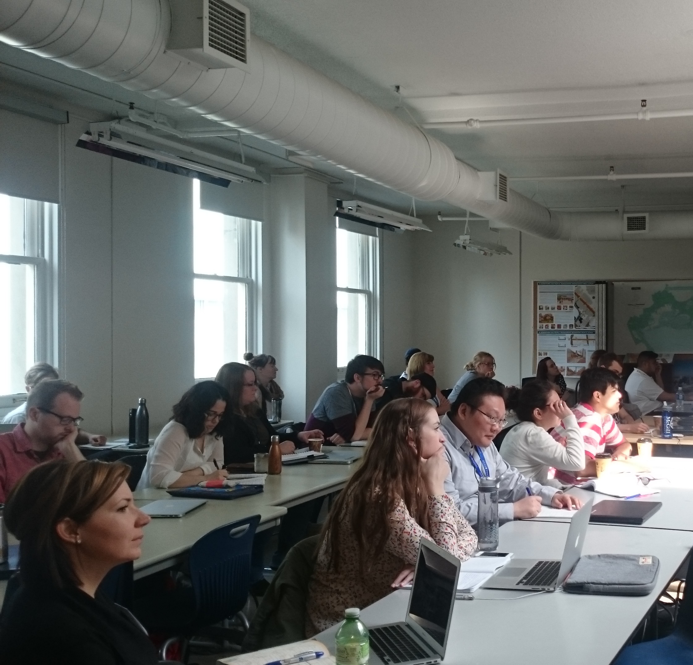
In this episode, we take a look at the just concluded 2016 Geothink Summer Institute. Students at this year’s institute learned difficult lessons about applying actual open data to civic problems through group work and interactions with Toronto city officials, local organizations, and Geothink faculty. The last day of the institute culminated in a writing-skill incubator that gave participants the chance to practice communicating even the driest details of work with open data in a manner that grabs the attention of the public.
Held annually as part of a five-year Canadian Social Sciences and Humanities Research Council (SSHRC) partnership grant, each year the Summer Institute devotes three days of hands-on learning to topics important to research taking place in the grant. This year, each day of the institute alternated lectures and panel discussions with work sessions where instructors mentored groups one-on-one about the many aspects of open data.
The 2016 Geothink Summer Institute wrapped up during the second week of May at Ryerson University in Toronto. Held annually as part of a five-year Canadian Social Sciences and Humanities Research Council (SSHRC) partnership grant, each year the Summer Institute devotes three days of hands-on learning to topics important to research taking place in the grant.
The 35 students at this year’s institute learned difficult lessons about applying actual open data to civic problems through group work and interactions with Toronto city officials, local organizations, and Geothink faculty. The last day of the institute culminated in a writing-skill incubator that gave participants the chance to practice communicating even the driest details of work with open data in a manner that grabs the attention of the public.
On day one, students confronted the challenge of working with municipal open data sets to craft new applications that could benefit cities and their citizens. The day focused on an Open Data Iron Chef that takes it name from the popular television show of the same name. Geothink.ca spoke to the convener of the Open Data Iron Chef while students were still hard at work on their apps for the competition.
“Richard Pietro, OGT Productions and we try to socialize open government and open data.”
“You have such a variety of skill sets in the room, experience levels, ages, genders, ethnicities. I think it’s one of the most mixed sort of Open Data Iron Chefs that I’ve ever done. So I’m just excited to see the potential just based on that.”
“But I think they’re off to a great start. They’re definitely, you know, eager. That was clear from the onset. As soon as we said “Go,” everybody got into their teams. And it’s as though the conversation was like—as though they’ve been having this conversation for years.”
For many students, the experience was a memorable one. Groups found the competition interesting as they worked to conceptualize an application for most of the afternoon before presenting it the institute as a whole.
“More in general, just about the sort of the challenge we have today: It’s kind of interesting coming from like an academic sort of standpoint, especially in my master of arts, there is a lot of theory around like the potential benefits of open data. So it’s kind of nice to actually be working on something that could potentially have real implications, you know?”
That’s Mark Gill, a student in attendance from the University of British Columbia, Okanagan. His group worked with open data from the Association of Bay Area Governments Resilience Program to better inform neighborhoods about their level of vulnerability to natural hazards such as earthquakes, floods, or storms. The application they later conceptualized allowed users to measure their general neighborhood vulnerability. Specific users could also enter their socioeconomic data to gain their own individual vulnerability.
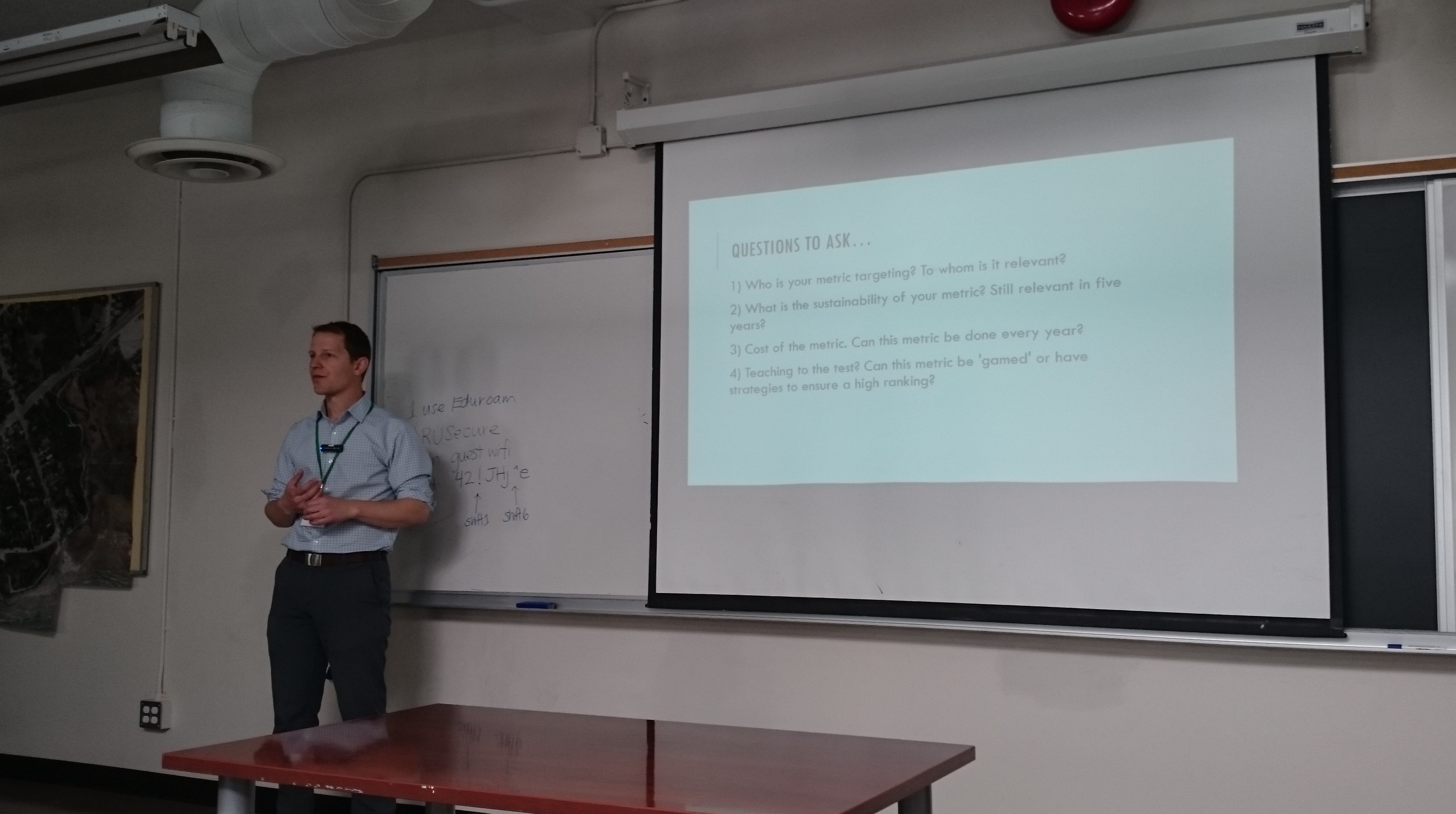
On day two, students heard from four members of Geothink’s faculty on their unique disciplinary perspectives on how to value open data. Here we catch up with Geothink Head Renee Sieber, an associate professor in McGill University’s Department of Geography and School of Environment, as she provided students a summary of methods for evaluating open data. Sieber started her talk by detailing many of the common quantitative metrics used including the counting of applications generated at a hackathon, the number of citizens engaged, or the economic output from a particular dataset.
“There’s a huge leap to where you start to think about how do you quantify the improvement of citizen participation? How do you quantify the increased democracy or the increased accountability that you might have. So you can certainly assign a metric to it. But how do you actually attach a value to that metric? So, I basically have a series of questions around open data valuation. I don’t have a lot of answers at this point. But they’re the sort of questions that I’d like you to consider.”
After hearing from the four faculty members, students spent the rest of the day working in groups to first create measures to value open data, and, second, role-play how differing sectors might use a specific type of data. In between activities on day two, students also heard from a panel of municipal officials and representatives of Toronto-based organizations working with open data.On day three, students transitioned to taking part in a writing-skills incubator workshop run by Ryerson University School of Journalismassociate professors Ann Rahaula and April Lindgren. Students were able to learn from the extensive experience both professors have had in the journalism profession.
“I’m going to actually talk a little about, more broadly, about getting your message out in different ways, including and culminating with the idea of writing a piece of opinion. And, you know, today’s going to be mostly about writing and structuring an Op-ed piece. But I thought I want to spend a few minutes talking about the mechanics of getting your message out—some sort of practical things you can do. And of course this is increasingly important for all the reasons that Ann was talking about and also because the research granting institutions are putting such an emphasis on research dissemination. In other words, getting the results of your work out to organizations and the people who can use it.”
For most of her talk, Lindgren focused on three specific strategies.
“So, one is becoming recognized as an expert and being interviewed by the news media about your area of expertise. The second is about using Twitter to disseminate your work. And the third is how to get your Op-ed or your opinion writing published in the mainstream news media whether it’s a newspaper, an online site, or even if you’re writing for your own blog or the research project, or the blog of the research project that you’re working on.”
Both Lindgren and Rahaula emphasized how important it is for academics to share their work to make a difference and enrich the public debate. Such a theme is central to Geothink, which emphasizes partnerships between researchers and actual practitioners in government, private, and non-profit sectors. Such collaboration makes possible unique research that has direct impacts on civil society.
At the institute, this focus was illustrated by an invitation Geothink extended to Civic Tech Toronto for a hackathon merging the group’s members with Geothink’s students. Taking place on the evening of day two, the hack night featured a talk by Sieber and hands-on work on the issues Toronto citizens find most important to address in their city. Much like the institute itself, the night gave students a chance to apply their skills and knowledge to real applications in the city they were visiting.
[Geothink.ca theme music]
[Voice over: Geothoughts are brought to you by Geothink.ca and generous funding from Canada’s Social Sciences and Humanities Research Council.]
###
If you have thoughts or questions about this podcast, get in touch with Drew Bush, Geothink’s digital journalist, at drew.bush@mail.mcgill.ca.
Peter Johnson was one of four Geothink Co-Applicants who gave presentations on day two of the 2016 Geothink Summer Institute. Listen to their lectures here as podcasts.
By Drew Bush
Geothink’s Summer Institute may have concluded but, for those of you who missed it, we bring you four talks to remember. These lectures come from day two of the institute when four Geothink faculty members gave short talks on their different disciplinary approaches to evaluating open data.
Students at this year’s institute learned difficult lessons about applying actual open data to civic problems through group work and interactions with Toronto city officials, local organizations, and Geothink faculty. The last day of the institute culminated in a writing-skill incubator that gave participants the chance to practice communicating even the driest details of work with open data in a manner that grabs the attention of the public.
Held annually as part of a five-year Canadian Social Sciences and Humanities Research Council (SSHRC) partnership grant, each year the Summer Institute devotes three days of hands-on learning to topics important to research taking place in the grant. This year, each day of the institute alternated lectures and panel discussions with work sessions where instructors mentored groups one-on-one about the many aspects of open data.
Below we present you with a rare opportunity to learn about open data with our experts as they discuss important disciplinary perspectives for evaluating the value of it. You can also subscribe to these Podcasts by finding them on iTunes.
Geothoughts Talk 4: Reflecting on the Success of Open Data: How Municipal Governments Evaluate Open Data Programs
Join Peter Johnson as he kicks off day two of Geothink’s 2016 Summer Institute by inviting students to dream that they are civil servants at the City of Toronto when the city receives a hypothetical “F” rating for its open data catalogue. From this starting premise, Johnson’s lecture interrogates how outside agencies, academics, and organizations evaluate municipal open data programs. In particular, he discusses problems with current impact studies such as the Open Data 500 and what other current evaluation techniques look like.
Geothoughts Talk 5: The Value of Open Data: A Legal Perspective
Teresa Scassa starts our fifth talk by discussing how those working in the discipline of law don’t usually participate in the evaluation of open data. While those in law don’t actually evaluate open data, however, legal statutes often are responsible for mandating such valuation, she argues. In particular, legal statutes often require specific types of data to be open. Furthermore, provisions in Canadian law such as the Open Courts Principle mean that many aspects of Canada’s legal system can be open-by-default.
Geothoughts Talk 6: Open Data: Questions and Techniques for Adding Civic Value
Pamela Robinson dispels the notion that open data derives value from economic benefits by instead discussing how such data can be used to fundamentally shift the relationship between civil society and institutions. She elaborates on this idea by noting that not all open data sets are created equal. Right now, she argues, the mixed ways in which open data is released can dramatically impact whether or not it’s useful to civic groups hoping to work with such data.
Geothoughts Talk 7: Measuring the Value of Open Data
In a talk that helps to summarize the previous three presenters, Renee Sieber discusses the different ways in which open data can be evaluated. She details many of the common quantitative metrics used—counting applications generated at a hackathon, the number of citizens engaged, or the economic output from a particular dataset—before discussing some qualitative indicators of the importance of a specific open data set. Some methods can likely capture certain aspects of open data better than others. She then poses a series of questions on how one can actually attach a value to the increased democracy or accountability gained by using open data.
If you have thoughts or questions about these podcasts, get in touch with Drew Bush, Geothink’s digital journalist, at drew.bush@mail.mcgill.ca