Category Archives: Geothink News

Tackling The Thornier Issues Plaguing Smart Cities – Geothink Summer Institute Day 2

Day two of Geothink’s 2017 Summer Institute at McGill University in Montreal, QC featured presentations by faculty on the pressing issues facing smart cities.

By Drew Bush

On day two of Geothink’s 2017 Summer Institute at McGill University in Montreal, QC, students got their hands dirty investigating the important issues facing smart cities. Each group presented unique findings in answer to a question they were asked to investigate from the disciplines of law, geomatics and geography.

The theme of this year’s Institute was “Smart City: Toward a Just City.” An interdisciplinary group of faculty and students tackled many of the policy, legal and ethical issues related to smart cities. Each of the three days of the Summer Institute combined workshops, panel discussions and hands-on learning modules that culminated in a competition judged by Montreal city officials and tech entrepreneurs. The goal of the competition was for student groups to develop and assess the major principles guiding Montreal’s 2015-2017 Montréal Smart and Digital City Action Plan.

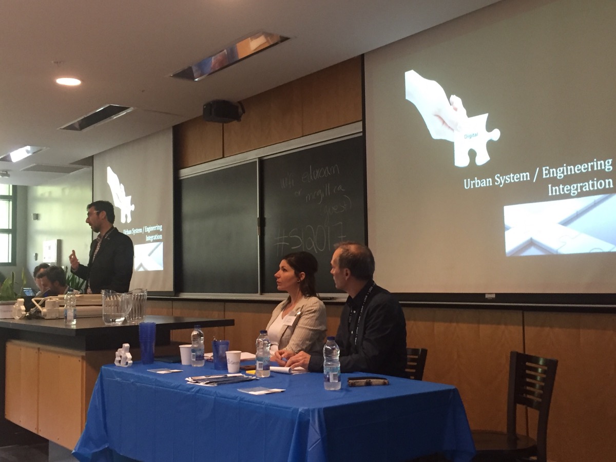
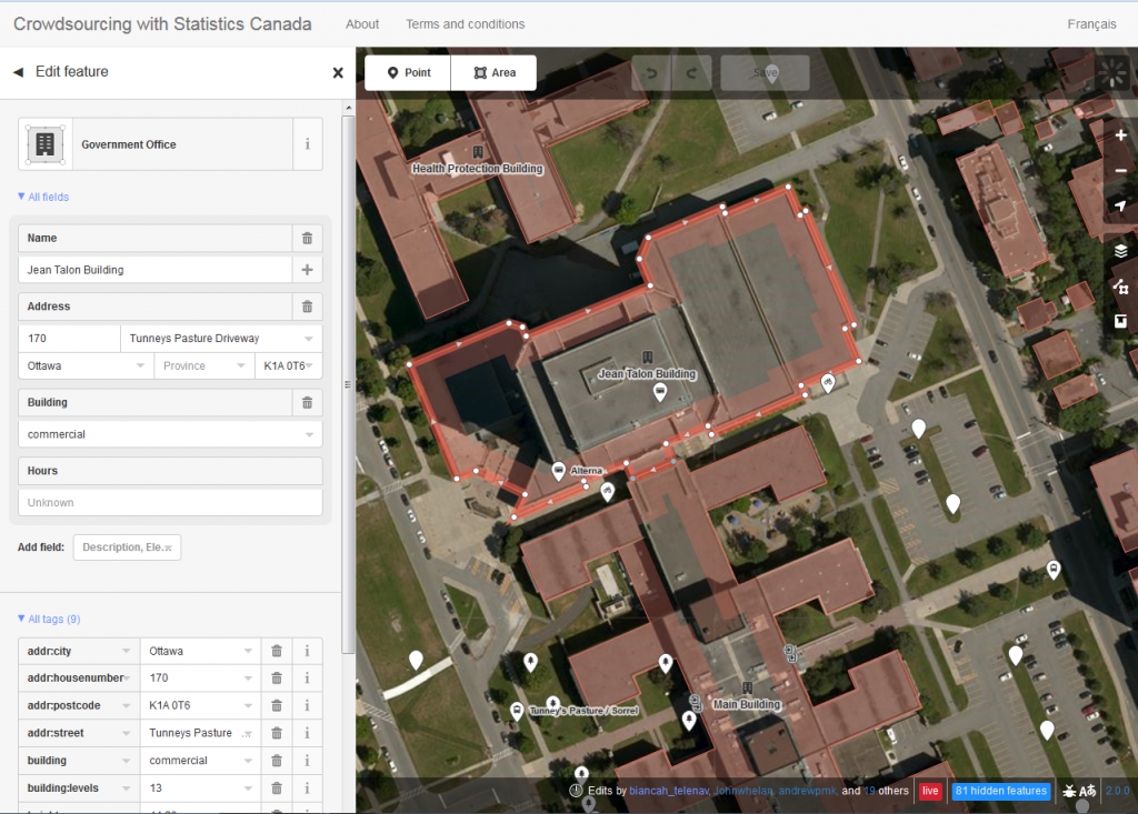
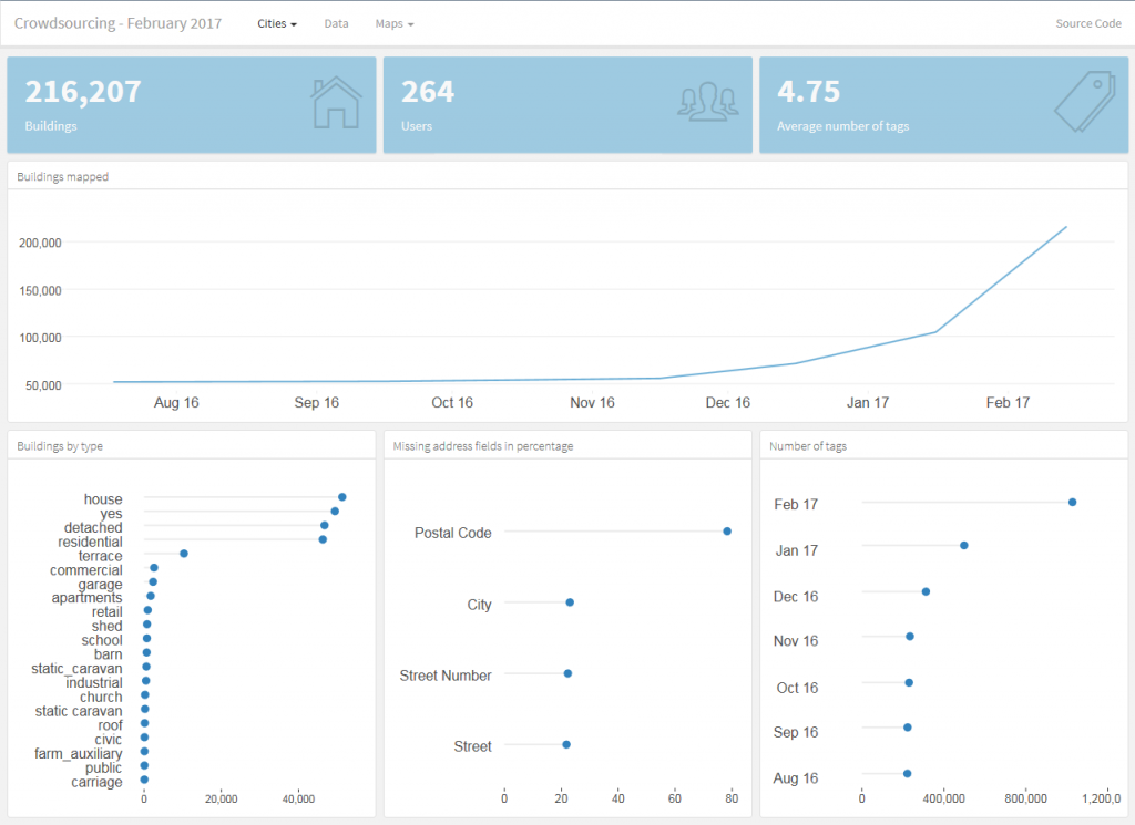
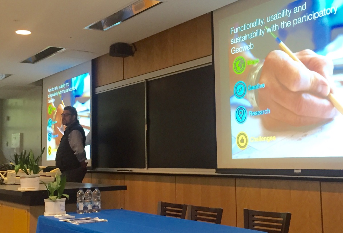
Before undertaking their own research, students heard from Institute faculty with expertise in each of the areas they were asked to investigate during half-hour presentations. This began with a presentation on the online, participatory mapping tool, GeoLive, by Geothink Co-Applicant Jon Corbett, associate professor in University of British Columbia at Okanagan’s Department of Geography. He was followed by Geothink Co-Applicant Teresa Scassa, Canada research chair in University of Ottawa’s Faculty of Law, who talked about the legal issues surrounding the development of applications (APPs) in smart cities. Geothink Co-Applicant Stéphane Roche, associate professor in University Laval’s Department of Geomatics, finished the morning by talking about ethics in smart cities.

“So law is in many respects about relationships, and certainly in this context is about relationships,” Scassa told students during her presentation. “And so one of the things you need to do when you are looking at and thinking about legal issues in this context is to think about what particular legal relationship or relationships you are talking about and you are thinking about. So, for example, a city may be thinking about entering into a contract with a particular service provider for a smart city’s service or a smart city’s APP. And that—there will be a relationship defined in legal terms between the city and the service provider at that point. And so that’s one relationship.”

“And there are going to have to be certain things worked out in the context of that particular relationship between the city and the service provider,” Scassa added. “The city that enters into a contract for that service may then also have a relationship with the users of that service. And so that’s another relationship. And it’s a relationship the city has to think about in terms of how it wants to define that relationship with its users.”

“There are two things that I really appreciate,” Geothink Co-Applicant Stéphane Roche, associate professor in University Laval’s Department of Geomatics, said. “The first one is the idea of talking about and thinking about smart cities without talking about smart cities. And that was the case this morning. And especially by—with the first presentation by [Jon Corbett]. I guess that what Jon has presented, you know, about participatory mapping for a community was and is really valuable for our reflection about smart cities.”

“It’s not a question of technology,” Roche added before noting that the second thing he appreciated was the interdisciplinarity of the presentations and students. “The main issue is involving community. The main issue is designing solutions that are in line with their view of space—[a community’s] view of their relationship with space.”

At the conclusion of the presentations, each student group was presented with a unique question that they had to answer. Questions were derived from each discipline and speaker’s presentation. They asked students to conduct research on how society should evaluate the usability and functionality of smart city APPs and how the additional data and APPs from a smart city create legal liability for cities that doesn’t fit within the policy structure that already exists.

“We are assessing the impact of like, I guess, the Geolive initiative,” Selasi Dokenoo, an undergraduate student at Ryerson University, said. “To clarify what it’s like and how do we assess the impact and benefits of this type of program.”

A different group worked with another site, iSearch Kelowna, for their question. The Web site makes use of open data to aid people in finding low-income rentals, supportive housing or emergency shelters within the City of Kelowna.

“For the exercise, the question is related to feedback,” Ali Afghanteloee, a doctoral student at Laval University, said. “Evaluating the functionality and usability of the web services about Kelowna. First of all, we’ve found out what is the criteria [for] evaluation. And, second, what are the tools to evaluate this kind of criteria. It’s just—we decided that, I think, that the quality criteria is very important because we decided that the user is very important. The usability. And spatially whether creating this site to find out what the services are—whether this is useable or not.”

The day concluded with each group presenting findings on what they had found during their research. For many, this proved enlightening and related well to their own work back at their home university.

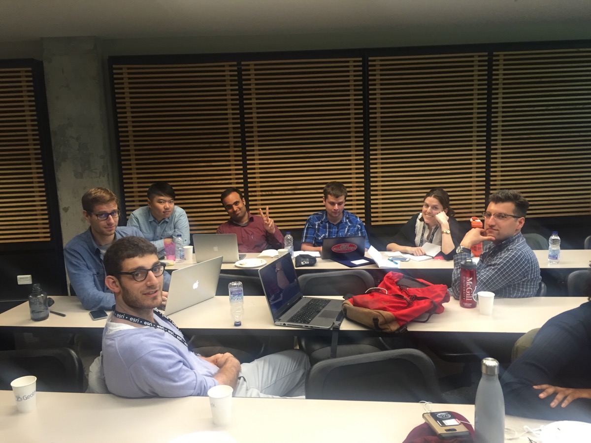
Student groups worked on day two to answer research questions posed by the panelists about smart cities.

“Well, I’m interested in policy mobility,” Brennan Field, a doctoral student at University of Saskatchewan, said. “So it’s been interesting in the past few days just looking at how smart cities, in terms of an urban policy space, have become mobile and have been spreading. And so in the case of the Montreal it was interesting hearing [Harout Chitilian] speaking of how the police department is using open data to report crime. And then their initial reticence and then kind of opening up to it. So I was already familiar with that—basically that has been how police departments generally respond to that particular policy. The policy of open data related to reporting police activity.”

“And seeing how a lot of it is cross-overs between how open data as urban policy has become mobile and how smart cities as urban policy has become mobile,” Field added. “So there are a lot of similarities and cross-overs with my research. So that’s what I’ve learned.”

###

If you have thoughts or questions about the article, get in touch with Drew Bush, Geothink’s digital journalist, at drew.bush@mail.mcgill.ca.

Bringing Smart Cities to an Interdisciplinary Group of Scholars – Geothink Summer Institute Day 1

A panel introduces the idea of a smart city to students at Geothink’s 2017 Summer Institute at McGill University in Montreal, QC.

By Drew Bush

The term smart cities can mean one thing to a scholar of geomatics and something entirely different to an urban planner. The morning panelists on the first day of Geothink’s 2017 Summer Institute at McGill University in Montreal, QC enlightened more than 30 students and visitors on their perspectives.

The panel kicked off the main theme of this year’s gathering: “Smart City: Toward a Just City.” Each of the three days of the Summer Institute combined workshops, panel discussions and hands-on learning modules that culminated in a competition judged by Montreal city officials and tech entrepreneurs. The goal of the competition was for student groups to develop and assess the major principles guiding Montreal’s 2015-2017 Montréal Smart and Digital City Action Plan.

Discussion began with introductions by Geothink Head Renee Sieber, associate professor in McGill’s School of Environment and Department of Geography. Presentations were given by Stephane Guidoin, open data chief advisor in Montreal’s Smart and Digital City Office and Geothink Co-Applicants Stéphane Roche, associate professor in University Laval’s Department of Geomatics; Pamela Robinson, associate professor in Ryerson University’s School of Urban and Regional Planning; Rob Feick, associate professor in Waterloo University’s School of Planning; Teresa Scassa, Canada research chair in University of Ottawa’s Faculty of Law; and Victoria Fast, an assistant professor at University of Calgary’s Department of Geography.

“I work on the smart city and especially on the way digital technology, geospatial technology could improve the capability of citizens to be more engaged in cities,” Roche told students to begin the panel discussion. “And this is why for me, smart is really linked to citizen engagement.”

“Smart cities, for me, is based on four components,” he added. “The first one is digital, so that means the integration of engineering the urban systems, so it’s really about urban engineering and improving the efficiency of engineering structure for urban management. The second component is open, so a smart city means opening cooperation and participation. The third one is this idea of being able to give an answer for different issues based on the use of sensing, learning and sharing. This is the component where citizen engagement is really, really important. And the fourth one is this idea of urban innovation. A smart city is also really linked to this idea of innovation. Not only economical innovation but the way we build cities. And the way we build living space for people.”

Not all the panelists focused on citizen-engagement or new sensors being installed in cities. Robinson spoke on how urban planners talk about smart cities. She noted that the role of planners is to consider the public good and how this should be defined and protected in the development of smart cities in relation to issues of sustainability, equity and inclusion. Scassa noted that she teaches law and, therefore, she thinks of smart cities as sensor-laden cities that make much new data available. For her, this opens many new questions for governance processes and personal privacy.

Later in the day, Montreal City Council Chairman Harout Chitilian introduced students to the ways in which Montreal aims to blend open data, new tech and entrepreneurship to make Montreal a leader in smart cities. He spoke at the Institute even as outside McGill the city celebrated its 375th anniversary. In an interview afterwards, he offered a practical perspective on what being a smart city meant for Montreal residents.

“So first and foremost, you get accountability,” Chitilian said. “So you know where your tax dollars are going in terms of as far as the services are concerned. You know how your contracts are being managed as far as who it’s being given out to and what are the concentration of contracts in certain areas. And you also have accountability from your public safety/police forces that have now a transparent way of reporting a crime map from the city of Montreal.”

“And then now, bit-by-bit, on a service-by-service basis, you also have real-time data of the progress of the services that are delivered to you,” he added. “And we started with snow removal but there will be much more in years to come.”

After more in-depth presentations on civic engagement by Feick and Robinson, accessibility by Fast and free public Wi-Fi by Guidoin, the day transitioned into its first student activity. Groups were asked to answer three questions about McGill’s campus and enrolling as a student. The catch was that half the groups could use free campus Wi-Fi (which Chitilian had just announced as part of the city’s plan) and the other half could not use any online sources.

“I think it was a good chance to re-think about the internet that’s available in different places,” said Wonjun Cho, an undergraduate student at McGill. “I think it was personally easier to find many places using Internet and Wi-Fi. And, yeah, it would have been interesting if I had an experience in analogue as well to compare. But overall it was a lot of fun.”

As a resident of Montreal, Cho also felt strongly about the city’s move to install free public Wi-Fi.

“There are many tourists who visit Montreal every year,” Cho added. “And, especially international tourists, they often find a hard time to get place to place. And these days so many people use apps and Google maps and trip sites to find hotels. And it would definitely be an enhanced experience for visitors to Montreal. And also for people who live here because not many people have unlimited amounts of data on their cell phones.”

As the day drew to a close, students were led in a discussion by Sieber on what they knew about smart cities prior to their arrival and how the day’s events had changed their perspectives. In attendance were students of mixed disciplines ranging from geography and urban planning to law and geomatics.

“If you see what’s going on right now with the group work, getting students from different universities, from different parts of Canada—let’s face it from different disciplines—bringing together their own set of experiences and skills into a group learning situation, I think that’s a meaningful outcome as well,” Geothink Co-Applicant Jon Corbett, associate professor at University of British Columbia at Okanagan’s Department of Geography, said. “So I’m really happy to see how well the students seem to be getting on, how well they work together in small groups, and I think that, hopefully, will be laying the foundation for, you know, for future graduate students. So that when they go to conferences or, who knows, when they become academics, they will already have that relationship or those relationships in place.”

###

If you have thoughts or questions about the article, get in touch with Drew Bush, Geothink’s digital journalist, at drew.bush@mail.mcgill.ca.


A New Narrative for Collecting Statistical Data: Statistics Canada’s Crowdsourcing Project

This is a guest post from Statistics Canada on their new initiative on crowdsourcing geospatial data

Statistics Canada’s crowdsourcing project offers an exciting new opportunity for the agency to collaborate with stakeholders and citizens to produce and share open data with the general public — that is to say, data that can be freely used and repurposed.

Data collection is evolving with technology; for example, paper-based and telephone surveys are increasingly replaced with online surveys. With an array of modern technologies that most Canadians can access, such as Web 2.0 and smartphones, a new mechanism for data sharing can be piloted through open data platforms that host online crowds of data contributors. This project provides insight into how Statistics Canada can adapt these modern technologies, particularly open source tools and platforms, to engage public and private stakeholders and citizens to participate in the production of official statistics.

For the pilot project, Statistics Canada’s goal is to collect quality crowdsourced data on buildings in Ottawa and Gatineau. The data include attributes such as each building’s coordinate location, address and type of use. This crowdsourced data can fill gaps in national datasets and produce valuable information for various Statistics Canada divisions.

On September 15, 2016, Statistics Canada launched a web page and communications campaign to inform and motivate the citizens of Ottawa and Gatineau to participate in the pilot project. This pilot project is governed and developed by Statistics Canada’s Crowdsourcing Steering Committee. Statistics Canada’s communications with the local OpenStreetMap (OSM) community and collaboration with stakeholders and municipalities have allowed the pilot project to succeed.

To crowdsource the data, the project uses OpenStreetMap, an open source platform that aims to map all features on the Earth’s surface through user-generated content. OSM allows anyone to contribute data and, under the Open Data Commons Open Database License (ODbL), anyone can freely use, disseminate and repurpose OSM data. In addition to the web page and campaign to encourage participation, Statistics Canada developed and deployed a customized version of OSM’s iD-Editor. This adapted tool allows participants to seamlessly add points of interest (POIs) and polygons on OSM. The platform includes instructions on how to sign up for OSM and how to edit, allowing anyone, whether tech-savvy or not, to contribute georeferenced data (Figure 1).

Figure 1. Snapshot of the customized version of OSM’s iD-Editor. Users can select a building or POI to see the attributes. Users can edit these attributes or they can create an entirely new point or area.

Statistics Canada has maintained communications with its stakeholders and participants through outreach, and has monitored contributions through dashboards. Outreach has taken place by communicating with the global and local OSM communities by using mailing lists and having local meetups, as well as by organizing webinars, presenting at local universities and participating in conferences associated with open data. Negotiation and collaboration with the City of Ottawa have also opened building footprints and addresses for contributors to add to the map.

The project has been monitored using an open source dashboard developed by Statistics Canada. The dashboard provides a timeline (currently covering August 2016 to February 15, 2017) that specifies the number of buildings mapped, the number of users and the average number of tags contributed on OSM in each target city. Furthermore, it shows the amount of certain building types (e.g., house, residential, commercial) and the number of missing address fields by percentage (Figure 2). In general, the dashboard highlights the increased OSM contributions in Ottawa and Gatineau since the initiation of the project.

Figure 2. The open source dashboard monitors the production of data on OSM within the pilot project’s geographic scope of Ottawa and Gatineau. In the image above, both Ottawa and Gatineau have been selected. As seen in the top graph, buildings mapped in both cities have increased since the project’s initiation.

In the second year of the pilot project, Statistics Canada intends to develop a mobile app that will allow contributors to map on the go. Outreach will be maintained and, as more data are collected, quality assessments will be conducted. Success has been derived through collaborations, learning and sharing ideas, and developing user-friendly open source tools. As the project expands over time, Statistics Canada will uphold these values and approaches to ensure both an open and collaborative environment.

If you are interested in participating in the project, visit Statistics Canada’s Crowdsourcing website for a tutorial or to start mapping. Feel free to contact us at statcan.crowdsource.statcan@canada.ca to subscribe to a distribution list for periodic updates or to ask questions about the project.

Rural open data: more than just a technical issue

By Suthee Sangiambut

The conversation around open data is most commonly found at the city level. Ian Parfitt, GIS instructor and Coordinator of Selkirk College’s Selkirk Geospatial Research Centre, has a project looking at open data for rural communities. Parfitt’s past challenges in gaining access to data led to his project, which is helping to develop open data for planning in rural British Columbia. In an interview, Parfitt talked about issues of scale at both demand and supply sides for open data in the region stating that, “in the smaller communities, even digitisation is an issue. Some small communities still use paper maps.” Regarding the digital divide, internet connectivity in rural Canada lags behind larger urban centres, but it is unclear whether the pool of skills to draw upon is smaller than in cities says Parfitt. However, he noted that “if there is a divide in skills amongst users, that is likely to change.” The province of British Columbia is in the process of making programming an integral part of the school curriculum while initiatives such as CODE BC, supported by the provincial government, connect teachers with teaching material. Parfitt also notes that rural tech communities, such as in Nelson, BC are continuing to grow.

Some of the disparities between urban and rural data collection are due to population – larger population centres with more institutions and infrastructure simply produce more data. With economies of scale and an economic stimulus, it makes sense to have real-time data collection and analysis. Cities are also host to more consumers of data of all kinds. Parfitt says that it is “all about scale. Since federal institutions are interested in data they can roll out nationwide, and local governments focus on their own scales, rural areas tend to get left behind. At the same time, national and sub-national decision makers tend to be quite far away.”

Without the resources of federal government or a large municipality, rural areas face relatively high, and potentially unjustifiable costs when it comes to geospatial data collection and analysis. However, for Parfitt, rural data collection is more than just a cost issue. While he agreed that “centralization would help in certain cases”, particularly when it comes to the work on data standards of his own research group, Parfitt also emphasised that empowerment and autonomy are important to keep decision-making local. This ensures that “data serves some purpose and that those purposes are determined locally.” This, he admits, can be difficult when rural governments produce data in collaboration with other levels of government. The needs of rural communities can also be very different from urban communities such as risks of natural hazards, “we live in a mountainous area with big lakes. The transportation system is fragile. When only one road goes along the lake, a single fire or landslide could isolate the community.” For this reason, Parfitt’s research group is focusing on open data for planning around natural hazards.

Putting open data into the regional context, Dr. Jon Corbett (Geothink co-applicant, University of British Columbia Okanagan) says it is “completely different usership. Often, data has not been collected and archived because the needs for up-to-date information are not the same as in cities.” Therefore, rural data tends to be more static. However, Corbett continued, “this does not mean that legislators aren’t still subject to the same demands and requirements for participation, engagement, and informed decision-making.”

The effects of data release may also be different in rural areas says Corbett, “industry around land, such as resource extraction, use data often created and curated by government. If that data is made available, it would be good. On the other hand, look at issues around pipelines and dams. If we made that data available, it could even have adverse effects. Data for countermapping is a good idea, but sometimes that process can be appropriated by all kinds of groups, particularly those already in power.” Corbett highlighted that rural open data brings up even more issues of contention when put in context with First Nations, who need access to data to support land claims and review resource extraction proposals.

To address the above issues, Parfitt’s project is looking to collaborate with regional districts to make data available across communities. Key questions being asked are, “who is producing data, why, and how?” For more information on Ian Parfitt’s research group, visit the Selkirk Geospatial Research Centre website.

Dr. Corbett offered up some food for thought, “in the spirit of sharing government data, why don’t we expand our data repositories and include those outside government?”

Geothink co-applicant Dr. Teresa Scassa’s address to the Standing Committee on Transport, Infrastructure and Communities

Geothink co-applicant Dr. Teresa Scassa (University of Ottawa) recently appeared before the House of Commons’ Standing Committee on Transport, Infrastructure and Communities to speak on issues of data ownership and control, transparency, accountability and privacy in the context of smart cities. Speaking to the committee on 14 February, she emphasised the importance of “ensuring that the development of smart cities is consistent with the goals of open government.” She noted that data is viewed as a resource, therefore “where the collection or generation of data is paid by taxpayers it is surely a public resource.” In the smart city of the future, where data will be collected through sensors and citizen interactions with software platforms owned and operated by government or private firms, Scassa has voiced concern over rights of ownership and control over data. If data is collected on us as we navigate public spaces, do individuals maintain sovereignty over this data? Can cities maintain ownership over data collected by outsourced firms? Should the private sector owner of a sensor get to restrict access to data they collect, even in the context of open cities?

“How can we reconcile private sector and public sector data protection laws where the public sector increasingly relies upon the private sector for the collection and processing of its smart cities data?”

Scassa detailed three potential scenarios to explore these ideas. Read the full post on her blog here.

Geothinkers at the Spatial Knowledge and Information-Canada (SKI) conference in Banff

This year’s Spatial Knowledge and Information – Canada (SKI) conference will be held in Banff, AB on 24-25 February 2017. Several Geothink co-applicants and students will be presenting on their research, ranging from open data for public engagement and police-citizen interaction to the health and wellbeing of the homeless. Geothink Head, Dr. Renee Sieber, will also be making a keynote speech. Stay tuned for updates from the conference!

For the full programme, see here.

New Ryerson University Class from parternship between Dr. Pamela Robinson and Civic Tech Toronto

Ryerson University has an exciting new class in The Chang School of Continuining Education. Geothink co-applicant Dr. Pamela Robinson (Ryerson University School of Urban and Regional Planning) has partnered with Civic Tech Toronto to create CVUP 110: Digital Government and Civic Tech. This is a non-credit university course aimed specifically at teaching civil servants about digital-driven change in the public sector. The course covers prototyping, human-centred design, and agile project management.

The course will be held during the Spring/Summer 2017 term, from 8 March to 19 April.

To find out more about the course, you can attend a free information session to be held on 9 February, or see the course description here.

New Geothink graduate: Dr. Harrison Smith

Dr. Harrison Smith recently completed his PhD at the University of Toronto’s Faculty of Information under the supervision of David J. Phillips and co-supervised by Geothink co-applicant Dr. Leslie Shade (University of Toronto). In this article, he tells us how his research examined the impact of location data in marketing. Dr. Smith’s next endeavour is a post doctoral research position at Newcastle University’s Global Urban Research Unit in the UK under the direction of Roger Burrows and Steve Graham.

By Harrison Smith

My dissertation, “The Mobile Distinction: Economies of Intimacy in the Field of Location Based Marketing”, examines the cultural and economic significance of location data in new kinds of marketing applications. When you survey existing research on location-based media, you tend to see a focus on user-centric studies that examines how these new interfaces can produce new kinds of intimacies and affective relationships between people and places. While certainly important, I argue there is a gap in our understanding of the political economy of locative media, and in turn the geo-spatial web, particularly with respect to how audiences are commodified and classified into specific segments through location data. I hypothesized that marketers are using location data to measure consumer lifestyles and tastes in ways that are similar to geodemographic classification. Traditionally, audiences are segmented by postal codes; in my dissertation, I sought to understand how location data can be used in a similar way to measure and classify lifestyles along particular hierarchies of cultural and economic worth. This allows us to theorize a broader political and cultural economy of the geo-spatial web, and questions certain dominant beliefs concerning the relationship between interactive cartography, big data, and power, particularly as urban environments are increasingly mediated by mobile for a variety of civic and commercial applications.

I focused specifically on the emergence of location based marketing using Pierre Bourdieu’s conceptual framework of habitus, capital, and field. I gathered my data through qualitative interviews with mobile and location-based marketers, participant observations of marketing conferences, as well as document analysis of mobile and location based marketing literature.

I asked two basic questions:

  1. What is the political economy of location data in mobile and location-based marketing?
  2. What are the underlying values, beliefs, philosophies of location data in the field of location based marketing?

These two questions are complimentary because the economic value of location data is contingent upon how marketers can successfully imbricate audiences into new fields of cultural production by appealing to specific logics of consumer lifestyles and practices through mobile media. Put differently, I discovered that the potential success of location based marketing depends on audience consent to participate and interact with marketers. This is important because it reveals a deeper level of understanding about geo-locative media and data that is structured by social, cultural, and economic relationships between consumers and institutional forces such as marketers.

I was particularly interested in understanding the specific values and philosophies that marketers are trying to enact in order to reveal how location data can inform geodemographic classifications using new kinds of metrics. I discovered that marketers employ numerous strategies for collecting location data from audiences that extend beyond GPS sensing. Sometimes, audiences may not even realize this is happening on an everyday basis because of the numerous methods it is possible to collect or infer location data from smartphones without our knowledge. For example, in some cases, location data is not actually collected by marketers themselves, but instead harvested from third party advertising exchanges during routine advertisement requests. When that happens, location data can be used to measure the efficacy of advertising. Third parties analyze the extent to which mobile advertising can drive audiences into particular stores, effectively offering a mobile measurement for audience conversion rates, namely by driving audiences into particular locations.

Furthermore, this can also be done through the passive collection of MAC (media access control) addresses, which are unique identifiers for hardware that are broadcast by smartphones on regular intervals. This is interesting because it represents a non-intrusive method for collecting location data. It is also worth considering how this kind of location data could also be used by non-commercial institutions, such as urban planners. In fact, there are many examples in which public spaces such as parks are now layered with sensors that collect location data from visitors, and can measure who they are, where they came from, and what other places they visited.

However, this is not an inevitable trend in the future of smart cities, as I argue that the capacity for collecting location data depends on the production of consent or the negotiation of resistance. A lot of work and investment must be done to convince large brands and individual stores of the value of targeting consumers in this way. The smartphone is a very personal, intimate device, and there may be resistance from consumers to letting marketers track them all the time, with ubiquitous access to their location history, or the ability to send targeted push notifications to mobile audiences in specific locations. This necessarily brings up important ethical questions around surveillance and privacy, as well as the kinds of lifestyles and consumer practices that are encouraged through mobile media. In my own interviews, many marketers side-stepped the issue of privacy by focusing instead on the inherent value exchange of data for various kinds of rewards or distinctions.

We will definitely see many different conversations emerge around how location data intersects with our values and attitudes towards surveillance in increasingly automated urban environments. In an interdisciplinary context such as Geothink, this will allow us to ask better questions concerning the value of location data, and be more critical on these issues.

I would like to thank my supervisory committee, which includes David Phillips, Leslie Shade, and Ronda McEwan. I also want to thank Geothink, particularly for the friendships I have developed on the team, and which has helped me appreciate the broader significance of my research.