Category Archives: Conferences

Geothink Programme Guide for the American Association of Geographers (AAG) 2017 Annual Meeting

By Suthee Sangiambut

The Annual Meeting of the American Association of Geographers will be in Boston, MA from 5 April to 9 April 2017

The Annual Meeting of the American Association of Geographers will be in Boston, MA from 5 April to 9 April 2017

Geothink once again has a strong presence at the American Association of Geographers (AAG) Annual Meeting, this time to be held in Boston, Massachusetts, USA. Make sure not to miss two very special sessions: The Dark Side of Open Data Part One and Part Two, organized by our very own Geothink co-applicants.
See below for a compiled list of Geothink co-applicant and student presentations, discussions, and panel appearances. You can also search the programme here.

Remember to tweet at us (@geothinkca) and use #geothink and #AAG2017 conference tags.

Wednesday 5 April 08:00 – 09:40
1117 Information geographies: Social dimensions of Web 2.0 cartographies
Location: Room 206, Hynes, Second Level

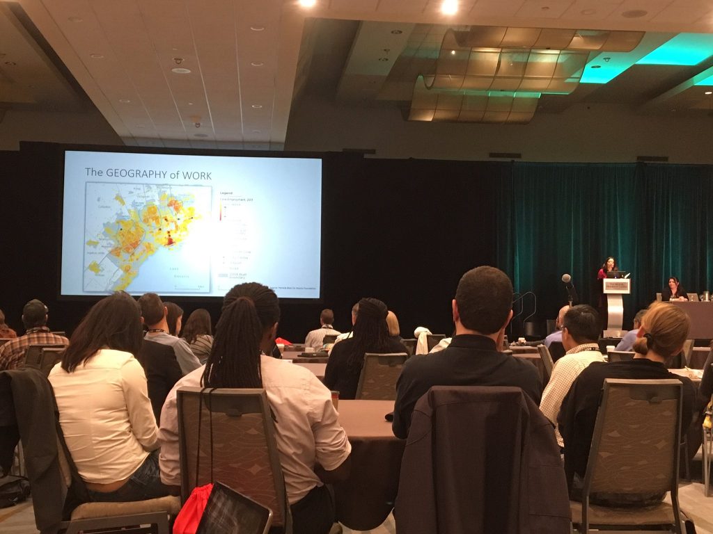
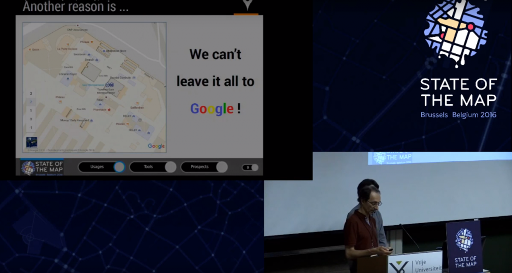
08:00 Laura Garcia is presenting Are individuals responsible for their own privacy in the geoweb

Wednesday 5 April 08:00 – 09:40
1123 Emerging Field Methods for Environmental Perceptions and Behavior
Location: Room 303, Hynes, Third Level

08:00 Edward Millar is chairing the session and presenting on The Cottage Effect: Investigating Spatial Bias in Citizen Science Using a Comparative Analysis

Wednesday 5 April 12:40 – 14:20
1457 The Dark Side of Open Data – Part One
Location: Gardner A, Sheraton, Third Floor

Pamela Robinson, Peter Johnson, and Teresa Scassa are organizers. Peter Johnson is chairing the session.
12:40 Suthee Sangiambut and Laura Garcia are Interrogating the open in open data from interdisciplinary perspectives
13:00 Renee Sieber is unveiling Façades of Openness in Government
13:20 Elizabeth Judge and Tenille Brown are presenting “Tort, Open Data, and the Geoweb: A Framework for Assessing Negligence”
13:40 March Burchfield is detailing When a mandate for transparency and open data culture is not quite ready for prime time
14:00 Jon Corbett and Shelley Cook explain How open is your redlining policy? Exploring geospatial data sharing tools to improve homeless service provision in British Columbia, Canada.


Wednesday 5 April 14:40 – 16:20
1557 The Dark Side of Open Data – Part Two
Location: Gardner A, Sheraton, Third Floor

Pamela Robinson, Peter Johnson, and Teresa Scassa are organizers. Renee Sieber is chairing the session.
15:00 Peter Johnson presents on Municipal Open Data: A Slow Death?
15:20 Teresa Scassa presents Government use of georeferenced social media data and analytics: challenges for transparent and open government
15:40 Keira Webster and Pamela Robinson present Fostering the ‘Time is Now’ Mentality: the Role of Open Data in Urban Climate Resilience
16:00 Pamela Robinson presents Unlocking the Civic Potential of Open Data: Whose job is it?


Wednesday 5 April 16:40 – 18:20
1633 Spatial Decision Support Across Disciplines: Scholarship, Pedagogy and Practice
Location: Room 313, Hynes, Third Level

Rob Feick is a panellist

Thursday 6 April 15:20 – 17:00
2591 Urban-economic perspectives on technology
Location: Nantucket, Marriott, Fourth Floor

Renee Sieber is a discussant

Friday 7 April 13:20 – 15:00
3441 Big data and data privacy
Location: Liberty C, Sheraton, Second Floor

14:20 Rob Feick will speak on The spatial disconnect problem

Saturday 8 April 13:20 – 15:00
4469 Symposium on Human Dynamics in Smart and Connected Communities: Whither ‘human dynamics’ within geography?
Location: Regis, Marriott, Third Floor

Renee Sieber is a discussant

Saturday 8 April 15:20 – 17:00
4586 Trees in the City 3: Social and Ecological Influences in the Urban Forest
Location: Salon I, Marriott, Fourth Floor

16:20 James Steenberg is presenting Counter-intuitive Relationships Between Housing Renovation, Socioeconomic Status, and Urban Forest Ecosystems

Saturday 8 April 17:20 – 19:00
4638 Digital \\ Human \\ Labour 5: Panel
Location: Independence East, Sheraton, Second Floor

Renee Sieber is a discussant

Sunday 9 April 16:00 – 17:40
5583 Learning and Applying Tools in Geography: Interdisciplinary Applications of GIS
Location: Exeter, Marriott, Third Floor

Renee Sieber and Jon Corbett are panellists

Leveraging Open Data: International perspectives presented at URISA’s GIS-Pro 2016 conference

This is a cross-post from Geothink co-applicant Dr. Claus Rinner‘s website, written by Geothink student Sarah Greene, Ryerson University. Sarah is Candidate for the Master’s of Spatial Analysis at Ryerson University. Her research focusses on open data.

By Sarah Greene

This past week, URISA held its 54th annual GIS-Pro conference in Toronto, bringing together GIS professionals and businesses from around the world. The conference provided many interesting sessions including one focused entirely on open data. This session, titled “Leveraging Open Data”, included government as well as private sector perspectives.

The session began with a presentation from the Government of North Carolina, discussing the importance of metadata. They are currently collaborating with a number of agencies to create and share a metadata profile to help others open up their data and understand how to implement the standards suggested. They have produced a living document which can be accessed through their webpage.

The next speaker at the session represented Pitkin County in Colorado. They represent an open data success story with a number of great resources available for download on their website including high quality aerial imagery. An important aspect to their open data project was their engagement with their local community to understand what data should be opened, and then marketing those datasets which were released.

The Government of Ontario was also present as this session, presenting on the current status of open data for the province. The Ontario Government promotes an Open by Default approach and currently has over 500 datasets from 49 agencies available to download through their portal. They are working towards continuing to increase their open datasets available.

A presentation by MapYourProperty provided an interesting perspective from the private sector using open data to successfully run their business. They heavily depend on visualizing open data to provide a web-based mapping application for the planning and real estate community to search properties, map zoning information and create a due diligence report based on the information found. This is one example of many that exist in the private sector of open data helping build new companies, or help existing companies thrive.

Lastly, a representative from Esri Canada’s BC office wrapped up the session reminding us all of the importance of opening data. This included highlighting the seemingly endless benefits to open data, including providing information to help make decisions, supporting innovation, creating smart cities and building connections. Of course, open data is big business for Esri too, with the addition of ArcGIS Open Data as a hosted open data catalog to the ArcGIS Online platform.

This session showcased some great initiatives taking place in Canada and the United States that are proving the importance of opening up data and how this can be done successfully. It is exciting to see what has been taking place locally and internationally and it will be even more exciting to see what happens in the future, as both geospatial and a-spatial data products continue to become more openly available.

A talk at the GIS Pro 2016 conference. Photo credit: Claus Rinner

A talk at the GIS Pro 2016 conference. Photo credit: Claus Rinner

See the original post here

The State of the Map 2016

Recently graduated Geothink student Julia Conzon (McGill University) has recently returned from the State of the Map conference in Brussels, on a travel grant. Julia was able to meet individuals interested in different social, political, and technical components of OpenStreetMap, which solidified her beliefs that the success of volunteered geographic information relies on both social and technical fields. Julia’s interests in mapping include: increasing diversity to reduce the digital divide and harnessing government support.

SOTM group photo (photo by Tatiana Van Campenhout)

SOTM group photo (photo by Tatiana Van Campenhout)

By Julia Conzon

I recently attended the State of the Map (SOTM) in Brussels, Belgium. SOTM is a conference that discusses various social, political, and technical components of OpenStreetMap (OSM), a mapping website that aims to map all of Earth’s landscapes, such as social and physical infrastructures. You may wonder, doesn’t Google already do this? In short, yes, Google has done an efficient job producing Google Maps and its associated routing/navigation software; but it still has its limitations. First, Google Maps has several unmapped locations. As addressed by SOTM’s keynote speaker Allan Mustard, US Ambassador to Turkmenistan, if you compare the map of Ashgabat, Turkmenistan, between Google Maps and OSM, you will certainly see a difference (Figure 1). Secondly, Google’s spatial data is not open, which hampers equality and empowerment. Thanks to Ambassador Mustard’s initiative to use OSM, he and several Ashgabat locals have mapped out the remote city and now the citizens can use this open spatial data for various socio-economic purposes. For example, prior to the OSM maps, Ashgabat taxi drivers did not know where all the gas stations were located. Now, with a local map openly accessible to all citizens, Ambassador Mustard says taxi drivers are more efficient at navigation. In short, OSM provides an open-source platform that allows worldwide internet users to contribute geographic features of anywhere from anywhere, which then can be freely downloaded by anyone to use.

Figure 1. Differences in Ashgabat, Turkmenistan between OSM (left) and Google Maps (right) (screenshots from OSM and Google Maps)

Figure 1. Differences in Ashgabat between OSM (left) and Google Maps (right) (screenshots from OSM and Google Maps)

Government Support
As seen with Ambassador Mustard, there are some within government who do support crowdsourced mapping initiatives. With Federal funding, Statistics Canada has announced a pilot crowdsourcing project starting in October 2016 to use OSM’s platform to crowdsource building data. It was also exciting to see the government presence at the conference (such as a member of Statistics Canada) and government partnerships such as between Etalab (a French government organisation) and OSM France.

Through one of the Birds of a Feather (BoF) discussions I participated in, it is apparent that OSM’s platform is positively reshaping certain government’s perceptions on how to produce open data. However, a presentation from Usman Latif, a journalist from Pakistan and the founder of Open Humanitarians (formerly DigitalHumanitarians.pk), reminded the SOTM audience that not all governments are democratizing their data. In Pakistan, broad laws have made unauthorised mapping activities by locals illegal. Usman risks penalties if he encourages local mapping, but he explained that to follow the law, he encourages students and youth to map parts of the world outside Pakistan and “to be a part of a global humanitarian society.” Usman’s goal is to proliferate a vibrant community of humanitarian mappers in Pakistan who can eventually use their mapping skills to participate in the global humanitarian society, particularly in disaster response. With Pakistan prone to earthquakes and floods, Usman hopes these educated Pakistanis will contribute to domestic disaster responses once Pakistan opens up local mapping. With this mindset, Usman now educates university students in Pakistan on using OSM. Although not all governments are supportive of open spatial data, Usman’s goals illustrate how educating locals about OSM and encouraging them to contribute to global (digital) humanitarian society can promote local empowerment, something I believe is a worthwhile alternative.

Smart Cities
Apart from social and political components of OSM, many presentations also addressed technical components; more specifically, new automated tools for OSM users. Some of these tools can be used to promote smart cities. Christian Quest and Michel Blancard from Etalab presented OpenSolarMap (view Figure 2). This presentation discussed using machine learning to identify which rooftops throughout France are most suitable for solar panel instalment based on rooftop aspect direction (north, south, west, east, or flat). Although there are still some variables that are excluded (e.g., solar intensity or rooftop angle), the software does highlight a more efficient methodology.

etalab-visualisation

Figure 2. Etalab’s map visualization of rooftop directions (photo by Julia Conzon).

There were also three presentations proposing different methods to map indoor areas. Indoor data can be used for a series of smart city applications, such as geomarketing. For instance, a mobile app could link indoor routing with a store’s product information to direct a customer to the product they want in the store while also encouraging them to pass by other similar products. Although each presentation proposed slightly different methodologies to map out indoor areas, all three shared similar concerns on mapping certain features, such as whether a stairway takes you up or down a floor. There were also different stances on opening up the indoor data to the public. For example, French National Railway Company (SNCF) have mapped the interiors of all popular stations in Paris; but, instead of this data being openly accessible to the public, they combined their data with OSM data to create an app that provides maps of these stations’ interiors. Unfortunately, this app is not available for free, which disappointed myself and my neighbouring audience members. On the other hand, Roland Olbricht’s and Roland Wagner’s workshop taught the audience how to map building interiors with OpenStationMap, which is an OSM project that aims to incorporate indoor mapping onto OSM’s station polygons. As Google Maps has also introduced indoor mapping, Carto Cité’s presentation on indoor mapping reminded the audience, ‘We can’t leave it all to Google’ (Figure 3). If we leave indoor mapping to a few corporations, data accessibility may be restricted for commercial interests.

Figure 3. Indoor mapping efforts should not be undertaken by only a few actors

Figure 3. Indoor mapping efforts should not be undertaken by only a few actors (screenshot from YouTube)

Conclusion
Overall, the State of the Map presented two trends: collaborative learning and machine learning. The latter trend reflects discussions on automation of mapping processes, while the former trend reflects discussions on on-the-ground mapping with locals. Although these trends seem diverging, OSM’s platform is capable of incorporating both. As OSM Foundation’s Mikel Maron mentioned, it is about being “a part of the database.” Whether it be building technical tools to ease mapping complex areas or educating locals to contribute geospatial data, both trends aim to provide open geospatial data for all to use.

This collaborative environment has ultimately encouraged me to sustain the initiative for open spatial data. With the knowledge I have gained from the conference, I will introduce several new activities to Maptime MTL. Feel free to contact me at juliaconzon@gmail.com or maptimemtl@gmail.com if you are interested in participating or collaborating. You can also connect with me on Twitter @julconz and LinkedIn.

Notes from the GIScience Conference 2016

Last month, Geothink took part in the GIScience 2016 conference in Montreal, a biennial conference for academics in the field of GIS and geography. Geothink was present as a sponsor. Additionally, multiple Geothink academics were present to engage in academic discussion, and members of Geothink were also involved in the organisation of the conference.
One of our volunteers, Lesley Johnson, reports her experience of the conference.

By Lesley Johnson

The 9th installment of the International GIScience conference was held in Montreal (27-30 September) – the first time the conference has been held in Canada. The conference was ambitious as it covered a lot of ground in 4 days: from a workshop on Machine Learning on Tuesday, to the impact of human intention on geospatial data quality on Thursday, and then finally to the definition and meaning of GIScience itself on Friday.

Perhaps the overarching goal of the conference was to put the sheer breadth of this challenging, shapeshifting, but most of all, exciting, field of study into perspective. How do we categorize GIScience? Where does it fall in the tree of science? Is it indeed a discipline in its own right?

To answer these questions, over 250 attendees from across the globe came together to debate these questions and find out about the latest advances in the field. The conference kicked off on Tuesday with hands-on workshops (“Understanding Spatial Data (big and Small) with Visual Analytics”, “Machine learning methods for spatial and temporal analysis”). Attendees in the Machine Learning tutorial were taught by University College of London’s James Haworth on how to use Support Vector Machine regressions to analyze datasets; an important skill for any budding or experienced GIScientist to have in their back pocket.

Wednesday’s schedule was packed full of exciting and diverse sessions. Following the keynote on the “Internet of Mobile Things”, the Cognition and Place session was held, where attendees were asked to think about “place” beyond the positivist notion of “space”. The importance of spatial scale and cell resolution was also emphasized and re-examined in the Raster Models and Modelling session, moderated by Memorial University’s Rodolphe Devillers. Barbara Buttenfield’s research “measuring distance as the horse runs” was especially interesting, as I had personally never heard of the term before. Differences in spatial resolution can affect distance calculations. Even at local scales, it is important to account for factors such as the curvature of terrain.

img_20160929_111925

Thursday’s keynote on “Artistry in GIScience” by Deniis Hlynsky (Rhode Island School of Design) sparked many an interesting conversation. It pushed scientists to think outside of the academic box, and think about what great beauty there is in the phenomena that we study everyday: from starlings flying across the sky each wing beat captured and superimposed, to cartographic design. Does GIScience always need to be about …science? Can GIArt be a discipline in its own right?

As the conference came to a close on Friday, a final panel of GIScientists was brought together and were asked by Dr. Renee Sieber, one of the main conference organizers, “what is GIScience?” The question led to other questions, such as “Does the title of a researcher determine their funding opportunities, or does the research speak for itself regardless?” and “What name would bring the most attention to a higher education program: spatial data sciences or geographic information sciences?” As a graduate student, most of the conversation seemed pointless: Can’t we just do research and not worry about the semantics of it? I then realized that gaining funding and disseminating your research are crucial to doing research after graduate school. Maybe I do indeed need to think about the implications of the title on my business card a bit more.

Collaboration is also needed between the Geographic Information Systems and the Geographic Information Science; between those who are engaged in GIScience questions (such as those relating to spatial data accuracy), and those who use Geographic Information Systems software for specific domain questions.

Finally, congratulations go to Dr. Renee Sieber, for receiving the Canadian Association of Geographers Lifetime Achievement and GIScience Excellence Award!

The conference was, in short, wide in scope and ambitious in its depth. It achieved its goal of bringing GIScientists (or spatial data analysts, if you will) from across the globe, and pushing the definition of GIScience itself. Needless to say, I look forward to the tenth installment of the GIScience conference – hopefully I’ll have figured out what to call myself by then.

Geothink at the International Open Data Conference – Day 2

By Suthee Sangiambut

This Friday saw the conclusion of the International Open Data Conference (IODC) 2015, with an atmosphere of optimism and celebration. Attendees came from all corners of the world in numbers far greater than previous conferences—one indication that the open data movement may be gaining momentum. On this final day, stories of open data implementation were shared from both the developed and developing world.

Friday’s panel emphasized questions that went beyond the release of data. A panel which included top officials from Canada, the United States, and the World Bank answered questions  on how to break down data silos to ensure people can work together. Commonly referred to as open by default, the panelists felt data ownership needs to be discouraged so that more data ends up in this format.

In particular, they felt such a cultural shift within governments would allow for knowledge sharing with the publics they serve and within the state. Furthermore, it would produce efficiencies that are impossible under today’s paradigm of data produced by a single agency for its own use. Instead, interoperability needs to be technical (such as data formats and standards which would allow the combining of data from different departments), human (common nomenclature and processes to allow communication between departments), and legal (so issues of copyright and intellectual property do not prevent data sharing).

Amparo Ballivan, a lead economist at The World Bank, added that governments not only need more openness in data but that “openness in partnerships” is also desirable.  In other words, our outreach and educational programmes to promote open data and data sharing must be as transparent as the data they seek to open up.

“We are called to display the same kind of behavior that we demand of others,” she said.

Catherine Woteki, under secretary for research, education & economics and chief scientist at the United States Department of Agriculture, proposed another solution for this challenge. In particular, she felt that a ‘thesaurus’ is needed to provide links between data-sets in different silos. She emphasized a problem-driven approach to releasing data, with priority given to sharing the data needed to address real problems that has the highest impact.

Throughout the conference, there was also discussion on the role of intermediaries or the non-profit or advocacy groups that promote the usage and availability of open data. Intermediaries were acknowledged as crucial in bridging digital and data divides, to bring open data and its benefits to those unaware or without the skills to leverage it. Intermediaries will also be important actors when attempting to capture local knowledge.

Panelists in other sessions felt that the private sector has become interested in opening up data. At a panel titled “Corporate data sharing for the public good: shades of open,” there was much discussion on the potential benefits of having the private sector open up their data to the public. Potential first steps to be taken were: regulatory frameworks, connecting practitioners, and creating tangible use cases.

The day ended with a recap of the conference, hosted by David Eaves. Key points included: the move beyond engagement through hackathons, moving beyond simply releasing data on portals towards addressing impacts, and general inequalities such as digital divides. On the subject of intermediaries, it was noted that the public is still speaking mainly through intermediaries, resulting in a gap between the demand and supply sides for data. This gap needs to be bridged in order to meet people’s needs.

IODC 2016 will be hosted next year in Madrid, Spain. For web archives of the panels, visit the IODC 2015 website.

The Final take-home points:

  • Citizen engagement needs to become a more sustained effort
  • Standardization still needs to be pushed
  • Measurement of outcomes and impacts need to be formalized
  • ‘Open’ culture and ways of thinking need to be promoted in all sectors
  • Data must move away from silos to become interoperable
  • Intermediaries are important actors that help bridge gaps between demand and supply sides
  • Problem-driven approaches to releasing open data should be encouraged

If you have thoughts or questions about this article, get in touch with Suthee Sangiambut, Geothink’s Newsletter Editor, at suthee.sangiambut@mail.mcgill.ca.

Geothink at the International Open Data Conference 2015 – Day 1

By Suthee Sangiambut

The 2015 International Open Data Conference (IODC) opened today, May 29, at the Shaw Centre in Ottawa. Below, we detail the conclusions from several panel discussions on open cities.

In fact, open cities were the featured topics in two of the day’s panel sessions. While a number of case studies were given, panelists emphasized that few cities (less than 1%) globally have adopted any type of open city initiative.

However, the case studies demonstrated the potential for sensing and data analysis to be used to improve resource allocation and targeting in a city’s public services. A good example given was by Stephane Contre, the chief analytics officer for the City of Edmonton. In particular, he mentioned how hotspot mapping using a kernel density function was done on light bulb point data and on crime point data. This results in new layers representing point data with continuous surfaces. Such a representation allows officials to layer the light bulb, other hotspot data, and various crime data sets, identify correlations, and identify areas in need of additional resources or patrolling.

Not only was there a focus on the data side of open cities, there was also an emphasis on the need for citizen engagement. Without citizen engagement in an open city initiative, city residents simply become receivers of public services. Feedback loops that allow citizen input are needed to make sure city officials can adequately gauge and react to the demands of citizens.

Furthermore, big barriers to releasing open data still remain, especially in the organizational culture within government and due to the lack of political support. Additionally, civil servants require better computer and data literacy to bring about a ‘data first’ mindset where civil servants keep in mind the idea of openness as well as the possible analysis they could perform on a given data set.

Closing remarks were made by Sir Nigel Shadbolt of the Open Data Institute (ODI) and Tony Clement, president of the Treasury Board of Canada, who both expressed great optimism for the future of open data. According to Shadbolt, the next step for open data is in empowering individuals with their own data. He believes a mashing of open government data with personal data and even mobiles and wearable personal sensors will allow us to create even richer data driven experiences that improve quality of life.

Follow #IODC15 for rapid updates by attendees on conference activities.

If you have thoughts or questions about this article, get in touch with Suthee Sangiambut, Geothink’s Newsletter Editor, at suthee.sangiambut@mail.mcgill.ca.

Geothink at the Canadian Open Data Summit 2015

By Suthee Sangiambut

The Canadian Open Data Summit 2015 wrapped up yesterday at the Shaw Centre in Ottawa with the City of Edmonton receiving this year’s Canadian Open Data Award—a nod to the advancement of their open data and open government initiatives. The event was hosted by Open North, and a number of Geothink’s team, partners, and students were present.

To start the day, Tim Davies gave an overview of trends and attitudes in the global open data community. He raised the question of whether open data is just another community or economic input, or whether it is becoming another way of performing coproduction between citizen and government. A summary of his opening talk is here.

A number of other panels and workshops also produced interesting points to take home. With the understanding that we have, in large part, moved beyond the simple problem of getting government data out to the public, these sessions focused on the problems of standards, consistency, engagement, and impact.

Two issues tackled at the summit, in particular, included the problem of bridging out beyond hackathons and closing gaps in institutional culture. The sentiment of many participants was that additional or improved methods are needed to maintain and deepen citizen engagement with open data over the medium and long term. Hackathons are great for initial engagement, but are perhaps not able to sustain interest in open data for long.

Additionally, hackathons have limited reach in terms of audience. Efforts in engagement need to move beyond the open data and hackathon communities to reach those not yet exposed to the data or technologies. Institutional culture refers to attitudes and approaches to open data management in bureaucracy. While openness in data is becoming the norm in some places, legislation is not enough and requires adoption and understanding of concepts of open government by civil servants themselves.

A detailed overview of the events will be available in the next Geothink Newsletter. For rapid updates on the week’s events in Ottawa, follow #IODC2015 on Twitter.

If you have thoughts or questions about this article, get in touch with Suthee Sangiambut at suthee.sangiambut@mail.mcgill.ca.

Geothink Program Guide for the Associaton of American Geographers (AAG) 2015 Annual Meeting

This year's American Association of Geographer's (AAG) Annual Meeting is in Chicago, Illinois.

This year’s American Association of Geographer’s (AAG) Annual Meeting is in Chicago, Illinois (Photo courtesy of AAG.org).

By Drew Bush

A long line-up of Geothinkers will be presenting at this year’s Association of American Geographers (AAG) Annual Meeting in Chicago next week. You’ll definitely not want to miss four of our team members as panelists on Civic technology: governance, equity and inclusion considerations on Thursday at 8:00 AM. Other highlights include presentations by Geothink Principal Investigator Renee Sieber and our students including Cheryl Power and Tenille Brown.

Below we’ve compiled the schedule for all of the project’s team members, collaborators and students who will be presenters, panelists and chairs during the conference. Find a PDF of our guide here. We hope you find this useful for finding the right sessions to join. You can also find the full preliminary AAG program here.

If you’re not able to make the conference, you can follow along on Twitter and use our list of Twitter handles below to join the conversation with our participants.

Join the Conversation on Twitter
Alex Aylett: @openalex_                                    Peter Johnson: @peterajohnson
Zorica Nedovic-Budic: @TurasCities               Andrea Minano: @Andrea_Minano
Tenille Brown: @TenilleEBrown                       Claus Rinner: @ClausRinner
Jonathan Corbett: @joncorbett                       Pamela Robinson: @pjrplan
Sarah Elwood: @SarahElwood1                       Teresa Scassa: @teresascassa
Victoria Fast: @VVFast                                       Renee Sieber: @RE_Sieber
Muki Haklay: @mhaklay                                    Harrison Smith: @Ambiveillance

And remember to use the conference hashtag #AAG2015 and our hashtag #Geothink or address @geothinkca when you Tweet.

Come to our Sessions at AAG 2015

Tuesday, April 21

Wednesday, April 22

Thursday, April 23

Friday, April 24

Saturday, April 25

If you have thoughts or questions about this article, get in touch with Drew Bush, Geothink’s digital journalist, at drew.bush@mail.mcgill.ca.