Author Archives: Drew Bush

Measuring the Value of Open Government Data – Summer Institute Day 2

 Day two of Geothink's 2016 Summer Institute began with short lectures on specific disciplinary perspectives on open data. Teresa Scassa, Canada Research Chair in Information Law at the University of Ottawa, gave a legal perspective on the value of open data.

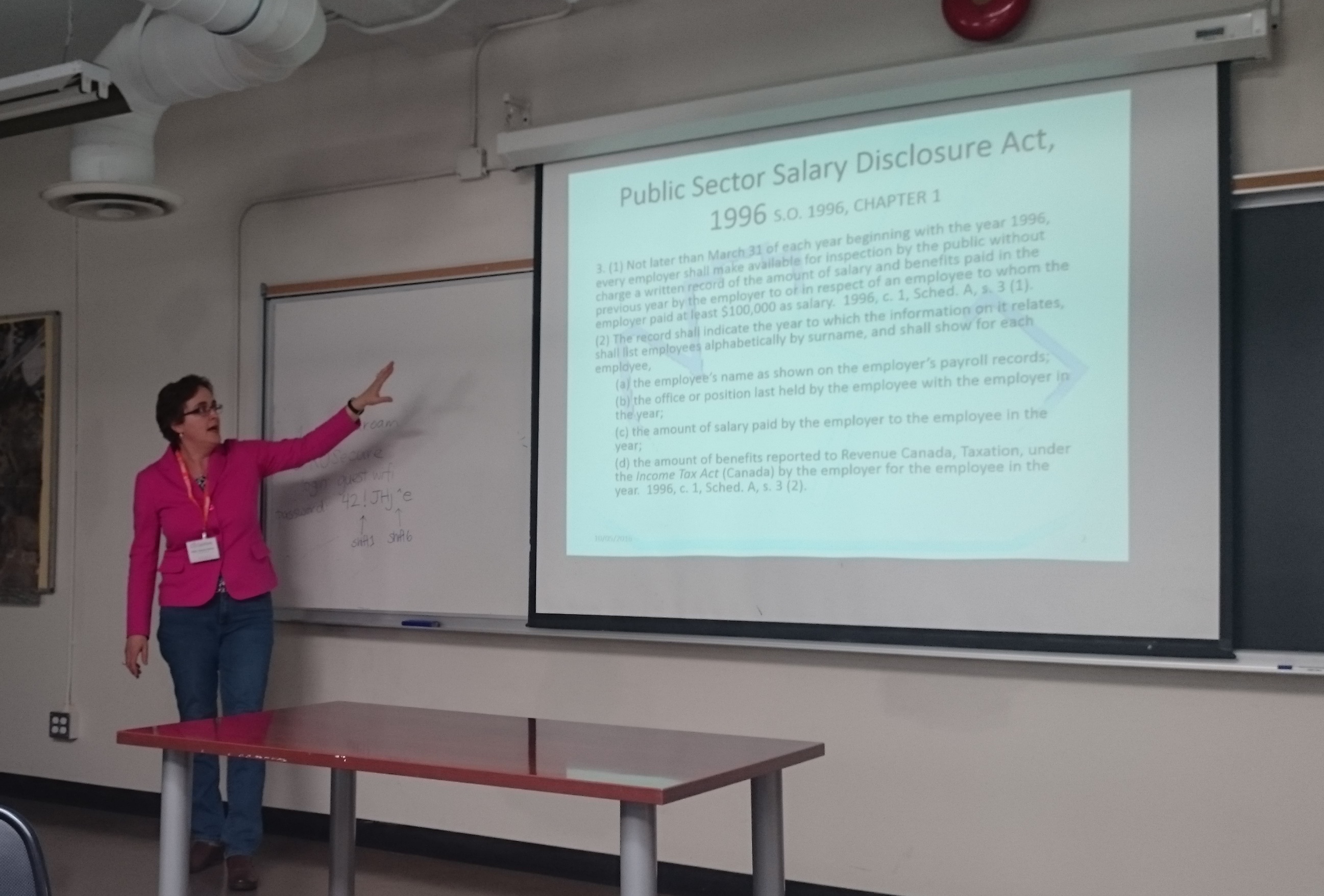
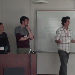
Day two of Geothink’s 2016 Summer Institute began with short lectures on specific disciplinary perspectives on open data. Teresa Scassa, Canada Research Chair in Information Law at the University of Ottawa, gave a legal perspective on the value of open data.

By Drew Bush

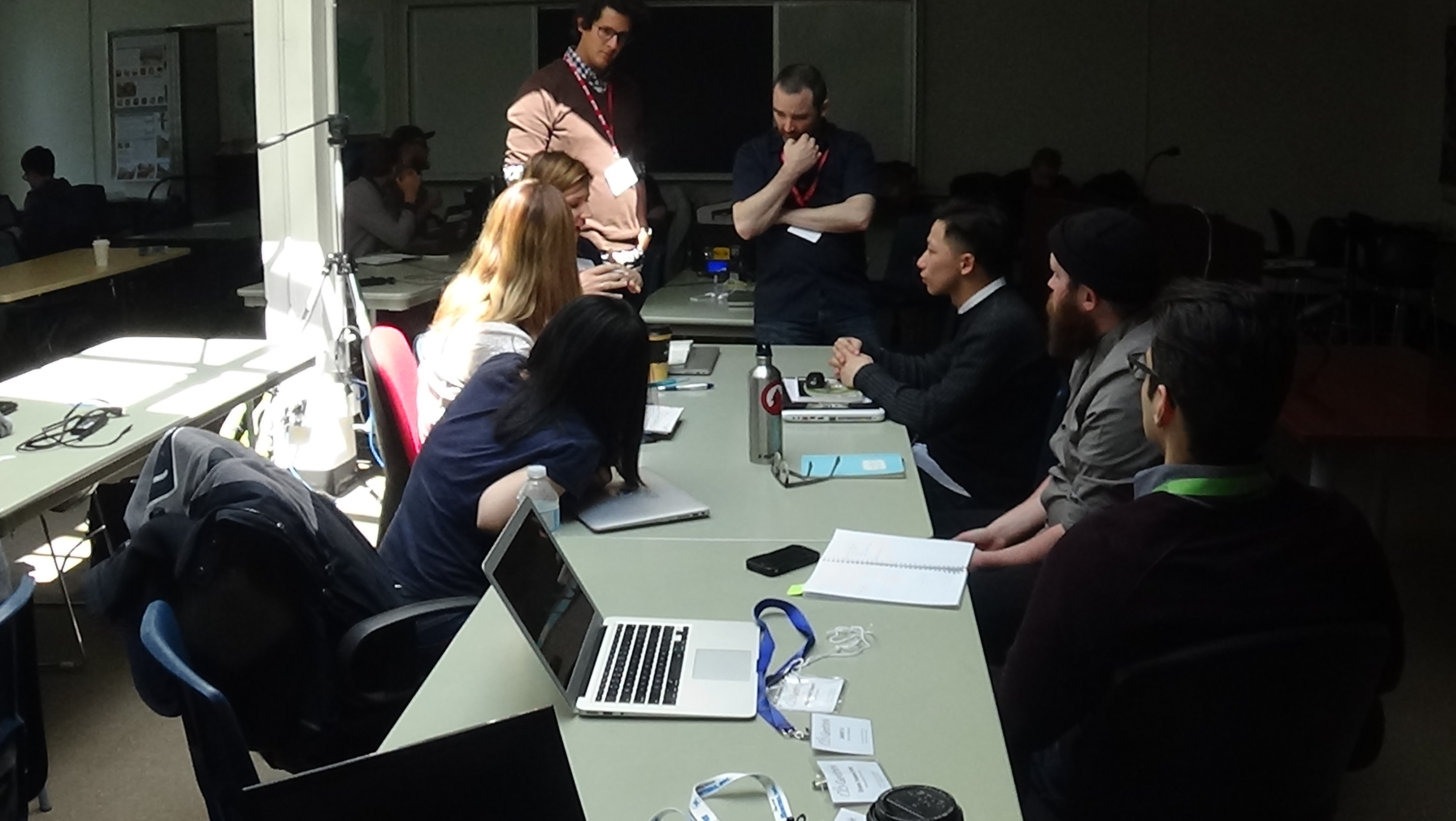
Day two of the 2016 Summer Institute began with presentations from Geothink’s faculty that aimed to provide different disciplinary approaches to evaluating open data. Armed with this information, students spent the rest of the day working in groups to first create measures to value open data, and, second, role-play how differing sectors might use a specific type of data.

The morning began with 30-minute presentations from members of Geothink’s faculty. Peter Johnson, an assistant professor at Waterloo University’s Department of Geography and Environmental Planning, led off with a presentation on how municipal governments evaluate the success of their open data programs.

“This is the situation that we sort of find ourselves in when it comes to evaluating open data,” Johnson told students. “There’s this sort of world outside of government that’s bent on evaluating open data. And those are people like me, academics, those are non-profits, those are, you know, private sector organizations who are looking at open data and trying to understand how is it being used. So this is kind of, I think, a sign that open data has arrived a little bit. Right? It’s not just this sort of dusty, sort of nerdy cobweb in the corner of the municipal government basement. It’s something that other people are noticing and other people are taking an interest in.”

Johnson was followed by Teresa Scassa, Canada Research Chair in Information Law at the University of Ottawa, with a legal perspective on the value of open data. Pamela Robinson, associate professor in Ryerson University’s School of Urban and Regional Planning, gave a civic-oriented approach to the value of open data, one that was intentionally at odds with the private sector.

“I’ll be really blunt, I’m not that interested in making money from open data,” Robinson told students in regard to the common municipal reason for opening data. “It’s important but it’s not my thing. As an urban planner, my primary preoccupation is about citizen’s relationships with their government. And I’m interested in the proposition that open data as an input into open government can fundamentally shift the relationship between civil society and institutions.”

Finally, Geothink Head Renee Sieber, associate professor in McGill University’s Department of Geography and School of Environment, provided a summary of the methods for evaluating open data.

Each of these short lectures were part of a comprehensive look at open data during the three-day institute. Students at this year’s institute learned difficult lessons about applying actual open data to civic problems and on how to evaluate the success of an open data program. In between activities on day two, students also heard from a panel of municipal officials and representatives of Toronto-based organizations working with open data.

Held annually as part of a five-year Canadian Social Sciences and Humanities Research Council (SSHRC) partnership grant, each year the Summer Institute devotes three days of hands-on learning to topics important to research taking place in the grant. This year, each day of the institute alternated lectures and panel discussions with work sessions where instructors mentored groups one-on-one about the many aspects of open data.

But many students struggled not only with thinking about how to evaluate the open data that they were working with, but also with how to determine the impact of any project that utilizes such an information source.

“I think a big challenge that I personally am facing is this idea of it’s supposed to have real improvement for society, it’s suppose to help society,” Rachel Bloom, from McGill University, said. “But we find that a lot of vulnerable populations actually won’t have access to these applications and the technology. So it’s kind of like trying to reconcile this idea of helping while also being aware that like maybe you are not actually reaching the population you are trying to help. Which is kind of what openness is about—is actually engaging the people personally.”

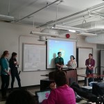
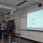
It is for such reasons that evaluating open data can be quite nuanced—an idea represented in student group presentations on the topic. The presentations varied greatly with some student groups choosing metrics based on the things that a community might value and then establishing an outside monitor to observe datasets and report back to the community. Other students established a workflow to harness citizen input to evaluate open data through instruments such as online surveys.

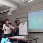
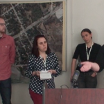
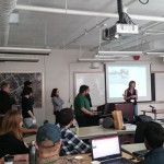
An afternoon panel comprised of local city officials and representatives from groups concerned with open data discussed the practical side of publishing, using, and evaluating open data as it stands today. The panel included Keith McDonald, former open data lead for City of Toronto; Bryan Smith, co-founder and Chief-Executive-Officer of ThinkData Works; Marcy Burchfield and Vishan Guyadeen, from The Neptis Foundation; And, Dawn Walker and Curtis McCord, Geothink students from University of Toronto who designed the Citizen’s Guide to Open Data.

Two of the primary concerns shared by panelists included the lack of standards for which differing municipalities provide open data, and the gap that exists between how open data is provided and what businesses or citizens require to actually use it. Smith spoke of how early visions of students and application developers using open data to radically transform life in cities have not scaled up to the national level particularly well.

“What we are seeing, which I don’t think anyone predicted, is the large companies—mostly companies that run a bunch of apps that probably everyone here has on their phones—are the ones who are the biggest purveyors of open data,” Smith told students. Issues with the type and quantity of data (as well as differences between how data is provided in different places) have limited other players and even some of these big developers too.

For more on this discussion, check out an excerpt of the panel discussion below. We pick up the discussion as the panelists talk about standards in relation to the Open Government Partnership.

In role-playing activities, students considered the issues raised by the panel as well as the practical problems citizens or other groups might face in finding the open data they require. Concluding presentations included those from students playing the role of real estate developers, non-profits concerned with democracy, and a bicycle food courier service.

Stay tuned for the full audio of each professors’ talk presented as podcasts here. Also check back on Geothink for a synopsis of day three, and, of course, watch more of our video clips (which we’ll be uploading in coming days) here.

If you have thoughts or questions about this article or the videos, get in touch with Drew Bush, Geothink’s digital journalist, at drew.bush@mail.mcgill.ca.

Cooking up Open Data with the Iron Chef – Summer Institute Day 1

Richard Pietro and James Steenberg discuss one group's open data application with them at Geothink's 2016 Summer Institute.

Richard Pietro and James Steenberg discuss one group’s open data application with them at Geothink’s 2016 Summer Institute.

By Drew Bush

The 2016 Geothink Summer Institute kicked off on May 9 with introductions from Geothink Head Renee Sieber, associate professor in McGill University’s Department of Geography and School of Environment, and Pamela Robinson, associate professor in Ryerson University’s School of Urban and Regional Planning. By that afternoon, the 35 students attending had gotten their hands dirty conceptualizing applications for real open data.

Students at this year’s institute learned difficult lessons about applying actual open data to civic problems through group work and interactions with Toronto city officials, local organizations, and Geothink faculty. The last day of the institute culminated in a writing-skill incubator that gave participants the chance to practice communicating even the driest details of work with open data in a manner that grabs the attention of the public.

Held annually as part of a five-year Canadian Social Sciences and Humanities Research Council (SSHRC) partnership grant, each year the Summer Institute devotes three days of hands-on learning to topics important to research taking place in the grant. This year, each day of the institute alternated lectures and panel discussions with work sessions where instructors mentored groups one-on-one about the many aspects of open data.

On day one, students learned about open data during an Open Data Iron Chef event with Toronto-based open data expert, Richard Pietro, who affectionately calls himself an open government and open data fanboy. He’s known for twice riding his motorcycle across Canada to raise awareness of open data, his film Open, and the company he founded OGT Productions. All of this work has led him to a unique view of open data and open government.

“It [open data and open government] allows people to customize their government,” Pietro said between sessions. “It’s as simple as that. And whenever anybody asks what it means: It just allows people to customize their government. Very similarly it does what social media did in 2004 to our relationships with our friends and companies and celebrities. Open data and open government is like social media but ten years ago.”

“It’s very new,” he added. “Some people understand its potential but nobody really understands how much it’s going to change everything about how people interact with their government and how government interacts with people. So it’s going to have incredible transformative powers.”

Watch a clip of Pietro introducing the Open Data Iron Chef event on day one here:

After Pietro’s introduction to open data, James Steenberg, a postdoctoral researcher at Ryerson University with Robinson, walked students through the different file types open data is often released in, what an actual data set might look like, and how to go about working with such data.

“I think it would be more useful if I just went through all the questions I would have if I was literally doing an Iron Chef by myself at home in the kitchen, which I did,” Steenberg told students. “Small apartment, my work desk happened to be pretty much in my kitchen, so I was able to draw some inspiration.”

“And I put together some slides and questions and answers based on just the questions I had starting from scratch,” he continued. “So going to the open data portal, downloading them, opening them up, what kind of file formats are we looking at and so forth. So that’s what I’m going to do today, I’m going to bounce around from a few different files as you saw. But basically I’d like to just develop my own civic app here of what I hope can be a useful function in the city.”

The majority of the day was then given over to students actually finding data they wished to work with (Pietro gave a wide variety of examples during his presentation), a close examination of their chosen datasets, and determining novel uses for which the data could be used to improve city services or better engage citizens. At the end of the day, students presented their proposals that included an analysis of gaps in open data (in availability and quality) and what data was needed to be able to create an open data solution to a chosen real-world problem.

For one student group, this meant taking a closer look at data pertaining to water main breaks within the City of Toronto. In particular, they hoped to determine if any spatial pattern existed with water main breaks in comparison to aspects of the built or natural environments that might influence this phenomenon. The group felt such data could be used to help predict future break sites and facilitate repair before a rupture occurs.

Experiences with this type of work within the group varied widely.

“I don’t have a lot of background in some of this mapping stuff, so I come at it from a very different perspective,” Shelley Cook, from the University of British Columbia, Okanagan, said.

Her group-mate, in contrast, felt quite comfortable with the project the group had chosen.

“So I’ve had a lot of experience doing research on sort of the geographic side of open data, looking at geographic content,” Edgar Baculi, from Ryerson University, added. “I like this activity. This is a great experience. One question that comes to mind right now is why the quality of the data isn’t what I want it to be. In the future, I’d like to see the quality of the data better released, better published from municipal governments to help better answer questions we have as citizens in the decision-making process and in making things better for everyone else.”

Stay tuned for more iTunes podcasts from the Summer Institute here, check back on Geothink for synopses of days two and three, and, of course, watch more of our video clips (which we’ll be uploading in coming days) here.

If you have thoughts or questions about this article or video, get in touch with Drew Bush, Geothink’s digital journalist, at drew.bush@mail.mcgill.ca.

Getting a Better Handle on Geosocial Data with Geothink Co-Applicant Robert Feick

 Images and text from sites like Flickr (the source of this image) provide geosocial data which University of Waterloo Associate Professor Robert Feick and his graduate students work to make more useful to planners and citizens.

Images and text from sites like Flickr (the source of this image) provide geosocial data that University of Waterloo Associate Professor Robert Feick and his graduate students work to make more useful to planners and citizens.

By Drew Bush

A prevailing view of volunteered geographic information (VGI) is that large datasets exist equally across North American cities and spaces within them. Such data should therefore be readily available for planners wishing to use it to aid in decision-making. In a paper published last August in Cartography and Geographic Information Science, Geothink Co-Applicant Rob Feick put this idea to the test.

He and co-author Colin Robertson tracked Flickr data across 481 urban areas in the United States to determine what characteristics of a given city space correspond to the most plentiful data sets. This research allowed Feick, an associate professor in the University of Waterloo’s School of Planning, to determine how representative this type of user generated data are across and within cities.

The paper (entitled Bumps and bruises in the digital skins of cities: Unevenly distributed user-generated content across U.S. urban areas) reports that coverage varies greatly between downtown cores and suburban spaces, as may be expected, but also that such patterns differ markedly between cities that appear similar in terms of size, function and other characteristics.

“Often it’s portrayed as if these large data resources are available everywhere for everyone and there aren’t any constraints,” he told Geothink.ca recently about this on-going research. Since these data sets are often repurposed to learn more about how people perceive places, this misconception can have clear implications for those working with such data sets, he added.

“Leaving aside all the other challenges with user generated data, can we take an approach that’s been piloted let’s say in Montreal and assume that’s it going to work as well in Hamilton, or Calgary, or Edmonton and so on?” he said. Due to variations in VGI coverage, tools developed in one local context may not produce the same results elsewhere in the same city or in other cities.

The actual types of data used in research like Feick’s can vary. Growing amounts of data from social media sites such as Flickr, Facebook, and Twitter, and transit or mobility applications developed by municipalities include geographic references. Feick and his graduate students work to transform such large datasets—which often include many irrelevant (and unruly) user comments or posts—into something that can be useful to citizens and city officials for planning and public engagement.

“My work tends to center on two themes within the overall Geothink project,” Feick said. “I have a longstanding interest in public engagement and participation from a GIS perspective—looking at how spatial data and tools condition and, hopefully, improve public dialogue. And the other broad area that I’m interested in is methods that help us to transform these new types of spatial data into information that is useful for governments and citizens.”

“That’s a pretty broad statement,” he added. “But in a community and local context, I’m interested in both understanding better the characteristics of these data sources, particularly data quality, as well as the methods we can develop to extract new types of information from large scale VGI resources.”

Applying this Research Approach to Canadian Municipalities

Much of Feick’s Geothink related research at University of Waterloo naturally involves work in the Canadian context of Kitchener, Waterloo, and the province of Ontario. He’s particularly proud of the work being done by his graduate students, Ashley Zhang and Maju Sadagopan. Both are undertaking projects that are illustrative of Feick’s above-mentioned two areas of research focus.

Many municipalities offer Web map interfaces that allow the public to place comments in areas of interest to them. Sadagopan’s work centres on providing a semi-automated approach for classifying these comments. In many cases, municipal staff have to read each comment and manually view where the comment was placed in order to interpret a citizen’s concerns.

Sadagopan is developing spatial database tools and rule-based logic that use keywords in comments as well as information about features (e.g. buildings, roads, etc.) near their locations to filter and classify hundreds of comments and identify issues and areas of common concern. This work is being piloted with the City of Kitchener using data from a recent planning study of the Iron Horse Trail that that runs throughout Kitchener and Waterloo.

Zhang’s work revolves around two projects that relate to light rail construction that is underway in the region of Waterloo. First, she is using topic modeling approaches to monitor less structured social media and filter data that may have relevance to local governments.

“She’s doing work that’s really focused on mining place-based and participation related information from geosocial media as well as other types of popular media, such as online newspapers and blogs, etc.,” Feick said. “She has developed tools that help to start to identify locales of concern and topics that over space and time vary in terms of their resonance with a community.”

“She’s moving towards the idea of changing public feedback and engagement from something that’s solely episodic and project related to something that could include also this idea of more continuous forms of monitoring,” he added.

To explore the data quality issues associated with VGI use in local governments, they are also working on a new project with Kitchener that will provide pedestrian routing services based on different types of mobility. The light rail project mentioned above has disrupted roadways and sidewalks with construction in the core area and will do so until the project is completed in 2017. Citizen feedback on the impacts of different barriers and temporary walking routes for people with different modes of mobility (e.g. use of wheelchairs, walkers, etc.) will be used to study how to gauge VGI quality and develop best practices for integrating public VGI into government data processes.

The work of Feick and his students provides important insight for the Geothink partnership on how VGI can be used to improve communication between cities and their citizens. Each of the above projects has improved service for citizens in Kitchener and Waterloo or enhanced the way in which these cities make and communicate decisions. Feick’s past projects and future research directions are similarly oriented toward practical, local applications.

Past Projects and Future Directions

Past projects Feick has completed with students include creation of a solar mapping tool for Toronto that showed homeowners how much money they might make from the provincial feed-in-tariff that pays for rooftop solar energy they provide to the grid. It used a model of solar radiation to determine the payoff from positioning panels on different parts of a homeowner’s roof.

Future research Feick has planned includes work on how to more effectively harness different sources of geosocial media given large data sizes and extraneous comments, further research into disparities in such data between and within cities, and a project with Geothink Co-Applicant Stéphane Roche to present spatial data quality and appropriate uses of open data in easy-to-understand visual formats.

If you have thoughts or questions about this article, get in touch with Drew Bush, Geothink’s digital journalist, at drew.bush@mail.mcgill.ca.

Abstract of Paper mentioned in the above article:

Bumps and bruises in the digital skins of cities: Unevenly distributed user-generated content across U.S. urban areas
Abstract
As momentum and interest builds to leverage new user-generated forms of digital expression with geographical content, classical issues of data quality remain significant research challenges. In this paper we highlight the uneven textures of one form of user-generated data: geotagged photographs in U.S. urban centers as a case study into representativeness. We use generalized linear modeling to associate photograph distribution with underlying socioeconomic descriptors at the city-scale, and examine intra-city variation in relation to income inequality. We conclude with a detailed analysis of Dallas, Seattle, and New Orleans. Our findings add to the growing volume of evidence outlining uneven representativeness in user-generated data, and our approach contributes to the stock of methods available to investigate geographic variations in representativeness. We show that in addition to city-scale variables relating to distribution of user-generated content, variability remains at localized scales that demand an individual and contextual understanding of their form and nature. The findings demonstrate that careful analysis of representativeness at both macro and micro scales simultaneously can provide important insights into the processes giving rise to user-generated datasets and potentially shed light into their embedded biases and suitability as inputs to analysis.


Second Annual AquaHacking Event Invites You To Hack to Preserve the Water of the Saint Lawrence River

Un navire arrive à Montréal.

The 2016 AquaHacking event will focus on the Saint Lawrence River in Quebec with a summit to be held in Montreal in October.

By Drew Bush

AquaHacking will bring together water stakeholders and technology enthusiasts (and hackers) to solve freshwater issues including those related to climate change. The weeks-long hackathon will culminate in a two-day summit in Montreal, QC on October 6 & 7, 2016.

The organizers of the event believe it’s a great opportunity for developers and water researchers alike to come together to address problems of water preservation and gain valuable exposure and contacts with NGO’s, companies, and government organizations. The second annual event is organized through a partnership between IBM Canada and the de Gaspé Beaubien Foundation.

Participants will have a chance to win up to $50,000, sign their first client contract, have their solution supported by recognized incubators, win accounting/legal/marketing advice, access software/hardware companies, and showcase their projects to high-profile decision-makers and investors.

Last year’s challenge brought 300 participants together with 70 hackers developing ten mobile/web applications to preserve the Ottawa River. The first place winner was the River Ranger application that allows anyone to help collect data about streams, lakes, rivers, and bays. All of the applications were then distributed to the local community.

Those interested in this year’s challenge can sign up here. Or follow @AquaHacking on Twitter.

If you have thoughts or questions about the article, get in touch with Drew Bush, Geothink’s digital journalist, at drew.bush@mail.mcgill.ca.

Geothoughts 10: Governing Makerspaces in Toronto with Jordan Bowden

A McGill University undergraduate has undertaken unique research on the governance of Toronto’s Makerspaces.

By Drew Bush

We’re very excited to present you with our tenth episode of Geothoughts. You can also subscribe to this Podcast by finding it on iTunes.

In this episode, we examine a project funded by McGill University Arts Undergraduate Research Internship Award (ARIA) and Geothink. In it, one student has found a huge variance between the types of Makerspaces found in Toronto. The city’s groups represent what McGill University Undergraduate Jordan Bowden calls a unique Canadian evolution of the Makerspace concept. He worked with Geothink Head Renee Sieber, associate professor in McGill University’s Department of Geography and School of Environment.

A Makerspace is a place where people come together and share commonly owned tools, equipment, or software to learn new skills. They can be for profit, they can be non-profit, they can be run by a group of individuals, or by larger institutions like universities or libraries. First popular in China and other Asian countries, these do-it-yourself (DIY) spaces where people can gather to create, invent, and learn have also spread to the United States and, more recently, Canada. Many of Canada’s Makerspaces face little formal regulation and differ greatly from their formulations than in other countries.

Thanks for tuning in. And we hope you subscribe with us at Geothoughts on iTunes. A transcript of this original audio podcast follows.

TRANSCRIPT OF AUDIO PODCAST

Welcome to Geothoughts. I’m Drew Bush.

[Geothink.ca theme music]

“So Makerspaces, there are a lot of different terms that have sort of been in the same sphere as Makerspaces, ranging from Hackerspaces to Hacklabs to Fablabs to even some shared studio spaces which are less formal. All of kind have been put underneath the umbrella term of a Makerspace. And a Makerspace basically is a place where people come together and use commonly owned tools.”

That’s McGill University Undergraduate Jordan Bowden on his unique yearlong honours thesis project investigating how governance works in 10 different Toronto Makerspaces. He’s a long-time participant in the work being done in Makerspaces. He also recently completed his thesis for Geothink Head Renee Sieber, associate professor in McGill University’s Department of Geography and School of Environment.

“They can be for profit, they can be non-profit, they can be run by a group of individuals, or by larger institutions like universities or libraries. So in my research, I find that there is a huge variance of the practices between spaces that were using this term. Especially in Toronto which is where my research is focused. There was, there was just a huge variety of Makerspaces. I studied about 10 Makerspaces in my research. And some of them are run just groups of artists who are using commonly owned tools. Others were run by the local library and really focused on sort of entrepreneurship and that sort of thing.”

Still confused about how to define a Makerspace? You might not be alone, as the concept has varied and evolved as it has spread globally.

“So, yeah, I mean the term itself has only really emerged over the past four to five years I’d say. And before then, like Hackerspaces and Hacklabs, have like that term itself has a much longer history stretching all the way back to the 1990s. The main distinction there is that Hacklabs and Hackerspaces are often focused more on computers. Whereas Makerspaces can be focused really on any sort of production be it computers or woodworking or metalworking and that sort of thing.”

Bowden says that the question of how such spaces are governed in Canada is an entirely new one. And he adds that it’s crucial: What Makerspaces can actually do is greatly affected by how they are run.

“Within each Makerspace, some Makerspaces have sort of formal committees wherein makers are actually involved in the running of the space in every aspect. Whereas others are pretty much governed by a handful of people. Be they like a single executive director at a non-profit organization or like multiple actors in a for profit Makerspace. So it’s, yeah, there’s a lot there. My paper covers a lot of different examples of this. Yeah, there’s a lot of different actors involved.”

The project took Bodwen a great deal of time to research, conduct field work for, and then write about in the fall and winter of this academic year.

“I’ve been working on it basically since last summer. I did field research in Toronto over August of last year where I conducted 10 different interviews. I used nine in my research. And I also did observation at different Makerspaces around the city, and went to maker related events and did observation there as well.”

Not every hypothesis that Bowden hoped to explore panned out in the Canadian context of Toronto.

“I though there would be governmental actors involved, but I really found, I kept on trying to snowball and finding more people to interview. But it people kept on saying the same people I had already interviewed. So it was like who else should I interview? And then I would get the same answers from multiple people. So I realized the scene was pretty small. So instead I did more in depth interviews. They were each about 30 minutes to an hour long each.”

This work led Bowden to author a 63-page honours thesis entitled “Governance of Makerspaces in Toronto, Canada.” Find this paper at the McGill University library soon.

[Geothink.ca theme music]

[Voice over: Geothoughts are brought to you by Geothink.ca and generous funding from Canada’s Social Sciences and Humanities Research Council.]

###

If you have thoughts or questions about this podcast, get in touch with Drew Bush, Geothink’s digital journalist, at drew.bush@mail.mcgill.ca.

Geothink Research Gives Inside Look at how Toronto’s Makerspaces are Governed

A McGill University undergraduate has undertaken unique research on the governance of Toronto's Makerspaces as his honours thesis project.

A McGill University undergraduate has undertaken unique research on the governance of Toronto’s Makerspaces as his honours thesis project.

By Drew Bush

Google “Makerspaces” and you might not understand the definition you’re reading. First popular in China and other Asian countries, these do-it-yourself (DIY) spaces where people can gather to create, invent, and learn have also spread to the United States and, most recently, Canada.

Many are located at libraries where they include tools such as 3D printers, software, and electronics while others include craft and hardware supplies, online sites, tools, and more. People go to these social spaces to build and invent often with expensive, specialized equipment, while teaching and learning from their peers.

In research funded by a McGill University Arts Undergraduate Research Internship Award (ARIA) and Geothink, one student has found a huge variance between the types of spaces found in Toronto. The city’s groups represent what McGill University Undergraduate Jordan Bowden calls a unique Canadian evolution of the Makerspace concept. Many of Canada’s Makerspaces face little formal regulation and differ greatly from their formulations than in other countries, he added.

“My research tries to make the argument that there are sort of intervening factors between the actual desire to make stuff and start a Makerspace and the actual production of the thing,” he says of research he conducted into how 11 different Toronto Makerspaces are governed in the summer of 2015. His work was undertaken with the supervision of Geothink Head Renee Sieber, associate professor in McGill University’s Department of Geography and School of Environment. It will constitute his soon-to-be-submitted undergraduate honours thesis.

“It’s interesting because there are so many actors which have emerged in my research that participate,” he added. “Ranging from the local government, which has been involved only in a limited extent in the way that they fund maker events. Like there’s a big festival called the maker festival. And there’s also more formal like funding agencies. But it’s interesting they only fund very particular aspects of Makerspaces. So they’re only interested in more entrepreneurship focused endeavours versus artists.”

One of the main differences in the Toronto Makerspaces where Bowden conducted his interviews was the manner in which they were governed. At first, he focused his research on looking at the way formal provincial or federal agencies regulate what Makerspaces can build or how much noise they might make. But he didn’t find any evidence of the province or federal government regulating these spaces.

Bowden also believed he’d be able to interview a wide number of people and groups. But that didn’t pan out during the summer he spent observing different Makerspaces around the city and going to maker related events. What he found instead was a need for longer more in-depth interviews with fewer groups that possessed a wide variety of organizational structures. These interviews make up the core of his thesis research and include non-profit boards, for profit companies, groups of artists, local library groups, and spaces run by the government.

“Governance matters, [and] a wide variety of actors, including nonhuman, play a role in the governance system,” Bowden said of the Makerspaces he examined. Interestingly, the idea of governance within these spaces also varies greatly, he added.

“I use the term a lot in the paper, urban governance systems,” Bowden said. Such governance systems can shape a Makerspace’s existance and what people actually make, he added. There are a multitude of factors which restrict or enable what makers create in the space, like noise, tools, or the organizational factors.

Bowden has personal experience with such intervening factors. He’s been involved in the Makerspace community for quite some time, originally out of interest in a corporate project using a 3D printer. It’s led him to believe that there’s not much research right now on the different Makerspaces emerging in the Canadian context. In particular, he says, not much has been written on the differing contexts and mechanisms by which they’re governed.

“It’s been a year long project, which is actually a bit more extensive than the usual honours theses are,” he said. “It’s been great because I’ve been able to do field research which a lot of people wouldn’t do for undergrad thesis. Including interviews. So it’s really been a really great experience for me in terms of getting a good feel for research and doing field research as well.”

Find out more about Makerspaces and how Bowden conducted his research in Geothoughts Podcast 10: Governing Makerspaces in Toronto with Jordan Bowden.

If you have thoughts or questions about the article, get in touch with Drew Bush, Geothink’s digital journalist, at drew.bush@mail.mcgill.ca.

Geothink at the 2016 Annual Meeting of the American Association of Geographers

By Drew Bush

From March 29 to April 2, 2016, Geothink’s students, co-applicants, and collaborators presented their research and met with colleagues at the now concluded 2016 Association of American Geographers (AAG) Annual Meeting in San Francisco, CA. Over the week, Geothinkers gave 11 presentations, organized six sessions, chaired five sessions, and were panellists on four sessions. See who attended here.

“This year’s AAG provided a great opportunity to get geographically diverse Geothinkers together,” Victoria Fast, a recently graduated doctoral student in Ryerson University’s Department of Geography and Environmental Studies, wrote in an e-mail to Geothink.ca. “I can’t think of a better place for a meeting about a special journal issue on open data; there are so many fresh, uncensored ideas flying around the conference, both inside and outside of sessions.”

Of particular note for Fast was Panel Session 1475 Gender & GIScience (see her Geothink.ca guest post here). Panelists in the session included Geothink Head Renee Sieber, associate professor in McGill University’s Department of Geography and School of Environment; And, Geothink collaborator Sarah Elwood, a professor in University of Washington’s Department of Geography.

Others agreed.

“A panel on gender and GIScience was refreshing and enlightening,” Geothink Co-Applicant Scott Bell, a professor of Geography and Planning at University of Saskatchewan, wrote to Geothink.ca.

“My presentation was in a day long symposium on human dynamism,” he added. “It summarized a recently published Geothink aligned paper on human mobility tracking and active transportation (published in the International Journal of Geographical Information Science). It seemed to go over pretty well, I’m glad I was in the day-long event as the room was packed most of the day.”

For others, the high cost of the location meant they couldn’t stay for a full week or attend every single session. Still they reported good turnout by members of the Geothink team.

“This year we did not organize a specific panel or panels, or specific sessions to showcase Geothink work,” wrote Geothink Co-Applicant Teresa Scassa, Canada Research Chair in Information Law and professor in the Faculty of Law at the University of Ottawa. “This meant that our presentations were dispersed across a variety of different sessions, on different days of the week.”

Many Geothinkers were also intimately involved in running parts of the conference.

“This was a standout AAG for me,” wrote Geothink researcher Alexander Aylett, a professor and researcher at the Institut national de la recherche scientifique, who ran three sessions (Find an overview of what Aylette’s sessions did at www.smartgreencities.org). In collaboration with Andrés Lluque-Ayla from Durham University we ran a full day of sessions on the overlap between “Smart” and “Sustainable” cities.   We had some excellent presentations—including one from fellow Geothinker Pamela Robinson—and a strong turn out throughout the whole day. (Even at 8 AM, which was a shock to me!).”

For some students, it was the first time they had attended the meeting or presented their own research.

“This was my first time at the AAG,” said Geothink Newsletter Editor, Suthee Sangiambut, a maser’s student in McGill University’s Department of Geography with Sieber. “I was quite excited to be at the event and was able to meet all kinds of geographers, all of whom had different ideas on what geography exactly is.”

“It was great to see how global events of the past years were shaping our discussions on the Geoweb, privacy, surveillance, national identity, immigration, and more,” he added. “Those at the Disrupt Geo session were able to hear perspectives from private sector and civil society sides, which was quite refreshing and is something I would like to see more of in the future.”

The AAG annual meeting has been held every year since the association’s founding in 1904. This year’s conference included more than 9,000 attendees.

If you have thoughts or questions about this article, get in touch with Drew Bush, Geothink’s digital journalist, at drew.bush@mail.mcgill.ca. We also want to thank Victoria Fast for her willingness to share photos from the 2016 AAG Annual Meeting.

Please find an abstract for the presentation mentioned in this article below.

Leveraging Sensor Networks to Study Human Spatial Behavior

Abstract:
In the past decade society has entered a technological period characterized by mobile and smart computing that supports input and processing from users, services, and numerous sensors. The smartphones that most of us carry in our pockets offer the ability to integrate input from sensors monitoring various external and internal sources (e.g., accelerometer, magnetometer, microphone, GPS, wireless internet, Bluetooth). These relatively raw inputs are processed on the phones to provide us with a seemingly unlimited number of applications. Furthermore, these raw inputs can be integrated and processed in ways that can offer novel representations of human behavior, both dissagregate and aggregate. As a result, new opportunities to examine and better understand human spatial behaviour are available. An application we report here involved monitoring of a group of people over an extended period of time. Monitoring is timed at relatively tightly spaced intervals (every 2 minutes). Such a research setting lends itself to both planned and natural experiments; the later of which emerge as a result of the regular and on going nature of data collection. We will report on both a natural experiment  and planned observations resulting from 3 separate implementations of our smartphone based observations. The natural experiment that emerged in the context of our most recent month-long monitoring study of 28 participants using mobile phone-based ubiquitous sensor monitoring will be our focus, but will be contextualized with related patterns from earlier studies. The implications for public health and transportation planning are discussed.

Crosspost: In Search of the Mother of GIS? Thoughts on Panel Session 1475 Gender & GIScience at AAG 2016

http://b-i.forbesimg.com/yec/files/2013/06/mentors.jpg

Female mentors in GIS abound at the 2016 American Association of Geographers (AAG) Annual Meeting.

By Victoria Fast


This post was originally published on GIS2 at Ryerson University: Geographic Information Science and Systems on April 6, 2016. We re-publish it here with permission of Dr. Victoria Fast who presented at this year’s Annual Meeting of the American Association of Geographers (AAG).


Roger Tomlinson has passed, and Mike Goodchild is in (a very active) retirement. So, this panel made me consider: are we searching for a new father of GIS? In fact, do we need a father of GIS? Would a mother of GIS balance the gender scales? It seems all disciplines need leaders, and the powerful panellists in this session—populated with many of my mentors and leaders in the field, including Renee Sieber, Nadine Schuurman, Sarah Elwood, Agnieszka Leszczynski, Britta Ricker, and Matthew Wilson—demonstrates that we indeed have strong leadership in GIScience. This mostly female panel is a reminder that, in fact, there are many influential female scholars. But do we hear these influences? Do we hear them equally? Have we heard them in the past? Based on the discussion in this session, the answer in overwhelmingly ‘no’.

The discussion in this session revolved around the ways in which our science has been heavily masculinized, epitomized by the commonly accepted ‘Father of GIS’ notion. The discipline has been dominated by all-male panels, focused on programming and physical science, subdued critical or theoretical work, and “straight up misogyny in GIScience” (Renee Sieber’s words). Female scholars are less frequently cited, underrepresented as researchers in the field, and almost absent in the representation of the history of the discipline.

This made me think of deep-rooted masculinization I have faced in my GIS journey, as a student and now as an educator. Issues related to working in the ‘old boys club’ aside, masculinization was especially predominant when I taught a second year Cartography course. The textbook “Thematic Cartography and Geovisualization” contains a chapter of the History of Cartography. Without sounding ‘…ist’ myself, the chapter largely recognized the contribution of older, white males. I didn’t feel comfortable teaching my students that narrow history of Cartography, so instead went looking for my own resources to populate a ‘History of Cartography’ lecture.

I was delightfully surprised that there are so many resources available that show multi-faceted sides of cartography (and GISci more broadly). These perspectives and resources are often shared via disparate sources in journal articles, blogs, and discussion forums. For example, Monica Stephens has a great publication on Gender and the Geoweb in Geojournal [2013, 78(6)]. City Labs also has a great series on the Hidden Histories of Maps Made by Women (thanks for sharing Alan McConchie): http://www.citylab.com/design/2016/03/women-in-cartography-early-north-america/471609/. Unfortunately, they refer to it as the “little seen contributions to cartography”, but panels like this help address that while they’re little seen, they are highly impactful contributions. Over time, these blog posts, journal articles, and conference panels will (hopefully) amass and make their way to more formalized forms of textbook knowledge. (There was a great deal of interest by those attending this session in a published version of these compiled resources. Given the overwhelming response, I’m considering compiling a manuscript… stay tuned.)

I recognize that it is impossible to undo the deep-rooted masculinization that has persisted in GIScience. However, we can change how we address it moving forward. Let’s recognize that we don’t need a father (or mother) of GIS; we need leaders, visionaries, and mentors of all shapes, sizes, colours, backgrounds, and genders. I challenge all those who are GI Professionals in training to look for the untold story, the hidden history of GIS, and the little-seen influences on the discipline. I challenge those who teach GIS to go beyond the ‘truth’ presented in the textbooks. And lastly, I want to conclude by saying thank you to the powerful female mentors on this panels and ones not represented here; mentors who transcend the need for a ‘Mother of GIS’.

Dr. Victoria Fast is a recent doctoral graduate of the Department of Geography and Environmental Studeis at Ryerson University. Contact her at vfast (at) ryerson.ca.