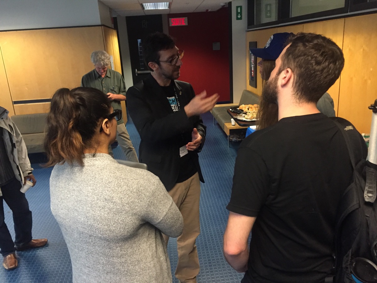
Geothink Co-Applicant Stéphane Roche, associate professor in University Laval’s Department of Geomatics, chats with students during a coffee break at Geothink’s 2017 Summer Institute at McGill University in Montreal, QC.
By Drew Bush
One of the hallmarks of any academic conference are the conversations that take place in-between sessions, in hallways and over meals. In our third Geothink Conversations, we aim to give you a flavor of these discussions at Geothink’s now concluded 2017 Summer Institute.
The theme of this year’s Institute was “Smart City: Toward a Just City.” An interdisciplinary group of faculty and students tackled many of the policy, legal and ethical issues related to smart cities. Each of the three days of the Summer Institute combined workshops, panel discussions and hands-on learning modules that culminated in a competition judged by Montreal city officials and local tech entrepreneurs.
The topic of our conversation was how to make sure human concerns remain paramount in the design of increasingly digital smart cities. It features Open North Executive Director Jean-Noé Landry; Geothink Co-Applicant Stéphane Roche, associate professor in University Laval’s Department of Geomatics; and, Victoria Fast, an assistant professor at University of Calgary’s Department of Geography. And, of course, I’m Drew Bush and I’ll be helping steer the conversation along.
To start us off, Roche got the conversation rolling on how to understand smart cities as a transition from urban living as it has been portrayed since the early 18th century to a new type of city based upon social organization and community that is aided by open data and digital technology.
“From a GIS, GIScience perspective, I sort of went extreme in the access to location, or the location aspects of access. So looking at the arrangements of doctors just to get a sense of, just at the physical level, is there an equitable arrangement of doctors. And we know pretty clearly that that’s not true across Canada, at different scales and at the scale of the nation.”
To draw this conclusion, Bell brings a Geographic Information Systems (GIS) perspective to the context of a broad variety of areas of interest in human health. For example, he has collaborated on interdisciplinary health, environmental, and social science research that uses both public and private data.
“My interest in health really has broadened areas of interest to look at access to a variety of things that effect our health.”
This year alone he has worked with the University of Saskatchewan’s College of Dentistry and also examined the accessibility of Canadian food in terms of finding healthy eating options. But collecting such data can sometimes be onerous work owing to the fact that different provincial colleges of physicians and surgeons have varying standards for their data, he must collect population data from Statistics Canada for comparison, and sometimes he might even collect his own data using surveys to gain insight.
“So we integrate data across a variety of sources, mostly publicly available not always in the sort of true and honest definition of open data…We collect our own sometimes using telephone surveys of people to get an idea of what’s controlling or what’s affecting their access to healthcare.”
What’s important is figuring out what particular issues might impact how people access doctors. These include aspects of a given doctor’s services, such as the number of patients they take, or the personal concerns of the consumer or patient.
“We as just members of the public when we look for a doctor, access can be affected by our own personal opinions, or beliefs, or worldviews, or preferences. So if I prefer to be seen by a male doctor and my neighborhood is filled with female doctors, a physical measure of access might show that there are lots of doctors near me and I should have great accessibility. But I’m not willing to see any of those doctors.”
[Geothink.ca theme music]
[Voice over: Geothoughts are brought to you by Geothink.ca and generous funding from Canada’s Social Sciences and Humanities Research Council.]
###
If you have thoughts or questions about this podcast, get in touch with Drew Bush, Geothink’s digital journalist, at drew.bush@mail.mcgill.ca.
Scott Bell is a professor in the Department of Geography and Planning at the University of Saskatchewan.
If you ask a Canadian what makes them most proud of their country, free and easily accessible healthcare would often be near the top of the list. But for one Geothink researcher, this commonly held narrative has been disproven and led him to help those in need of better healthcare.
“People in the north and some rural areas just don’t have that many doctors per person or have very low rates of doctors per 1,000 people,” Scott Bell, a professor of Geography and Planning at University of Saskatchewan, said. “And I think one of the things that really captured my interest here is that as Canadians and in Canada, we sort of expect equitable healthcare. And I think a lot of people—who have easy access to healthcare, are happy with their doctor’s care, and their ability to make appointments, and things like that—don’t think too much about the fact that not all Canadians have access to the free healthcare services we should all have access to. So that’s kind of a guiding principle.”
To draw the above conclusions, Bell brings a Geographic Information Systems (GIS) perspective to examine a broad variety of areas in human health. For example, he has collaborated on interdisciplinary health, environmental, and social science research that uses both public and private data including from surveys he has conducted himself and data he’s collected from provincial colleges of physicians and surgeons.
To get a sense of which populations are being served or not served by healthcare, his research compares the above data against population data from Statistics Canada (particularly, he says, the 2006 Long Form Census). This year he has worked with the University of Saskatchewan’s College of Dentistry and also examined the accessibility of Canadian food in terms of finding healthy eating options.
“My interest in health research really is focused on disparities in accessibility, and accessibility is a word that people use in day-to-day conversations a lot,” he told Geothink. “In terms of health, it’s a pretty complicated concept that is related not just to services themselves, where and when they’re available, when a clinic might be open, and how many doctors are there, and how many bookings they can take, or have open for drop-in or scheduling. But is also related to the patients themselves.”
It’s these consumer issues that can complicate how healthcare services can be made more accessible.
“Access can be affected by our own personal opinions, or beliefs, or worldviews, or preferences,” he said. “So if I prefer to be seen by a male doctor and my neighborhood is filled with female doctors, the physical measure of access might show that there are lots of doctors near me and I should have great accessibility. But I’m not willing to see any of those doctors.”
He has also found that when GIS is used to look at extreme situations in specific locations in Canada by just the arrangement of doctors, it’s not true that everyone has access to healthcare across the country. But identifying such a problem by locating those most in need often is the first step in starting a conversation to correct such problems.
If you have thoughts or questions about this article, get in touch with Drew Bush, Geothink’s digital journalist, at drew.bush@mail.mcgill.ca.