 Discussions of Open Data tend to be focused on urban contexts at the city level. Very few, if any, rural local governments provide open data. Significantly less is known about how open data affects rural communities than municipal populations. This Geothink&Learn was focused on rural and international open data and data sovereignty. This included an exploration of how open development can add value for open data in rural, international contexts and what challenges are posed when an organization’s data is stored outside of their country and is subjected to the laws of the country in which the data resides.
June’s session brought together a panel of academic and non-profit experts in the fields of Environment and Geography to discuss central questions of rural open data, international open data and data sovereignty by exploring what open data means in the context of both rural Canada and the international scale. How can networks of farmer organizations generate, collect and share local information about effective agricultural practice? How can rural communities benefit from Canadian open data policies? How can we include a more inclusive use of data and enhance digital rights?
On Friday, June 26 at 12:00 PM EST, Geothink.ca hosted its eleventh monthly Geothink&Learn video conference session on the topic of rural and international open data. It highlighted Geothink’s unique interdisciplinary perspective and included a myriad of ideas from our faculty, students and partners. (Catch a recording of the session along with a transcript of the question and answer session below.)
The panel was convened by Geothink Collaborator Ian Parfitt, an instructor at the School of Environment and Geomatics, Selkirk College, and Coordinator of its Geospatial Research Centre. Panelists included Tom Dool, Geographic Information System Technologist at Regional District of Central Kootenay; Ednah Karamagi, Executive Director of Busoga Rural Open Source and Development Initiative (BROSDI); and, Ana Brandusescu, Research and Policy Officer at the Worldwide Web Foundation.
A question and answer session followed after presentations concluded. Our panelists briefly introduced their research and then reflected on rural open data.
Download a PDF of this event to share.
When:
June, 26, 2018 at 12:00 PM to 1:15 PM [NOW CONCLUDED]
Where:
https://zoom.us/webinar/register/WN_7B4Q1y5UQ9K-OoOTFJoQBA
After registering, you will receive a confirmation email containing information about joining the webinar.
Convener:
Ian Parfitt
Moderator:
Sonja Solomun
Panelists:
 Ian Parfitt started work at Selkirk College as a GIS Instructor in the integrated environmental planning (IEP) program in 2002. His background was in conservation geographic information science (GIS). He has worked for the Long Beach Model Forest on Vancouver Island while a research assistant at UBC, and for the Fish and Wildlife Compensation program in Nelson as GIS Coordinator for many years. In his current role, he has helped design the curriculum for Selkirk’s Advanced Diploma in GIS as well as build research infrastructure and capacity at the College.
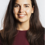
 Ana Brandusescu is a Research and Policy Officer at the Web Foundation. She is focused on driving a more inclusive use of data and enhancing digital rights, through various data, research and policy projects. These include Women’s Rights Online, the Initiative for Data Equity in Africa (IDEA) and the Open Data Barometer. She also works on open contracting and governance and artificial intelligence.
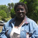
 Ednah Karamagi is executive director of BROSDI (Busoga Rural Open Source and Development Initiative). BROSDI works with a network of farmer organisations to generate, collect and share local information about effective agricultural practice. BROSDI integrates a range of Web 2.0 tools and more traditional approaches—from digital radio, mobile phones and blogs to regular Knowledge Sharing Forums and working with Village Knowledge Brokers.
Tom Dool is a Geographic Information System Technologist at Regional District of Central Kootenay.
