Author Archives: Drew Bush

An Emergent Field: Making Better Maps By Applying Geographical Science to the Human Brain

e3abbecd4

Monitoring the human brain. (Photo courtesy of Flickr user Tabsinthe)

By Drew Bush

City planners often use socioeconomic data collected in surveys to determine neighbourhoods that might benefit from improved services. Yet such types of data can have a significant margin of error, especially when they’re collected from a relatively small group.

“Especially if you want to look at a small subset of the population—say, kids under 5 who are living in poverty—the uncertainty level is just huge,” Amy Griffin, a senior lecturer in the School of Physical, Environmental, and Mathematical Sciences at Australia’s University of New South Wales told CityLab’s Laura Bliss last November. “A lot of times, people are making decisions based on highly uncertain census data.”

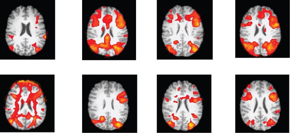
Her research looks at how different kinds of visualizations can affect decision-making, with an emphasis on understanding the cognitive processes behind the use of maps. Still others in her field are engaged in understanding how the human brain engages with maps in order to improve map-making and the role it plays in municipal governance.

Some in the field study neuroscience from the uniquely geographical perspective of how the human brain reacts to maps with differing standards, visual cues and rules. Sara Irina Fabrikant, head of the Geography Department at the University of Zurich, dedicates her time to understanding how users make inferences from the design elements on a map, and how mapmakers might then design maps that convey data more clearly.

For example, in experiments she conducted to compare a NOAA (National Oceanic and Atmospheric Administration) mass-media weather map versus one of her own design, she found design elements could be used to simplify confusing variables and help users better understand characteristics like wind pressure. Her map included well-defined contour lines for wind pressure and less emphasis on temperature colors.

“Are our rules really good ones?” Fabrikant told CityLab. “If so, how? If they’re not, how can we improve them?”

Amy Lobben, head of the Department of Geography at the University of Oregon, asks a different question. She wants to know what neurological processes are at play as individual brains perform map-related tasks. Her possible goal: to create a map that plays off a given person’s cognitive strengths and weaknesses.

“You could potentially design a map that works with individuals’ innate abilities,” she told CityLab.

If you have thoughts or questions about the article, get in touch with Drew Bush, Geothink’s digital journalist, at drew.bush@mail.mcgill.ca.
Open Data Gets Boost from Obama’s 2016 Budget Proposal

obama-budget-plan

Obama’s 2016 federal budget proposal (Photo courtesy of www.philstar.com).

By Drew Bush

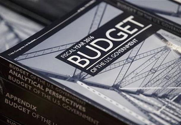
Lost in the details of a $4 trillion budget plan proposed by U.S. President Barack Obama are several provisions that seek to increase public access to government data, strengthen government analysis and collection of data and improve data-driven government decision-making, according to a story first reported in the Federal Times.

Released on February 2, Obama’s proposed 2016 budget for the federal government will likely meet strong resistance from a Republican controlled Congress. However, of more interest to the Geothink audience is the administration’s continuing support for programs which help collect, analyze and share the petabytes of data which the U.S. Government collects each day

“The administration is committed to continuing cost-effective investment in federal statistical programs in order to build and support agencies’ capacity to incorporate evidence and evaluation analyses into budget, management and policy decisions,” the budget reads. “The 2016 budget includes a package of proposals that would make additional administrative data from federal agencies and programs legally and practically available for policy development, program evaluation, performance measurement and accountability and transparency efforts.”

In terms of numbers, the proposed budget would increase funding for statistical programs by 2.5 percent, from $4.2 billion in 2015 to $5.2 billion in 2016. One of the largest shares would go to the U.S. Census Bureau which would receive $10 million to continue building out its collection of datasets and the infrastructure that allows users to collate, analyze and share data.

The funding would also help the federal government acquire state and municipal datasets that could then become accessible to the public. Furthermore, an additional $2 million would raise the General Service Administration’s E-Government initiative to $16 million. This program seeks to “develop and provides direction in the use of Internet-based technologies to make it easier for citizens and businesses to interact with the Federal Government, save taxpayer dollars, and streamline citizen participation.”

The administration has also supported the creation of a legislative commission proposed by Rep. Paul Ryan, R-Wisc., and Sen. Patty Murray, D-Wash., to examine ways to use government data to improve federal operations and support private research and industry.

If you have thoughts or questions about the article, get in touch with Drew Bush, Geothink’s digital journalist, at drew.bush@mail.mcgill.ca.

Spotlight on Recent Publications: Teresa Scassa at the Intersection of Intellectual Property Rights and Municipal Transit Data

By Drew Bush

faculty_olympics

Teresa Scassa is Canada Research Chair in Information Law at the University of Ottawa.

This story was originally reported on Teressa Scassa’s personal blog which you can find here.

In a paper just published in the Fordham Urban Law Journal, Geothink researcher Teresa Scassa argues that the actual laws governing intellectual property (IP) rights are often surprisingly irrelevant in disputes over rights to municipal transit data. Instead, she finds that being in a position to make a claim to IP rights is often more important than actually having a good claim.

“How people decide to interact with each other is more important than what their precise legal rights might be,” Scassa, the Canada research chair in information law at University of Ottawa, wrote in an e-mail to Geothink.ca. “Often, to understand the precise boundaries of those rights it is necessary to litigate and one or both parties may lack the resources to go to court. So, in those circumstances, parties may reach an understanding of how they will set the boundaries of their relationships.”

Her paper, entitled Public Transit Data Through an Intellectual Property Lens: Lessons About Open Data, examines some of the challenges presented by the transition from ‘closed’ to open data within the municipal context. She completed the paper as part of a Geothink project examining open data in a concrete context that’s particular to municipalities.

“In the municipal transit data context, there was generally an imbalance of resources between developers and municipalities, and there was little desire on either part to go to court,” she added. “Nevertheless, in the early days, municipal transit authorities asserted their IP rights using cease and desist letters. This assertion of IP rights was met with arguments about the need for open data, and eventually compromises were reached around open data that shifted over time, and varied from one municipality to another.”

In the paper, she examines how these legal developments have impacted the use of real-time transit data by developers seeking to make use of this data in digital applications and corporations hoping to add value to products and services they offer. In particular, the paper covers three types of data: 1) Route maps; 2) Static data (such as bus timetables that only change seasonally); 3) And, real-time GPS data generated by units installed on transit vehicles.

A number of municipalities exerted their IP rights over such data because of concerns that ranged from ensuring its quality and authenticity to preserving the ability to make data available on a cost-recovery basis.

“The emerging open data movement shifted some of these concerns and created a new set of expectations and practices around open municipal transit data,” she wrote in her e-mail. “As data become more complex (with the advent of real-time GPS data, for example) the IP issues shifted and changed again, raising new questions about open data in this context. This is where the next phase of my research will take me.”

To find out more about Teresa Scassa’s work, visit her personal blog here or follow her on Twitter @teresascassa. For more on IP, check out another of her recent papers (written with Univeristy of Ottawa doctoral student Haewon Chung) that analyzes various types of volunteer citizen science activities to determine whether they raise legal questions about IP ownership.

Find a link to the article along with its abstract below.

Public Transit Data Through an Intellectual Property Lens: Lessons About Open Data

This paper examines some of the challenges presented by the transition from ‘closed’ to open data within the municipal context, using municipal transit data as a case study. The particular lens through which this paper examines these challenges is intellectual property law. In a ‘closed data’ system, intellectual property law is an important means by which legal control over data is asserted by governments and their agencies. In an ‘open data’ context, the freedom to use and distribute content is a freedom from IP constraints. The evolution of approaches to open municipal transit data offers some interesting examples of the role played by intellectual property at every stage in the evolution of open municipal transit data, and it highlights not just the relationship between municipalities and their residents, but also the complex relationships between municipalities, residents, and private sector service providers.

If you have thoughts or questions about the article, get in touch with Drew Bush, Geothink’s digital journalist, at drew.bush@mail.mcgill.ca.